Strawberry Jam
“We are the Village Green Preservation Society
God save Donald Duck, vaudeville and variety
We are the Desperate Dan Appreciation Society
God save strawberry jam and all the different varieties”
The ‘Village Green Preservation Society’ was released by The Kinks in 1968, to moderate success. The big question is, however, was Ray Davis expressing a desire for maintaining traditional values or was he being ironic? Eminently sing-able and with great lyrics, Terroir, of course, assumed the latter. It is interesting to note, however, that:
· Protection of village greens has been possible since the Commons Act 2006
· Donald Duck is still a successful immigrant from the USA
· Desperate Dan has had a more difficult career (what really happened in that oil well explosion?) but he made the cut in the Dandy Annual for 2026
· Strawberry jam – seems to be as popular as ever, although other, more exotic, fruit jams are also now available.
Was Ray Davis actually responsible for all that?


what Donald Duck: https://en.wikipedia.org/w/index.php?curid=66173508 Desperate Dan: https://en.wikipedia.org/w/index.php?curid=57532342
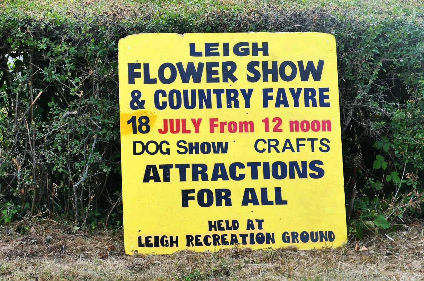
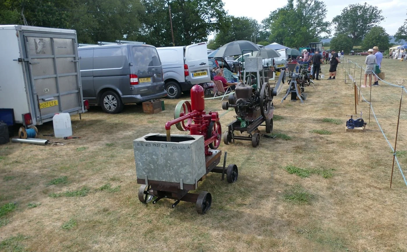
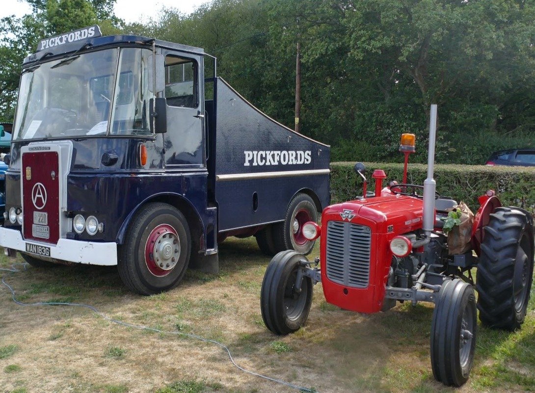
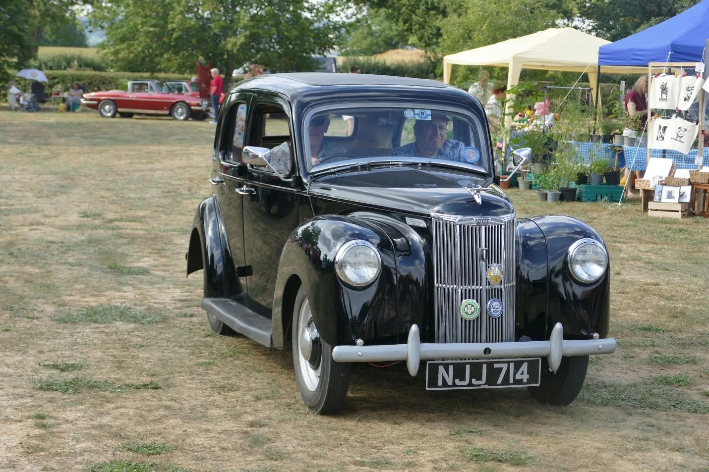
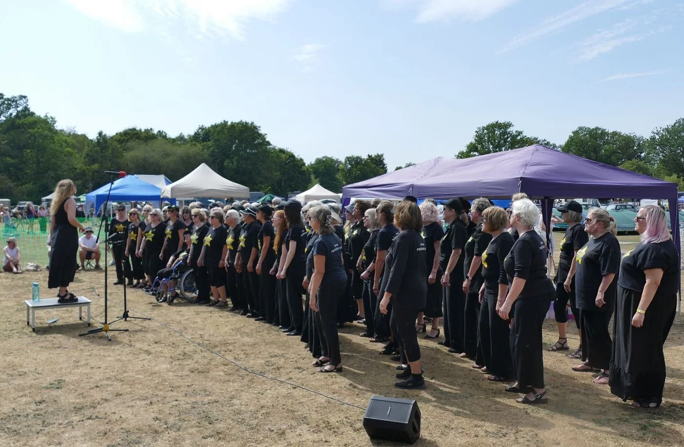
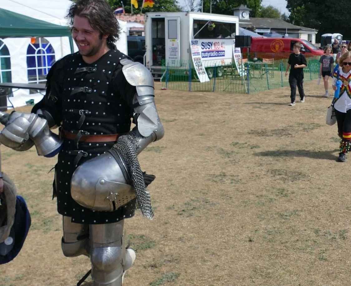
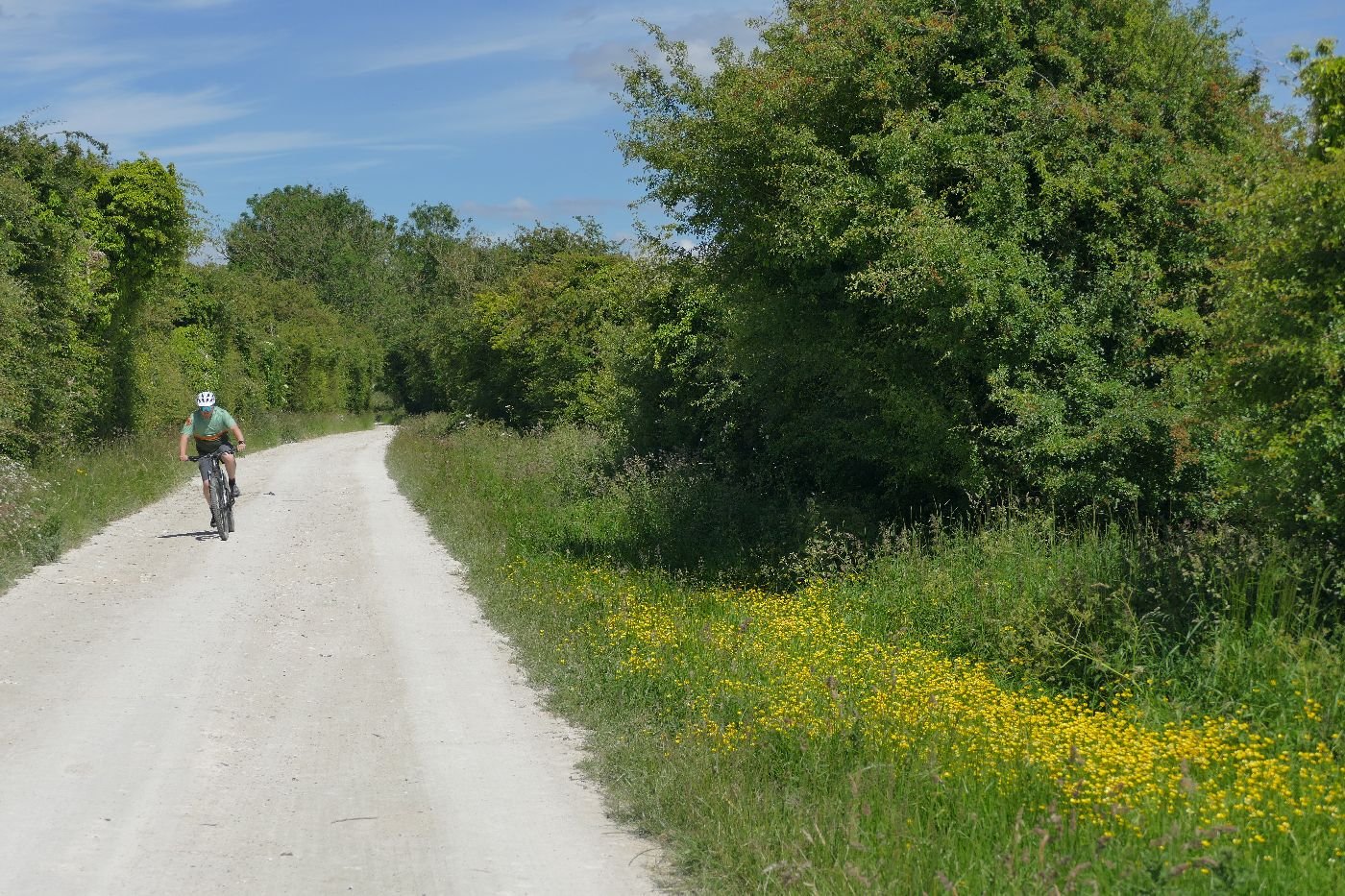
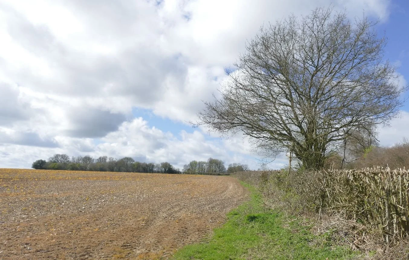
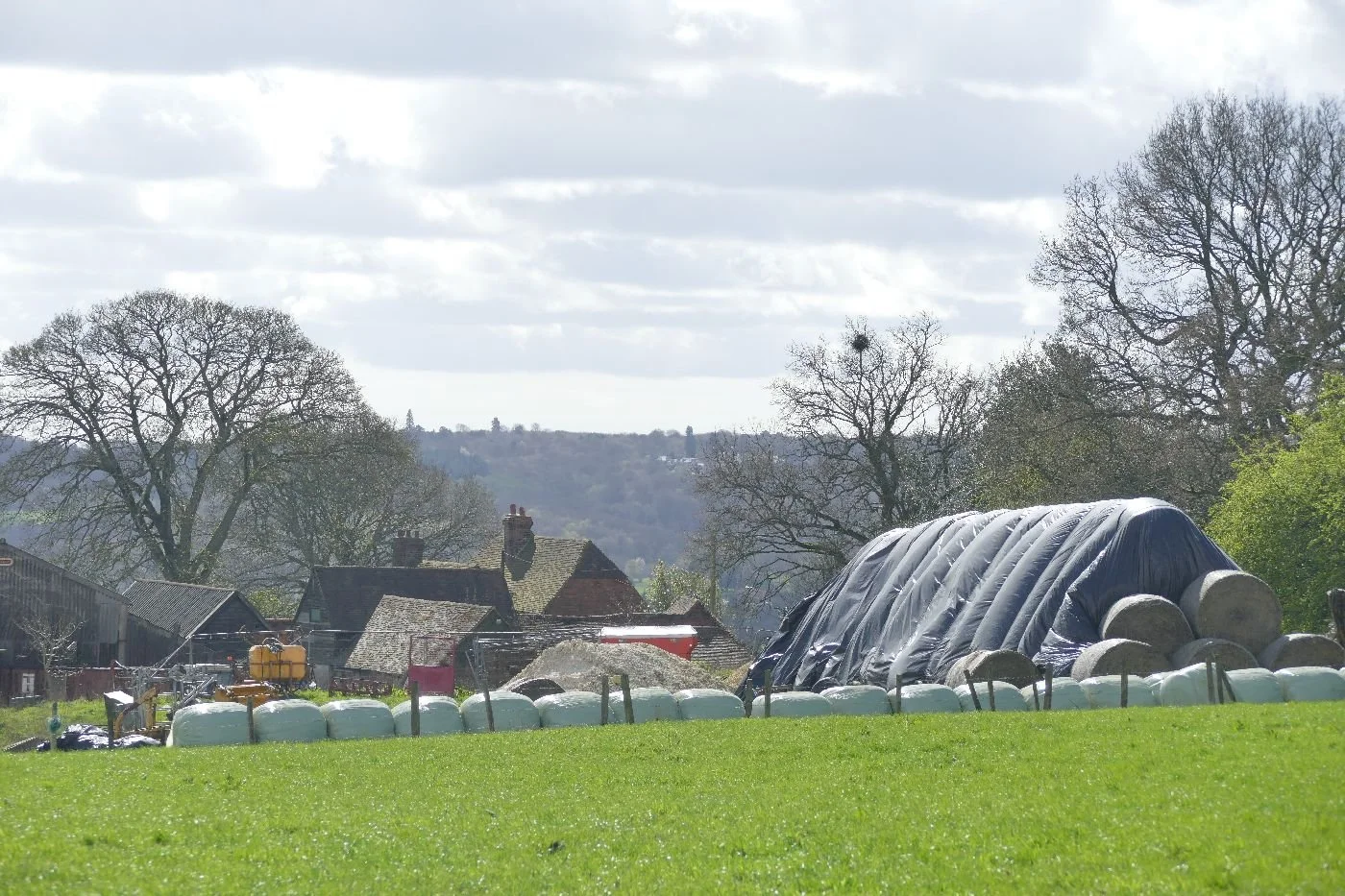
Terroir recently attended a local village fair, something which seems to have been part of British culture for a very long time, and often involves village greens and strawberry jam. It was an excellent afternoon and got us thinking about the history of fairs and how they might have changed over the centuries.
Terroir’s usual level of research would normally produce a plethora of reliable, sometimes academic, sources, but on this occasion information was distinctly sketchy. Here is Wikipedia on the British fête:
“Village fêtes are common in Britain. These are usually outdoor shows held on village greens or recreation grounds with a variety of activities. They are organised by an ad hoc committee of volunteers from organisations like religious groups or residents' associations.” (https://en.wikipedia.org/wiki/F%C3%AAte). A very recognisable village format, clearly assuming that the strawberry jam goes without saying but unhelpful on the origins of such events. There is a Wiki entry specific to ‘Fairs’ but as it has ‘multiple issues’ and ‘needs more citations’ we have declined to quote from it. There is definitely room for a decent doctorate on this subject but Terroir feels that funding may be an issue.
Using what sources are available, it seems that, historically, fairs were large commercial events or markets, often linked to religious and/or seasonal timetables, involving the sale of livestock and agricultural or household supplies and the hiring of staff. Pubs would be open and bargains struck.
Fairs have also featured in many literary works. John Bunyan’s Vanity Fair was used as an allegorical market place representing worldly sins and human desires. Thomas Hardy used them as both literary and theatrical key points (eg the auction of a wife and child in ‘The Mayor of Casterbridge’) and Jane Austen created local colour through sending her characters from ‘Emma’ to Kingston market in Surrey.
The famous Nottingham Goose Fair is probably a classic of the genre: a Michaelmas market based on cheese and the thousands of geese driven into town from the fens, many of which supplied the traditional Michaelmas meal of roast goose which marked the end of the harvest season. With a captive market of humans, travelling merchants started to bring in side shows and other forms of entertainment. “In 1928, the fair was relocated to the Forest Recreation Ground, having finally outgrown the city centre” (https://en.wikipedia.org/wiki/Nottingham_Goose_Fair).
Gradually the ‘fun’ fair became more dominant than the trading aspect and there are many historic and literary references to local villagers, and the staff from large Victorian houses, attending local fairs complete with side shows and entertainments (the television series ‘Downton Abbey’ features both horticultural and fun fairs).
Davis’s chorus from the ‘Village Green Preservation Society’, however, sends an ambiguous message on the subject of cultural conservation:
“Preserving the old ways from being abused
Protecting the new ways, for me and for you“
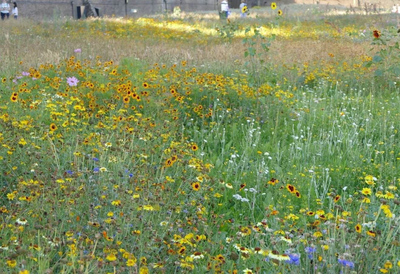
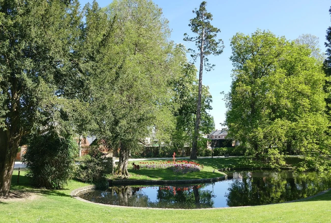
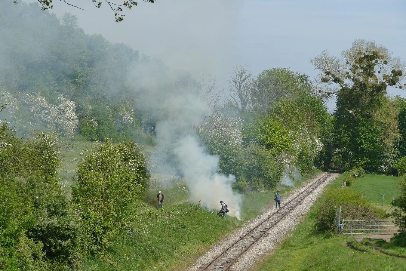
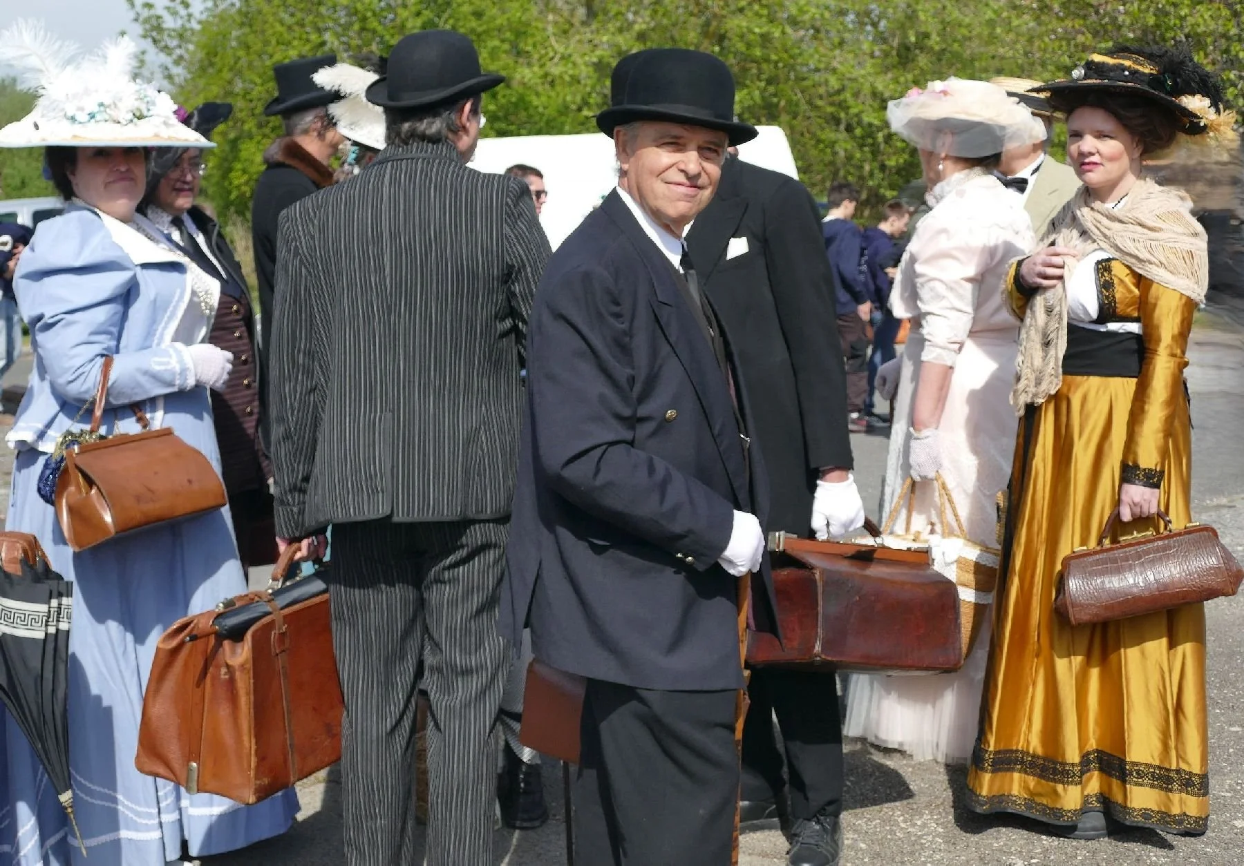
As Terroir clearly represents a form of ‘me and you’, we decided to go on a field trip to the aforementioned village fair, to assess the balance of old and new ways and levels of preservation and protection. The sacrifices we make in the cause of cultural landscapes!!
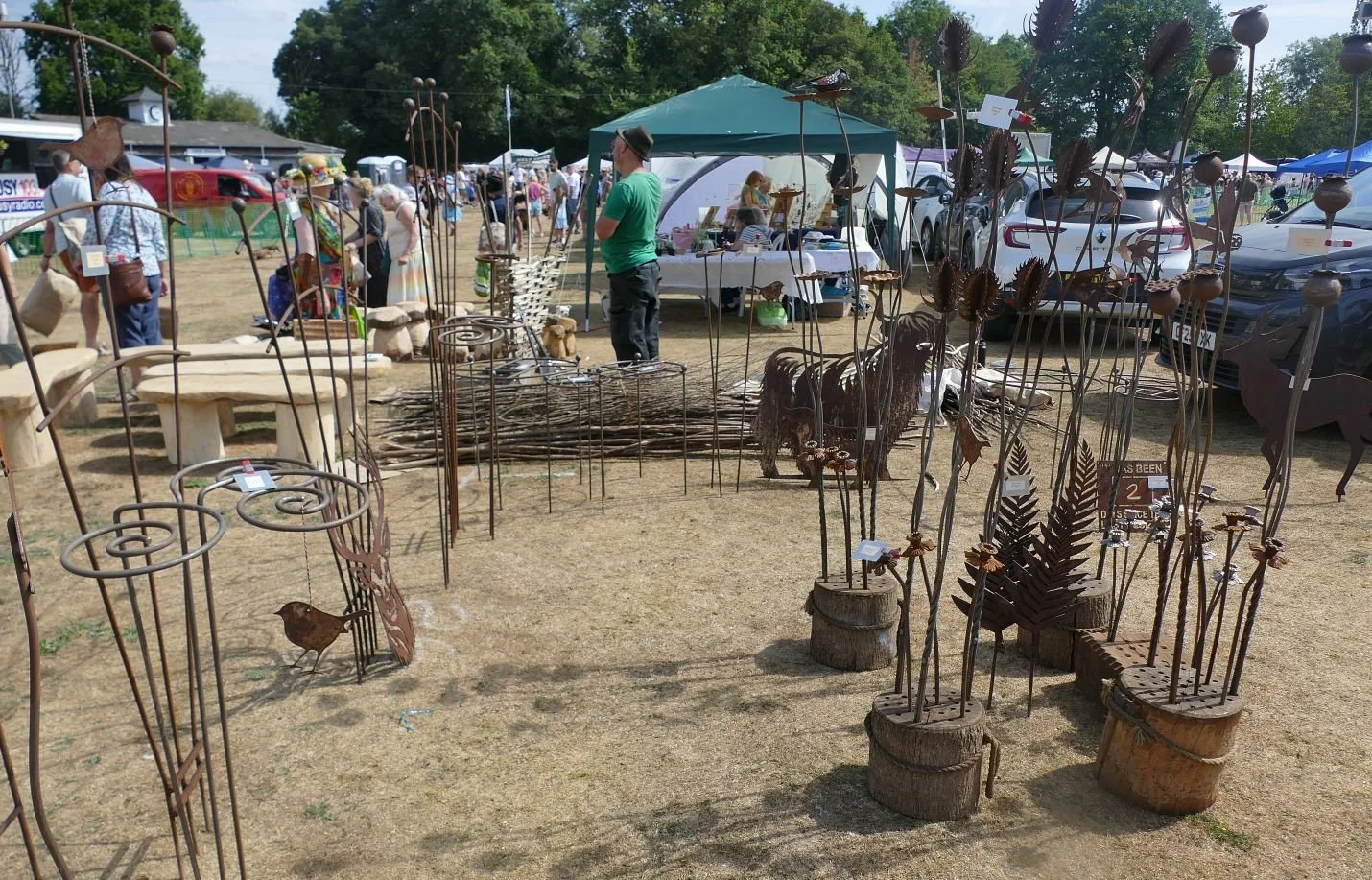
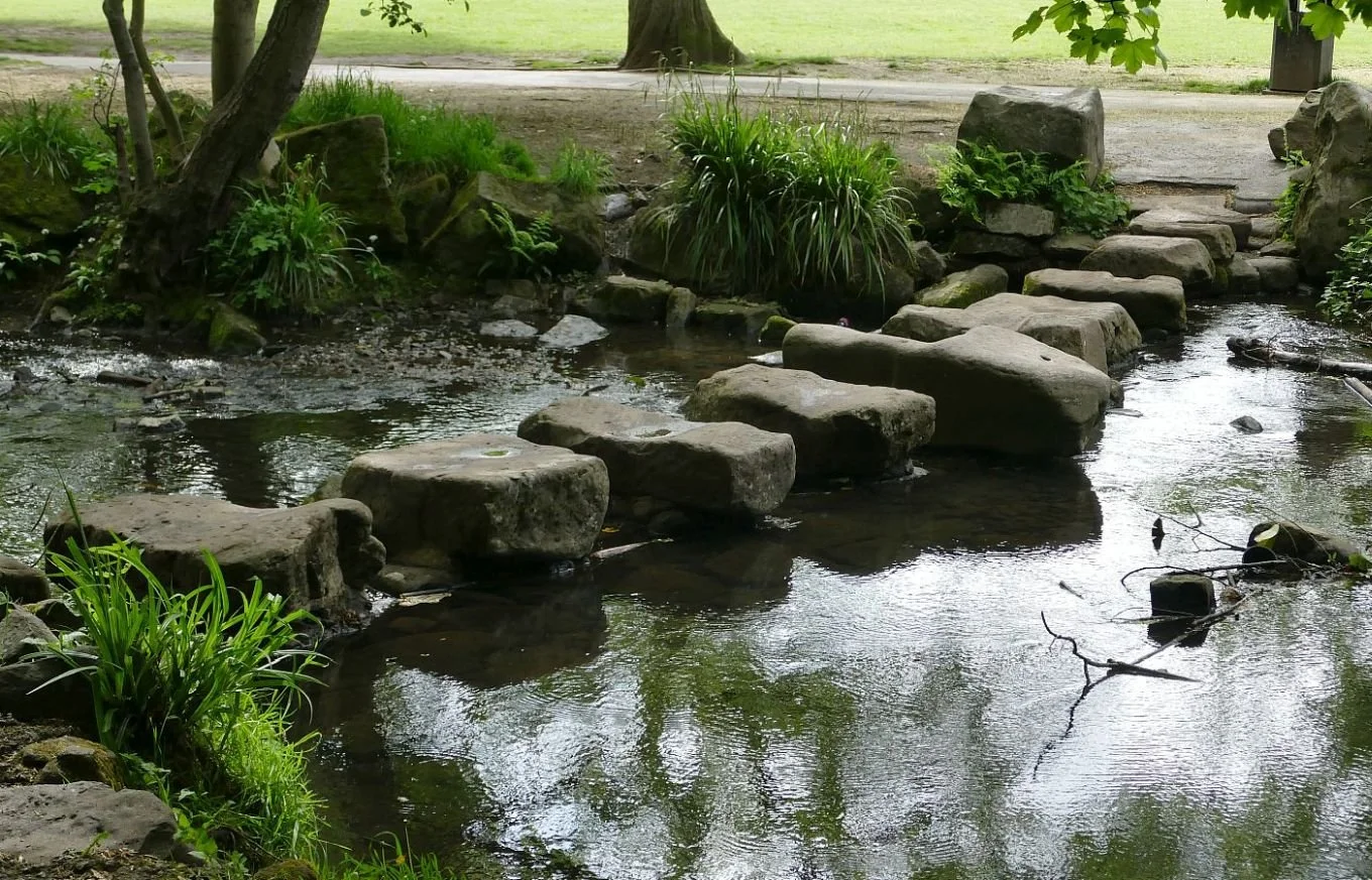
The village of Leigh, in Surrey, has a lovely village Green which was purchased by the Parish Council in July 2019, on a 99 year lease (https://www.leighvillage.org.uk/our-village/the-village-green/). This appears to represent a tick on the ‘preservation’ aspect. However, this year’s fair (sorry Fayre) was held on that other piece of open space to which every English village aspires - a cricket ground. This offered more space and another tick on the ‘preserved old ways’ list. Owzat?!
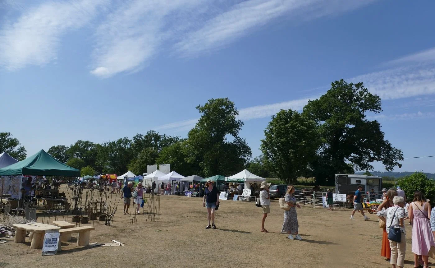
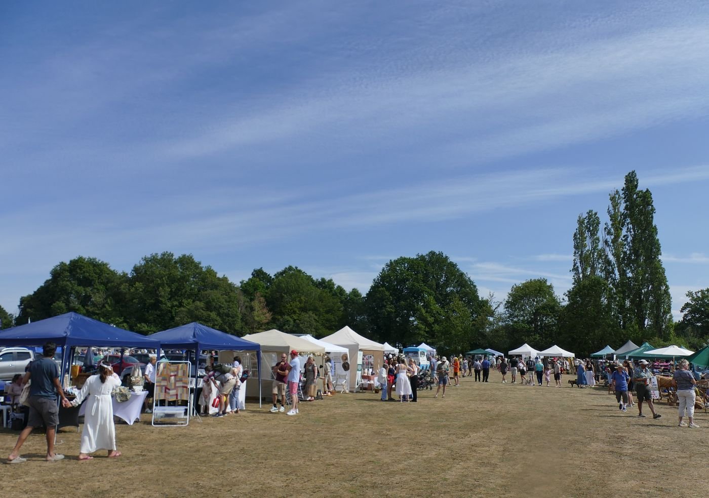
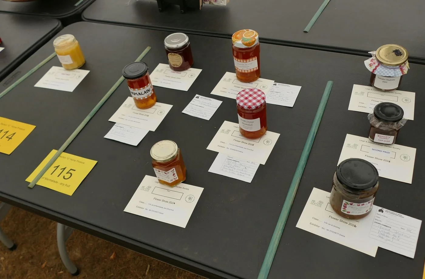
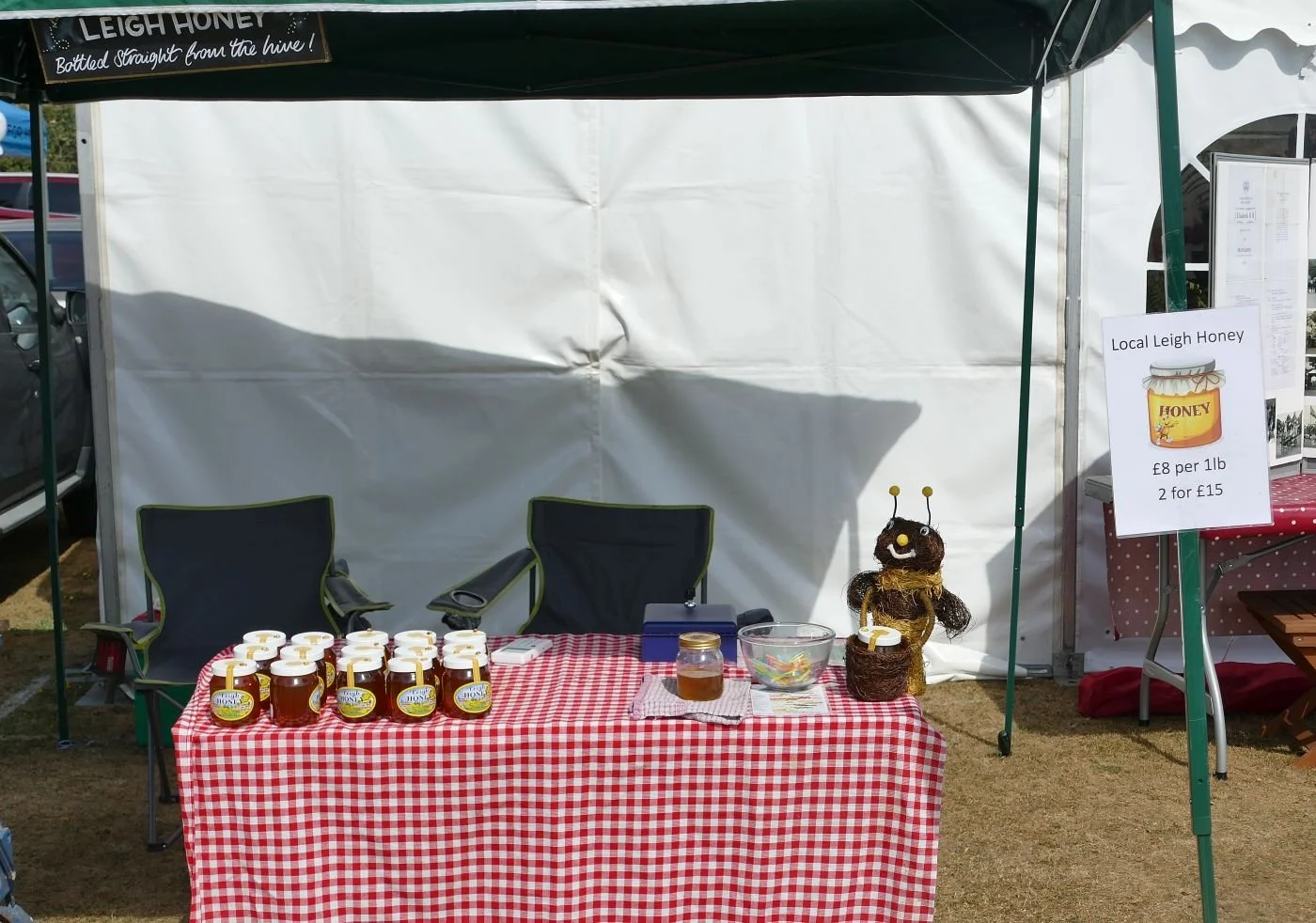
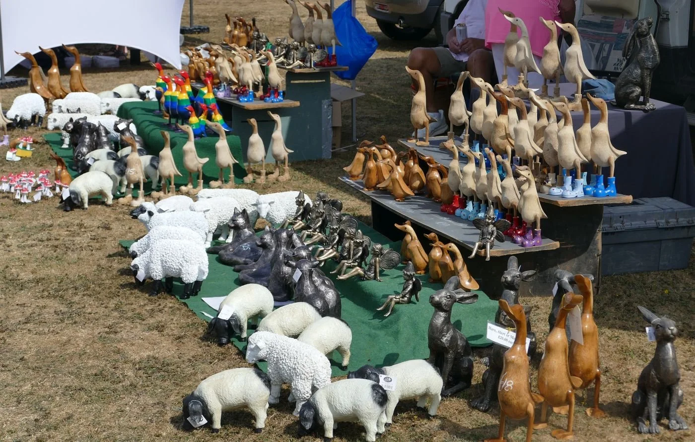
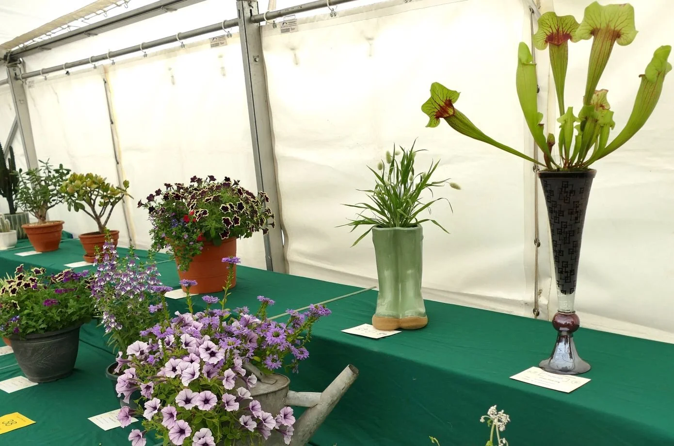
eHistorically, commerce seemed to be the basis of most fairs and this appears to still be true today, although the commodities have changed enormously. Instead of buying geese, horses, sheep, cattle or people, a respectable village fête now majors on craft products which may or may not feature local skills, materials or food. The link with the surrounding countryside may be tenuous but to the 21st century urbanite, the products of crafts people who probably live somewhere within the region are very attractive. We saw pottery, wood work, metal work, clothing and cakes, and the honey came from Leigh village itself.
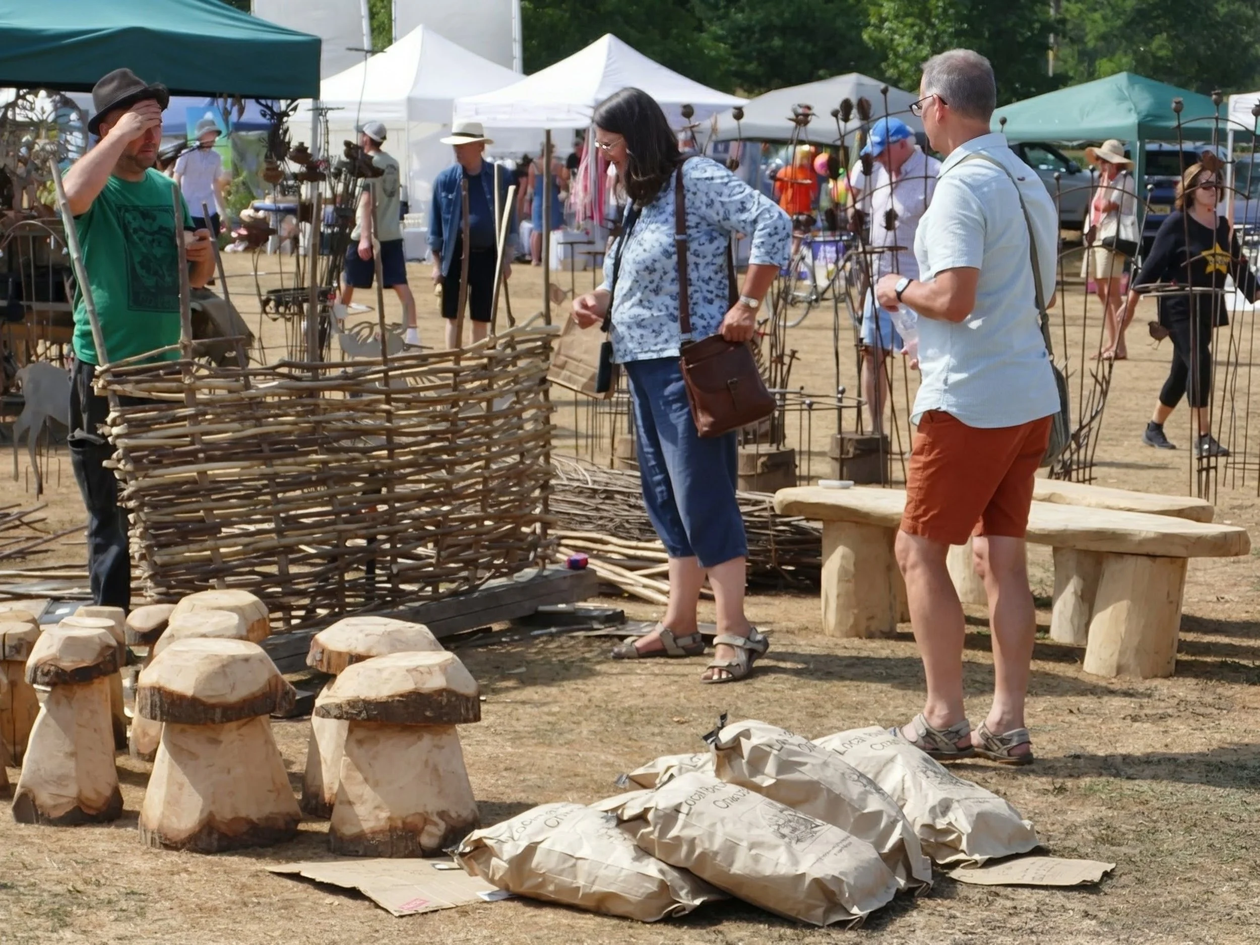

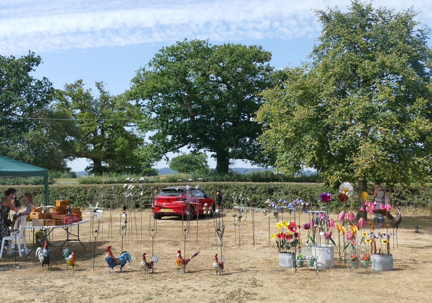
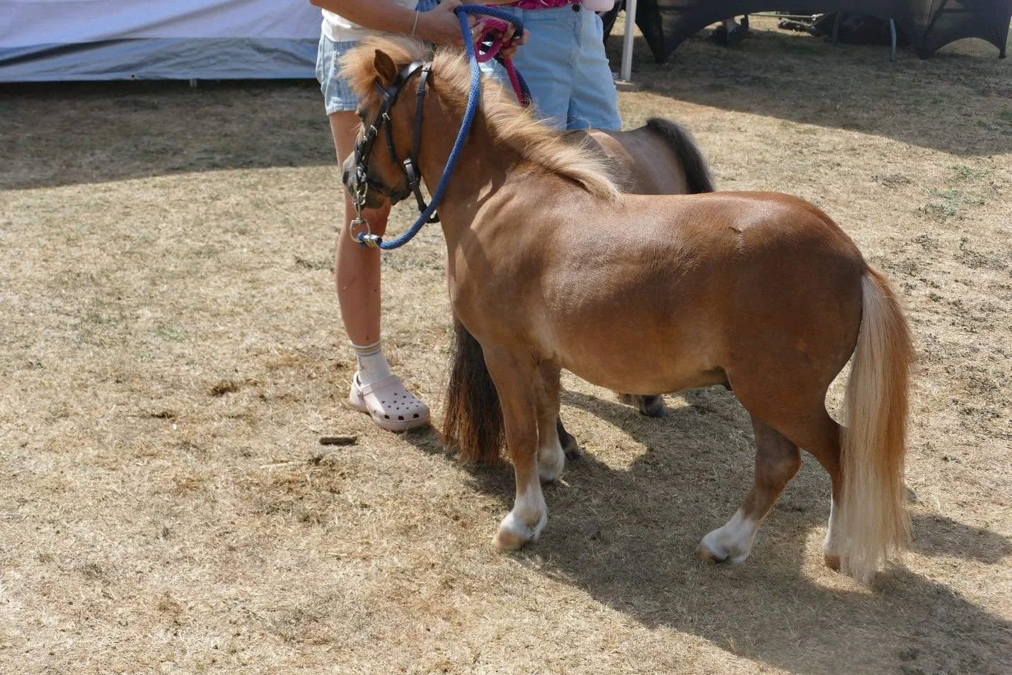
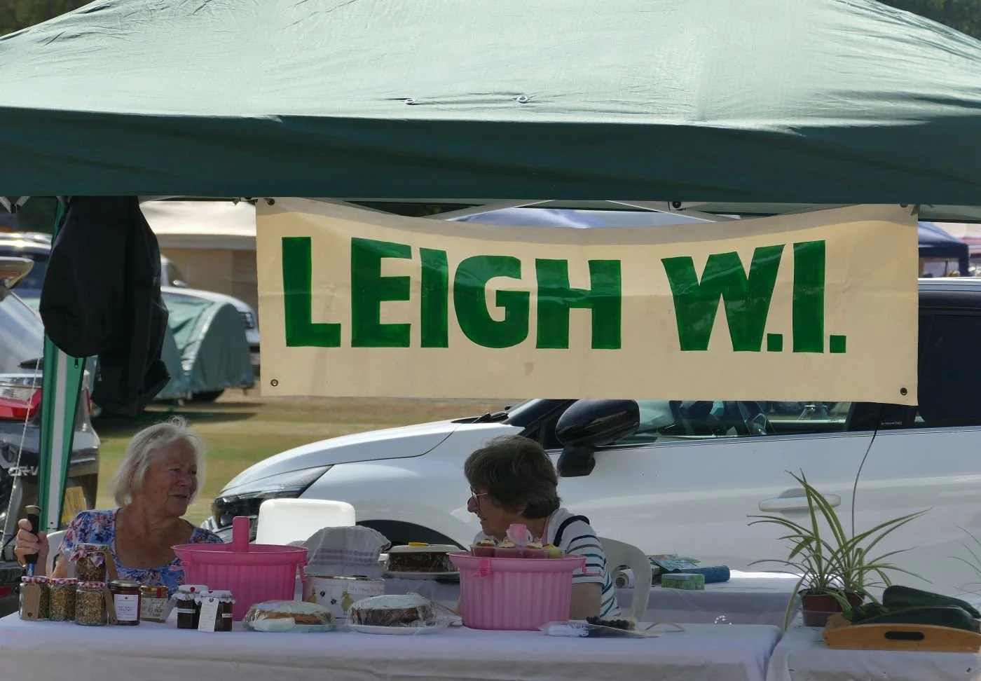
Tradition is still important however. What is a village fair without horses, however small, the WI and charitable fund raising? Although these days, members are probably as, or more, important than cold cash to local organisations.
Surrey is home to huge number of road vehicles but is still largely agricultural in terms of acreage. No doubt former fairs displayed, and certainly modern agricultural fairs delight in showing, the very latest technology in food production. Today, however, your average town and village dweller prefers to indulge in historic vehicles and ‘do you remember those’ moments.
There is entertainment - modern or hilariously pastiche - and the all important tea tent…
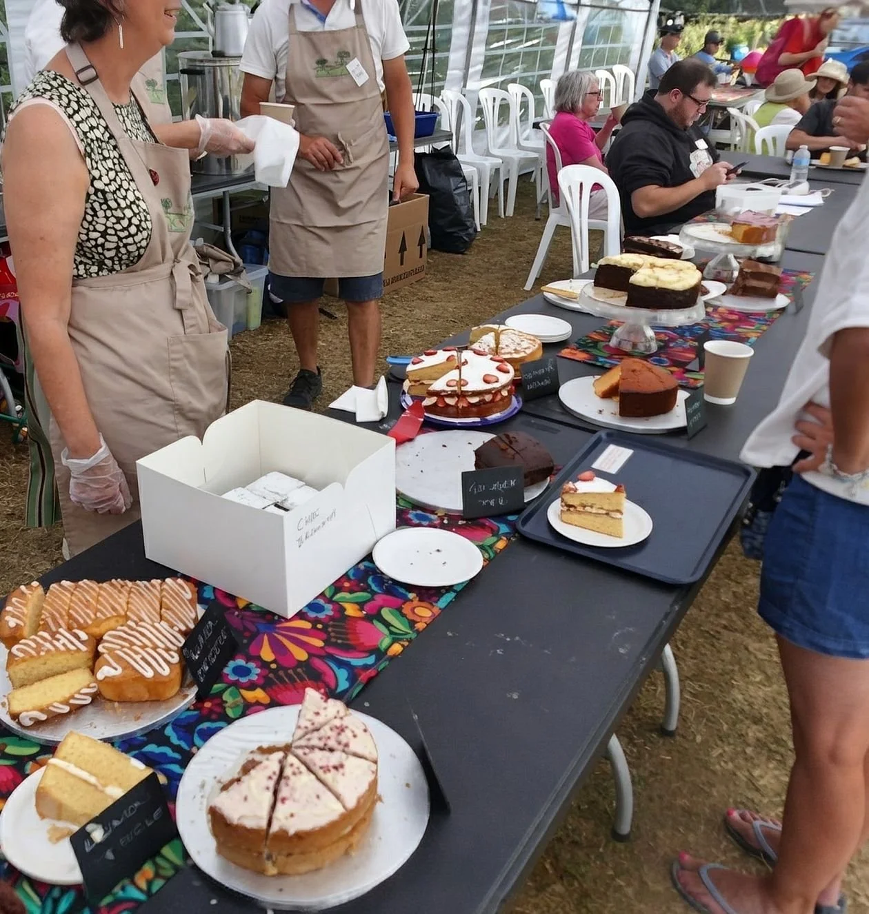
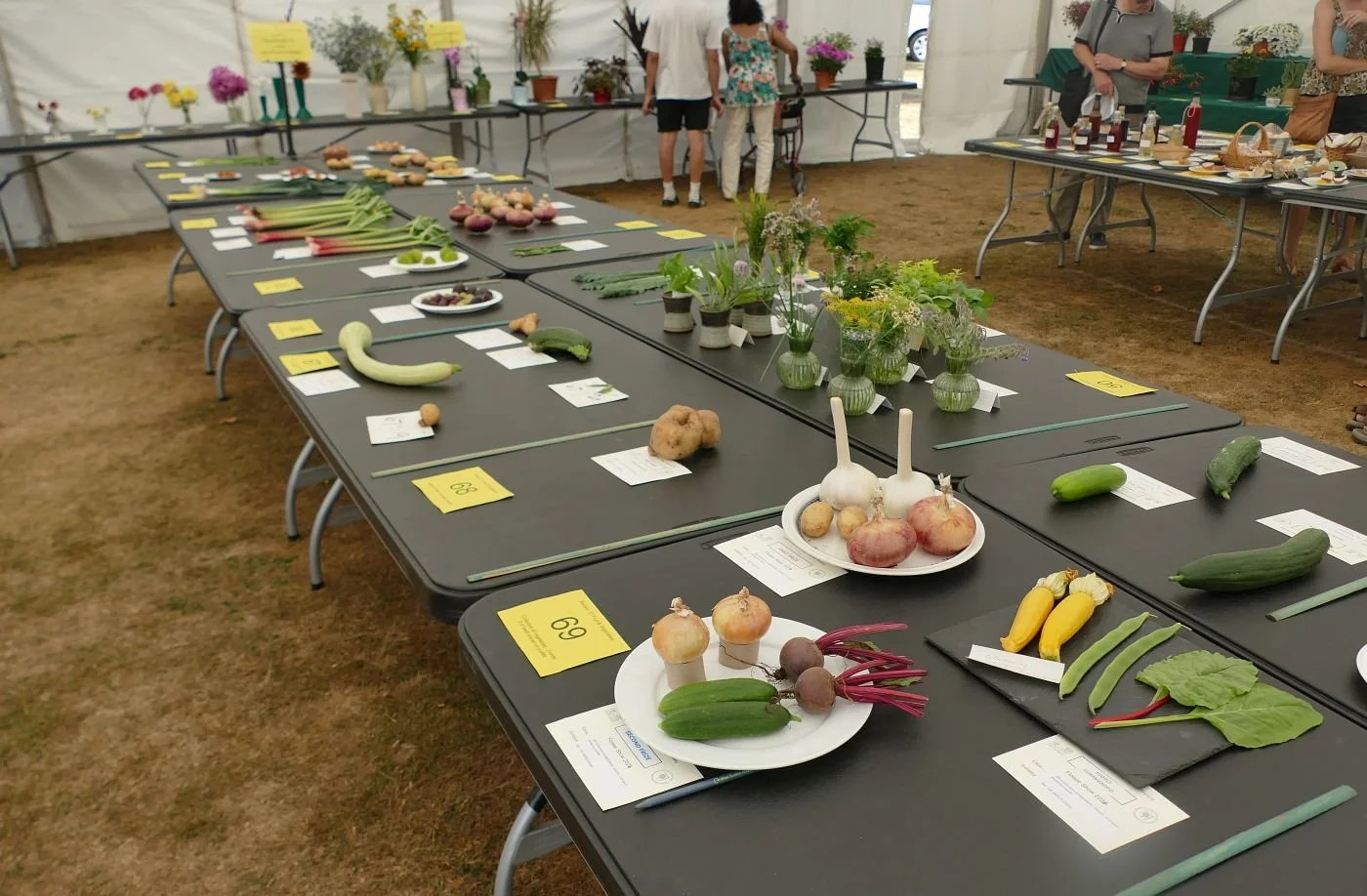
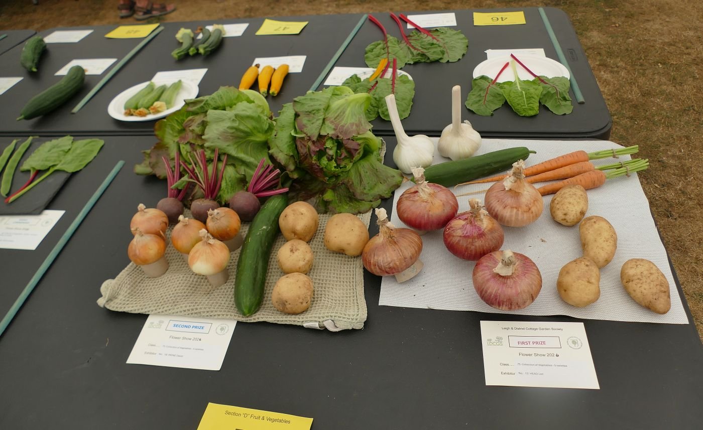
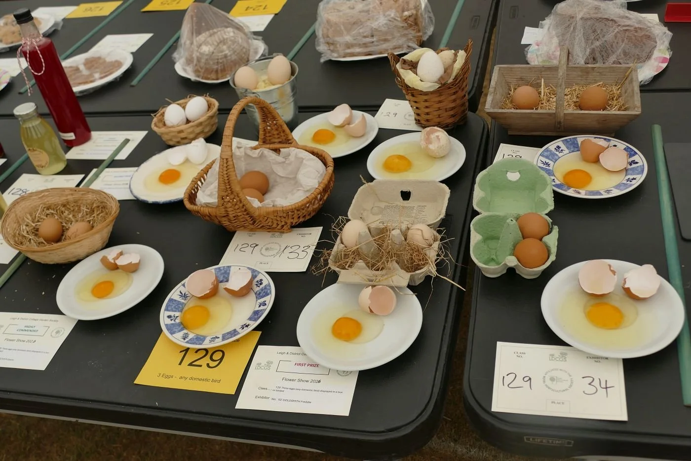
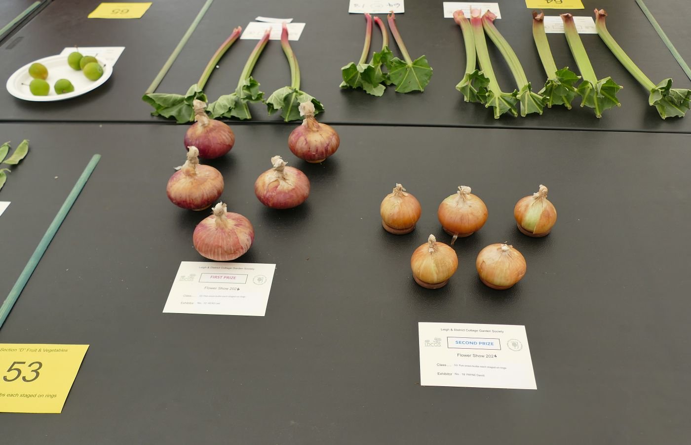
But best of all is the greatest and oldest tradition of competitiveness. The best strawberry jam, the largest veg and - queen of the fair - the very best Victoria Sponge. It was surely like this throughout history (although we presume that the Victoria Sponge only made and appearance in the 19th century; was it all about scones before that?). Competitiveness was still going strong in Terroir’s childhood and it still takes up significant time, effort and space in every self respecting village fair or fête.

It was a grand day out, but please, all you social scientists and oral historians, don’t forget to record how fairs (and life generally) have changed over time and whether
we are any good at
“Preserving the old ways from being abused
Protecting the new ways, for me and for you“
A Time to Plant …
It is with regret that we have to announce that Terroir South will not be renewing its allotment tenancy in the spring of 2027. Alternative arrangements will be made, chez Terroir, for increased fruit and vegetable production within the domestic garden.
Our allotment story began in April 2018. We kept a diary – there was obviously going to be a book in this – and the first entry reads:
“Lean over the gates of our two nearest allotment sites. Option 1 is a classic: well-tended, open aspect, attractive, even close to the railway line. Option 2 is close to the main road, sloping and surrounded by trees and has an air of neglect. But the site is much nearer. We send in an application and prepare to wait.”
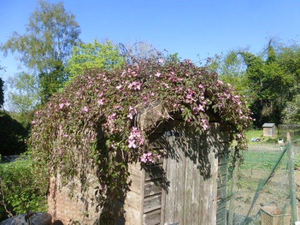
Within a surprisingly short time, we are offered a viewing with: “a young lad, training part time at Plumpton and working at the local authority offices [Plumpton College in Sussex specialises in land based skills training]. He tells me he is just about to get his chain saw ticket as we eye the weeping ash in the middle of the allotments. Once inside the site, the noise of the road fades; there are no allotments ridiculously close to the trees and a few which are hardly shaded at all. We have choices: 2 A has a tiny shed covered with clematis in full flower. It seems idyllic.
The whole site now has an air of excitement, of promise, of eccentricity, of homely potential, of inclusivity, of classlessness and shared values. I am surprised by how elated I feel at the prospect of being part of this. We discuss mulches, grass cutting and how quiet it is.”
We booked in and paid our ridiculously low rent
So why, eight years later, have we decided to quit? The short answer is ‘deer’. The long answer is far more complex: we aren’t quitting ‘allotment ideals’ but, inevitably, our lives have changed, priorities have altered and the allotment no longer fits comfortably with family life, responsibilities, aspirations and energy levels. The garden, however, will be getting a lot of attention.

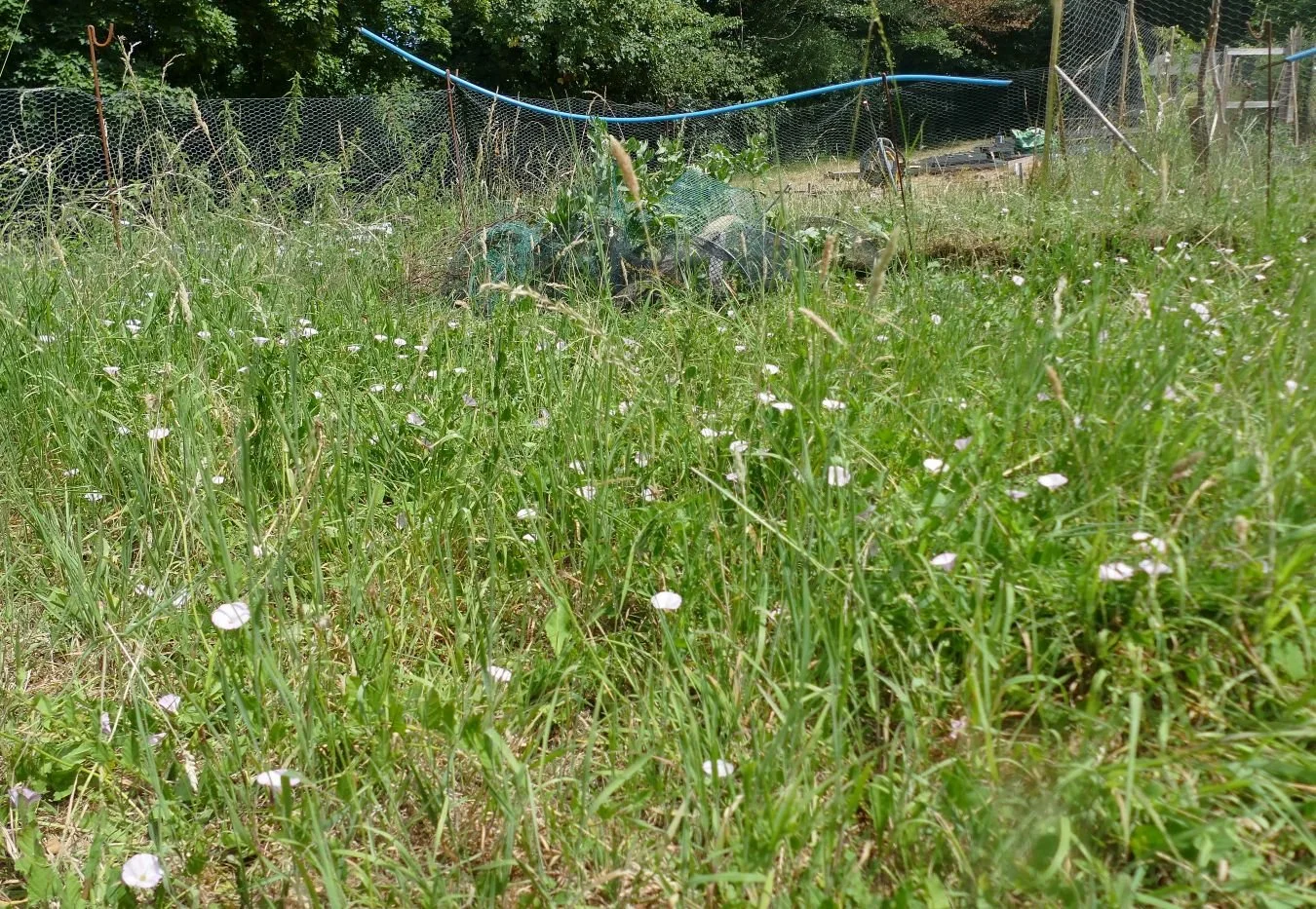
We learnt a great deal from our allotment and in the first couple of years we became experts on allotment wildflowers. At the beginning a tiny (broadleaved?) willowherb, bindweed and self-heal were frequent in the rough grass, scarlet pimpernel and creeping buttercup on the more open areas, ragwort on the edge of a former planting bed (complete with cinnabar moth caterpillars), together with speedwell and forget me knots.

as time passed, the scarlet pimpernel disappeared, the bindweed became rampant, the forget-me-knots created massed blocks of green or blue depending on the time of year, buttercup and dandelion were ubiquitous and the ragwort came and went. At some point, aquilegias started to appear in the beds around each fruit bush; very pretty, very stubborn and largely tolerated.
Our biggest learning curve was related to control of those plants and animals which vied with the plants we wanted to grow and eat ourselves. We refused to call them weeds or pests but we finally started to understand why farming has acquired such a bad name for the mass use of pesticides. Year on year we lost significant percentages of our fruit and veg to plants and animals which had got to our crops either before they emerged or before we could harvest them. If our nutrition had depended on our allotment alone, we would have starved.
We seriously considered every form of pest control. We quickly found that our planting beds were too small for fabric mulches. Any plant with a decent root system – couch grass or dandelions for example – just carried on growing until their roots had found an edge and could come up for air and sunlight.
We were determined not to use chemicals so, much of our, and our neighbours, time is spent in hand weeding. Many horticulturists swear by hoeing but although a hoed row of brassica or beet may look neat and tidy, the weedy root is still there, lurking below the surface, just waiting to pop up again and steal the light and nutrients from our beloved crop. Weeding, particularly after watering or rain, can remove the roots of most unwanted vegetation, and will keep even creeping buttercup under control, if not completely eradicated. Of course neither hand-weeding nor hoeing will ever eliminate bindweed, dandelions and couch grass but it does significantly reduce the amount of work required to keep them at bay (and increases the volume of next year’s compost – most of us have two to three compost bins constantly working on production of soil enrichment material). A commercial crop of wheat, maize or cabbages could never be effective under such a labour intensive regime.
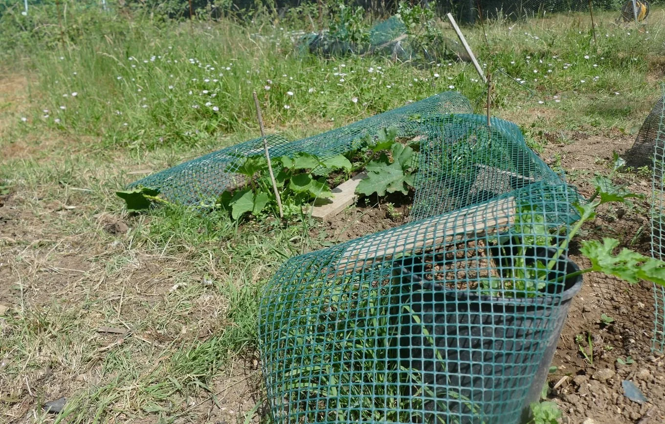
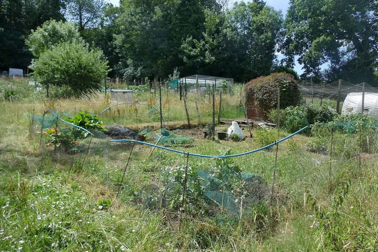
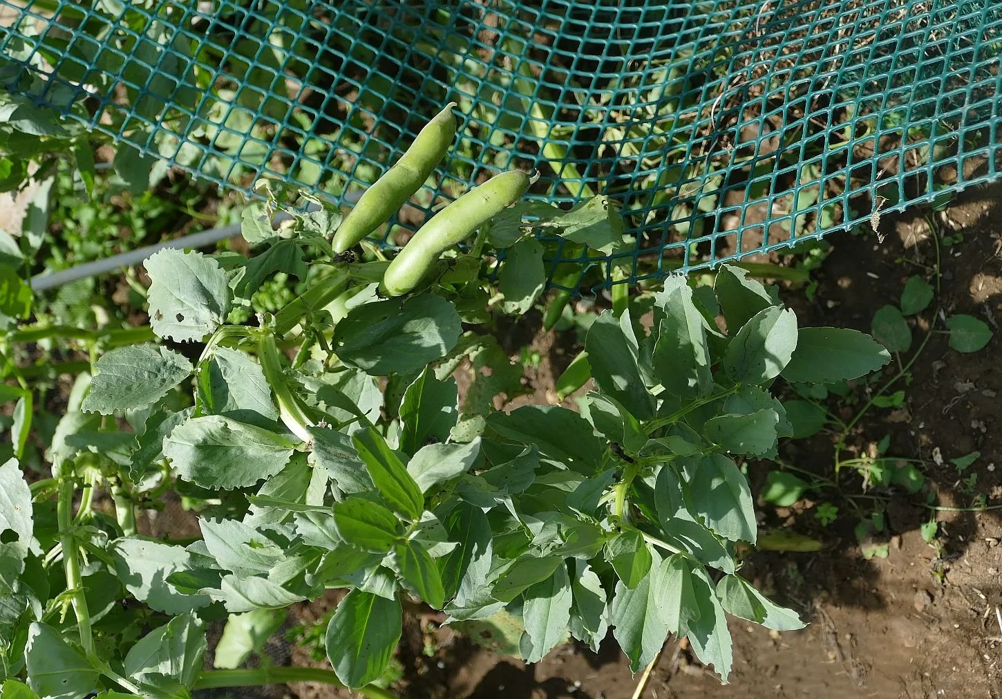
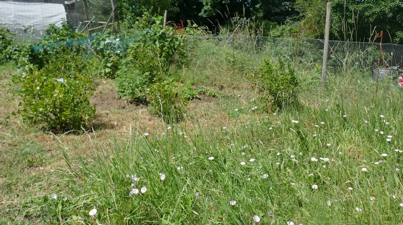
Many animal pests can be controlled fairly easily, even by using our hippie methods of recycling mesh, netting and other found objects. It’s not beautiful but it keeps the worst of the birds, slugs and even blackfly at bay. Again, commercial horticulture cannot survive on that philosophy. Pesticides or poly-tunnels are the norm – and some would say that these landscapes are not beautiful either.
Image above right: a neighbouring allotment poly-tunnel and below, a contrasting response to plant protection
The benefits of gardening and ‘allotmenteering’ to human health are well known. Apart from the upper body work out provided by weeding, the mental benefit of working among plants is outstanding. In particular, having your hands in the soil and experiencing, first-hand, the properties of your growing medium – water content, texture, bug life, root structures – is extraordinarily satisfying.
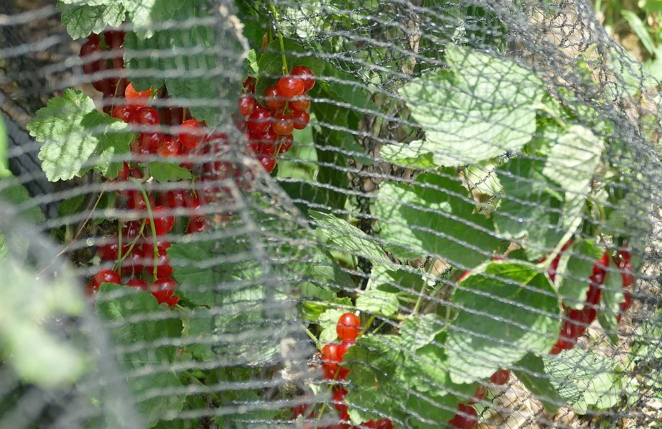
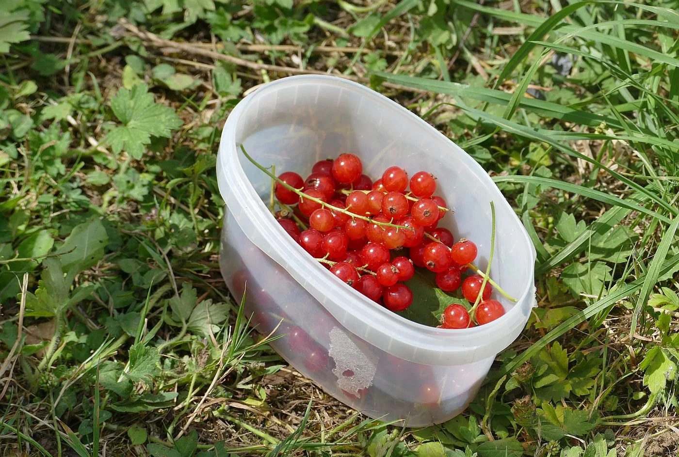
If you do raise a crop, the hope, the joy and the beauty of the process is followed by the thrill and deep satisfaction of picking and eating. When hope comes to fruition, there is the triumphant journey home with whatever has survived the onslaught of pests and weather. It peaks, of course, with the eating and preserving: homemade blackcurrant ice cream, fresh redcurrants on your morning cereal, rhubarb chutney and gooseberry crumble, courgette pie, Anglesey eggs with English leeks and chard, spinach or kale, fresh from the point of growth, gently wilted into any number of delicious dishes.

So what happened this year to make us even think about defaulting on allotment life? Enter the local deer – quite literally. Our allotment is surrounded on three sides by woodland. A main road deters deer from entering from the north and a proposed housing estate may well put paid to deer coming from the east, but the south is totally unprotected from these beautiful but ravenous browsers.
From the first year, we discovered that deer love the leaves of courgettes, pumpkins and raspberries. As we wanted to grow more than just rhubarb and potatoes, we erected netting around the raspberry plot in year 2 and wire mesh around the whole plot in year 3 - reuse of existing materials was insufficient to keep out the four legged raiders and we spent money on wire, posts and netting. The unit cost of allotment grown gooseberries shot up immediately but so did the production of other edible goods.
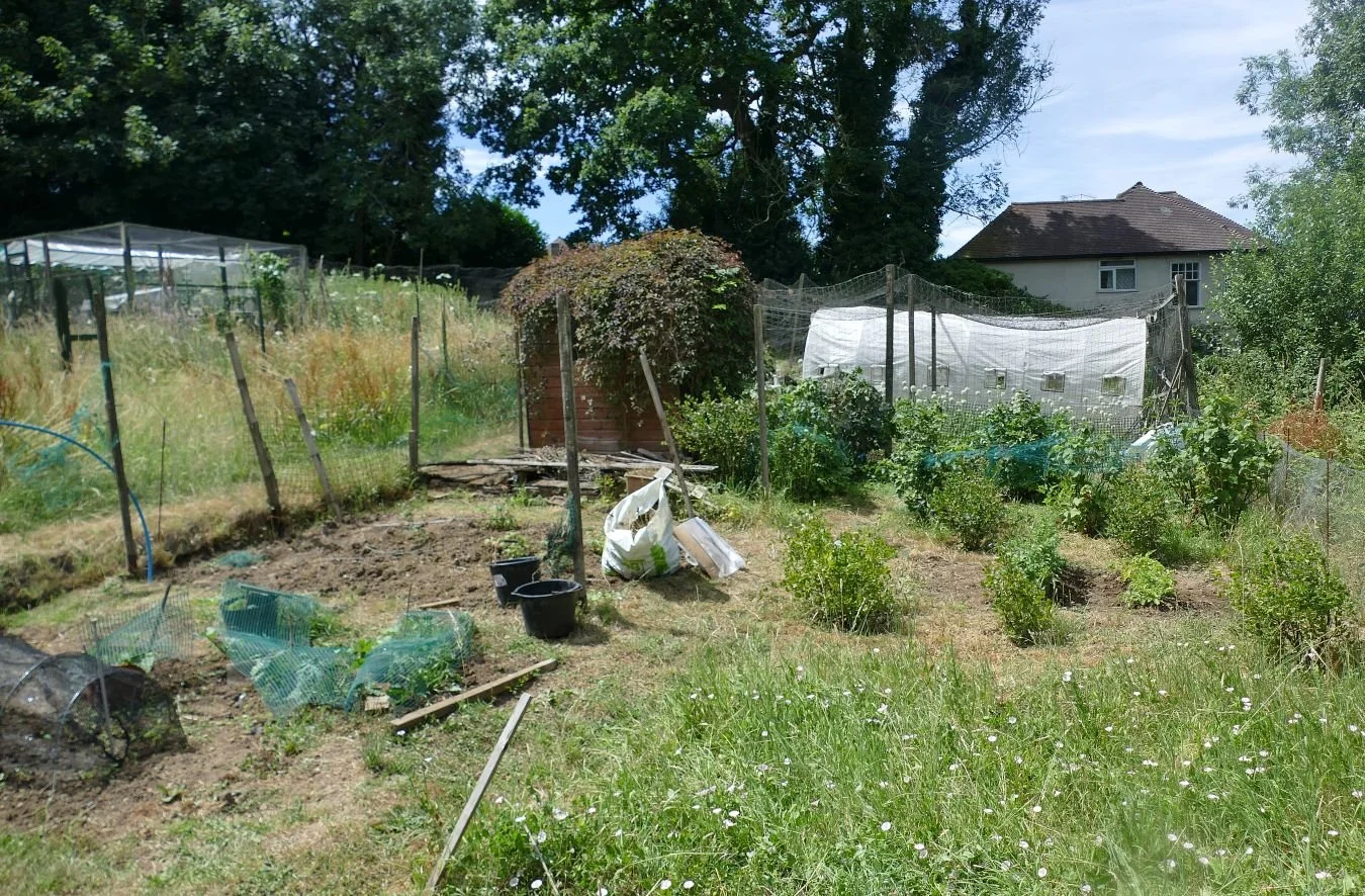
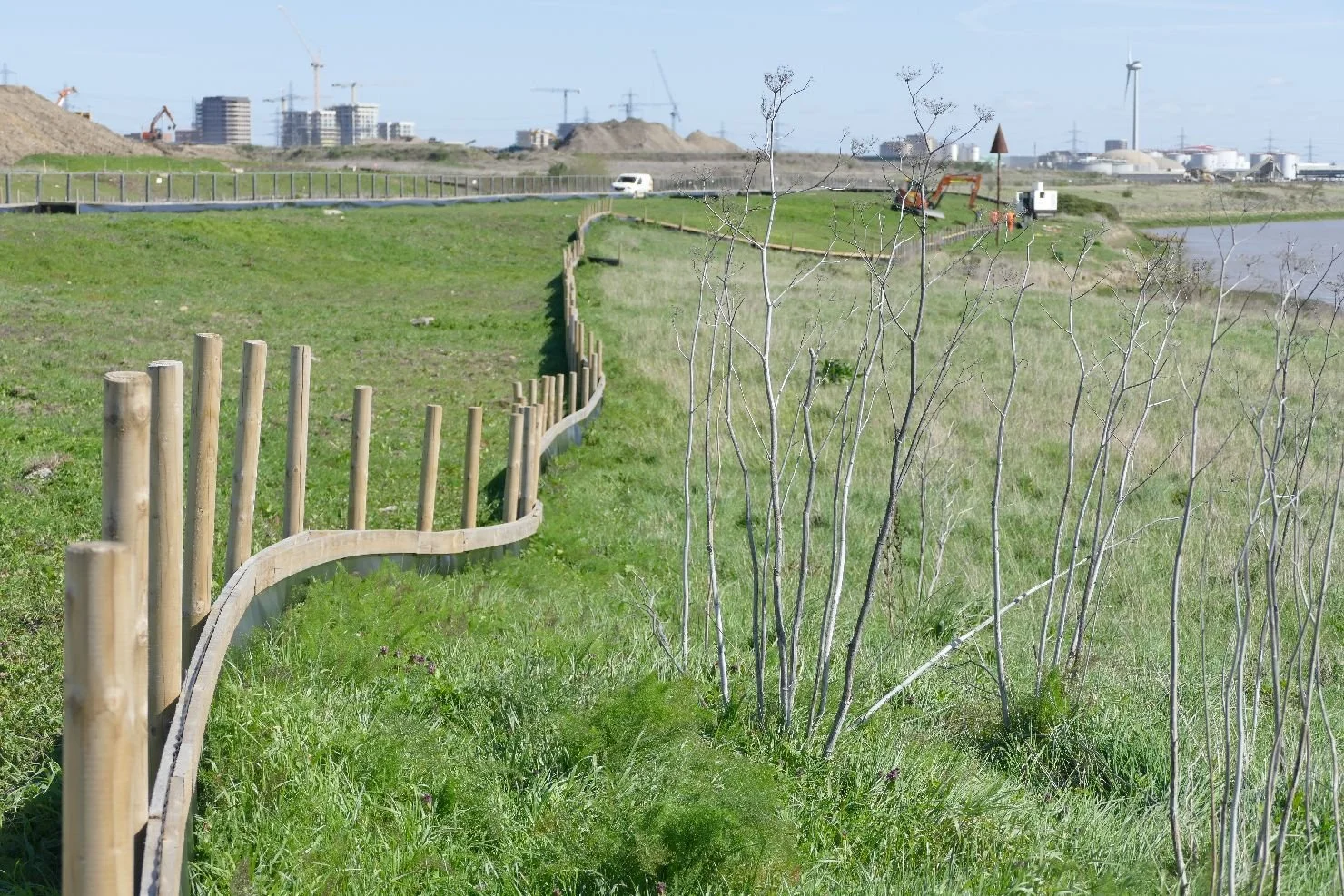
These days, however, our allotment site is busier than ever. We enjoy comparing notes and swapping plants with our neighbours. The chirrups of contented hens add to the soul-saving ambience. There are wild flower plots full of seasonal colour (we have one too - see below - but this year it’s mostly bindweed and grasses!), raised beds are contained by woven hazel stems, grapevines offer abundance and brassicas burgeon. The allotmenteers – all local – represent Ireland, mainland Europe and Canada. But we all have one thing in common: our plots are fenced against the deer.
Our plot, however, was still ‘protected’ by our six year old stake and wire combination. With every other plot guarded by 2 metre high timber, trellis and wire combos, the deer homed in on us. Last Sunday, we arrived to find one of our brand new netting tunnels nosed aside and the complete crop of red and green chard grazed to the ground. One of us was devastated.
This year we had invested more time than ever before in the allotment. We were now faced with a huge fencing bill to justify those hours. Other areas of our life were also ramping up with demands from family – growing up or growing old depending on the generation – and a mature house demanding repair. Not to mention the garden which is sending ever more enticing demands for attention.
A little voice suggested the unthinkable: give up on the allotment. With a shock we realised that it would be a relief. “A time to plant and a time to uproot”.
Second Thoughts

Terroir nearly had second thoughts about writing this blog. With the temperature even in a north west facing writing room hovering in the low thirties centigrade, the thought of spending time with a heat generating computer was not appealing.
But this title is also relevant to the vexed subject of climate change which is currently very pertinent. Surely we all knew that summers like this would be inevitable? Skiers have been chasing rising snow lines for years and this summer’s heatwave isn’t a blip, or a one off. We can’t shilly-shally over this any more. If you are a climate change denier, or campaign against sustainable solutions to energy production, or turn the hose on whenever your wallflowers start to wilt or the lawn turns brown, please, please have second thoughts. Give our children a platform from which to change society. Give our grandchildren a world in which to live.
But what we were actually intending to write about was ‘secondary woodland’! In Britain, secondary woodland is usually defined as woodland that has developed naturally on land that was previously cleared of trees.
When one of us was a child in south east England, our local open space was a fabulous area of undulating woodland with a couple of meadows, a strange hollow, some clumps of rhododendron (great for dens and hide and seek) and acres of bramble clumps which tore at our legs if we wandered off the path. Locally, this area was known, somewhat unimaginatively, as ‘The Woods’ and was surrounded on all sides by housing estates – mainly 1930s, but one was built later in the 1950s. One of us knows about the latter because the elder brother can remember when the site was farmland and was cultivated by a horse drawn plough!
Even as a child, I could recognise that this area had a special character. Some areas of the trees seemed to be mostly ‘even-aged’. Yes, there was a bluebell glade with wood anemone and, I think, celandine, but wildflowers were not widespread. An old multi-stemmed sweet chestnut provided a play area (known as the Peep-Bo tree) but was, we now realise, an old relic coppice stool. The hollow had been a gravel pit and the ploughed field was on former parkland. Looking at old maps, it now becomes obvious that some of the area had always been wooded but secondary woodland had grown into the spaces that were no longer farmed, following the speculative builders’ construction of the adjacent housing estates, in the early 1930s.
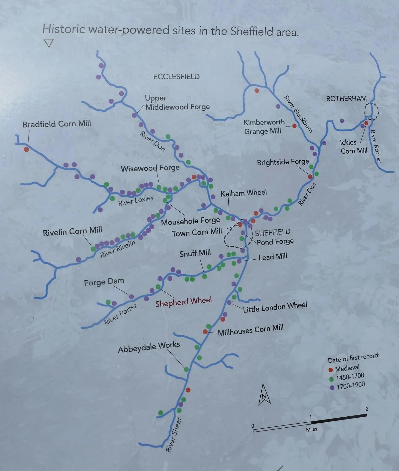
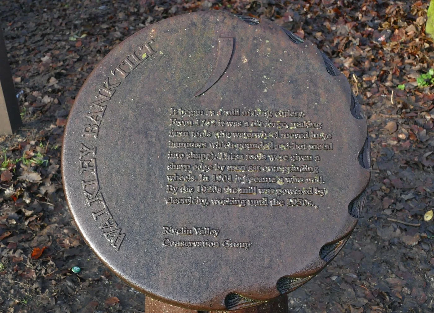
The history of Sheffield’s extensive secondary woodland is very different. Sheffield is often known as a city of hills but it is actually a city of river valleys! The rivers Don and Sheaff are fed by numerous streams including the Porter, Rivelin, Loxley, Blackburn and Rother. But the woodland which is now a feature of these valleys is relatively recent.
A history of the Don catchment (https://sheffield.ac.uk/doncatchment/about/history) reveals a long history of forest clearance for agricultural use, starting from the Neolithic and Bronze ages. Roman and Viking occupations expanded agriculture significantly and though the Normans brought a love of the chase and created large estates devoted to hunting, elsewhere agriculture was widespread, with open fields and extensive pastoral farming.
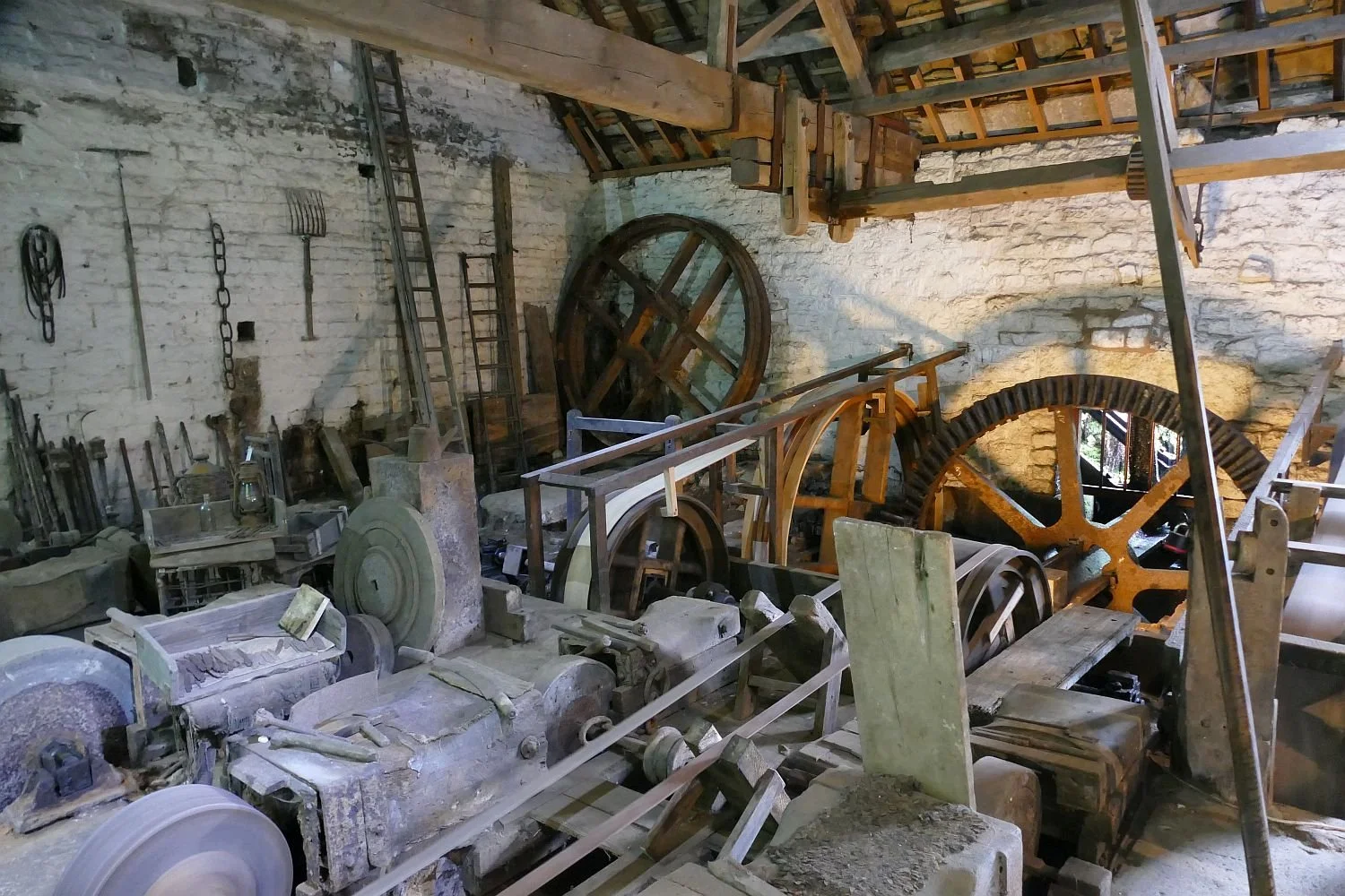
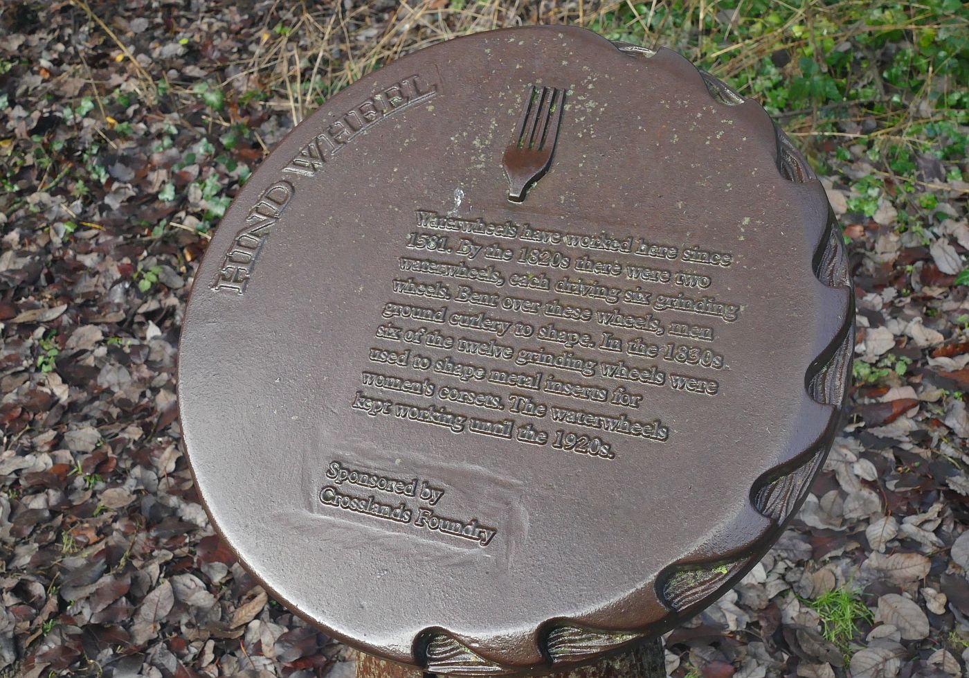
Technological change started impacting on Sheffield woodland in the 13th century. The number of fast flowing streams, and the presence of raw materials such as iron ore and coal, charcoal from what woodlands remained and stone suitable for grinding wheels, initiated the metal working tradition which made Sheffield the capital of cutlers. The ‘Little Mesters’ set up their works in the river valleys imbedding ribbons of industrial activity in an agricultural landscape.
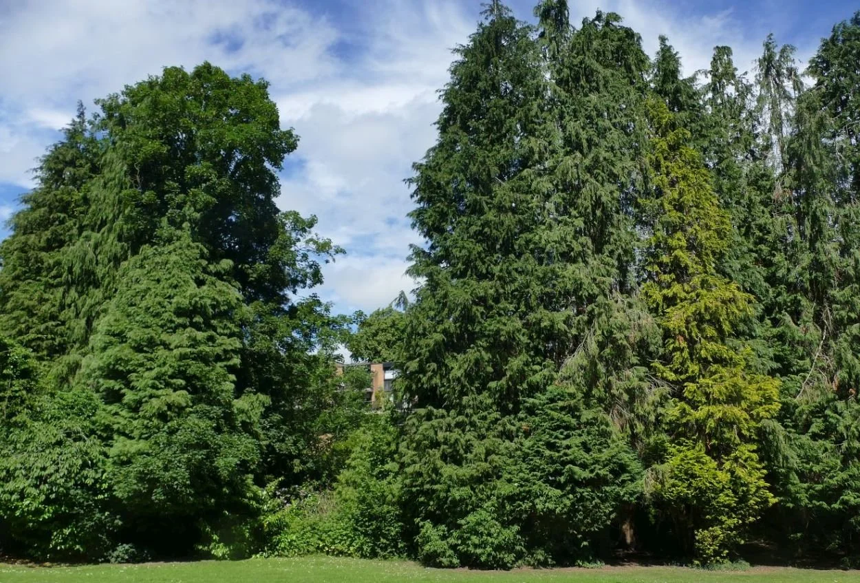
Today, these ribbons create verdant threads within the Sheffield urban area. The green canopy is largely made up of 20th century secondary woodland, sheltering a rich archaeology of water wheels, grinding wheels, workshops, furnaces, chimneys, dams, goits (channels to carry water into the works) and weirs.
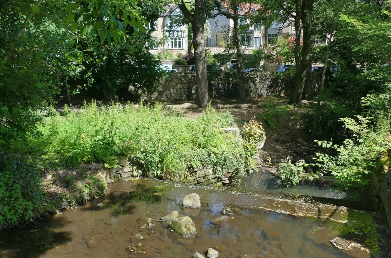
Today, the management of these leafy corridors is becoming increasingly challenging, if they are to deliver their new role of community green space.
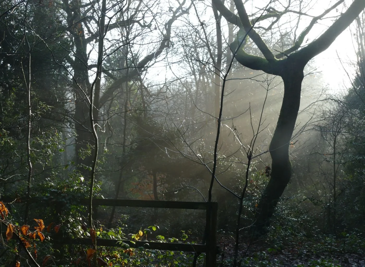
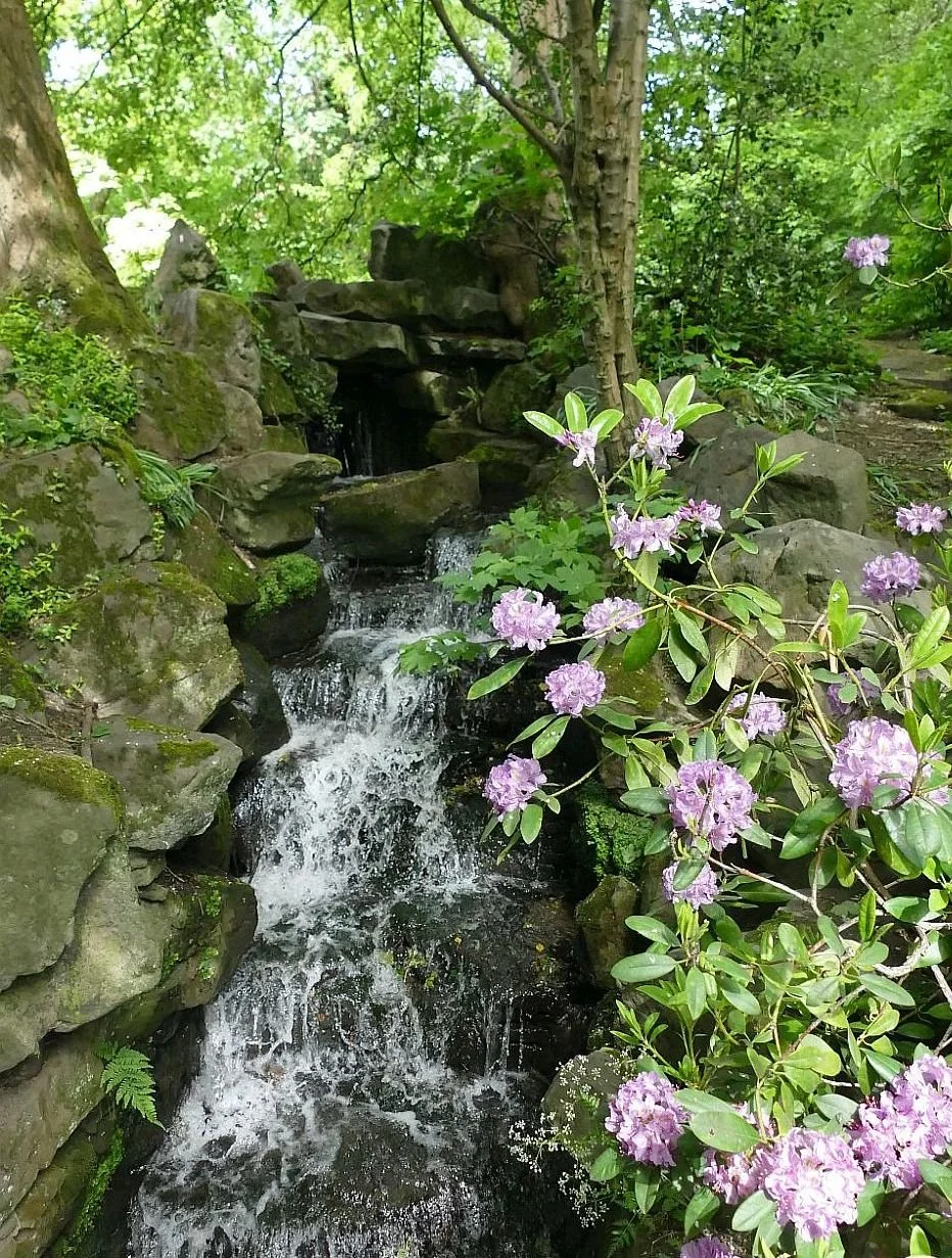
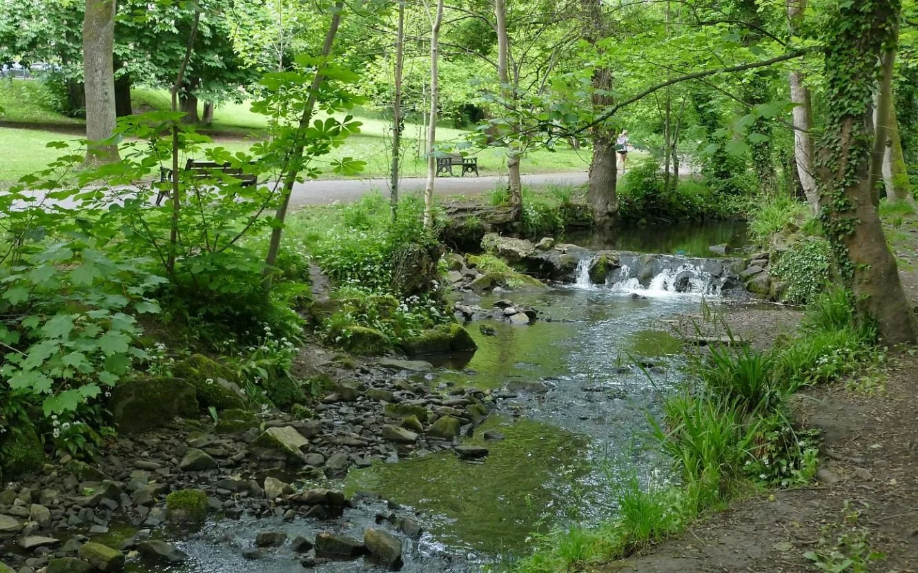
The Rivelin Valley Nature and Heritage Trail (left in spooky winter costume, and below) is a wonderful 2.5 mile homage to secondary woodland and industrial archaeology but still needs a careful hand to maintain access, safety, interpretation and artists installations.
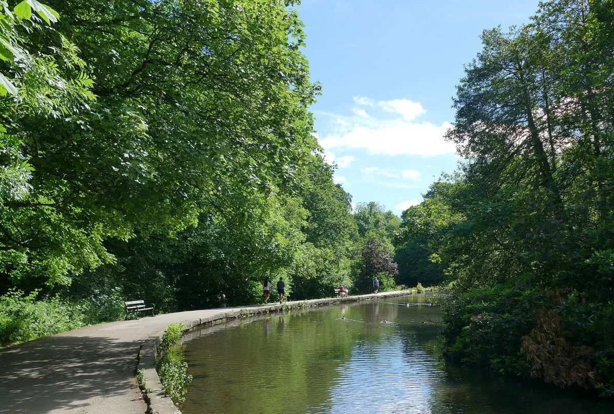
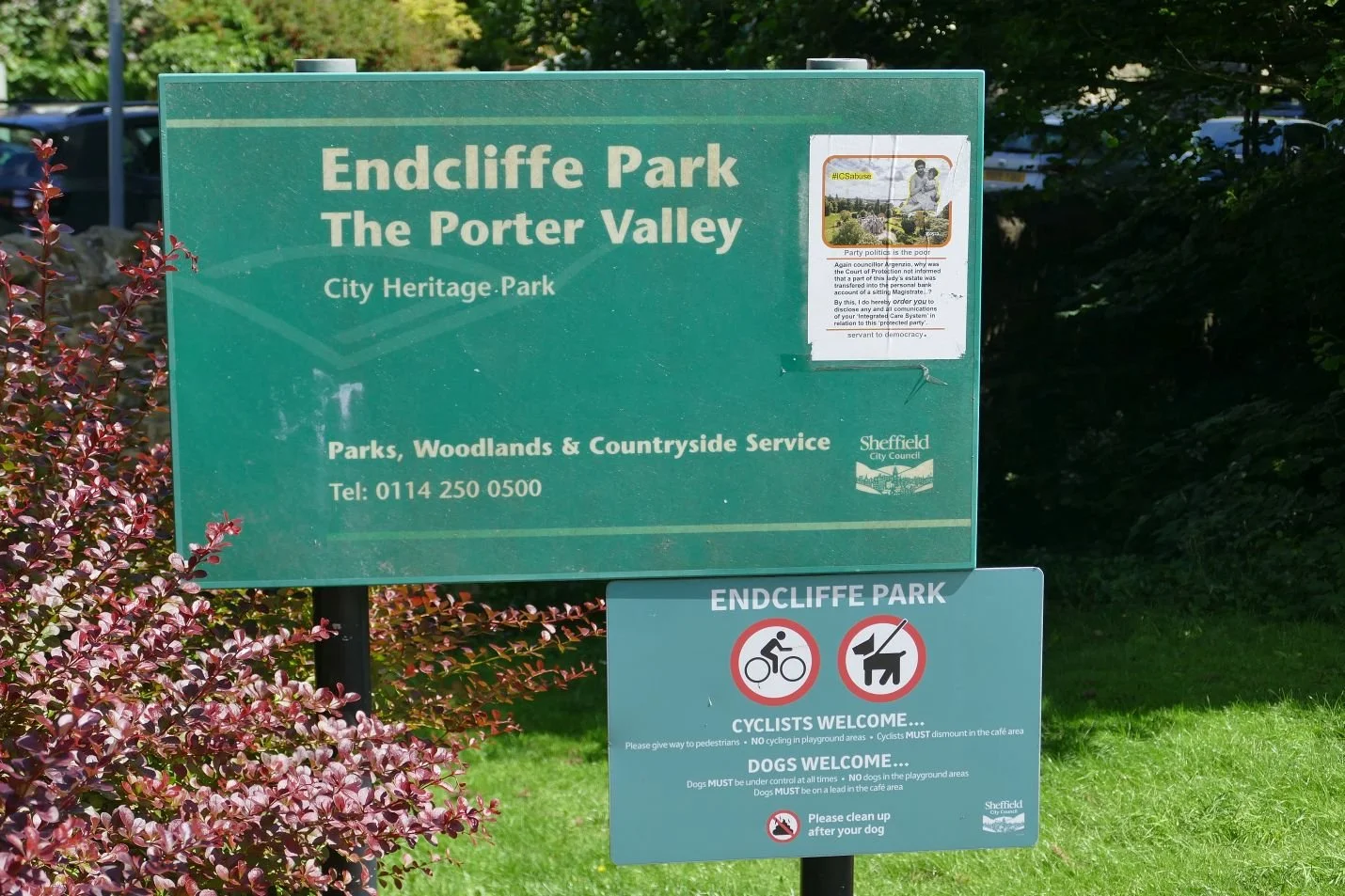
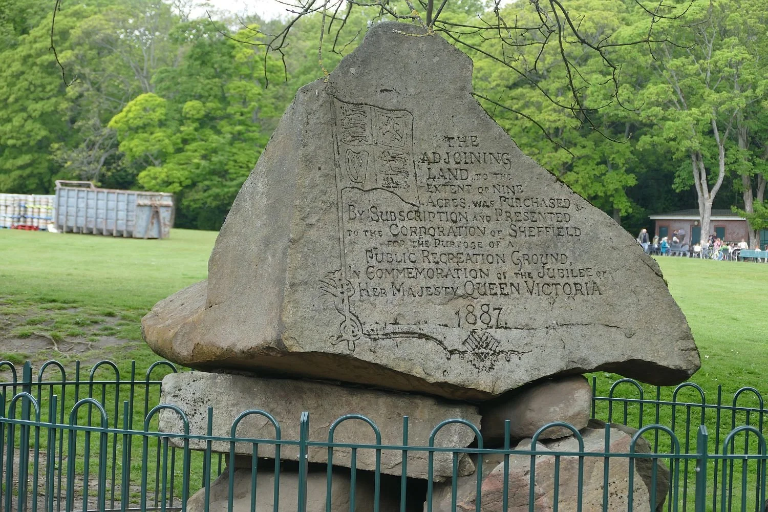
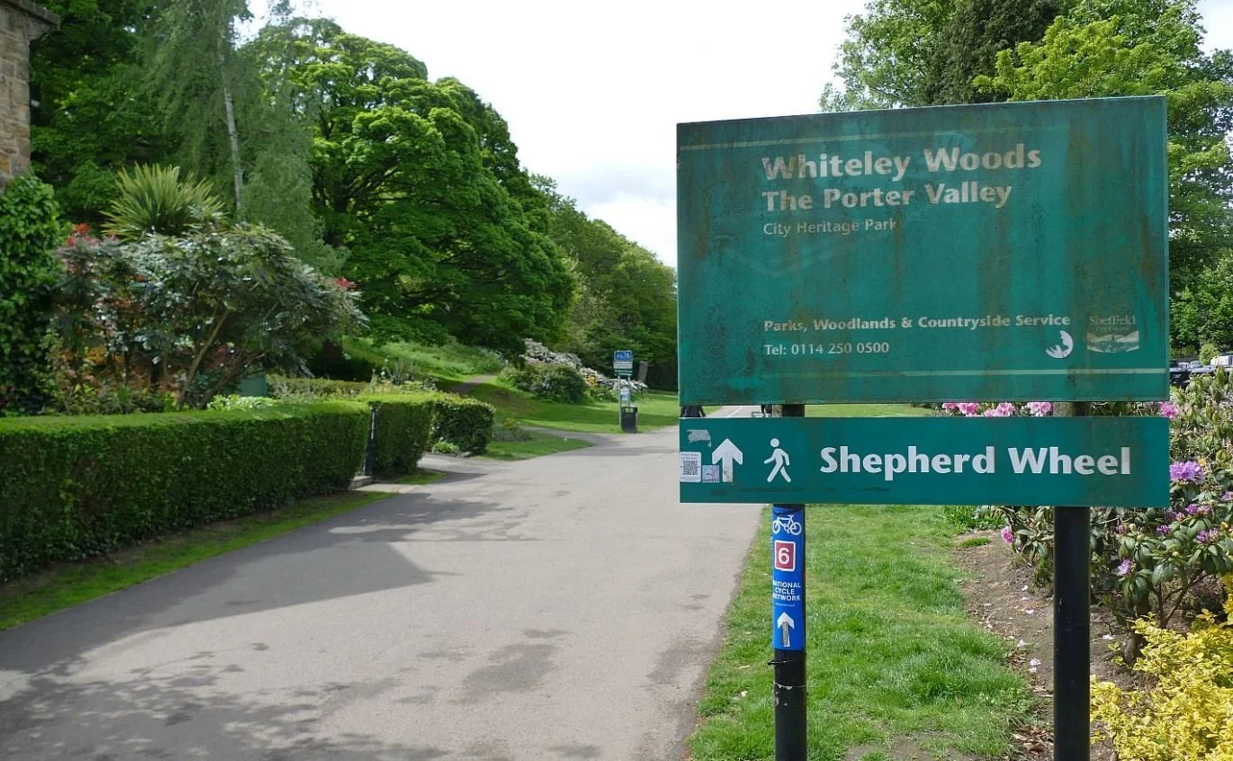
The Porter valley is much more complex in landscape terms and hosts over 4 miles of accessible, open spaces, linking the Peak District National Park to the centre of the city.
Five Parks have been created: Porter Clough (which nudges the boundary of the National Park), Forge Dam Park, Whiteley Woods, Bingham Park, and Endcliffe Park, the eastern end of which is less than 2 miles from the centre of the city.
Once upon a time, the rivers of the Don valley watered pastoral landscapes. Perhaps 500 years ahead of the steam engine and the Industrial Revolution, these rivers became the motive power for the foundation of Sheffield’s key industry - steel.
Now, in the 21st century the rivers have a new role to play by embracing their post industrial, ‘secondary woodland’ landscapes to promote health and well being. Good thinking.
Borders
What does the word ‘Border’ mean to you?
To the residents of Hay on Wye, the historic concept of a border as a line between two significantly different spaces is very familiar. Even today (or perhaps especially today) many English are still asking the question, ‘Is Hay on Wye in England or Wales?’ it is, of course, in Wales (just) but the fact that both town and river are known by their English names may account for some of the confusion.
Terroir has the feeling that the Romans were probably responsible for starting the English/Wales border hype, but the Normans were particularly hungry for the Welsh princedoms and fortified the border with numerous castles from which to launch their invasions.
The first Castle at Hay seems to have been built sometime in the 12th century - perhaps as early as 1100 - but this was later abandoned and a new castle built on higher ground. This edifice saw considerable action against the Welsh and also in the Wars of the Roses. (en.wikipedia.org/wiki/Hay_castle)
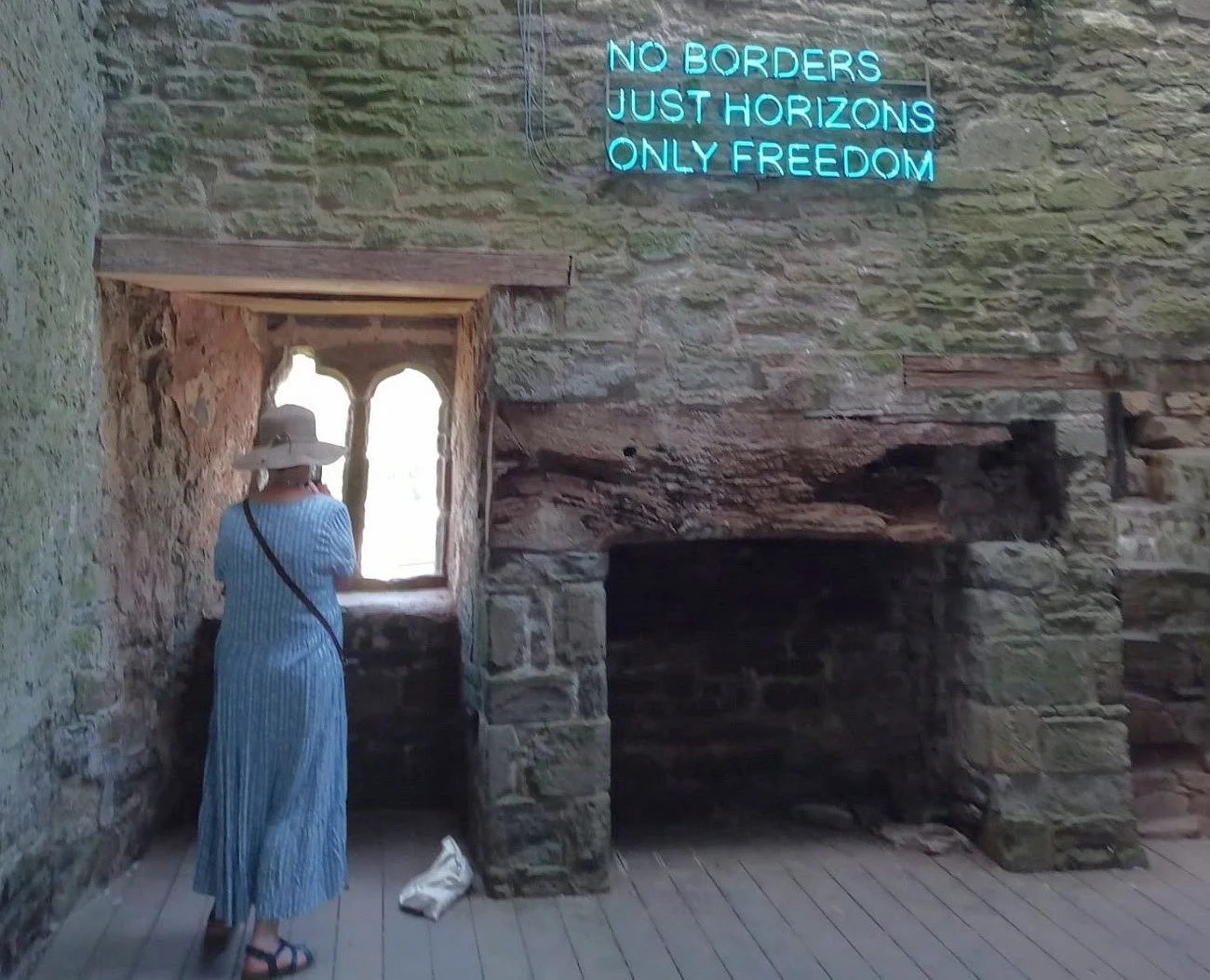
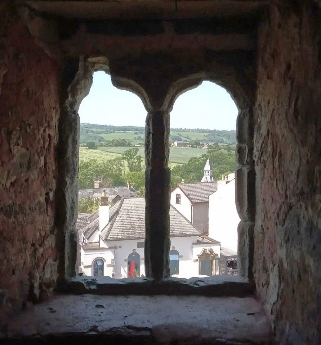
Right: looking out from Hay Castle across the town to the hills of the Welsh border landscape beyond
This summer the Hay Castle Trust is presenting an exhibition entitled “Borderlands: From the Welsh Borders to Antarctica: twenty two contemporary artists explore territory, identity and belonging”. The petty response (from Terroir) was ‘does a good title really have two colons and a slightly dodgy supply of capital letters?’. The serious response from a companion was, ‘I don’t like borders’. Indeed. Should we celebrate things which divide us?
This Image (left) is of one of the Borderland exhibits (and apologies for the technically appalling photograph and lack of reference to the artist). As a display piece of rural crafts it is arresting and impressive, but it stands alone with no context. It is a barrier? Is it part of a pastoral landscape with a use and a social history? To Terroir it appeared aggressive and confrontational, not a border or boundary that was in any way comfortable. No, this is not a comfortable border.
But borders don’t have to be political or even geographical in the traditional sense, The online Oxford English Dictionary definitions of the word includes flower borders, the decorative border on a piece of fabric, a type of dog, sheep or moth, a funeral border on notepaper and an exterior pile on a coffer dam. So no, borders don’t always have to be difficult or depressing.

?
In landscape terms, borders are seen as something to encourage and celebrate. Exploiting the ‘edge effect’ aims to add richness and diversity to adjoining landscapes, by building on the attributes of each and adding a few opportunities from the edge itself. For instance, a wide forest ride with a south facing border which can bask in sunlight and warmth, may encourage a wider range of species and habitats than that contained within the woodland alone.
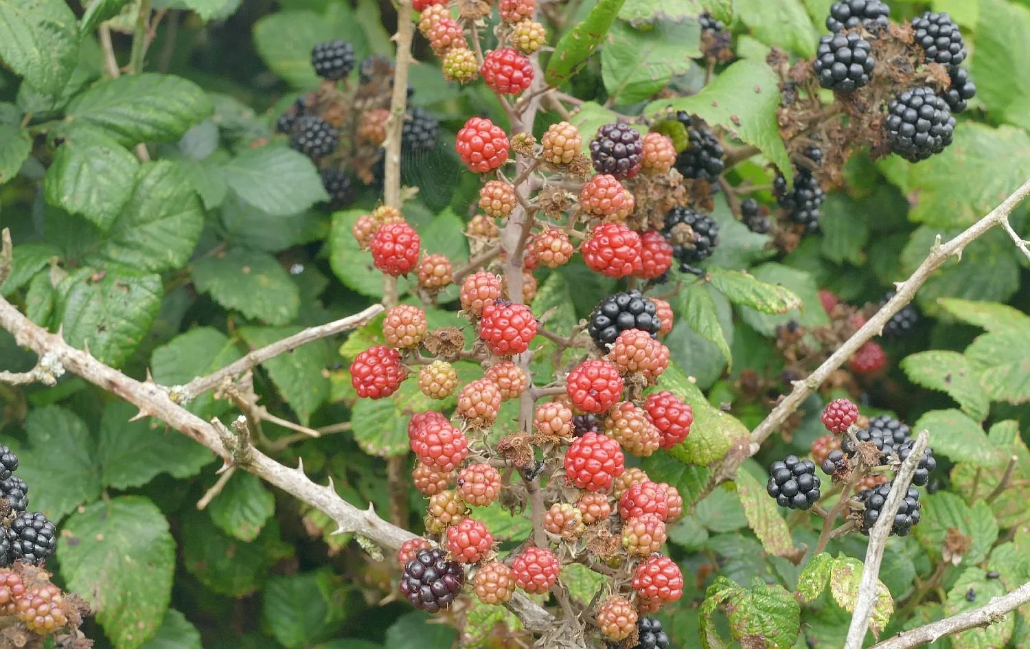
Inevitably, the theoretical ecology is complex but, to Terroir, the basic principle seems to be worth the effort. What’s not to like if the corridors created by footpaths and tracks are managed to create borders of local wildflowers between the path and the adjacent crop? Or if hedgerows and woodland borders are protected from grazing or ploughing to encourage greater species along their edges? Or if sharp transitions between one landscape and another are softened by a third vegetation type which exploits the boundary territory: a scrubby woodland edge with accessible blackberries waiting for the autumn harvest, a wildflower meadow between grass verge and road, a flood relieving rain garden between pavement highway or shallow water between main river and bank?
Can this philosophy be transferred to the political boundaries between nations or communities? The ‘edge effect’ requires consistent land management to ensure that communities on either side do not take over and obliterate the diversity of the border zone. This is something that politicians and diplomats find very difficult to accomplish. We doubt that even a border collie could achieve that but at least in landscape terms, not all borders are bad.

Don’t Judge a Book by its Cover?
And It’s hot, it’s half term, its holiday time, and it’s the start of the Hay Book Festival, which is located not quite in Herefordshire. Each of these statement is worthy of a blog in its own right but we are taking time out and pursuing an only semi-serious train of thought inspired by books.
Understandably, a Book Festival is full of books, is full of people trying to sell them and full of people who are probably willing to buy them. And what is the first thing that you see? The cover.
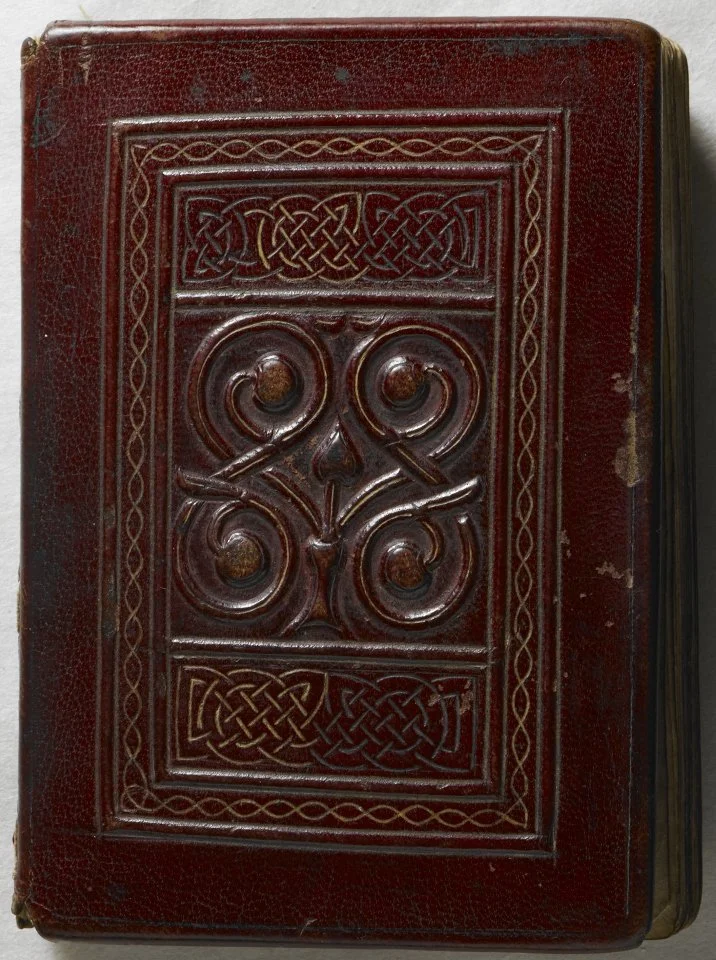
Book covers have been around as long as the books which they contain. Protection, identity and the cult of the words and pictures they enclose were as relevant in early book production as they are today. Monkish calligraphers wrapped their technicolour volumes in leather or even ivory or silk. These materials were embossed, engraved, tooled and inlaid with gold and jewels.
Thank you Wikipedia (https://en.wikipedia.org/wiki/Book_cover) for this image of the front cover of the St Cuthbert Gospel, said to be produced around 700 CE. The binding is described as “original tooled red goatskin” and thought to be the earliest surviving Western binding.
Modern book covers are still designed to impress and catch the eye but today must also tempt the target audience to reach for their credit card and purchase the volume which attracts them. Women’s magazine covers are still marketed, by and large, by a single image - a woman’s face - and although human figures still make popular book covers (illustrating either the author or the protagonist) many other contrivances are now employed to lure the reader.
Just how does landscape fare in the competitive world of book cover design? Take the Quiz - answers please to blogterroir.net@gmail.comor in the comments below - and we will let you know the results!
Topic 1 Poetry
Based on the covers below, would you buy Book A or Book B?
Topic 2 Classics

Topic 3 - Representatives of the Literati
Text 4 Futures

Topic 5 Struggles
Topic 6 Whodunnits
Enjoy browsing! Votes and Comments to blogterroir.net@gmail.com or in the comments box below.

Meadow Man
Professor Nigel Dunnett
1962 – 2026
There’s a programme on Radio 4 called ‘Last Word’. It’s the radio version of a newspaper’s obituary column and each week it offers listeners the chance to nominate individuals who they feel should be included in the programme.
One of us was participating in a landscape related Zoom meeting when we heard the news that Professor Nigel Dunnett had died, at the age of 63. I thought about contacting Last Word to suggest his inclusion in their next programme but to my shame, I didn’t do it. I needn’t have worried, however. Matthew Bannister - the show’s presenter – opened Nigel’s item with the words, ‘Lots of Last Word Listeners have been in touch with us to cover the life of horticulturalist Professor Nigel Dunnett of Sheffield University’. There are plenty of Dunnett admirers out there with more get up and go than we have.

Terroir was surprised by the strength of our reaction to the news of Nigel’s death. Yes, one of us had (albeit very limited) personal links with him, lived in a minor outpost of his world, knew people he knew, worked on at least one project with which he was intimately involved, and blogged on two more.
Image (right) © University of Sheffield
But our reaction was, in fact, symptomatic of the enormous impact he and his work had had on the environment around us.
The words used to describe Nigel’s contribution to the world of landscape sum up the difficulty of conveying the meaning and significance of working in the visible and invisible aspects of both urban and rural environments. In the last few days we have seen him described as:
horticulturist, garden designer, landscape designer, ecologist, planting designer, urban horticulturist, vegetation technologist, creator of innovative, immersive and sustainable planting schemes, and as a man who created biodiversity and colour and strove to connect people with nature in cities and towns.
If you want to know more please read the University of Sheffield’s obituary (https://sheffield.ac.uk/architecture-landscape/news/loving-memory-professor-nigel-dunnett) appropriately and gut wrenchingly entitled ‘In loving memory of Professor Nigel Dunnett’.
There are many other obituaries, ranging from horticultural magazines to at least one national newspaper. The Landscape Institute’s obituary lists the projects for which he was most famous and we have reproduced that list here. (https://landscapeinstitute.org/news/the-landscape-community-mourns-the-passing-of-professor-nigel-dunnett/)
“The Barbican Estate, London (2015)
Led the redesign of the podium landscapes, including Beech Gardens and the High Walk, transforming a Brutalist icon into a climate-resilient oasis using drought-tolerant, steppe-style planting within a Grade II listed setting.
Grey to Green, Sheffield (2016–2020)
The UK’s longest green street, replacing former dual carriageways with bioswales and rain gardens. A flagship project for climate resilience, significantly improving biodiversity and reducing urban flood risk.
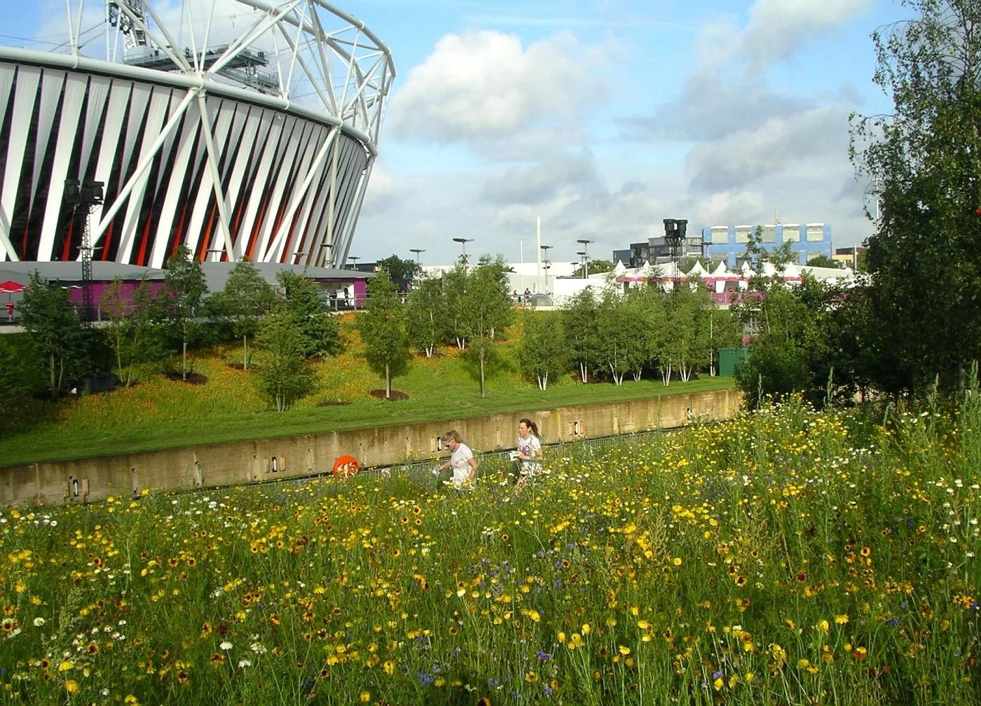
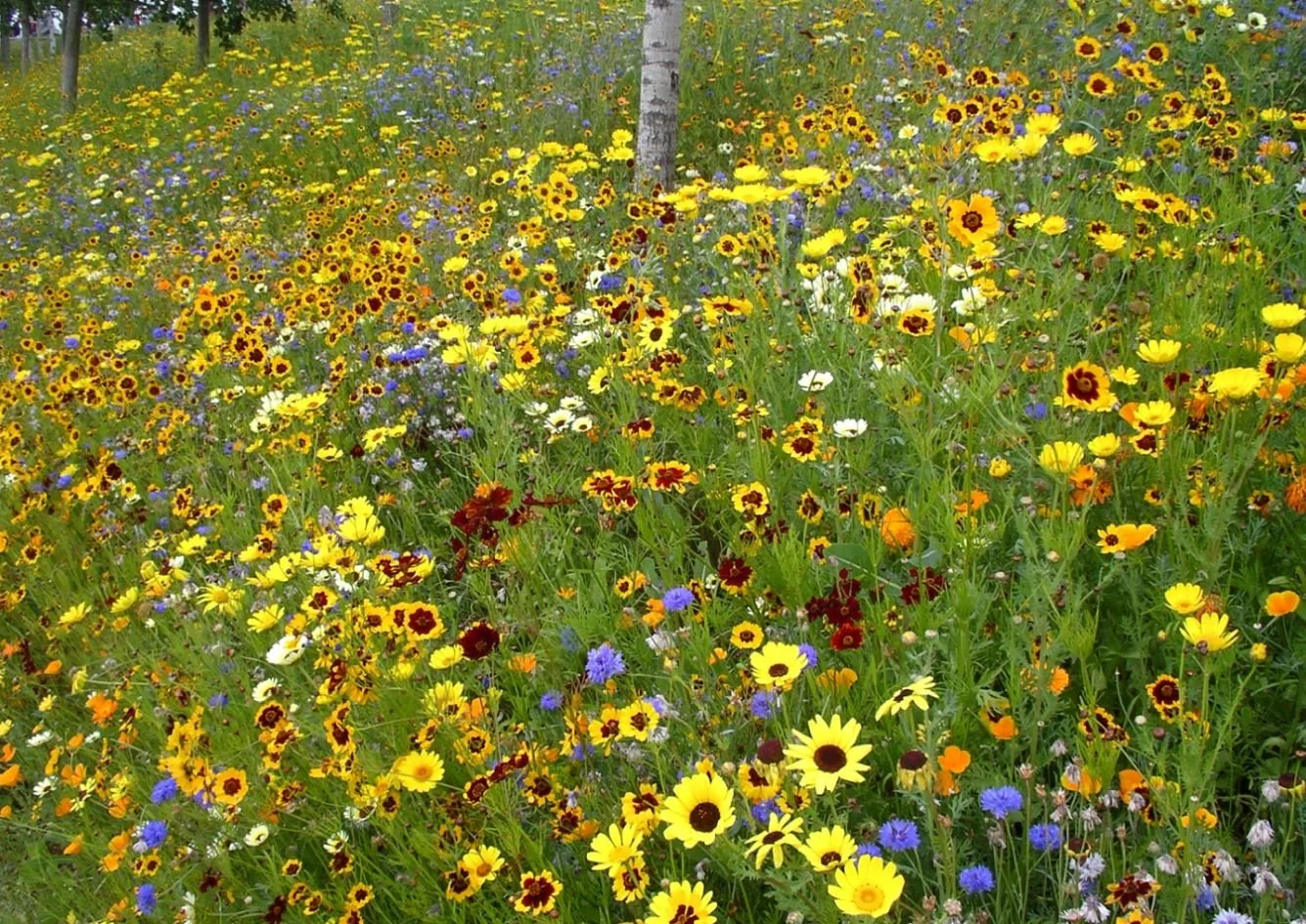
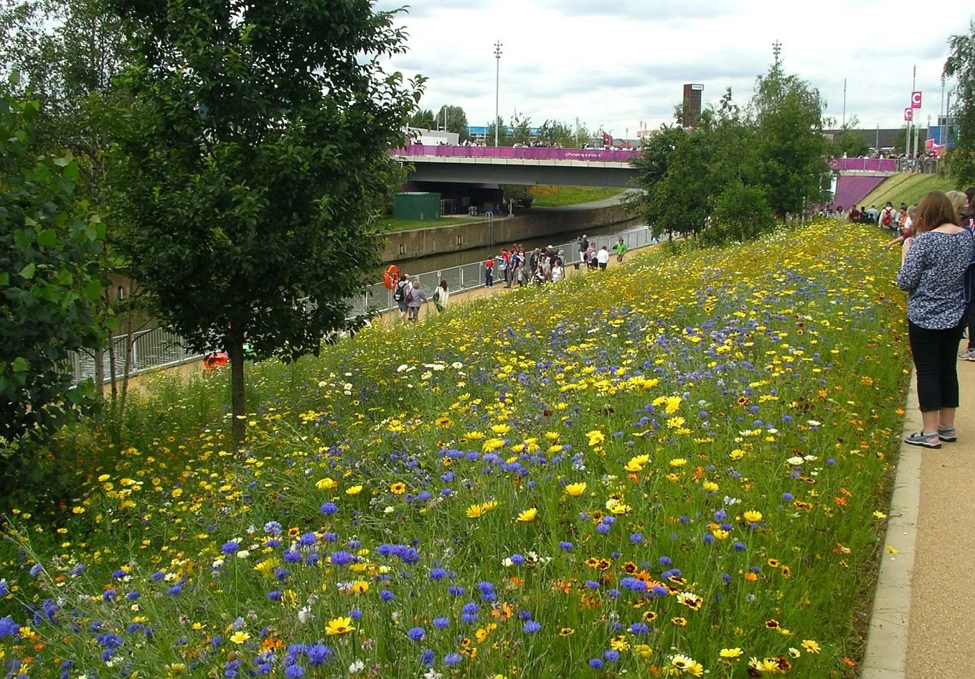
Queen Elizabeth Olympic Park, London (2012)
Principal planting consultant for the Olympic “Gold Meadows”, delivering large-scale pictorial meadows designed to peak in colour for the opening ceremony.
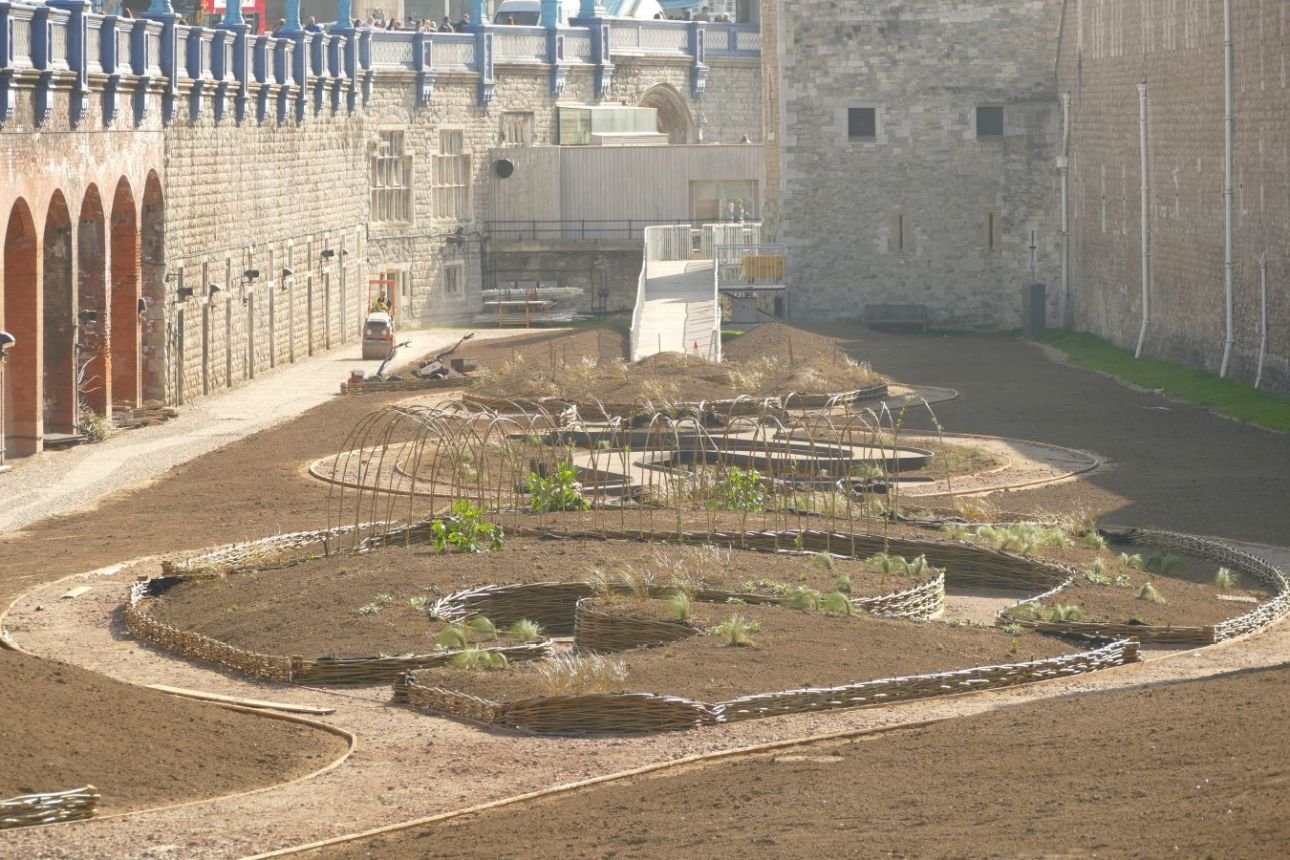
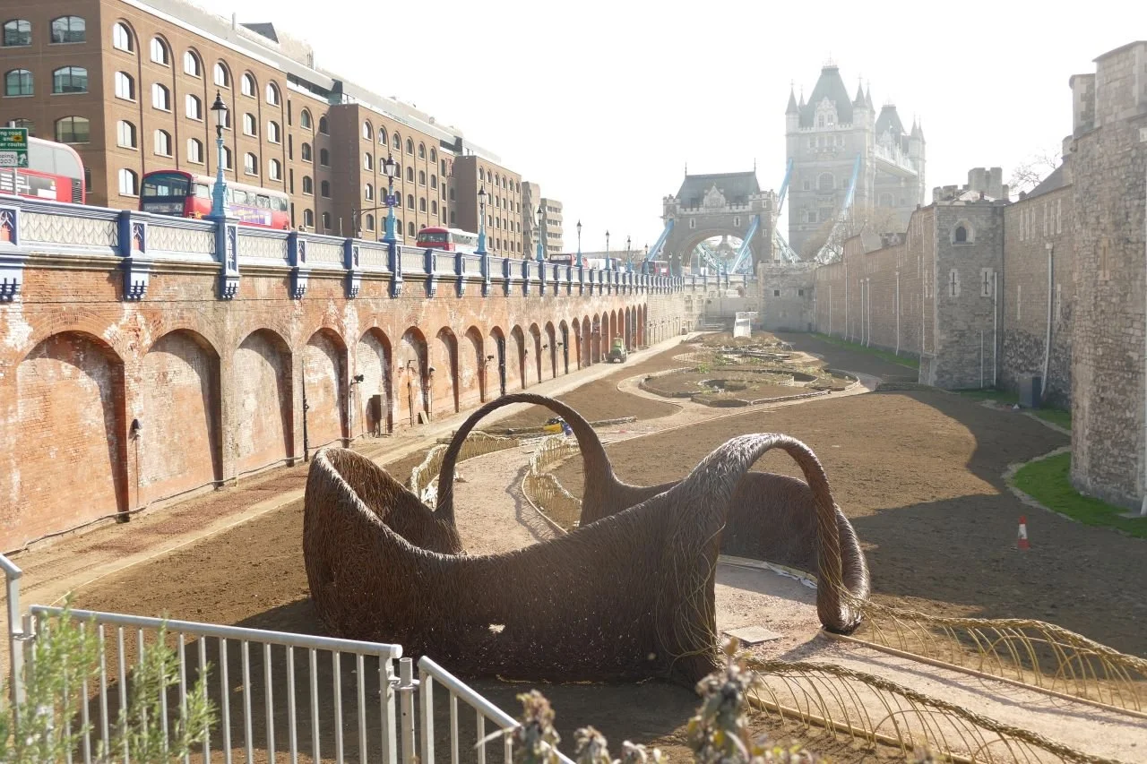
Tower of London Superbloom (2022)
Transformed the historic moat into a vibrant field of wildflowers using millions of seeds, reimagining a defensive space as an immersive and biodiverse landscape.
Grosvenor Square, London (completion 2026)
Leading the transformation of this historic square into a major urban forest, dramatically increasing planting and biodiversity and setting a new benchmark for green infrastructure in city centres.”
Terroir’s final offering is a brief photographic tour of three of these major projects. We never thought that they would be used so early in this context.
The Queen Elizabeth Olympic Park:
Grey to Green, Sheffield (from Blog 124 ‘River Hacks’)
Tower of London Superbloom - through the seasons

Nigel Dunnett: thank you.
Fête de la Vapeur
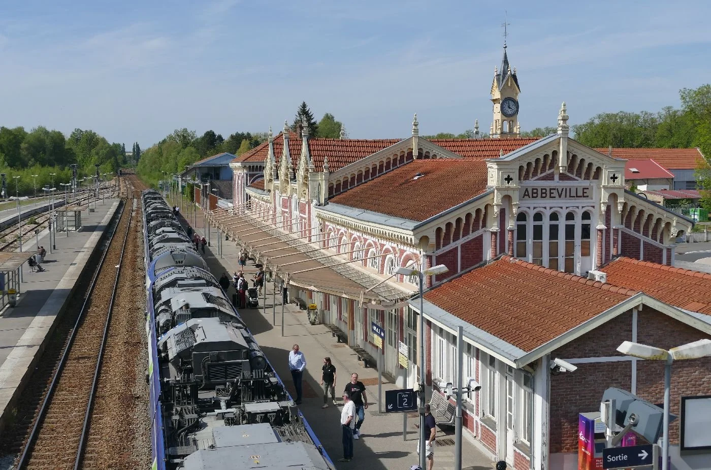
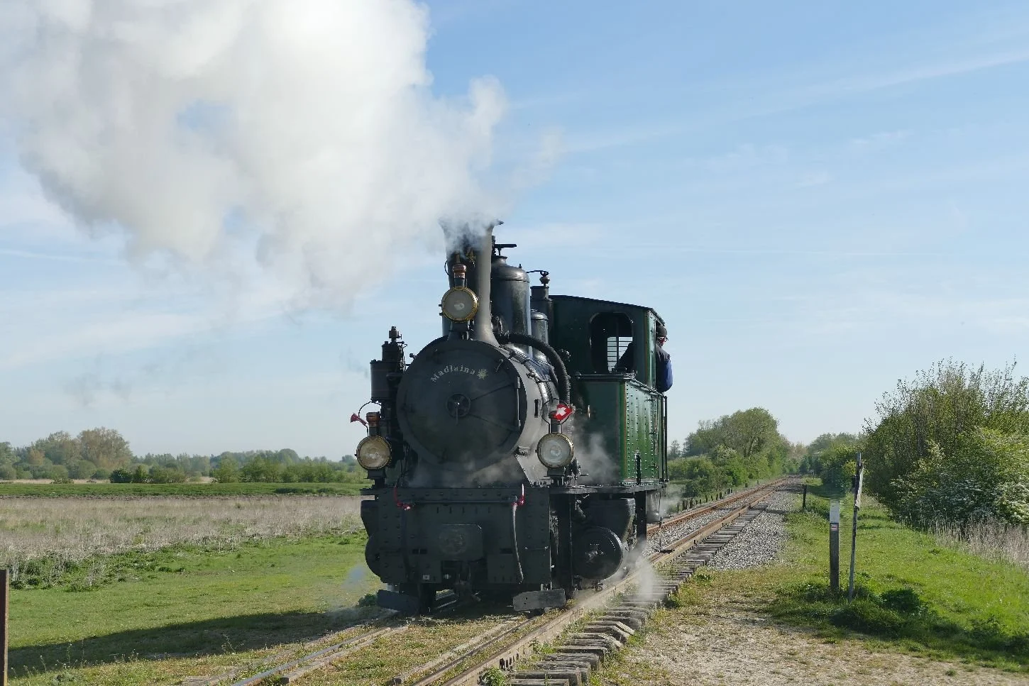
Towards the end of April, one half of Terroir found themselves in France at what was advertised as La Fête de la Vapeur. This was an opportunity for rail enthusiasts of all shapes and sizes [no, no, it’s not what you think – read on! Ed] to come together with their partners to savour the delights of the Baie de Somme: the culture, the food, the history and its geography. We were based at Abbeville, in the Somme Department - now part of the huge Hauts de France region which incorporates Picardie as well as Nord-Pas-de-Calais.
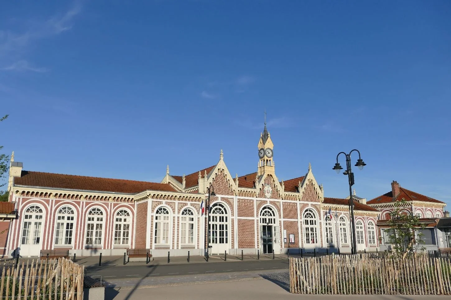
As we arrived at the glorious confection which is the station (right), we were immediately aware of the importance of water: the elevation of the town varies between just two and eight metres above sea level. There is also the Canal Maritime, and the Somme itself, crossed by several small bridges.
Images below: low and high tech water management
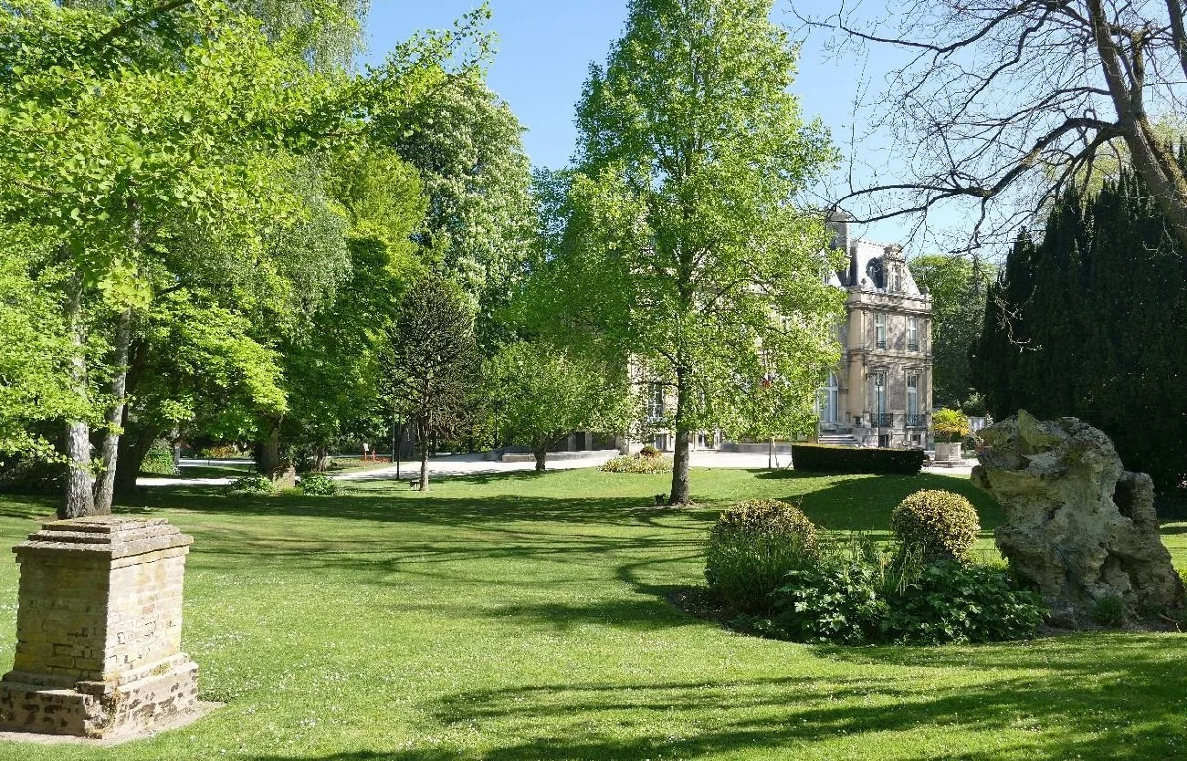
Within the town, there are parks, and reed-lined lakes and most particularly what was once the garden around the erstwhile home of 19th century botanist, Arthur Foucques d’Émonville. (Now there’s a name to conjour with for an English speaking visitor).
Nowadays his garden is a public space with its labelled ginkgo, monkey puzzle, giant sequoia, cedar of Lebanon, magnolia, sweet gum, and black walnut, amongst others, and of course some mallards feeling very much at home. Not quite what could be said for the model animals scattered through the bushes, part of a school project inviting responses to the theme of dark nature. They were of little concern to the lycéens enjoying a break from classes on the seats provided.
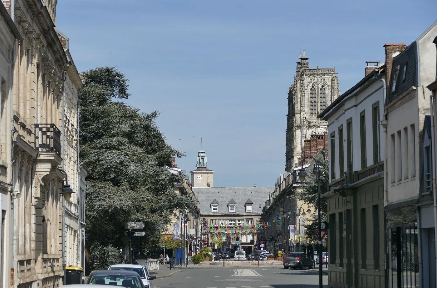
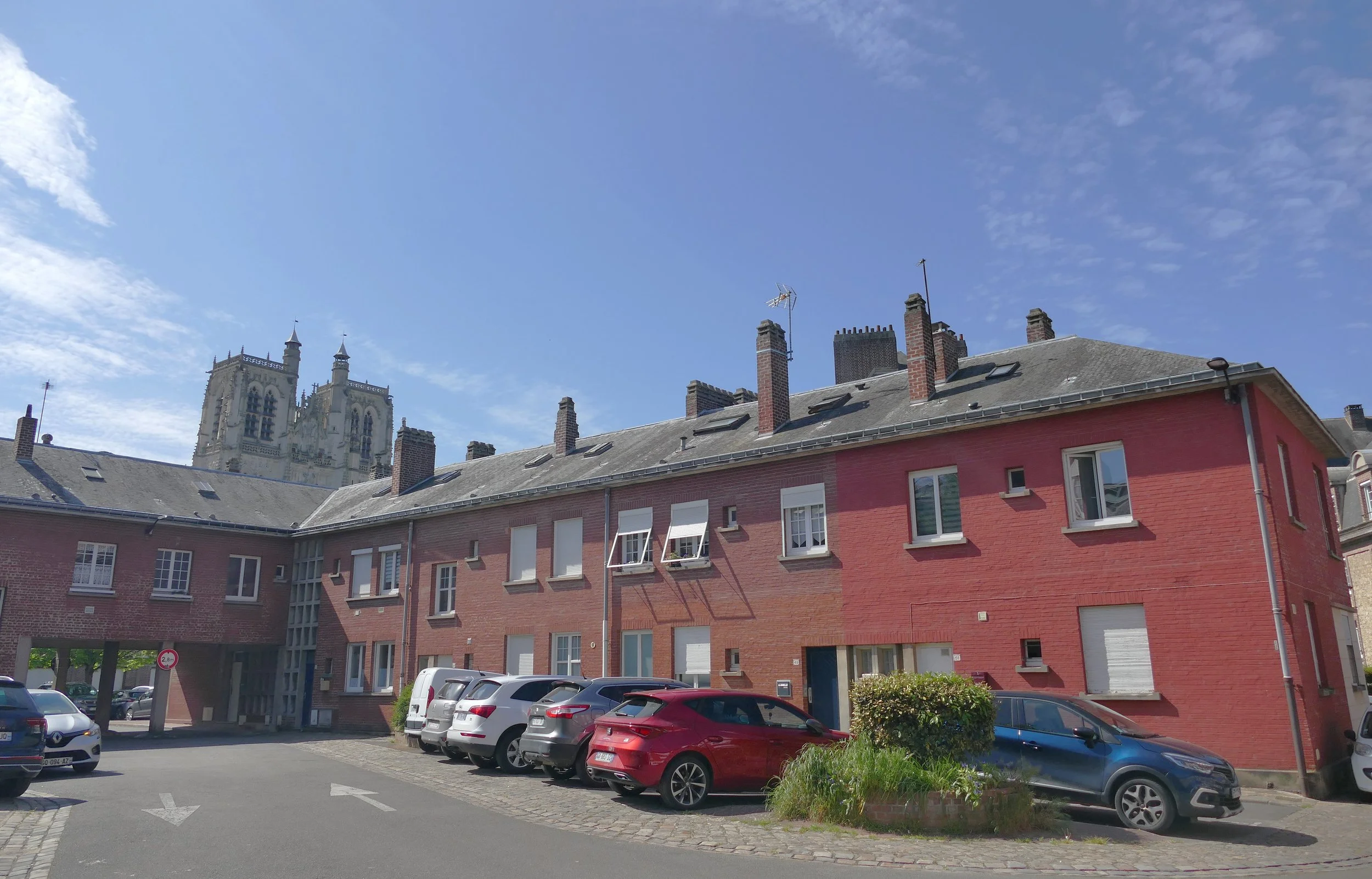
Most striking in the town is the dominating yet unfinished church of St Vulfram with its flamboyant gothic frontage and tower (right). It feels magnificent and by no means incongruous, sitting within a successful 1950s designed townscape (below), with rebuilt town hall and belfry and four storey linked blocks of housing, under which the main road passes around enclosed island spaces and pedestrian walkways.
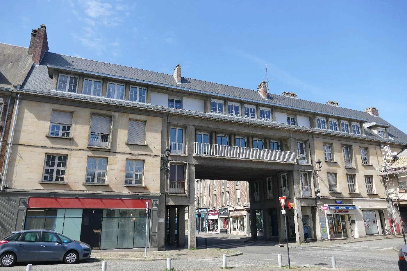
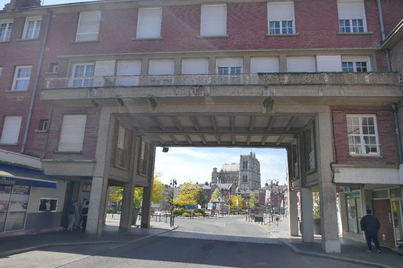
All this was the consequence of post war planning and determination to drastically improve sanitation, hygiene and the passage of people along the streets. . And why? The devastating German bombing of the town centre, during a period of over eight hours in May 1940 as part of the Blitzkrieg which successfully cut off the French armies from allied forces to the north. The town centre was flattened and only St Vulfram survived.
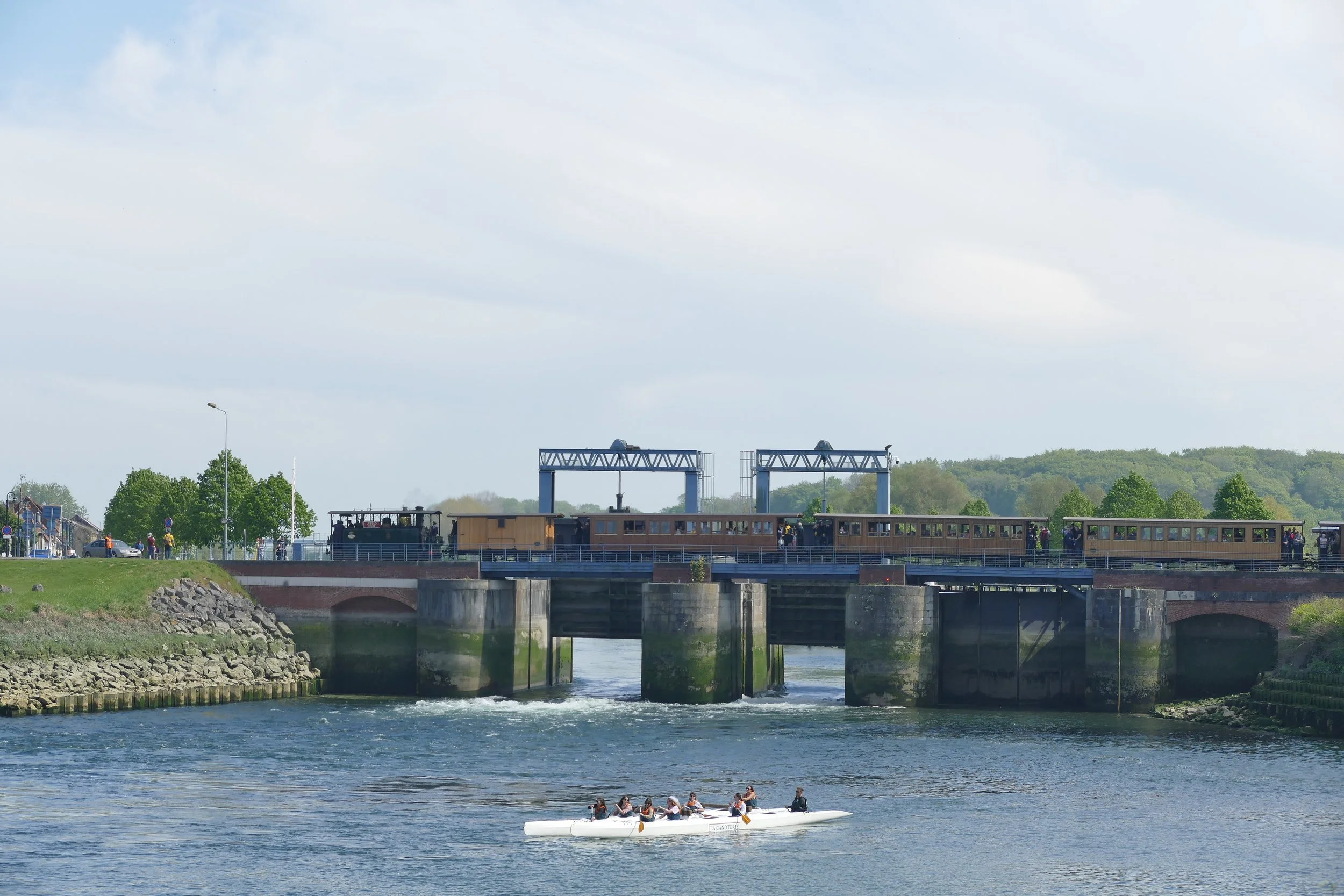
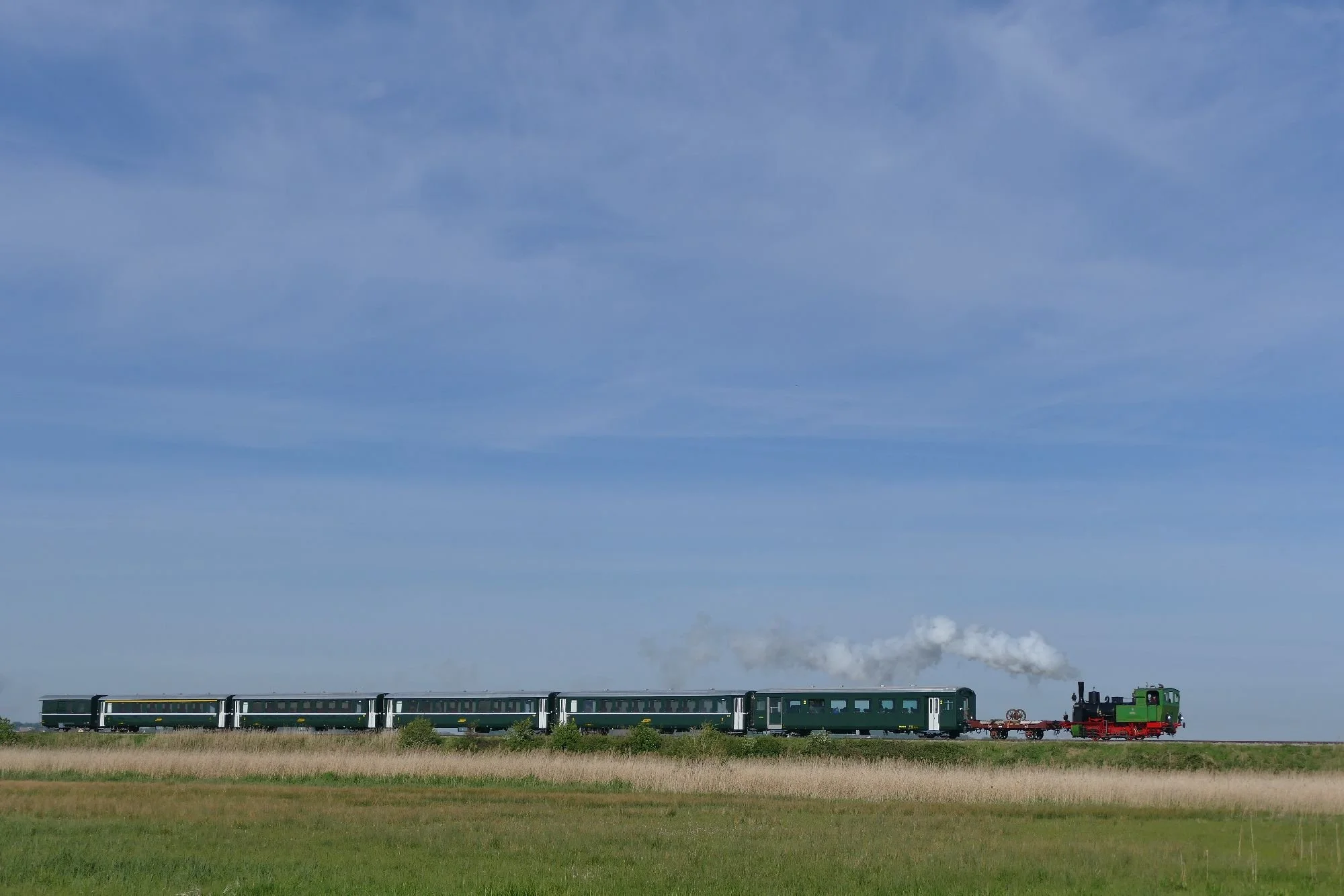
While Abbeville was our base, our main destination was the coast, the Somme estuary itself, and metre gauge heritage railways. A main line train (left) took us to Noyelles, from which the two arms of the tourist railway stretched out, one to the south, to Saint Valery and on to Cayeux sur Mer and, on the northern bank of the estuary, a branch to Le Crotoy.
Alternatively, you could hire a bicycle and cycle along the canal to reach Saint Valery, or switch from gricer to twitcher and find yourself diverted by the nature reserves.
The metre gauge railway arrived in the 1880s to service and encourage the growing tourist industry (Toulouse Lautrec chose Cayeux, Jules Verne Le Crotoy, for example). Goods carried were mainly sugar beet and flint pebbles for use in aggregate; and like so many other railways, they were on their last legs [wheels/rails? Ed] by the 1960s.
From the 1970s, there was the beginning of some hope for resurrection as a tourist railway. It helped that SNCF (the French railway company) continued very occasional use of the line for freight from Saint Valery; the tracks were dual gauge and could still take the larger, main line wagons.
This visiting Swiss locomotive (right) illustrates the system with one of
its wheels visible on the alternative, inner, metre gauge track.
The
goods traffic ceased in 1989 and the burgeoning not-for-profit organisation was able to operate the line purely as a tourist heritage railway.
Access to European and regional funding allowed a focus on a summer only tourist railway with passenger numbers increasing through the 80s and 90s. In recent years the railway has been carriing about 120,000 to 150,000 passengers a year between April and the autumn.
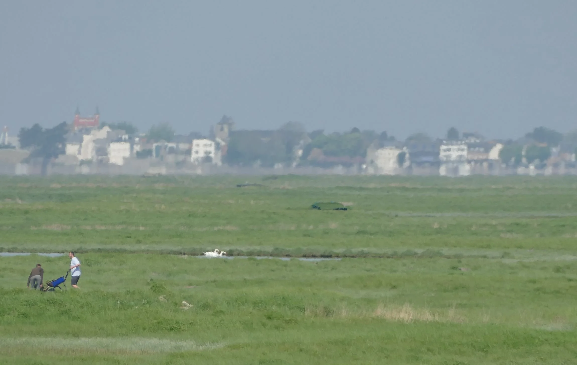
Our visit coincided with a gala bringing together engines from Belgium, Switzerland and Brittany. It was the first since Covid and was joined by another important local festival (le Festival de l’Oiseau) to celebrate the birds that make this area world renowned. The vast estuary provides breeding grounds for many species and habitat for thousands of migrating birds to rest and feed.
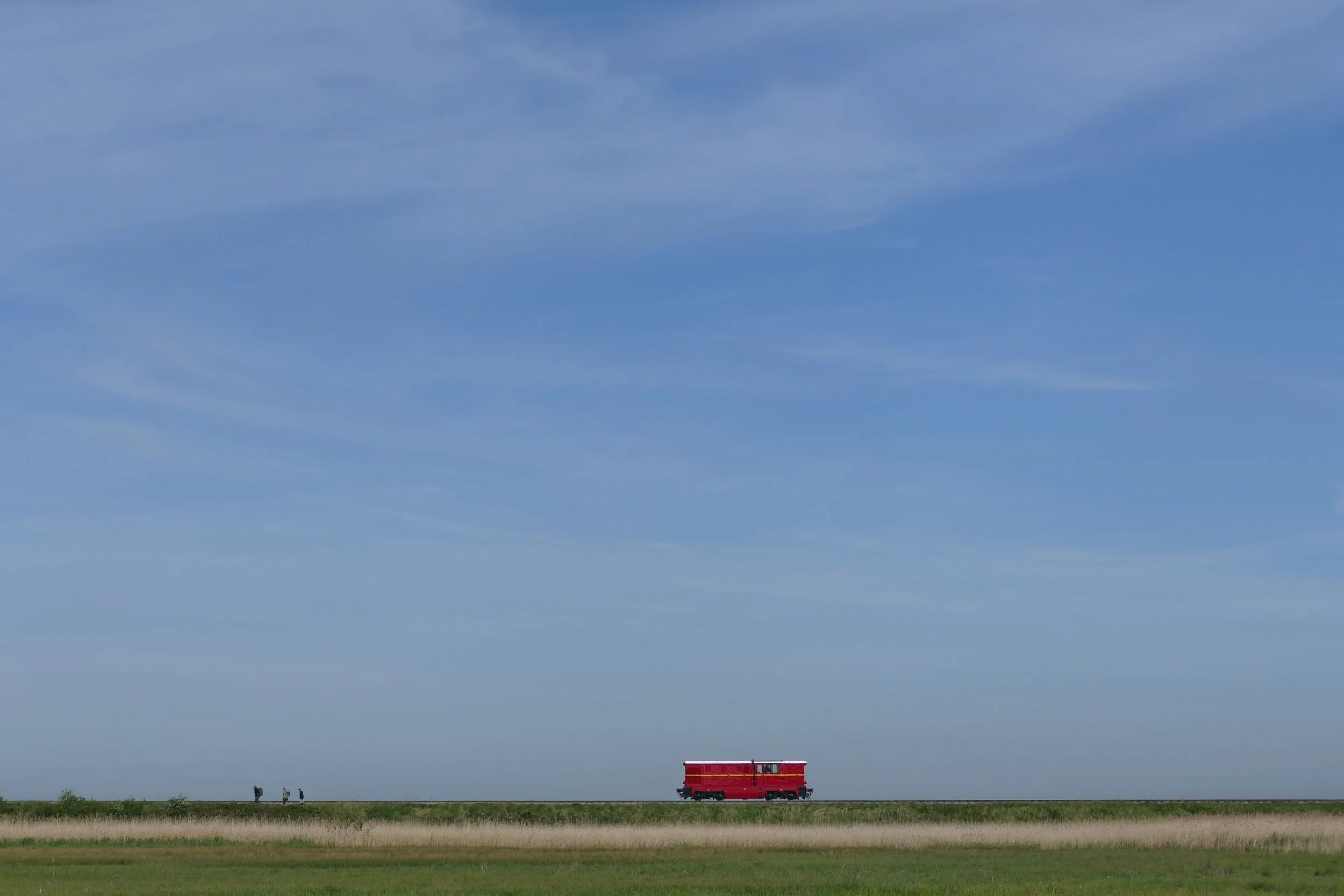
A ride on the railway through the marshes [as if excuses were needed! Ed] gives the opportunity to see all three sorts of egret, plus swans and herons. A walk into the marshes to see the steam engine haul its coaches along the flood protection embankment is altogether different. Hawthorn bushes, resplendent in white, give way to pastures and then to channelled water, before the embankment comes into view. Passing the reed beds we heard a cacophony of sounds, warblers and buntings - singing fit to bust - flitting momentarily into view. And then the two tone call of couple of cuckoos as the train arrives, white smoke drifting out across the marsh, and drowning out their sound, as it trundles past.
On crossing the bridge and sluice gates into Saint Valery, we find volunteers in yellow t-shirts doing a valiant task in guiding crowds and keeping people free from mishap. The distinctive yellow shirts at all the stations soon provided a familiar sight.
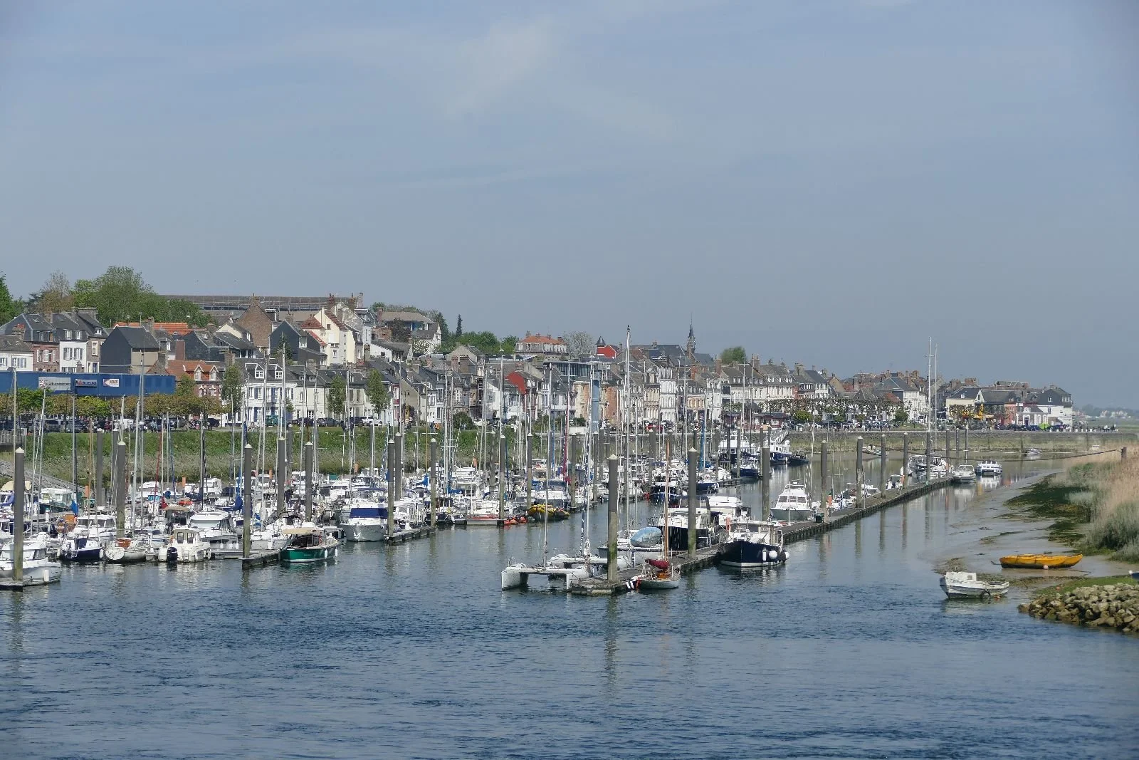
Around the station, stalls were set up to sell us local fare. From the port where William left to conquer Britain, dozens of berthed up yachts await their owners in the summer months (left). Le Crotoy remains visible in the haze across the estuary.
For us to see the ocean, or just the English Channel, required taking another train on to Cayeux-sur-Mer. The engine needed all its fire to hammer up the bank beyond the station, hauling its carriages on to the plateau above the estuary and spitting cinders in the effort. These set light to the trackside grass banks, but fortunately were quickly extinguished by some willing volunteers.
In our childhood, railway embankments in the UK were always clear of trees and here we saw the reason why. Leaves on the line were far less of a problem then, as passing locomotives were regularly the cause of lineside fires and kept the vegetation short.
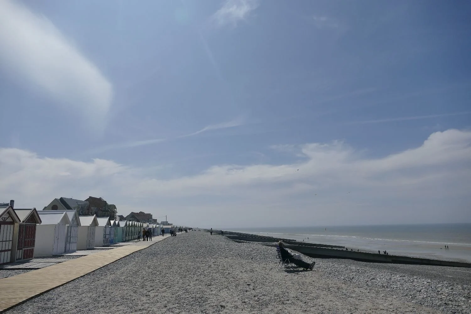
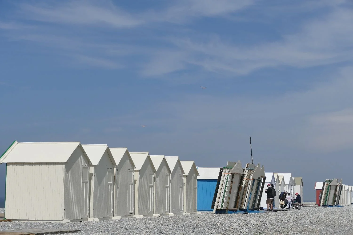
And finally we reached the sea, the lines of bathing huts , a proper beach, a few hardy souls already bathing. For us, an ice cream, the time to stand and stare, and look forward to the summer, while considering the big question:
What is the appropriate wear for a ride on a heritage railway? Now, where’s my bowler?
A Movable Feast
WYou know where you are with Christmas – it’s on the same date every year. Actually, it’s not quite that simple. We still ask that ridiculous question, ‘when is Christmas this year?’ What we mean, of course, is on which day of the week does the 25th December fall? Feel sorry for the clergy when Christmas Day occurs on a Saturday or a Monday.
We know that Easter always falls over a weekend. The big question is not just which weekend but also which month, and which religion! The date range for Western (Gregorian) Christianity is between 22 March and 25 April, based on the first Sunday after the first ecclesiastical, or Paschal, full moon that occurs on or after 21 March (the spring equinox). Got that? If you are Orthodox and follow the Julian calendar, then the date for Easter is calculated in the same way but the equivalent date span in the Gregorian calendar is April 3 to May 10.
If you are Jewish, Passover celebrations start on the 15th day of the Hebrew month of Nisan, which is also linked to the spring equinox/lunar New Year. Obviously this calculation opens up a greater variety of ‘When does Passover start this year?’ type of questions.
We could go on: many, many other spring festivals are celebrated around the globe, with timings defined by geography, belief and tradition. But researching just the specific celebrations mentioned above has done in the Terroir head with the multiplicity of websites devoted (pun intended) to Easter and Passover.

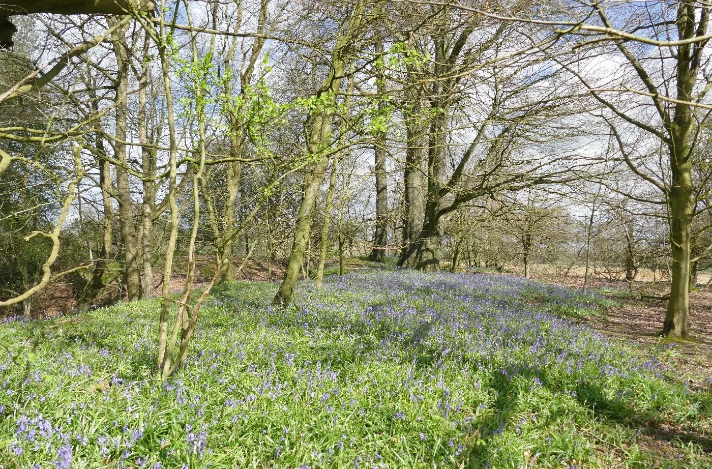
In Britain, we just love taking an Easter/spring walk but what we see not only depends on the lunar cycle but also on climate change shifting the flowering timing of many of the plants which define our spring.
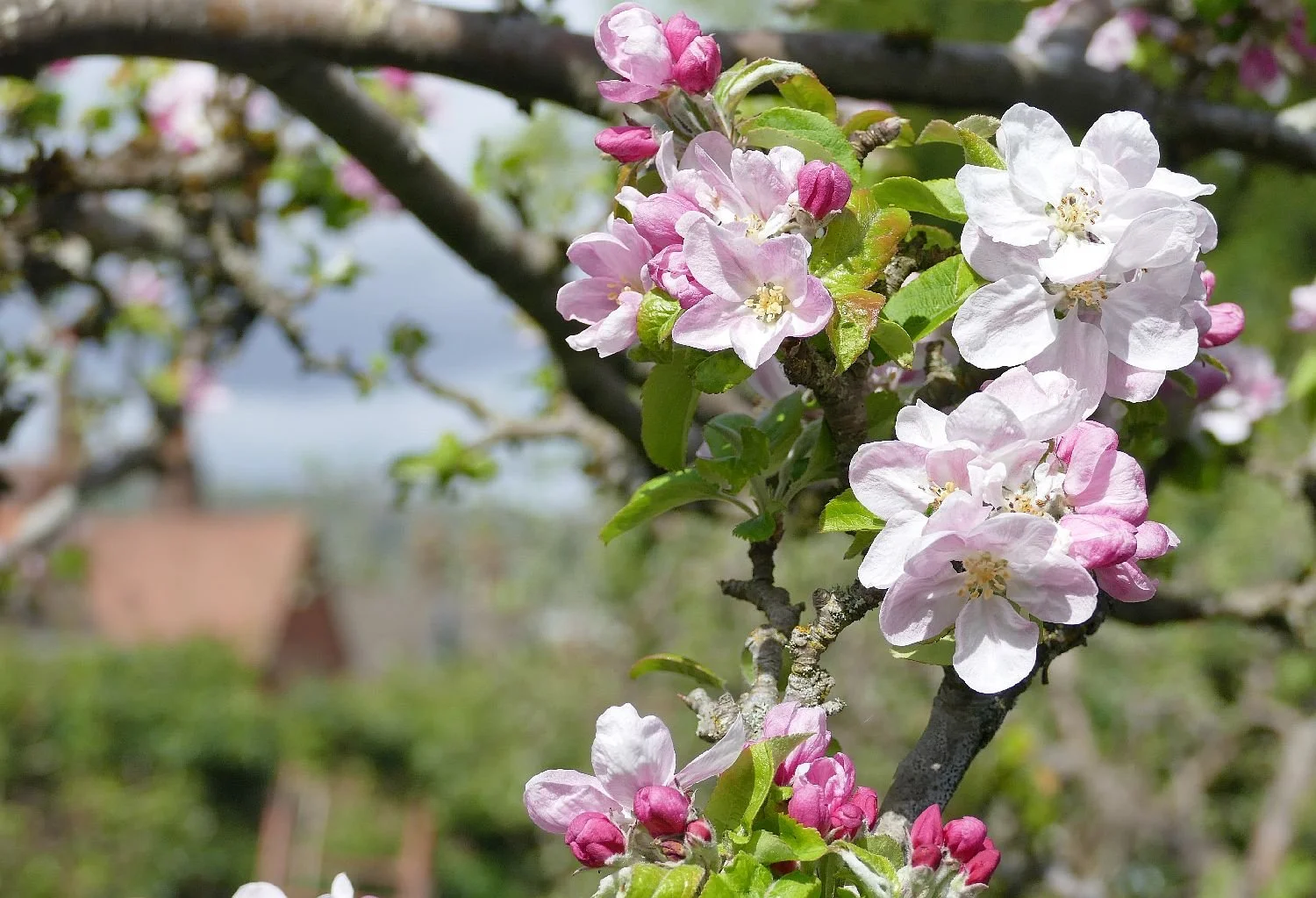
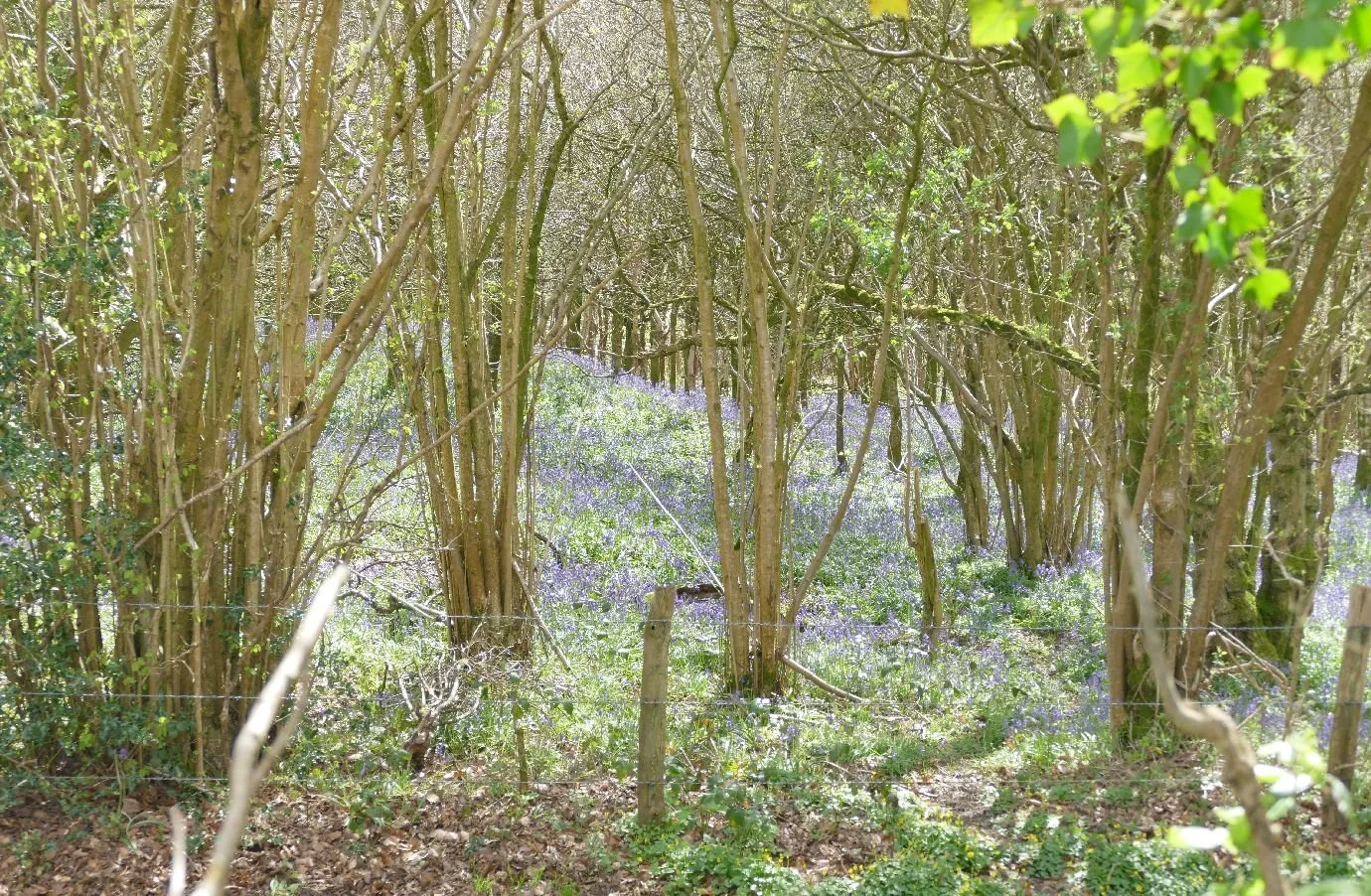
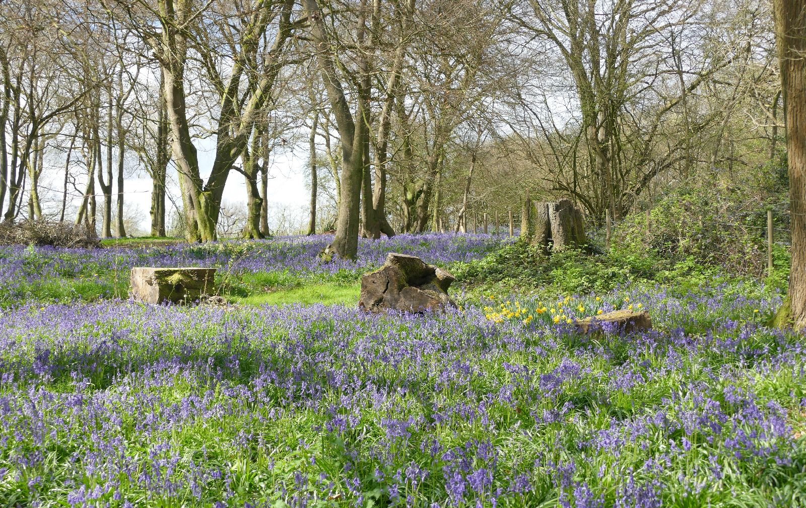
When will the primroses be out? When can we take the annual southern English pilgrimage to gasp at the site and scent of massed bluebells, rising from the floor of a deciduous woodland not yet in full leaf? Will the frost get that early apple blossom? Did we miss the cowslips or have they died out?
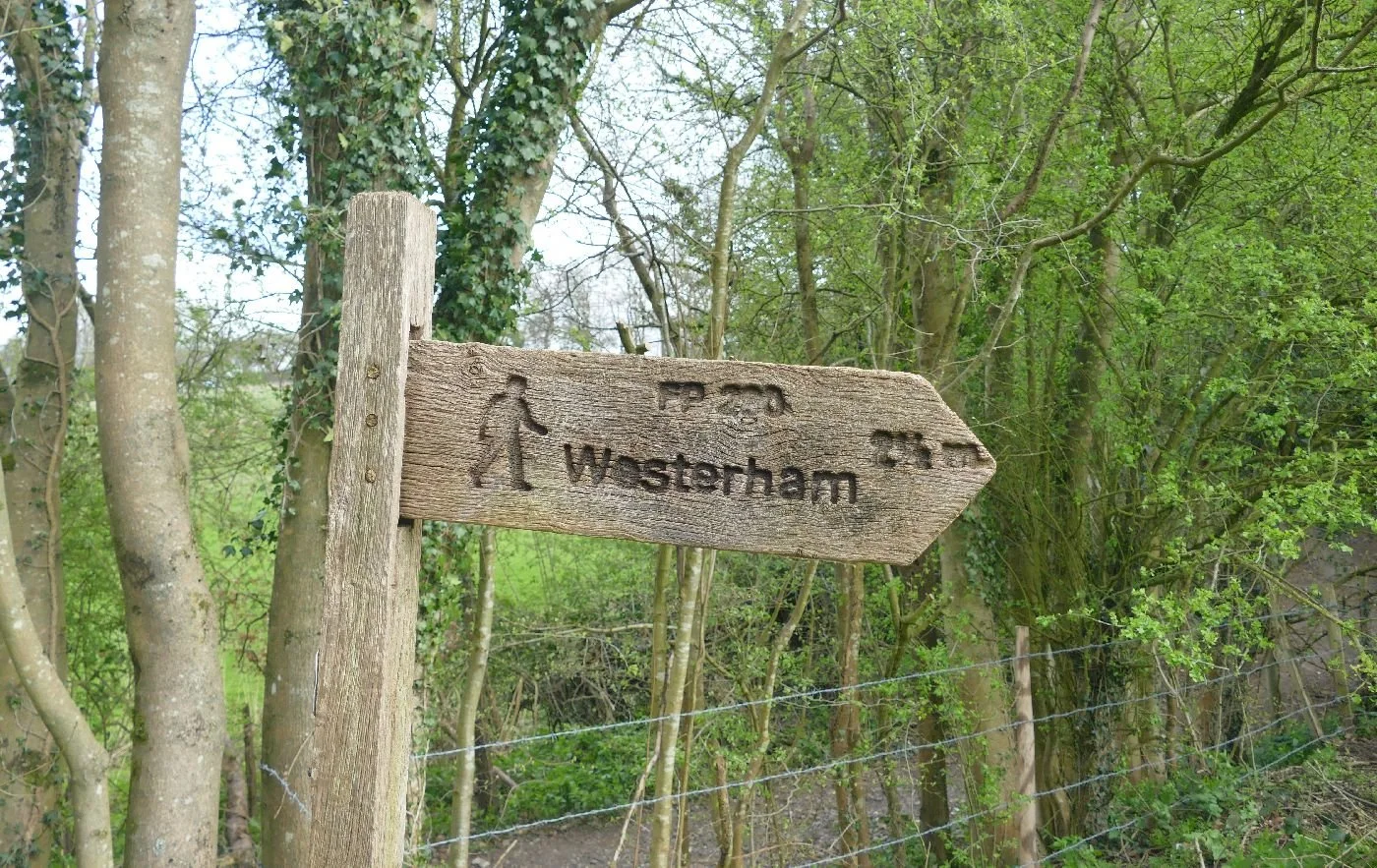
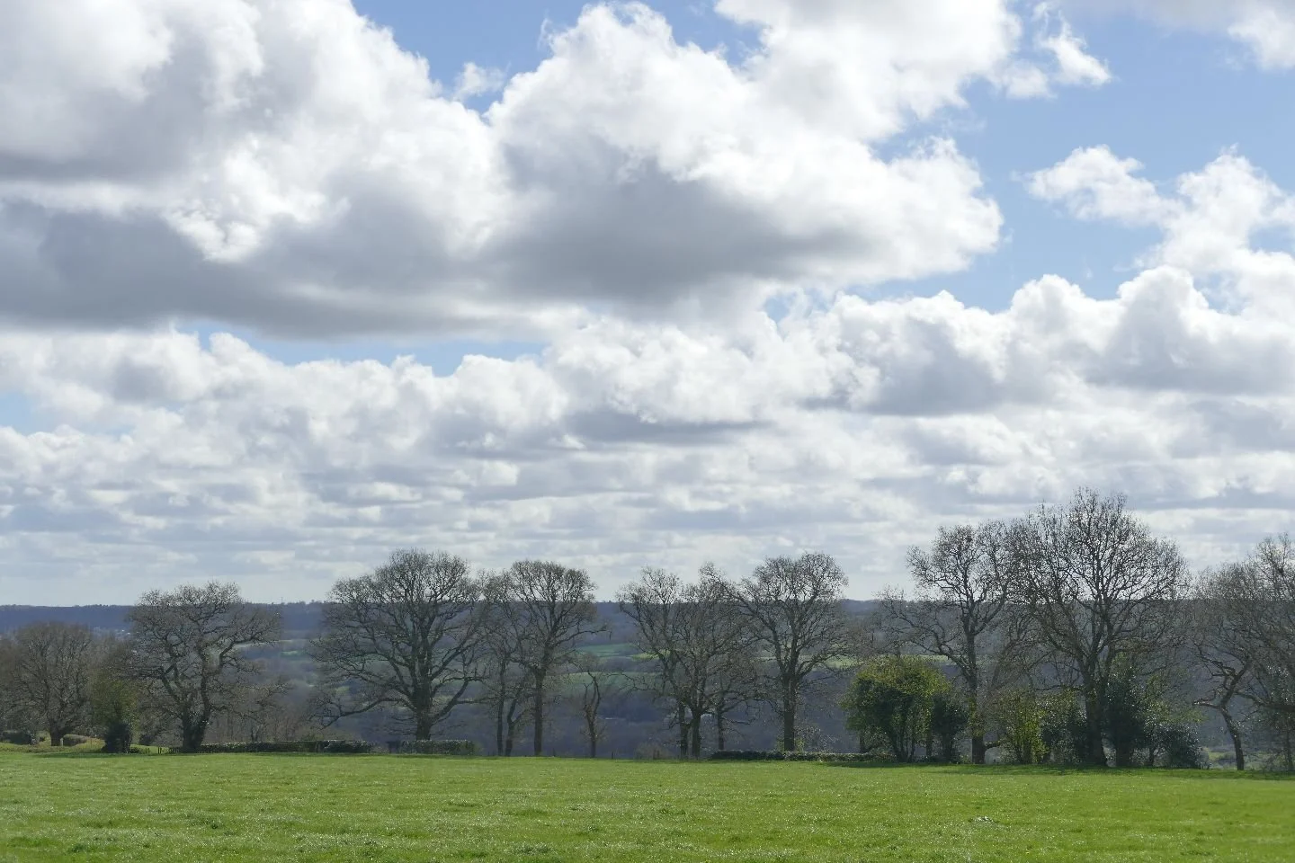
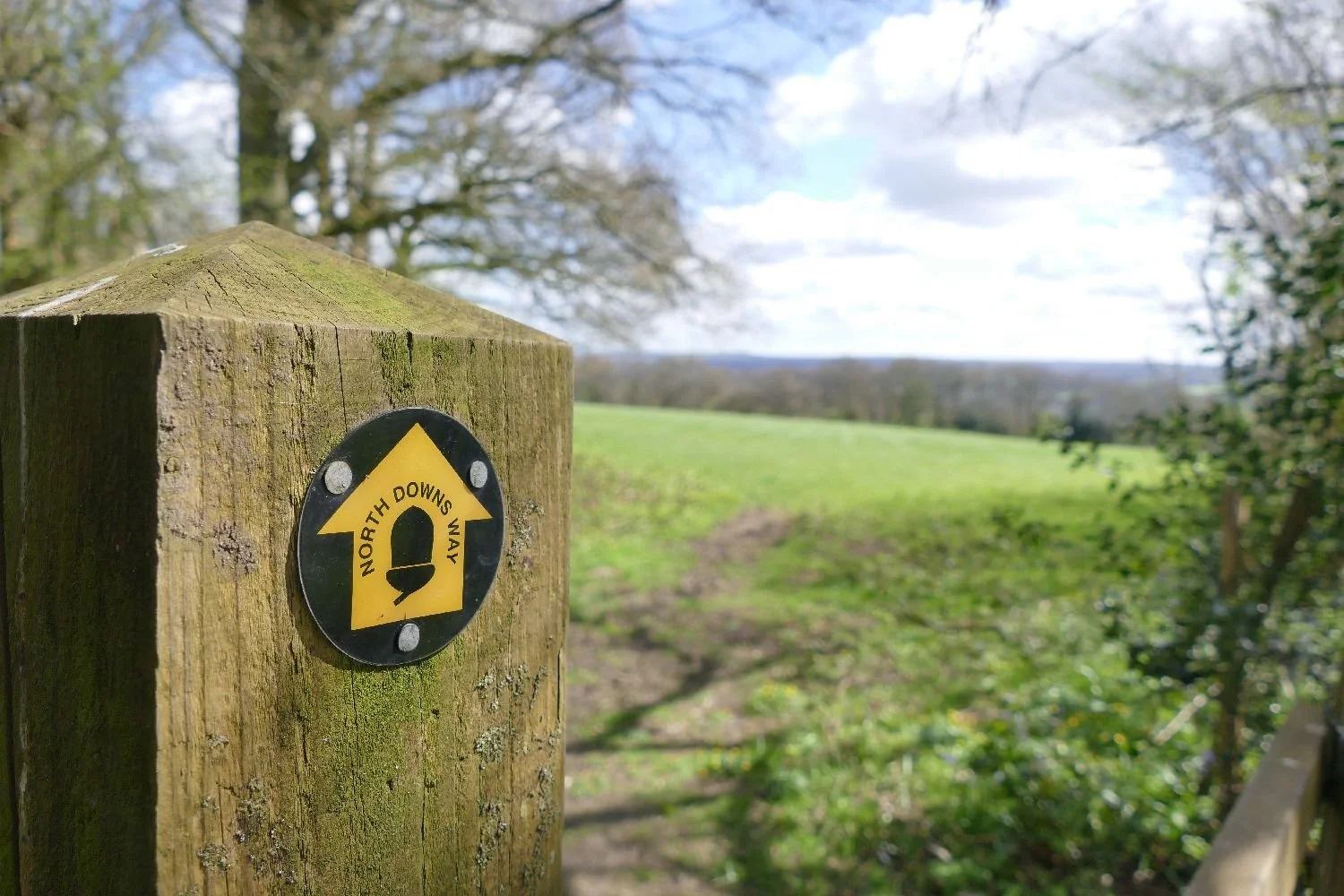
This year, Terroir took its spring walk on the North Downs, between Sevenoaks and Westerham.
This southern landscape was experienced by one of us as a child, and the parental talk was of open downland, of springy turf, full of the wild flowers (violets and thyme) which could survive summer sheep grazing, of coppiced woodland and of views southward over the Weald to Ashdown Forest and hazy glimpses of the South Downs.
One of us has no memories of Gatwick Airport, opened as an aerodrome in the late 1920s, graduating to RAF Gatwick in the 1940s and re-born as a full commercial airport in the late 1950s. There was no roar of motorways to sully the soundscape, just parental tales of walking the Downs in the 1930s, or of the derring-do of wartime fighter pilots based at nearby Biggin Hill Airfield.
How does that nostalgia and tradition compare with the landscape as experienced by Terroir at Easter 2026? The key element – the chalk based geology of the North Downs – has not changed, but the surface a treatment by agriculture, urban growth, accessibility, recreational trends, new technologies, and more has, of course, created a different landscape and set of management priorities.
Walkers (Terroir included) now tend to come by car and we contributed to the clogging up of Kentish lanes by squeezing the car onto a modest road verge, close to the route of the North Downs Way National Trail. Even when you know, intellectually, that chalk grassland now supports arable farming, it is still a shock - to us older ones at any rate - to join the North Downs Way, pass through the roadside hedgerow, and emerge into, yes, a ploughed field.
Once through the arable, we were back into grassland for the rest of the walk, but this is not the springy close grazed turf of the 1950s and 60s, but lush, bright green, low diversity, animal fodder. And if you think the springy turf was a myth, one of us has a clear memory of the shock of first experiencing this violet strewn phenomenon, and actually bouncing up and down on it!
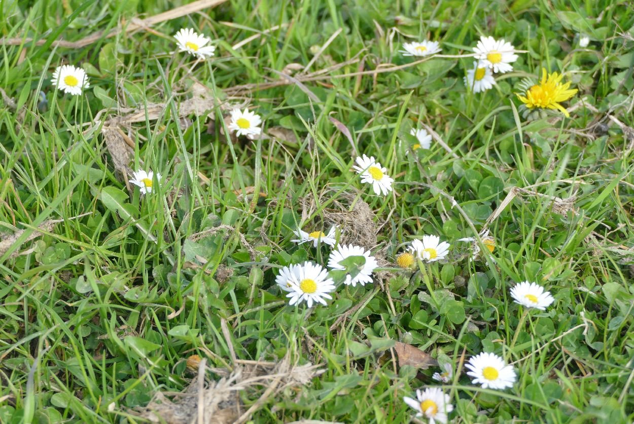
As you can see, many of the hedgerows are still there and this is where you will still find some of those classic wild flowers. To be honest, I would expect to see daisies (left) and selfheal (below) in an unkempt lawn and their presence certainly supports the feel that this is fodder crop grass rather than traditional grazing land.


The hedgerow oaks are old and tired, however, with few replacements. The current oldies are providing great habitat for invertebrates and lichens but may not be around for the next generation of downland walkers.
Bluebell woods are still very much with us, in the south, at least, but their management, as rotationally coppiced woodland with bigger widely spaced ‘standard’ timber trees, is becoming more and more a heritage craft than a form of woodland management with an economic future. How many bean poles, hurdles or pit props does Britain need these days? In the south of England, this Easter was timed perfectly for bluebell viewing, but our photographs clearly illustrate the continuing loss of elements of this managment style which encourage this spring flowering display at ground level.
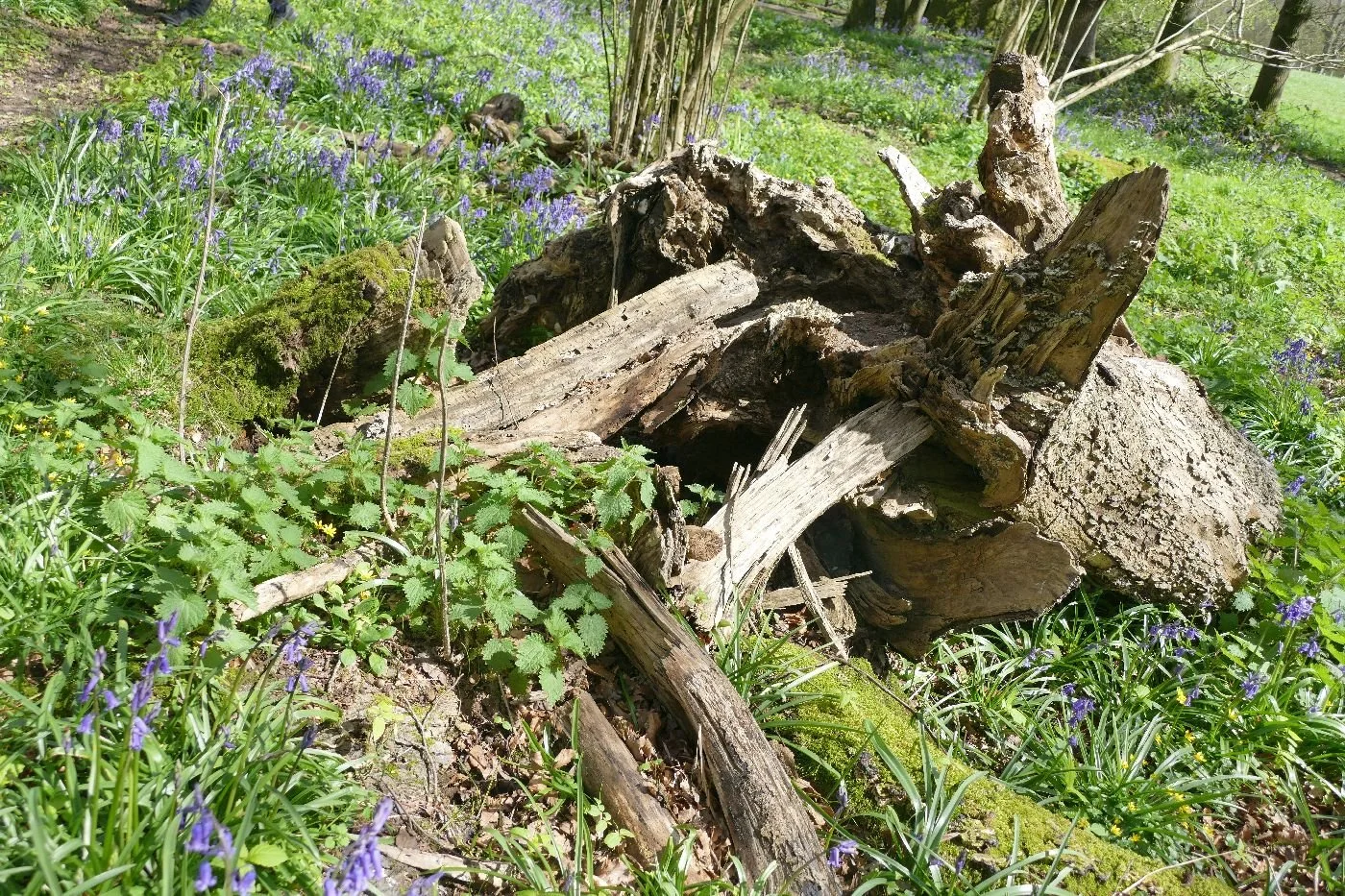
Left: coppice - but will anyone harvest it? Centre: the remains of an unloved and unwanted standard Right: the ghosts of the big oaks and not a coppice stool in site
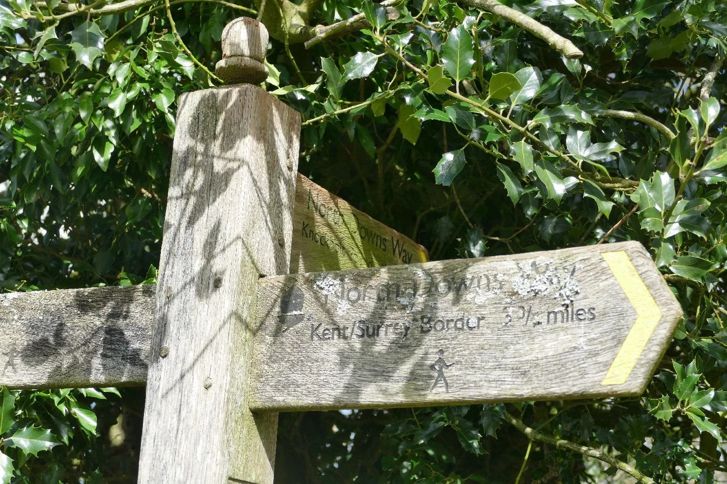
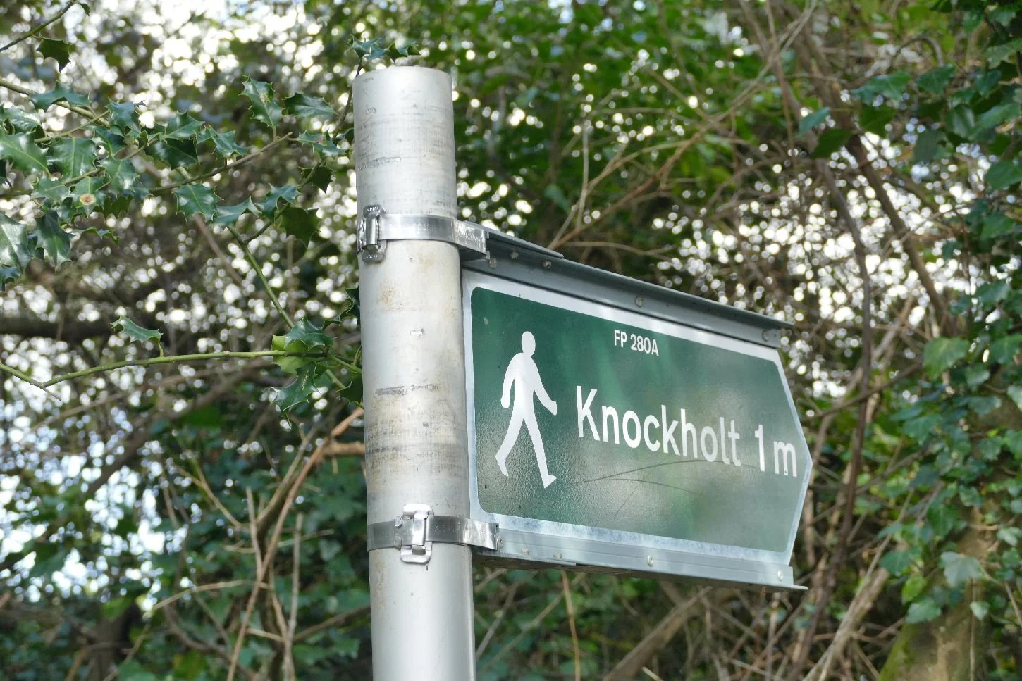
Even the character of our signage has changed. Are new materials more durable than old? Which will last the longest? Will the National Trails’ acorn become the walkers icon of the future, assumimg enough remain in place and still point in the right direction? Knockholt is certainly signed clearly, but do we really need to know that we are following footpath 280A?
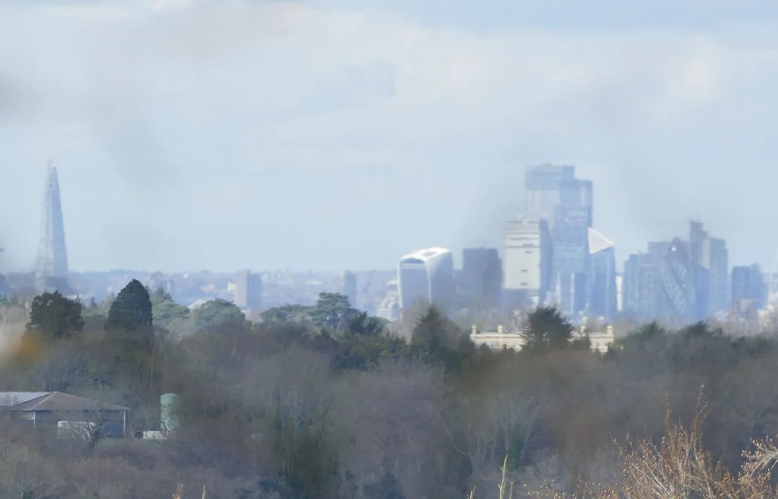
And we leave you with today’s grandest North Downs view: the Millennials will be telling their grandchildren that there was a time when you could see the Shard from here!
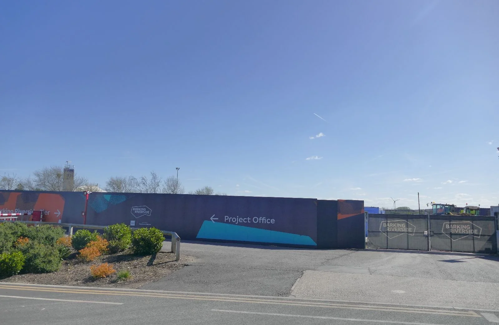
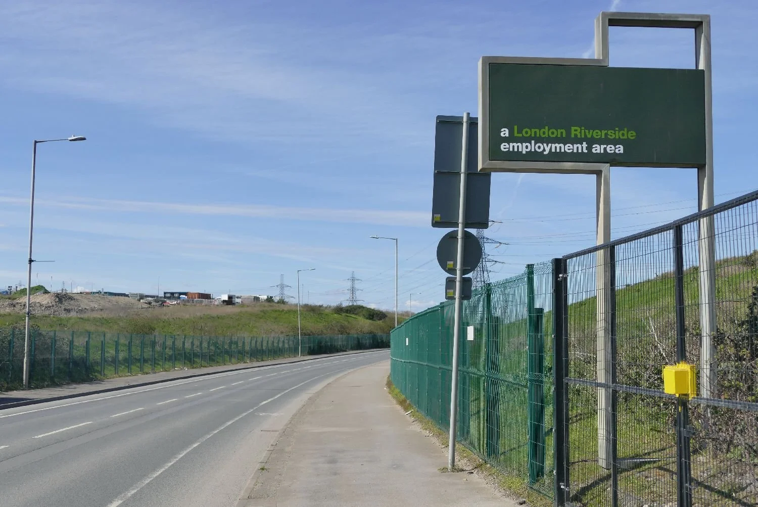
Building Barking Riverside
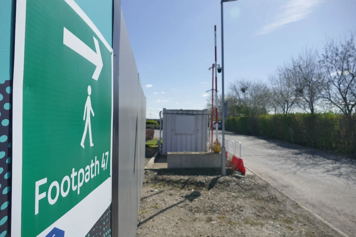
It was with some bemusement that one of us was told, very recently, that we had to go to Barking Riverside. Thames-side path number 47 was about to be closed and huge changes were afoot. Visiting was vital!
The tipoff came from the much loved, London based, blogger Diamond Geezer. If you don’t know him then click on https://diamondgeezer.blogspot.com/. It’s worth the effort.
In the meantime, here is an extract from DG’s post of 20th March:
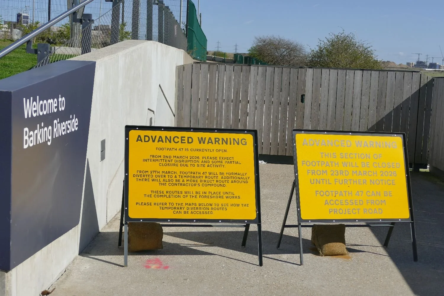
“For years I've been urging you to walk Footpath 47 at Barking Riverside before they redevelop it. You have one week left. From 27th March the footpath will be "formally diverted to a temporary route", a distant pavement slog nowhere near the river. It'll be diverted back when phase 1 of the foreshore works are complete, maybe in autumn 2027, but along new walkways and not the unspoilt foreshore it still nearly is.”
-
Perhaps this short paragraph is not the most exciting example of Diamond Geezer’s prose but it was a sufficient hint to send Terroir running for coats, cameras and travel passes. There is, in fact, a lot to unpack from this brief paragraph.
Let us step back for a moment and take a brief look at the history of this piece of Essex marsh land, adjacent to the River Roding and the Thames. The original village and parish name (which eventually evolved into the unfortunate name of Barking - yes, we’ve heard all the puns) appears to have been the Old English Berecingas (https://en.wikipedia.org/wiki/Barking,_London) which might have meant a settlement associated withwith someone called Bereca or the settlement near the Birch trees. Obviously Terroir favours the latter. The manor was huge and covered the area now occupied by Barking, Dagenham and Ilford. It was noteworthy for its Abbey (housing a nunnery), which was founded in 666 CE and demolished in 1536.
The rivers Thames and Roding seemed to have played an important part in the area’s early history with records of flooding, but also supporting fishing and farming. Proximity to London and improved transport no doubt supported the move to market gardening with industrial use closer to the Thames. The railway, from Fenchurch Street, arrived in 1854 and the London Underground in 1908. Barking officially became part of London in 1965. But Barking Riverside was still a concept as yet undreamed of.
Barking’s relationship with power stations started in 1897 and the first was actually a town centre affair. Coal-fired, it generated electricity for lighting and domestic use but also to operate the town’s Bascule Bridge over the River Roding and the tram system to carry workers to nearby Beckton Gas Works (https://yourcall.befirst.london/barking-heritage/stories/barkings-first-power-station-by-eric-feasey-and-simone-panayi).
The big boys started to arrive in the 1920s, located south east of Barking at Creekmouth (see black arrow on plans below), where the Roding flowed into the Thames and where industry was already developing, with wharfs for delivery of fuel and raw materials. Barking A Power station was joined by Barking B in the 1930s and C in the 1950s. All were decommissioned by 1981 and subsequently demolished.
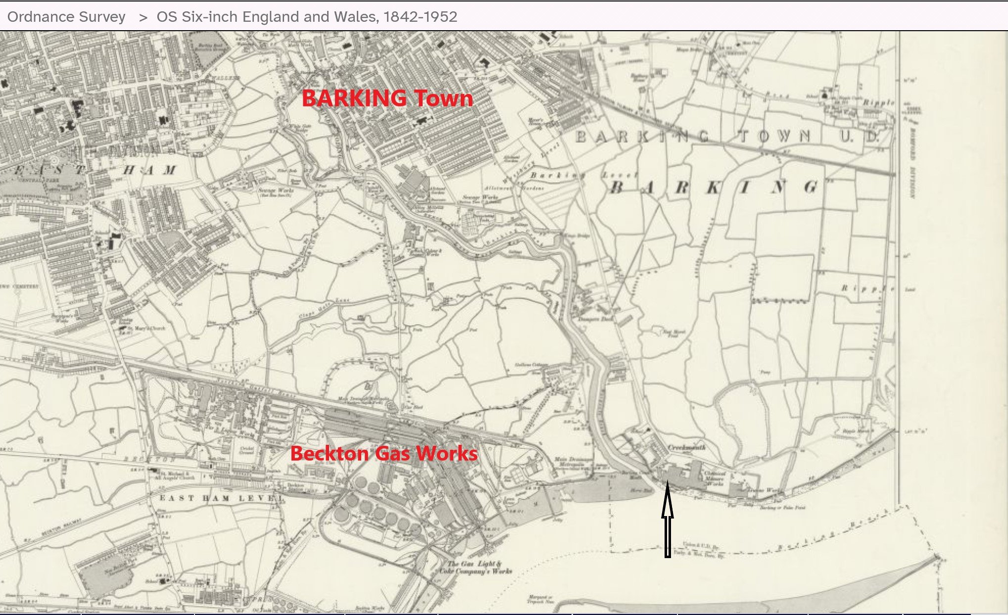
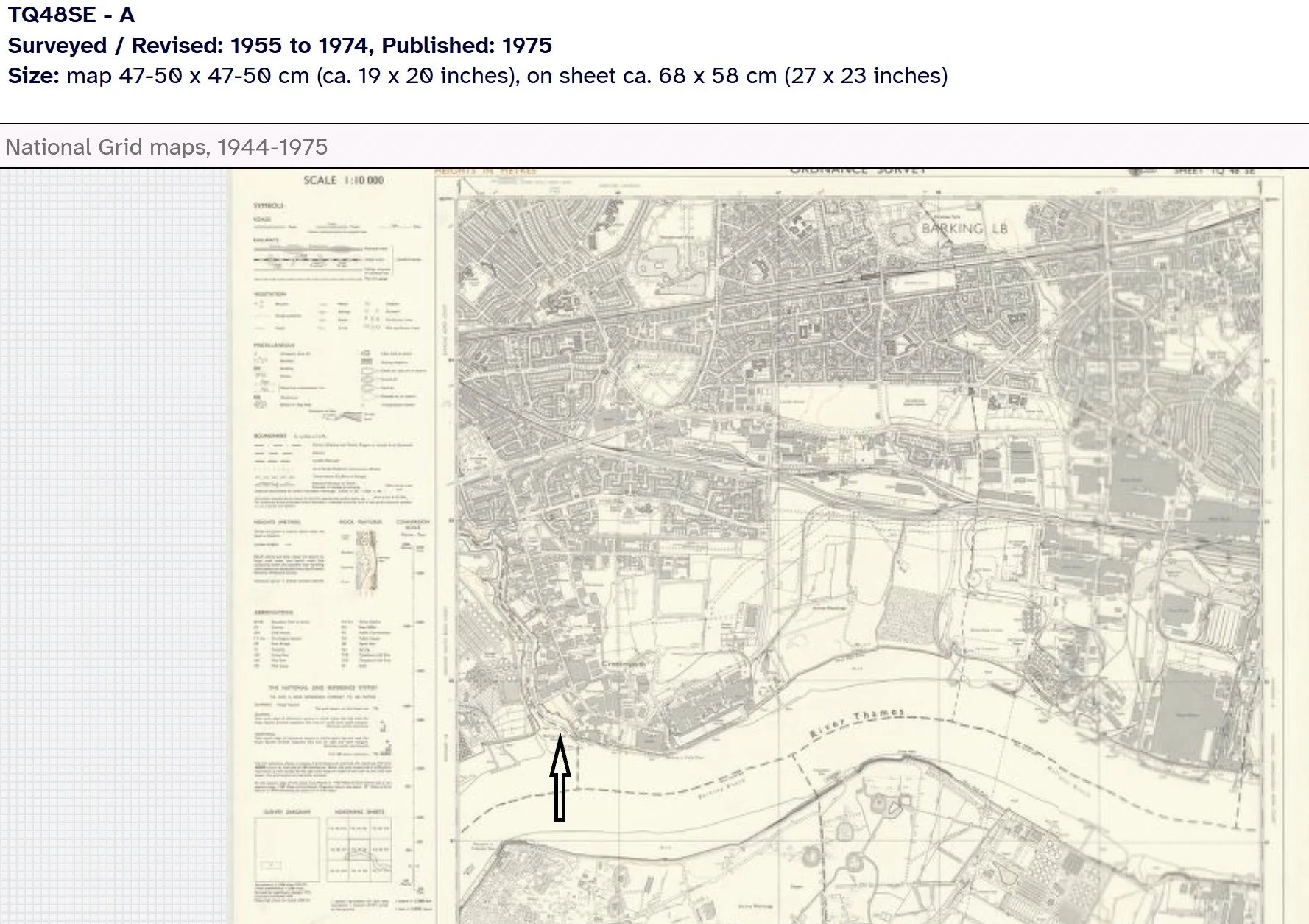
Images above: left - extract from Ordnance Survey Plan (surveyd 1913 - 1915) and, in contrast, right, a later map (revised 1955 - 1974)
© Reproduced with the permission of the National Library of Scotland' https://maps.nls.uk/index.
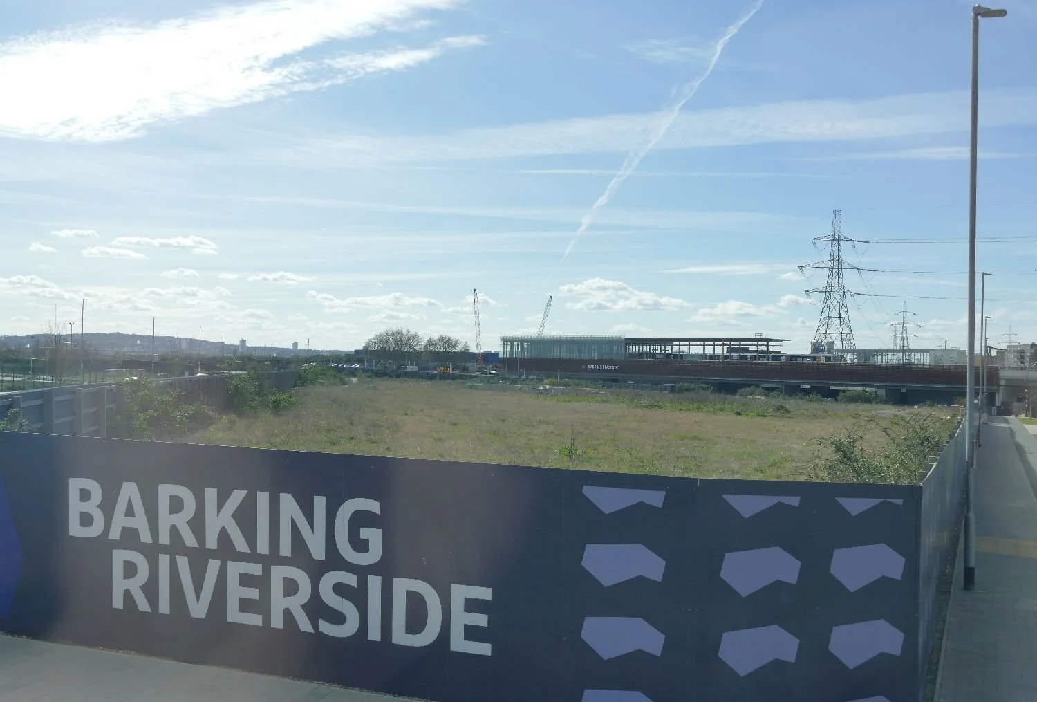
So what do you do, with a large, polluted, former industrial site, located on the north bank of the Thames, with no public transport to the nearest towns (Barking to the west and Dagenham to the east) but with good access to London’s mighty river and a fine view of Thamesmead on the opposite bank? Solve London’s housing crisis of course. Invent Barking Riverside.
Bureaucracy, partners, money and politics: it’s complicated so after studying many websites and taking the risk of asking AI, we take no responsibility for accuracy of the following; do tell us if we are wrong.
Site was identified for redevelopment in the 1990s as part of the Thames Gateway initiative.
Joint venture formed in 2004 with Bellway Homes
Outline Planning permission granted in 2007; first homes occupied in 2012.
Project stalls due to lack of funding for the significant infrastructure required. In 2016, a new joint venture is agreed between L&Q and the Mayor of London to form Barking Riverside Limited (BRL), as developer to oversee design, planning, place making and infrastructure projects.
The new joint venture secured funding for a London Overground Station, Thames Clipper Uber Boat and extension to local bus services, without which any further development would not be viable.

And finally, a new outline planning application was submitted in 2024 “to evolve and refresh the existing masterplan – which includes elements which are now over 16 years old – ensuring it can be flexible and sustainable, whilst delivering more vitally needed homes in Barking & Dagenham”.
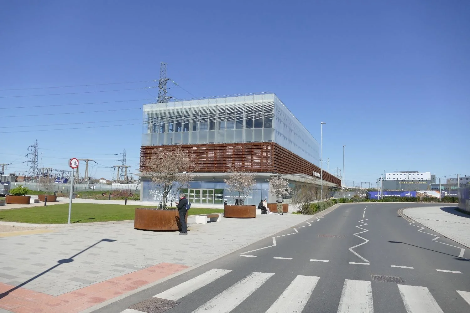
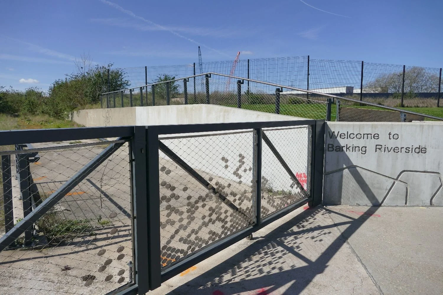
Planning permission was granted in March 2026 (we’re writing this in early April 2026!) Hence the rush to walk footpath number 47 before it was closed to allow the works to commence. Let us take you on a tour.
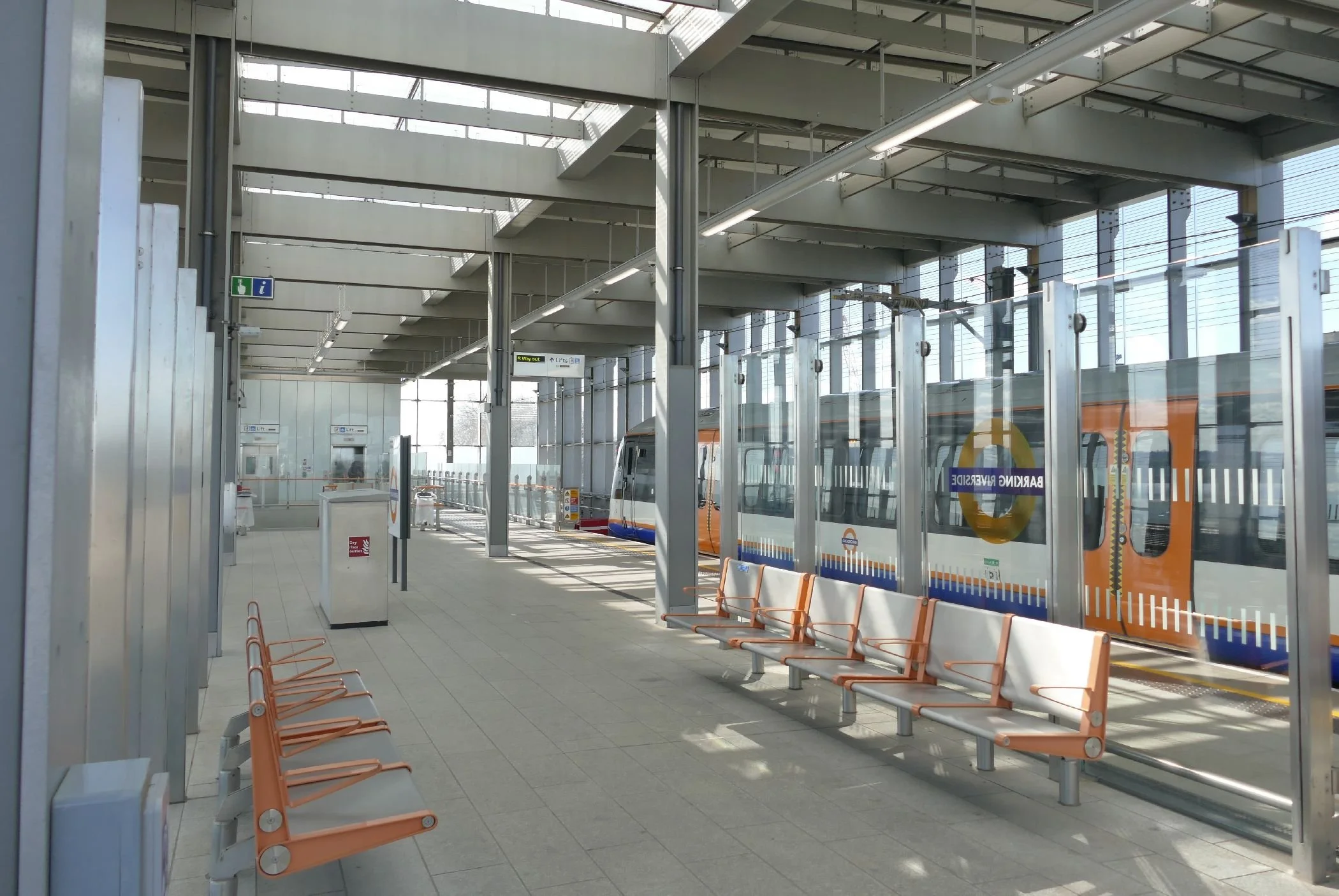
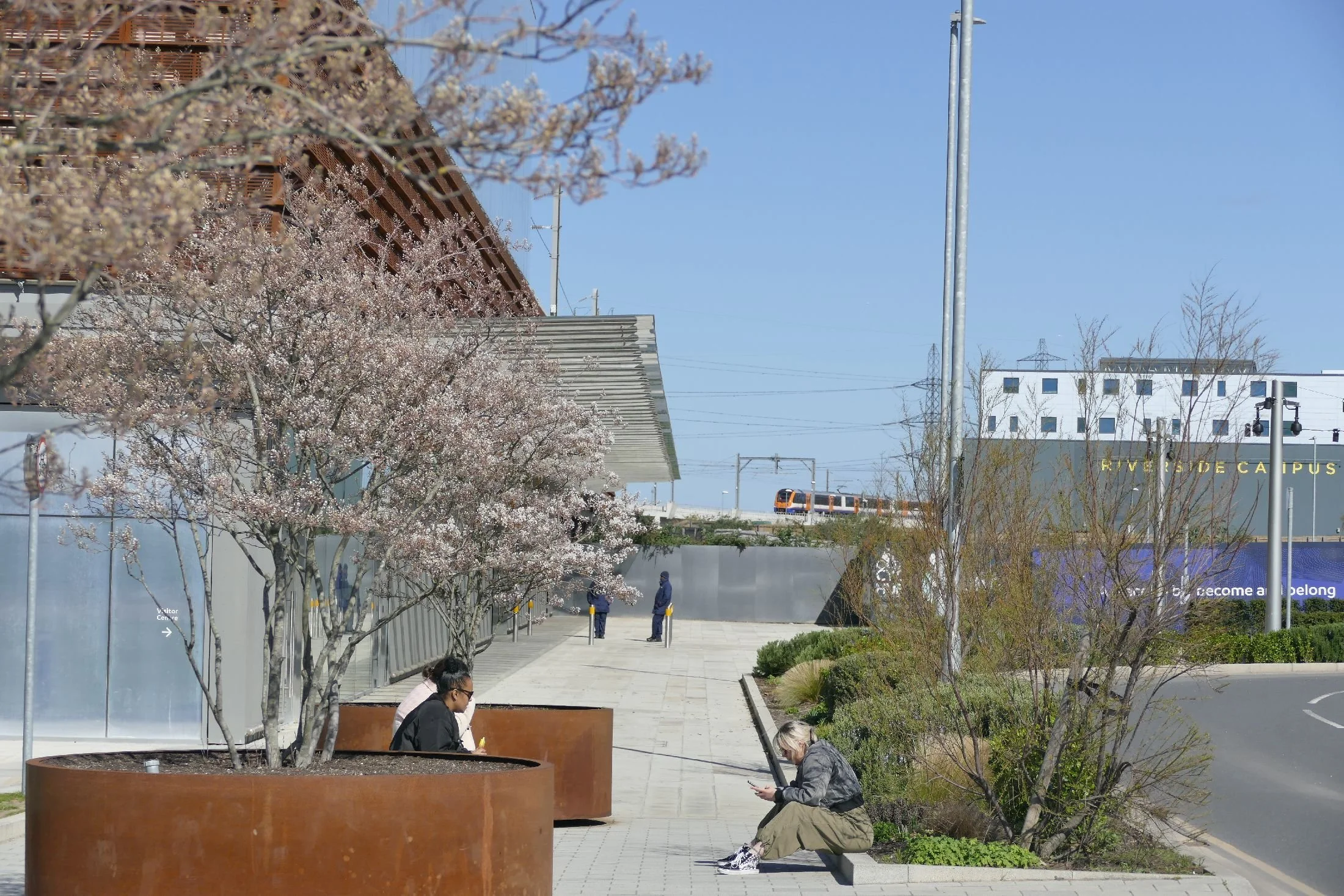
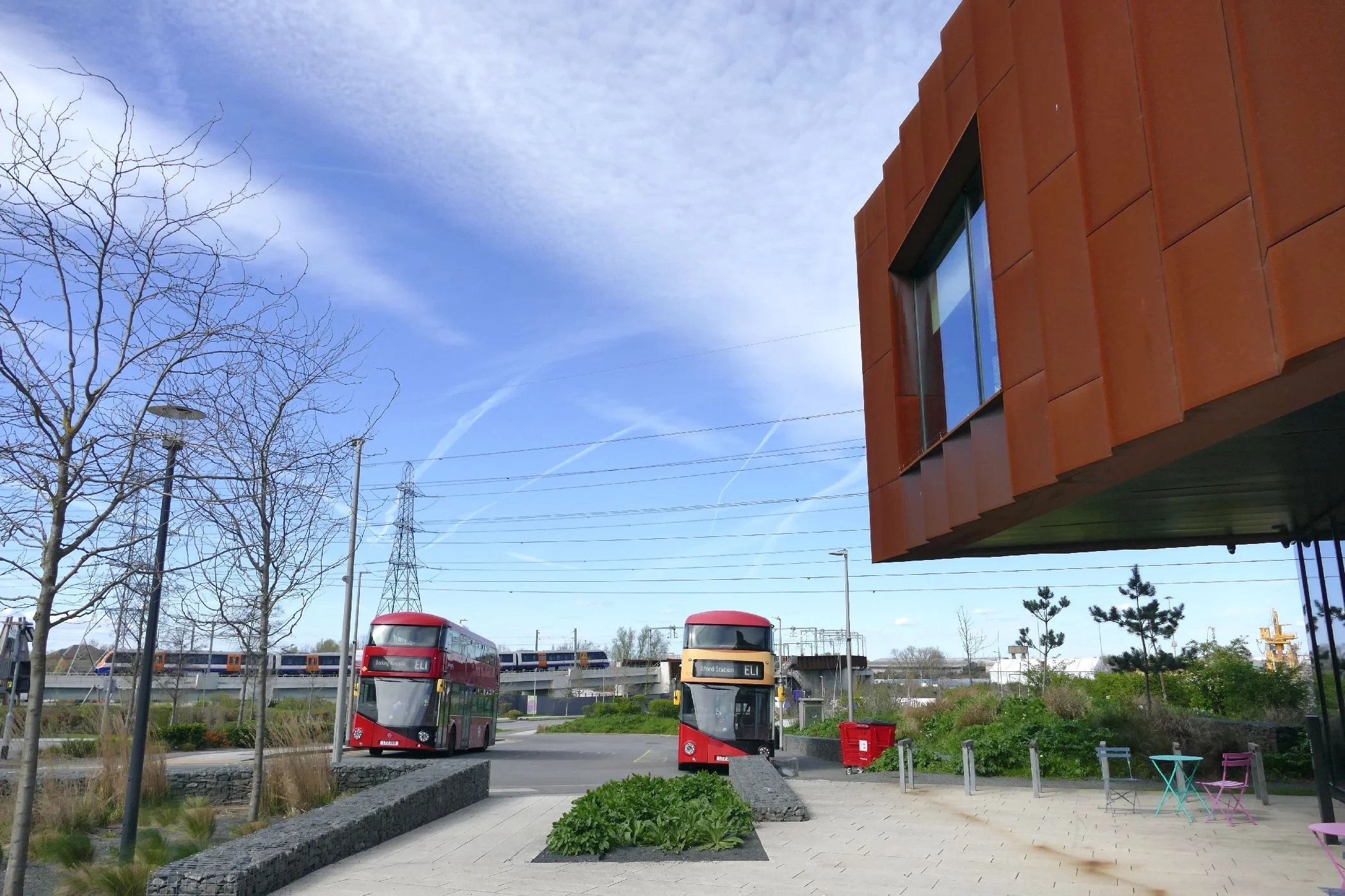
Arriving at Barking Riverside Station was a bizarre experience. It’s a huge, modern shoe box of a station standing proud above it’s surrounding town/riverscape and, at around 10.30 in the morning, almost empty. It’s clear that cycling is being encouraged here and the bike ‘shed’ is already fairly well used, considering the relatively small population. The down side of the train link, however, is that passengers are forced to change at the old Barking Station to continue their journey to anywhere other than Leytonstone, Walthamstow or Gospel Oak!
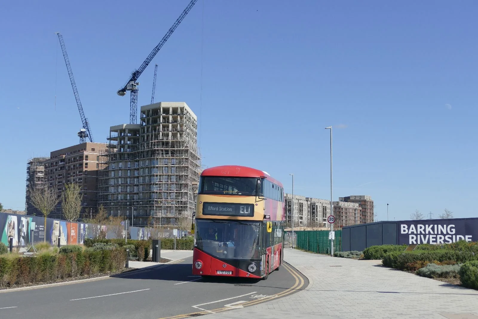
The bus looks strangely incongruous as it pulls into a deserted station ‘yard’ with an earlier phase of building nearing completion inn the background.
The Uber Boat has a fine new pier at which to dock. but it’s a long walk to the railway station/bus hub, let alone the nearest block of flats so its currently very limited service is probably unsurprising.
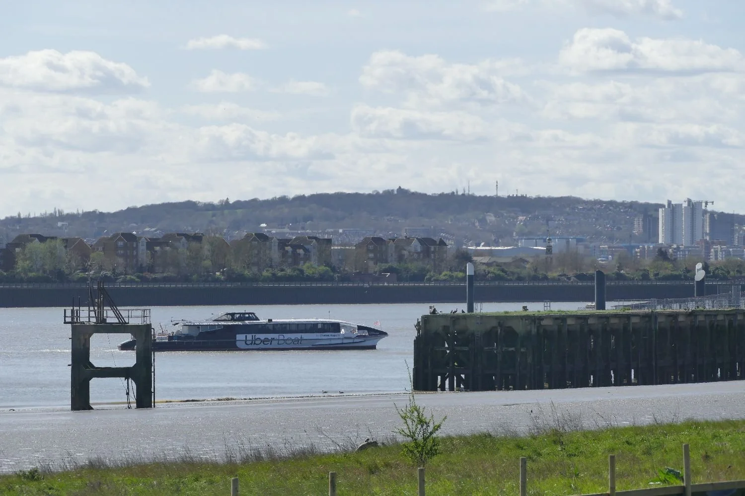
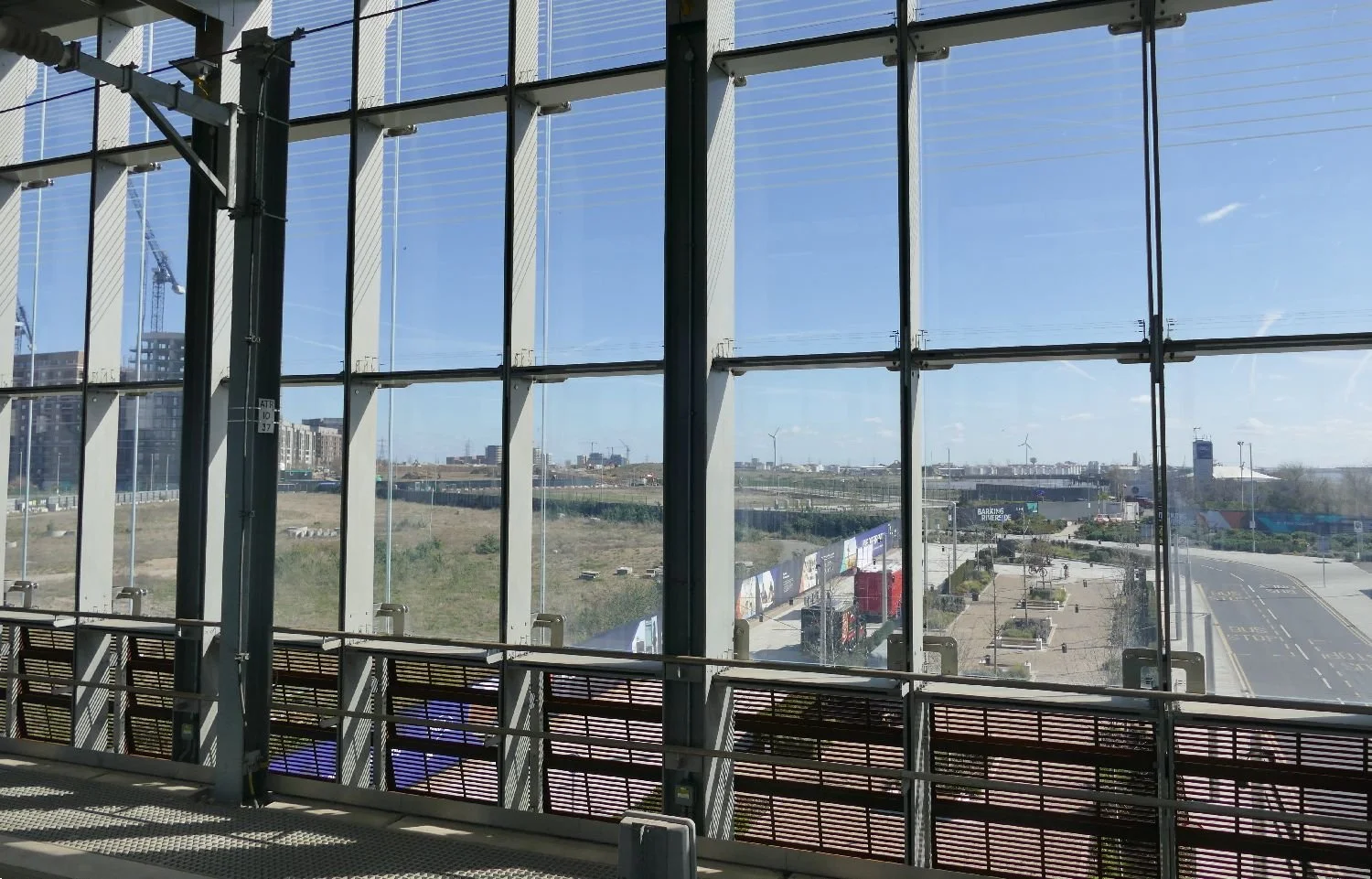
The landscape surrounding the transport hub is a mixed bag of fresh new townscape, and development areas waiting for the starter gun, all sandwiched between the Thames and the previously built out areas to the north.
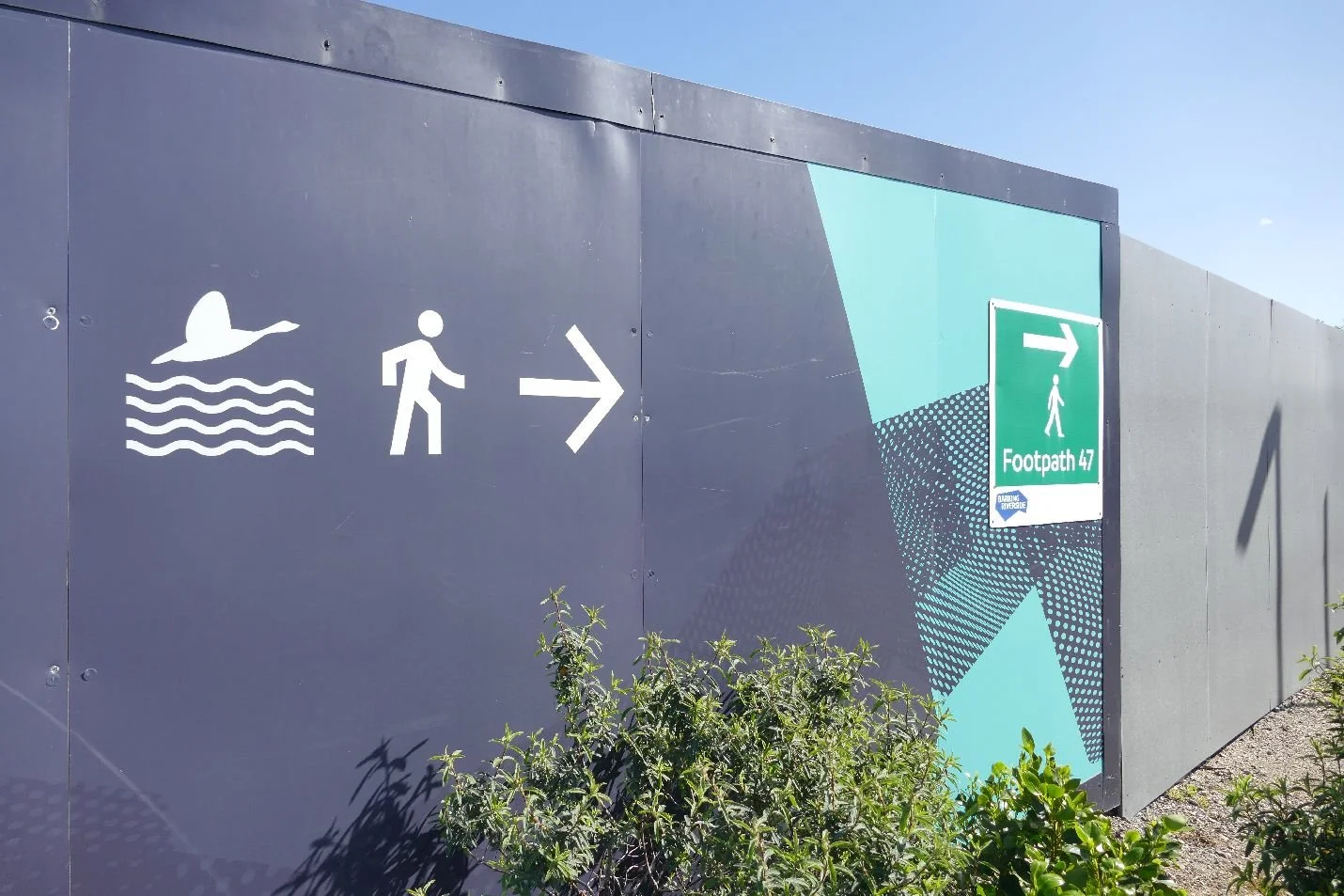
But where is footpath 47, we hear you cry? We’ll take a walk, once we’ve figured out the route.
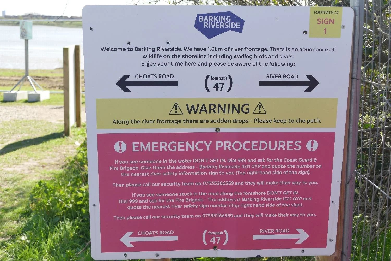
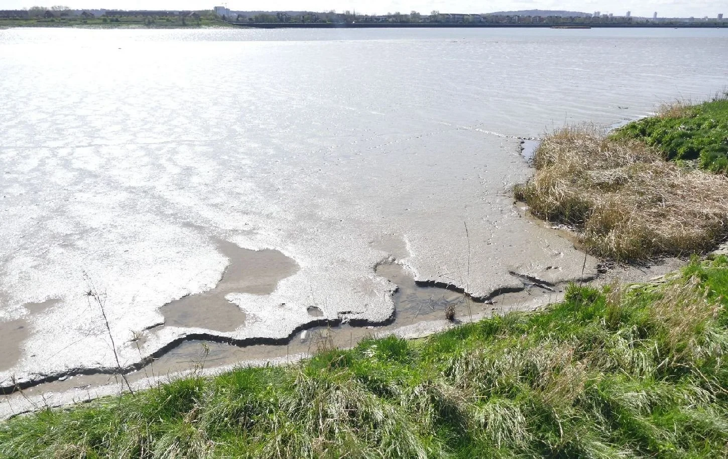
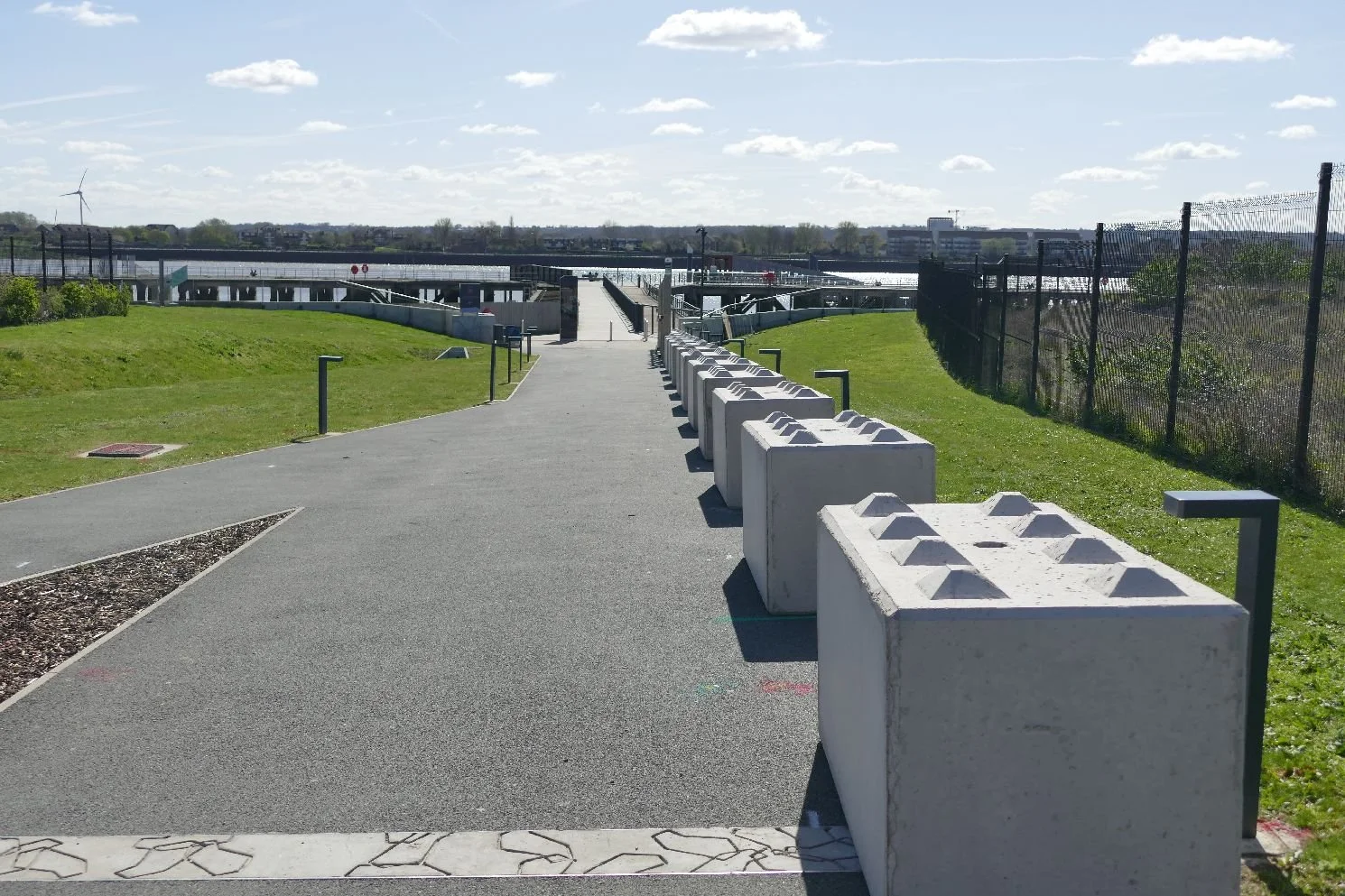
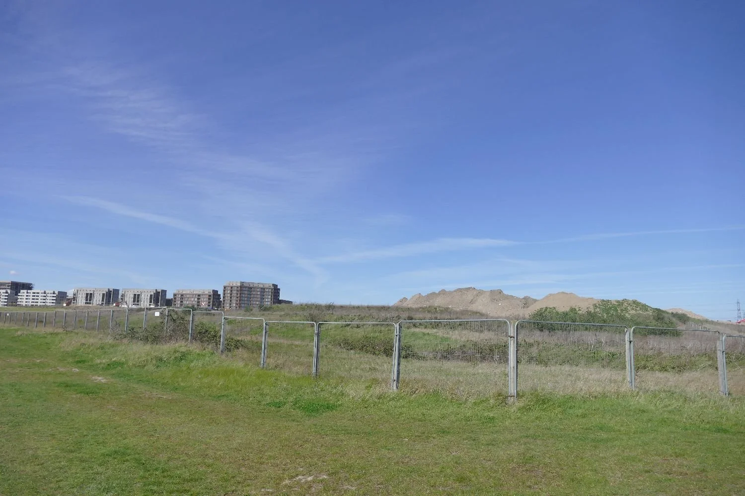
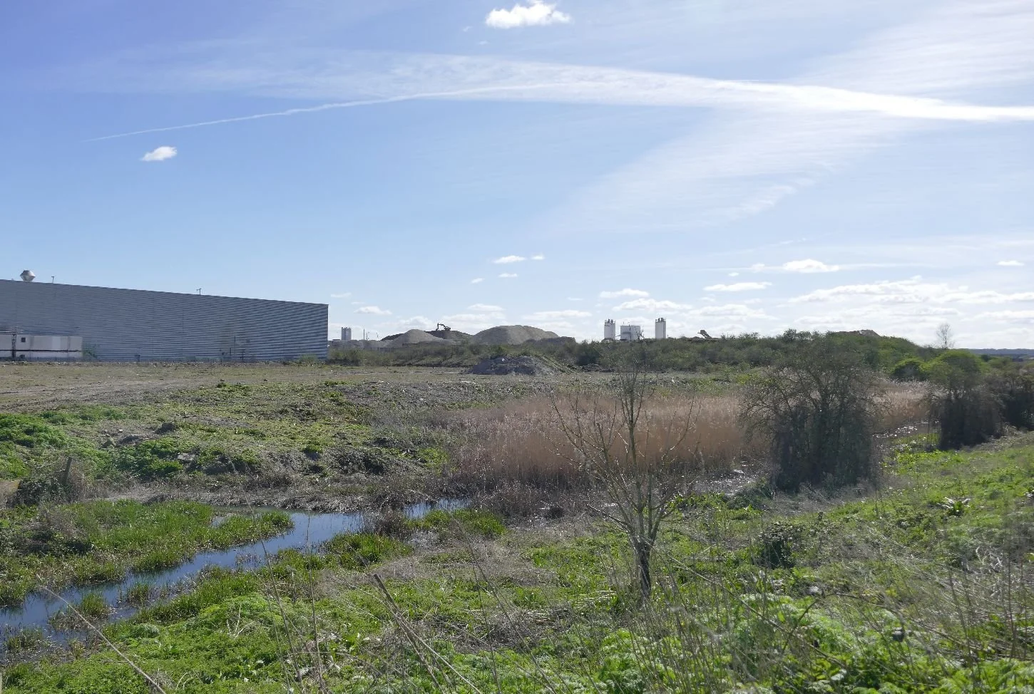
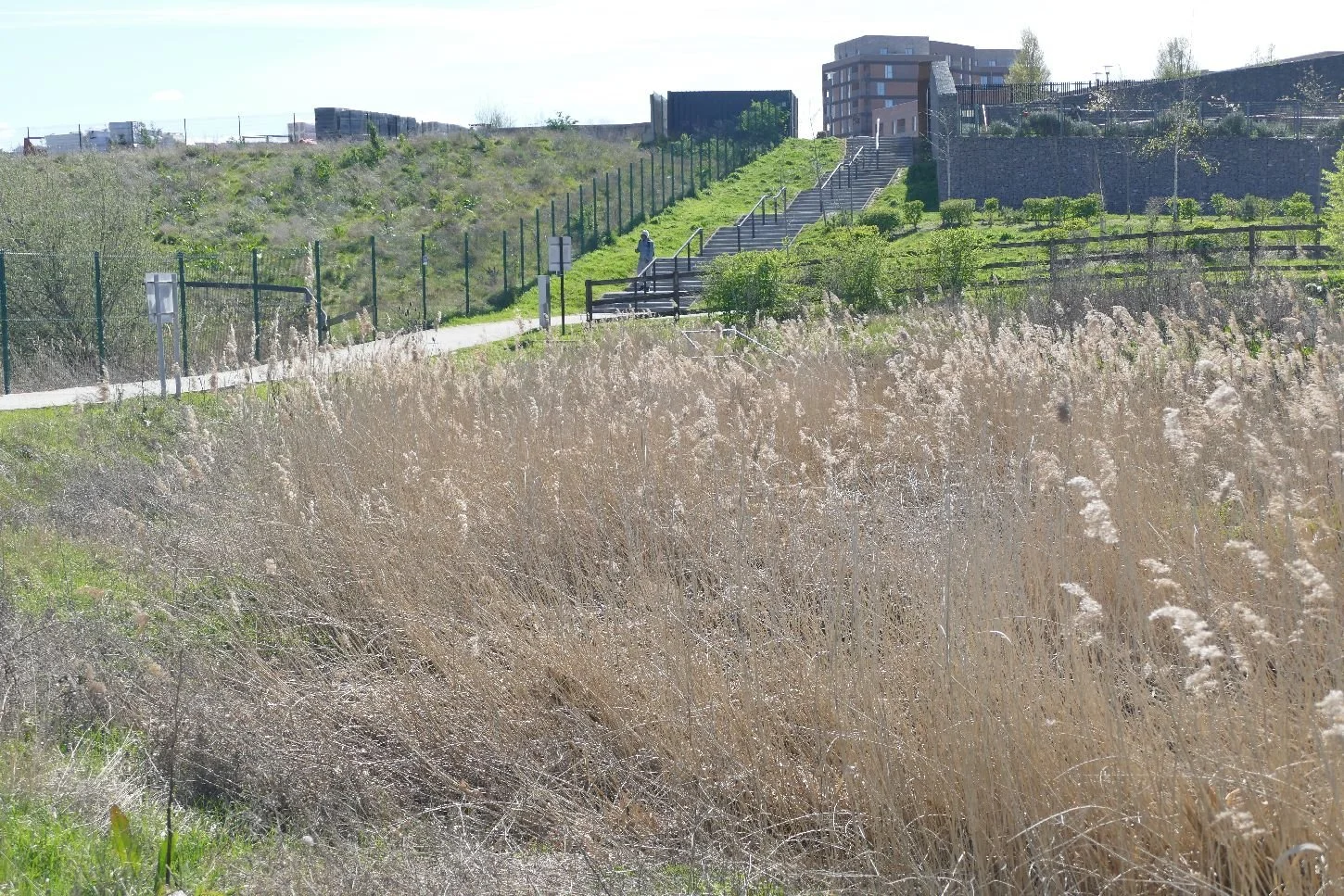
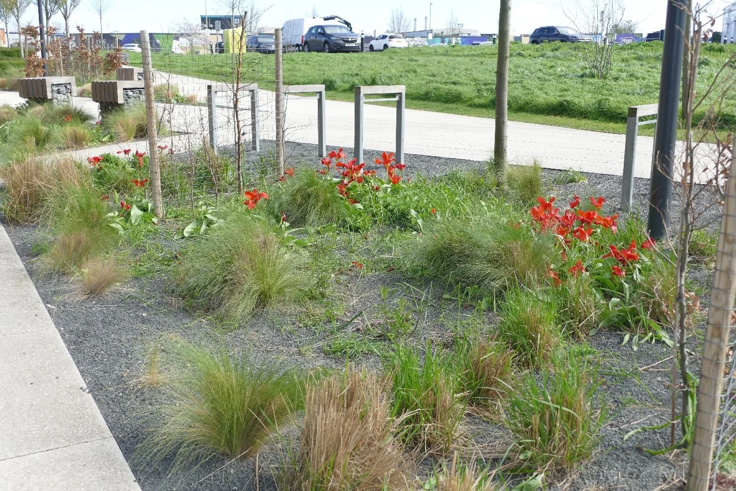
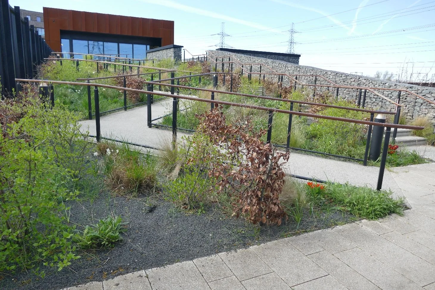
Once on the foreshore we can see the fabulous potential of the site for wellbeing, exercise, views, wildlife, art, education and just having fun. But, and it’s a big ‘but’, this will depend on the designers, the health and safety issues, wildlife management, flood control, underlying pollution, adjacent developmet and so on.
There is a big risk that path 47 will become an elegant, or worse an ugly, promenade constucted from hard material and with reduced access to the ‘soft’ water front itself.
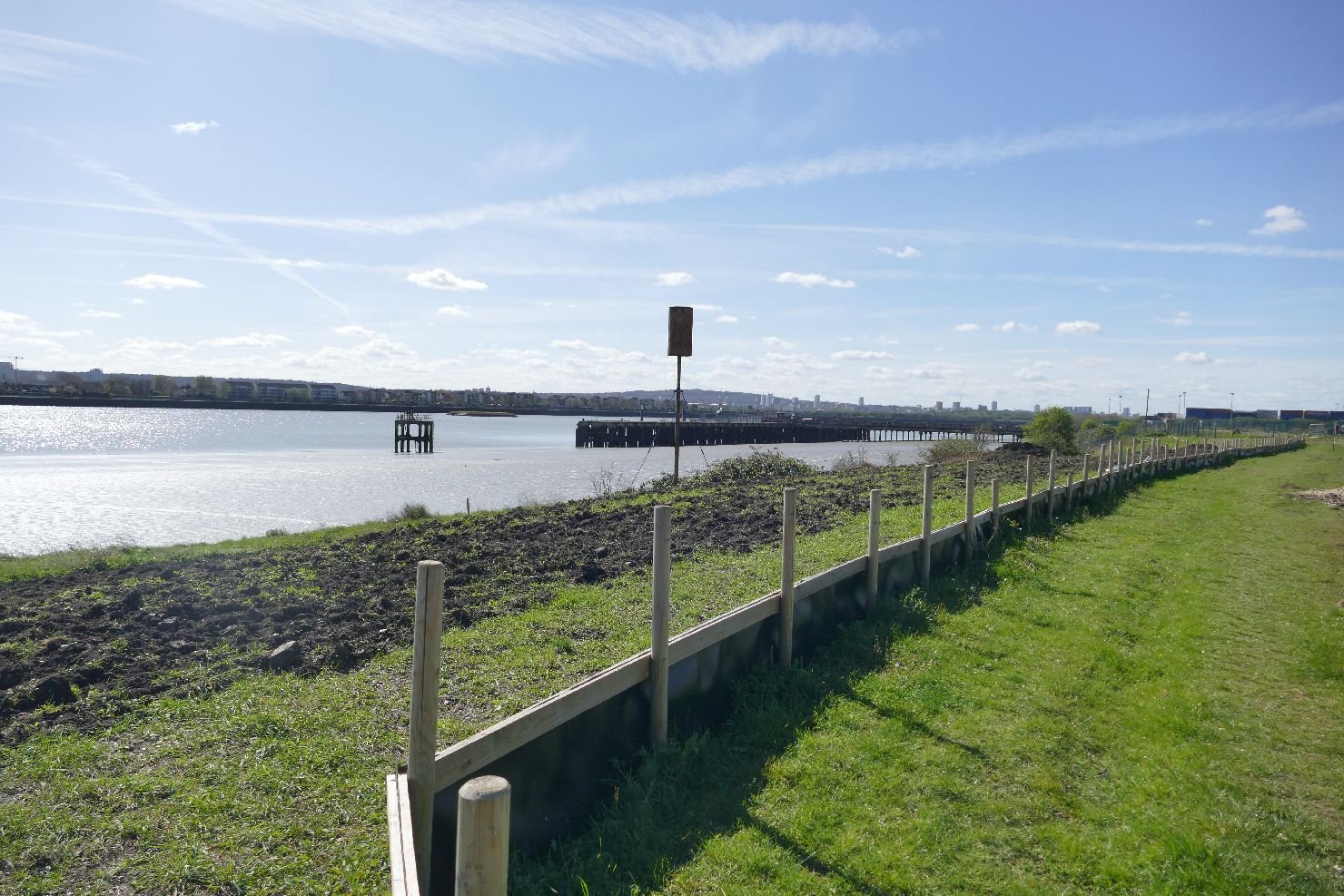
At the moment this is what Path 47 can offer on a sunny day:
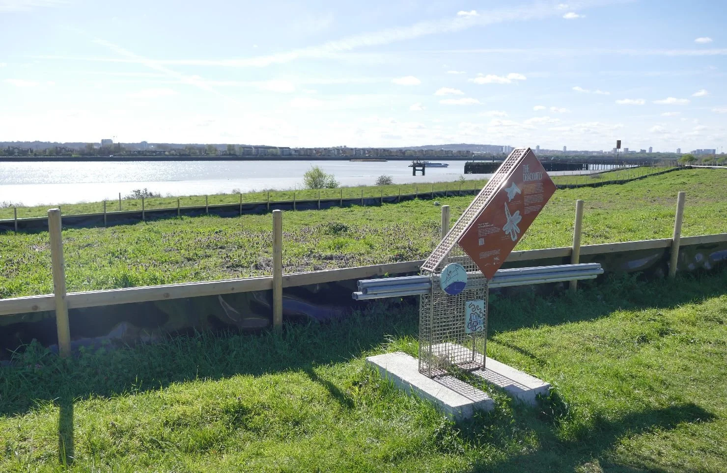
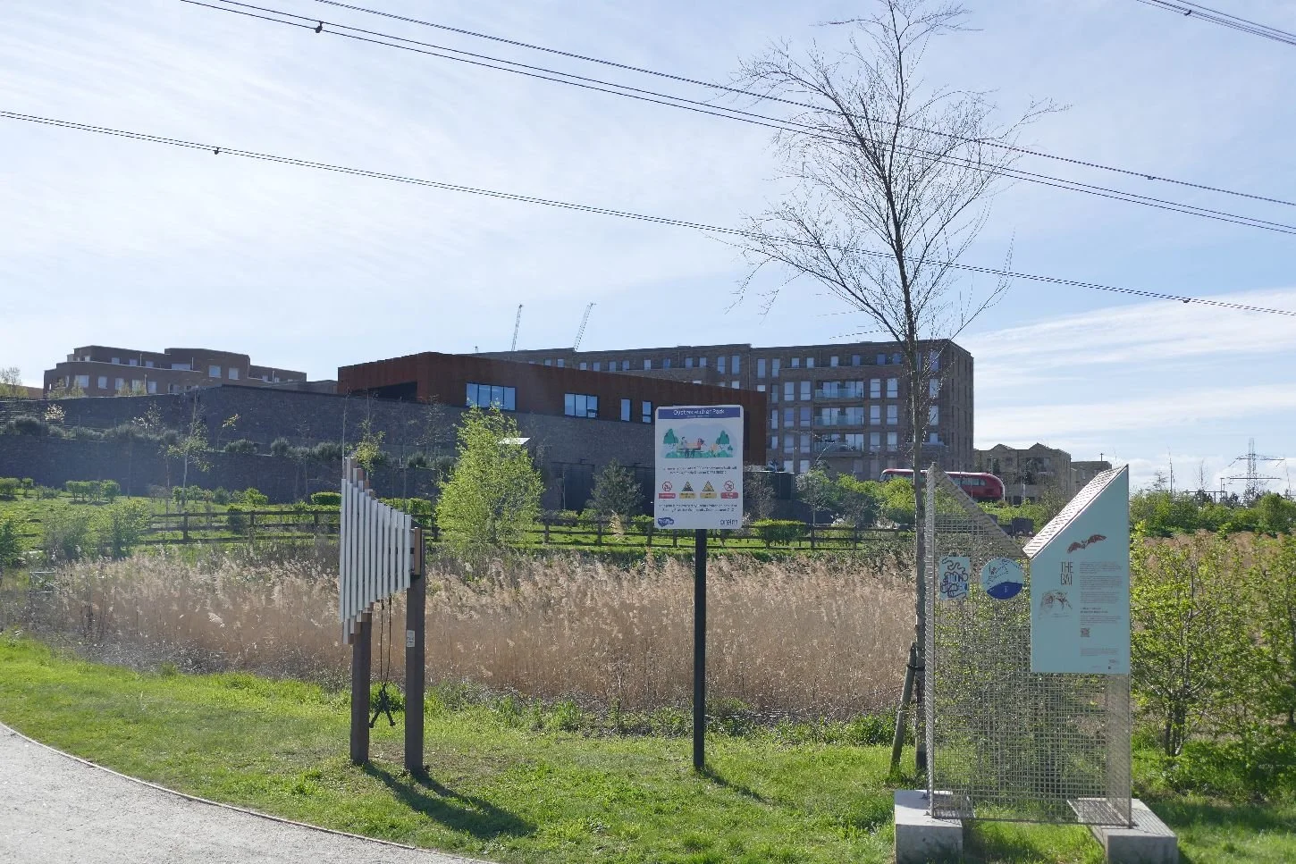
The ‘nature fence’, by the way is a very necessary adjunct to an ecologists contribution to a construction site. It’s other name is a ‘newt fence’ as these barriers control the movement of smaller animals. It works both ways: amphibians found within the construction site can be relocated to a safe area on the other side. It also stops them moving back - nothing upsets a construction programme more than a pond full of newts lurking where the diggers need to go.
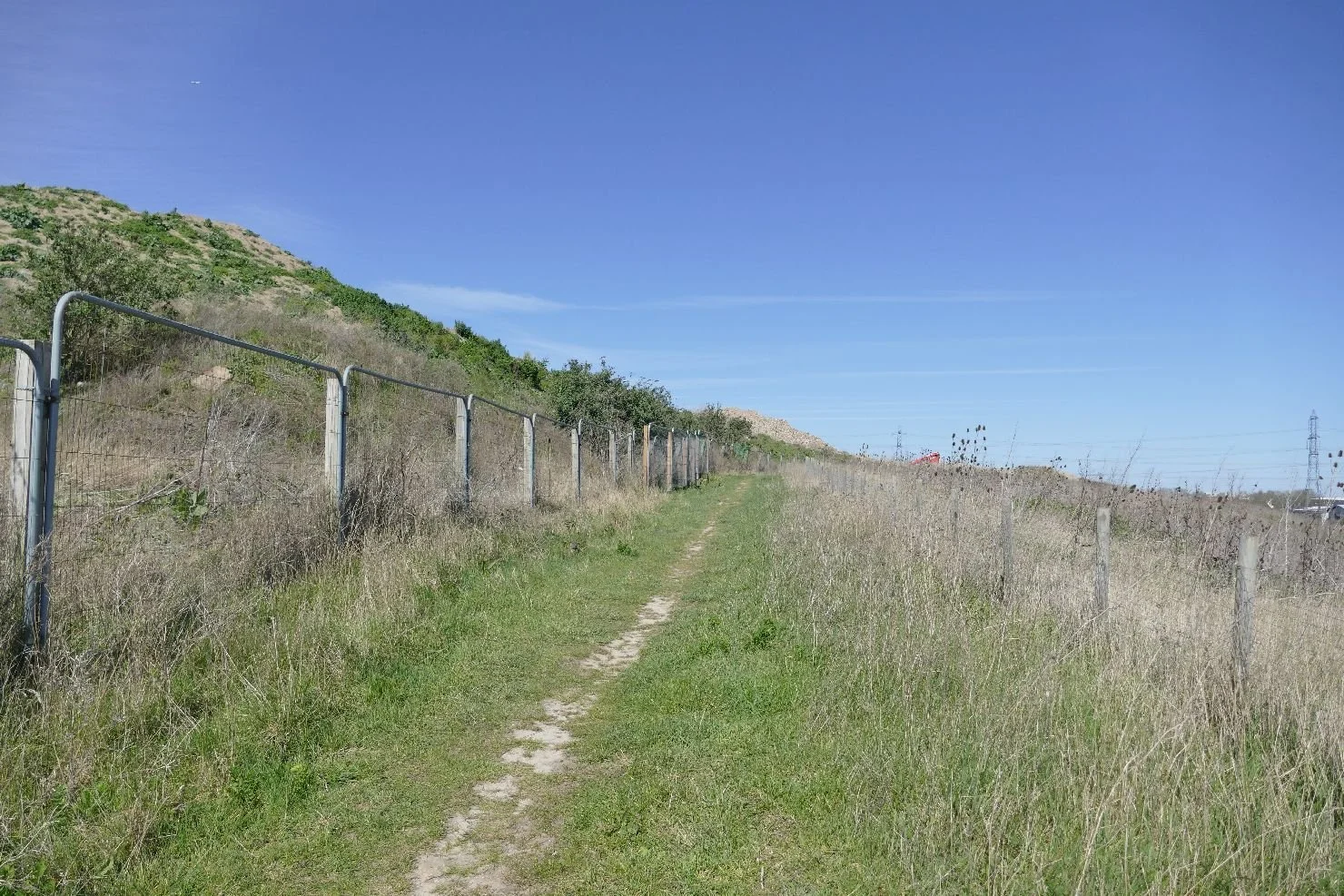
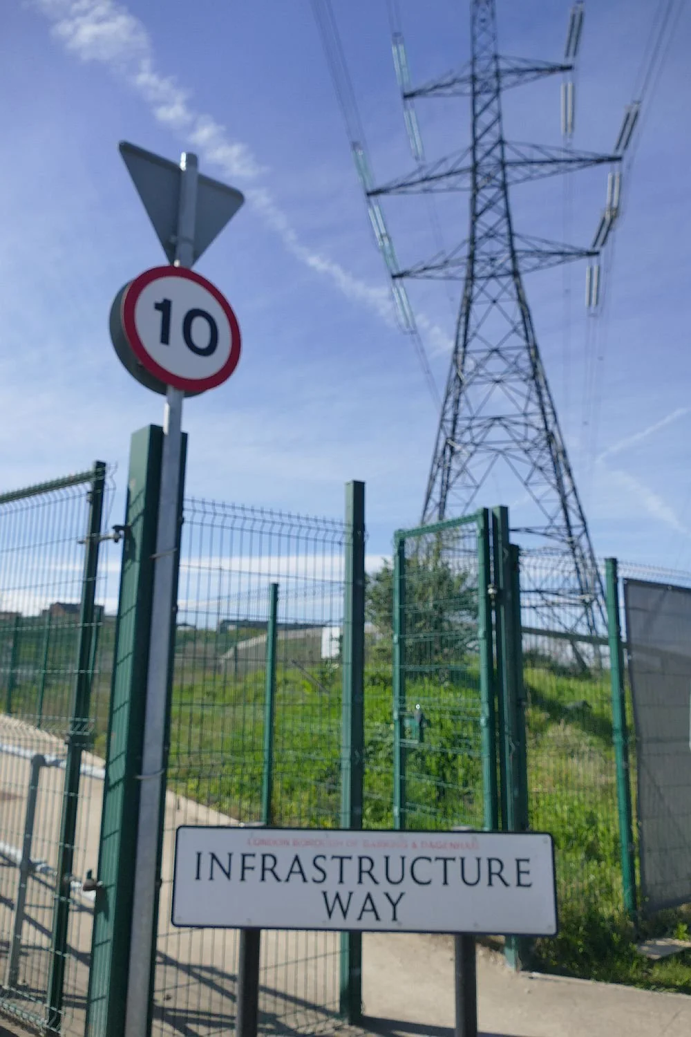
By now we have reached a small water way which separates the Riverside site from the edge of Dagenham. Google maps tells us that this creek is called the Gores and it a somewhat troubled stream with development and its rubble disrupting its valley from both sides. We scramble through the ‘Gores gap’ and emerge onto Choats Road which forms the northern boundary of Barking Riverside.
We feel that Choats Road has also altered its appearance as the Riverside site rises quite steeply to its south, contours which we suspect have been exaggerated by the need to raise the development platform above its polluted base.
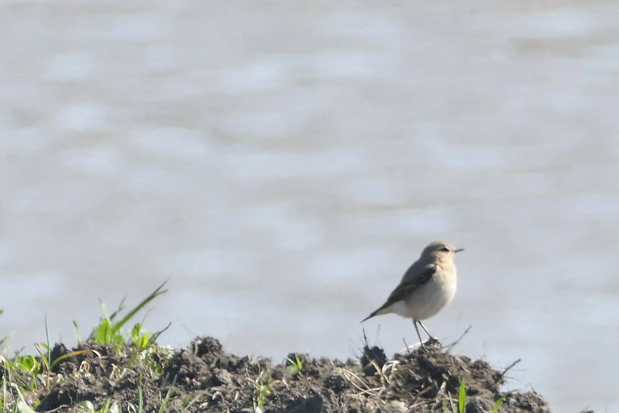
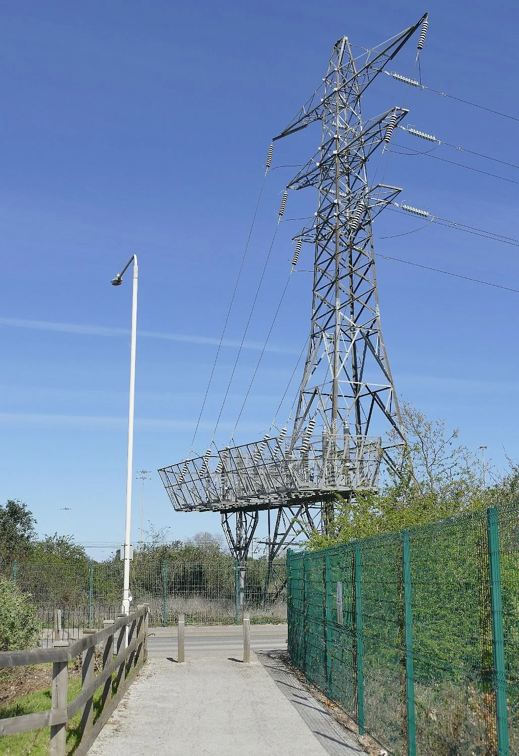
There are many signs of former uses along Choat road including some rogue flora, huge pylons necessary to carry the product of fomer power stations and some interesting signage.

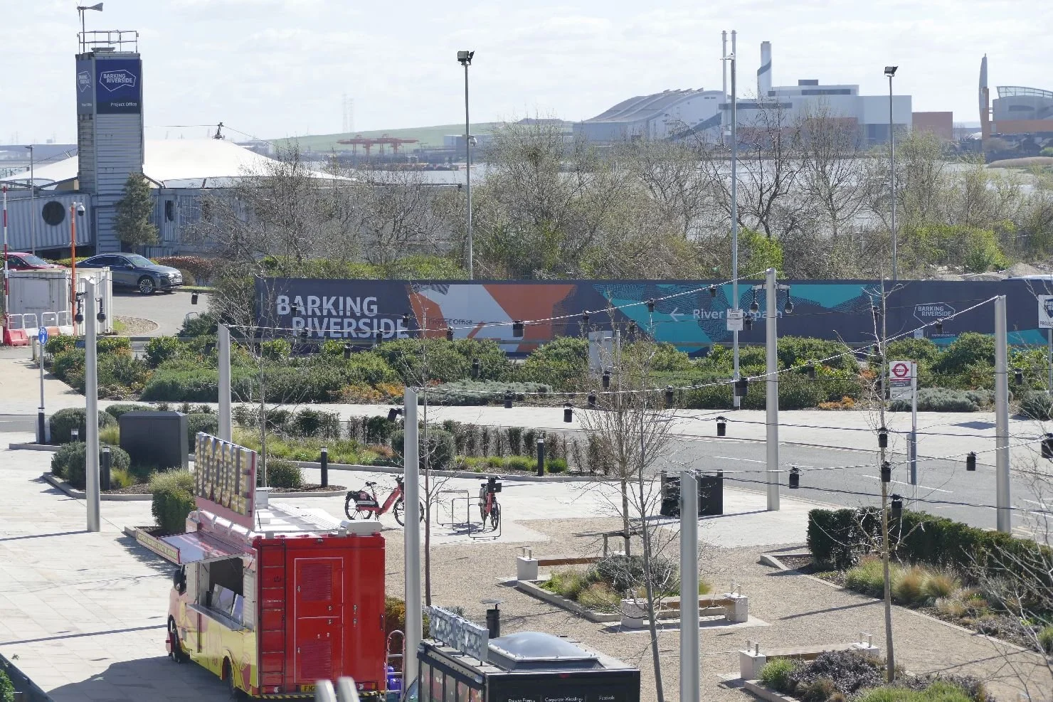
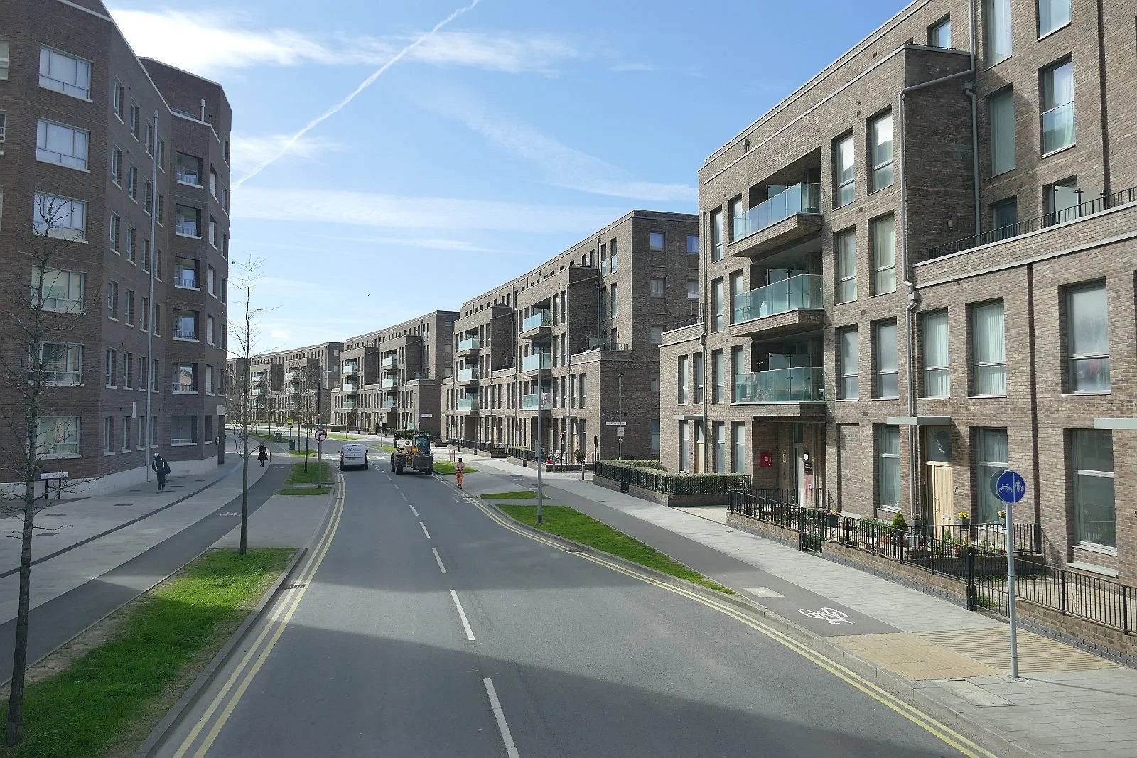
We are now entering the earlier phases of Barking Riverside. The buses still look lonely but they rapidly fill up with passengers once they cross the border and enter the outskirts of Barking. Their time will come. The play area has an interesting and perhaps appropriately industrial feel and was in use when we passed by.
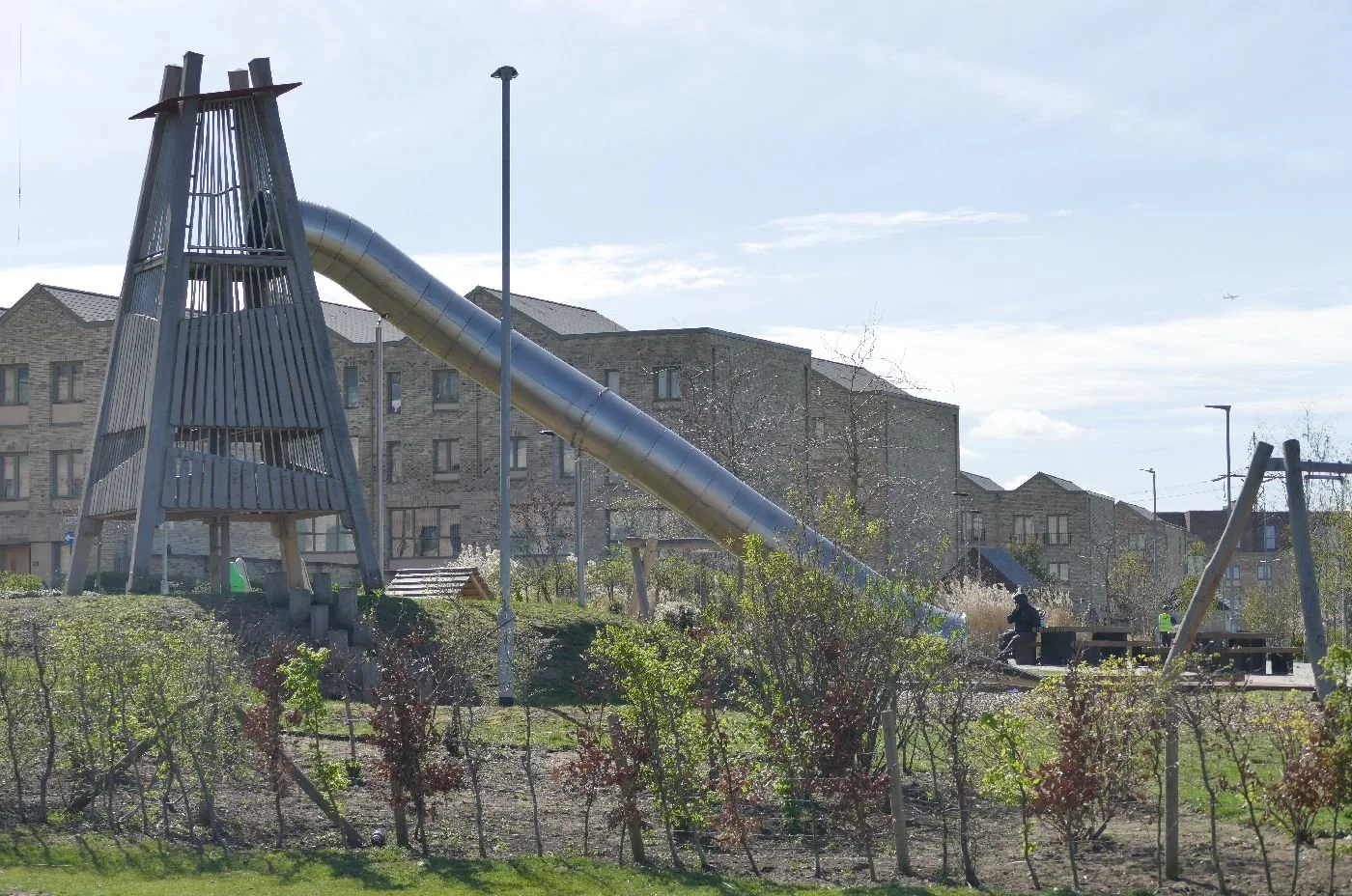
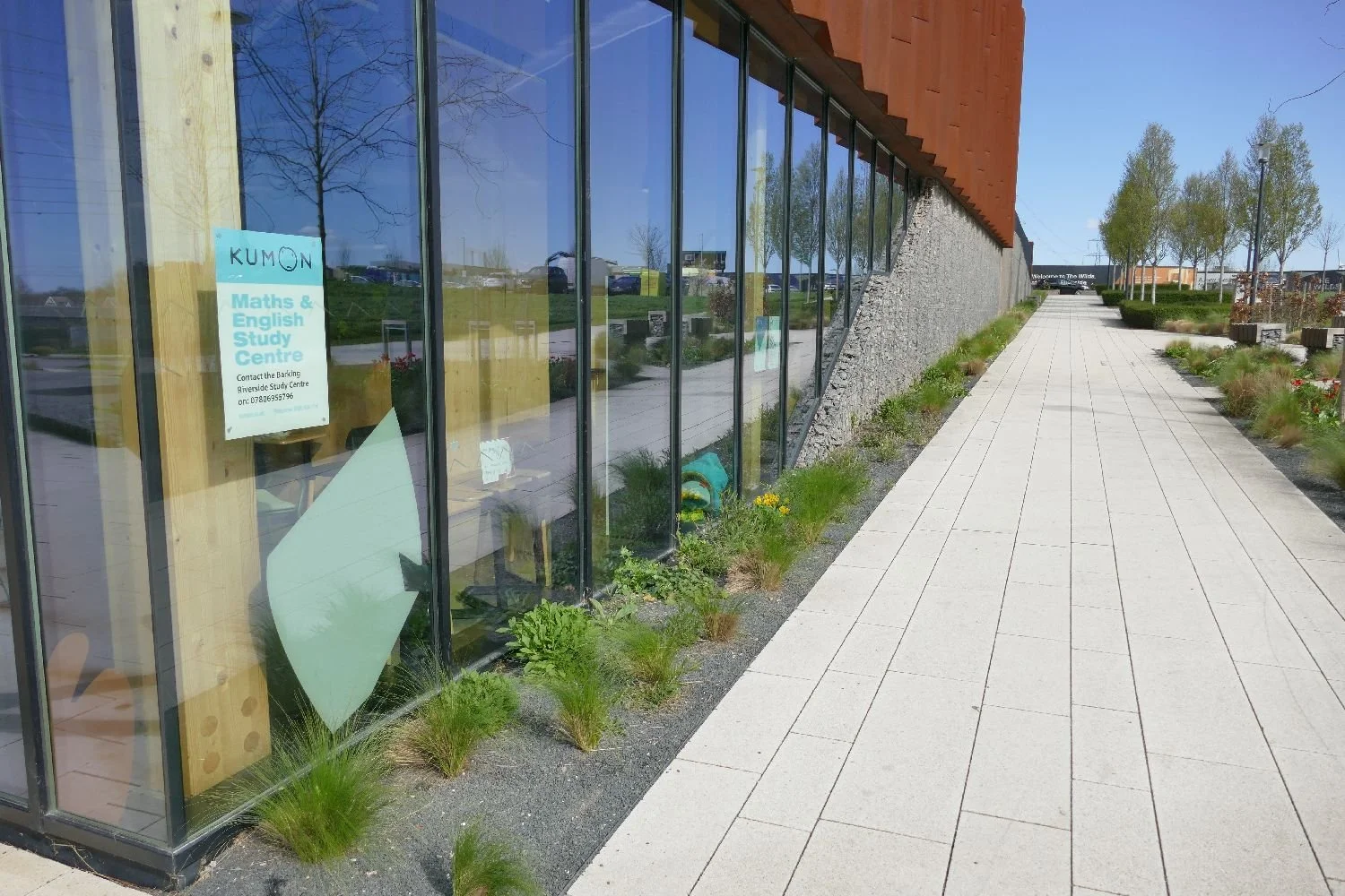
The cafe is excellent and the adjacent attempts at planting and public open space are admirable - as long as they get some quality maintenance.
But the architecture and townscape? Apologies if we missed the good bits, but the little bit we saw was - appallingly dull. Oh dear.
Richard III - A Landscape
Hands up those of you who think you have never read, or seen a performance of, Shakespeare’s Richard III. Yeah, Terroir too.
Or have we? Like Hamlet, it’s full of quotes, including ‘Now is the winter of our discontent”, and "A horse, a horse, my kingdom for a horse!". It has been performed on stage and screen by a plethora of famous actors, including Laurence Olivier and Ian McKellen, and lampooned by many more including Peter Cook, Peter Sellers and the Blackadder team. In fact, I think we all probably know it pretty well.
Shakespeare’s “Tragedy of Richard III” was probably written in the late 1590s, a smidge over 100 years after Richard died in battle. Although a fictionalised account, this tragi-history play (or is it a historical tragedy?) is probably a more entertaining way of getting a feel for King Richard’s last days than ploughing through history books or original documents. Certainly Shakespeare’s perspective displays a horrific number of parallels with the 21st Century. Perhaps there are rather fewer murders these days but the political infighting, metaphorical backstabbing and leadership battles are very familiar and, of course, the House of York features with many inappropriate alliances and misdemeanours. But to be fair, so does the House of Lancaster.

The play also represents an account of the last stage of the Wars of the Roses and the end of a Royal dynasty. The house of Plantagenet, although formed in France, had held the English throne from 1154 until 1485 but its downfall came via the warring rivalries of two cadet branches, the House of York and House of Lancaster.
The Plantagenet arms (right) were based on heraldic lions which symbolise courage, nobility, royalty, strength, stateliness and valour’ (thank you Wiki https://en.wikipedia.org/wiki/Lion_(heraldry)), as well as, of course, being the ‘king of the beasts’.
But flowers also seem to have been important to the Plantagenet clan. The planta genista, (Genêt to the French, Broom in English) is, of course, intimately linked with the family identity. The cadet houses adopted roses as their symbol. Unlike lions, roses and Broom must have been part of the everyday life of nobles and peasants alike. One theory for the choice of the rose suggests that the rose image could be turned into simple and colourful badges, easily recognised during battle; probably cheaper and easier to make and to secure onto your clothing, than three lions in various elongated postures. It gives a whole new meaning to the phrase ‘a bed of roses’.


Yorkist King Richard III was killed at the battle of Bosworth Field (some 15 miles west of Leicester), and Lancastrian (and Welsh) Henry Tudor became the first king of a new dynasty, securing his power base by marrying the heiress Elizabeth of York. The symbolic Tudor rose (right) was an amalgam of the two Plantagenet roses.
It’s neat and diplomatic but I do think that the central ring, highlighted by the red petals, does look ridiculously like a poached egg.
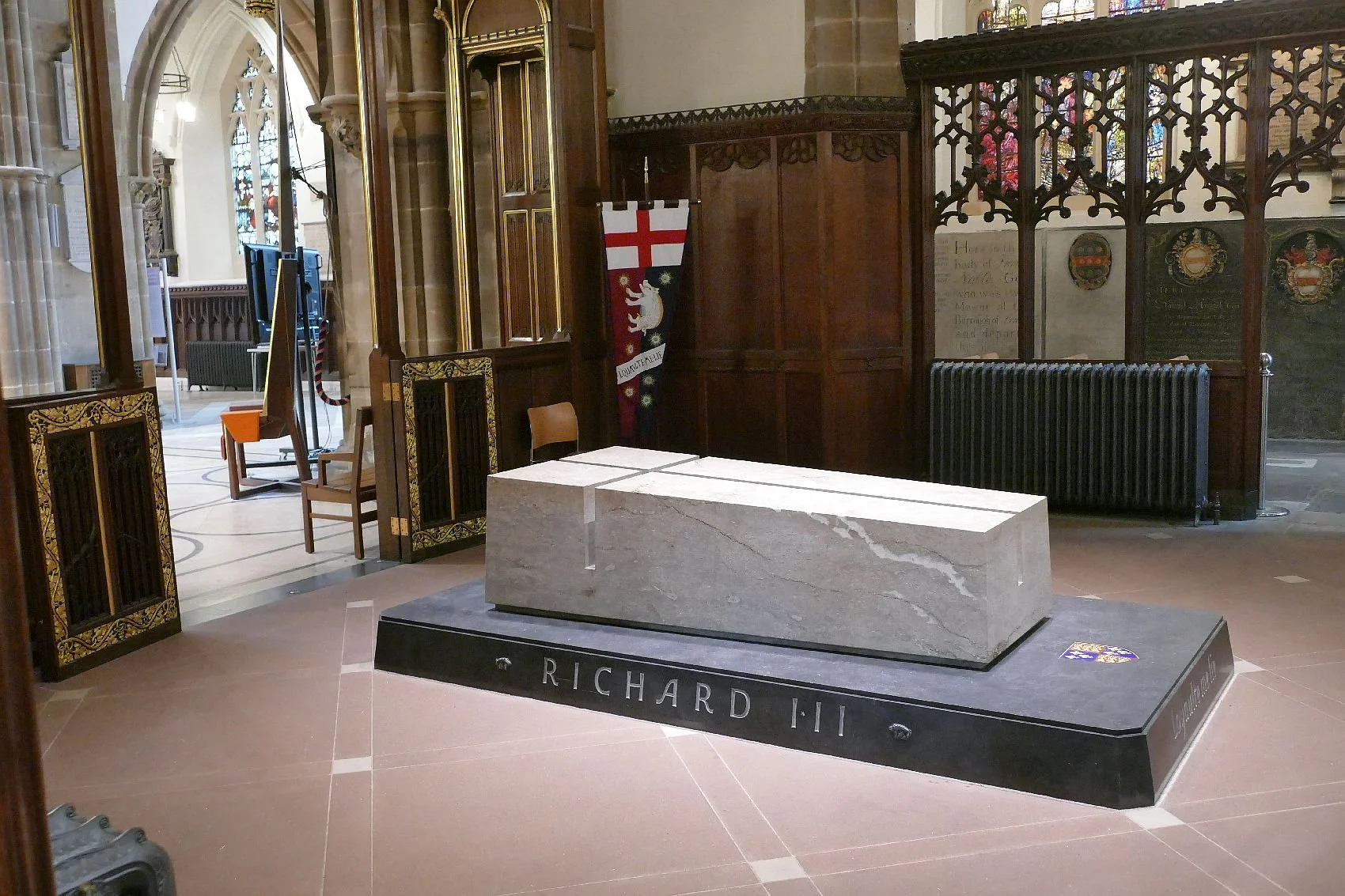
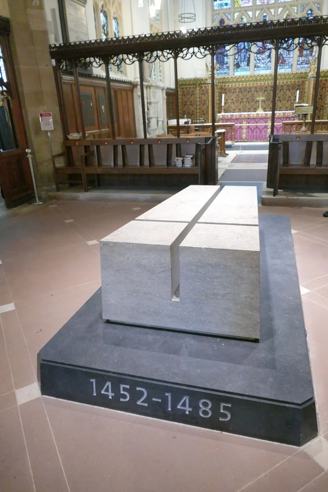
After his death at Bosworth Field, Richard III went on to become famous for being the only member of the English/British royal family to have been exhumed from under a Council carpark.
As Terroir was passing through Leicester, we decided to start a journey – calling it a pilgrimage would be far too consequential – to get a feel of Richard’s landscape heritage from defeat to final resting place in Leicester Cathedral. Due to unavoidable circumstances, including a reluctance to visit a battle field in early March, we will be telling this story backwards. So, here is the landscape of Richard Plantagenet, Part III.
Our journey started at Leicester Cathedral. The religious history of Leicester is pretty varied. According to Wikipedia and the Cathedral website, the original church of St Martin was built on Roman ruins. In 689 St Martin’s had a bishop but with the arrival of the Danes, Bishop Ceolred fled to Dorchester and the dioceses were merged (the result must have covered an enormous area). In 1086, the Norman Domesday Book lists six churches in the town, and St Martin’s was replaced by a Norman building in the same year. In the early 13th century The Grey Friars built a Monastery opposite St Martin’s and the church itself seems to have been enlarged in both the 13th and 15th centuries, becoming the town’s civic church with strong links to the local Guilds. The Reformation stripped out its insides but building continued over the centuries, with a major restoration by – guess who – the Victorians. In 1927 the diocese of Leicester was re-established and the parish church returned to cathedral status. St Martin’s is one of over a dozen English parish churches which were converted to cathedrals in the 20th century.
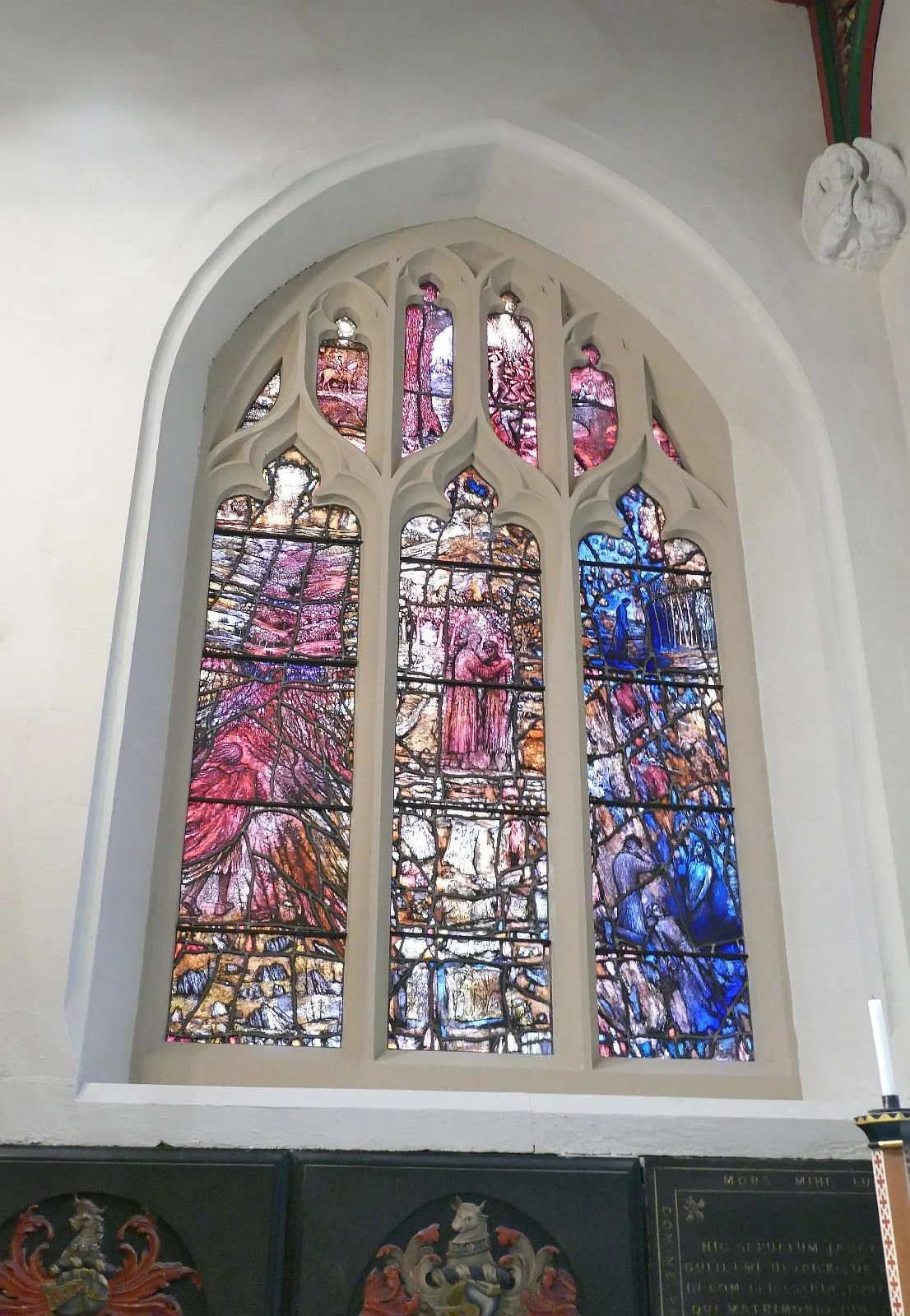
Consdering its history, the interior of the cathedral is unsurprisingly varied, and happy to display its architecture and civic history. Thomas Denny’s windows (row 2 below) “use scenes inspired by the life of Richard III to depict key themes and verses of the Bible, enabling us to reflect upon the stories of our own lives and universal themes” (https://leicestercathedral.org/redemption-windows-denny).
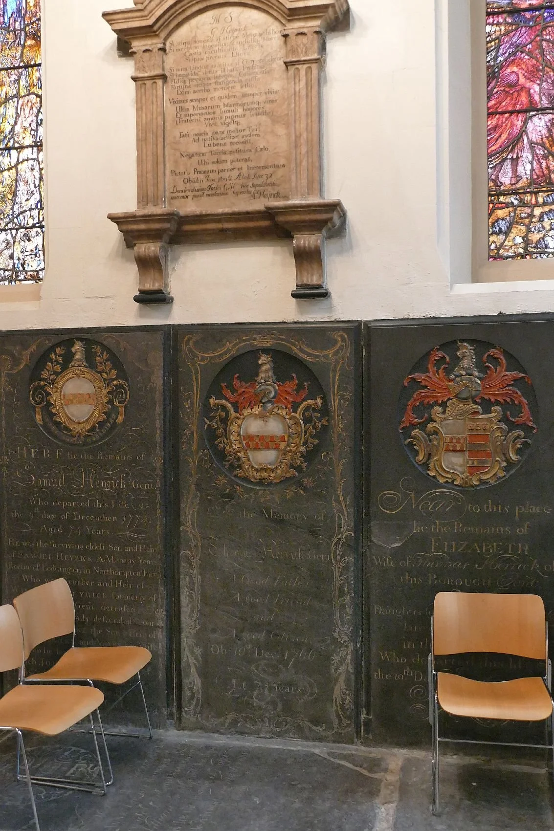

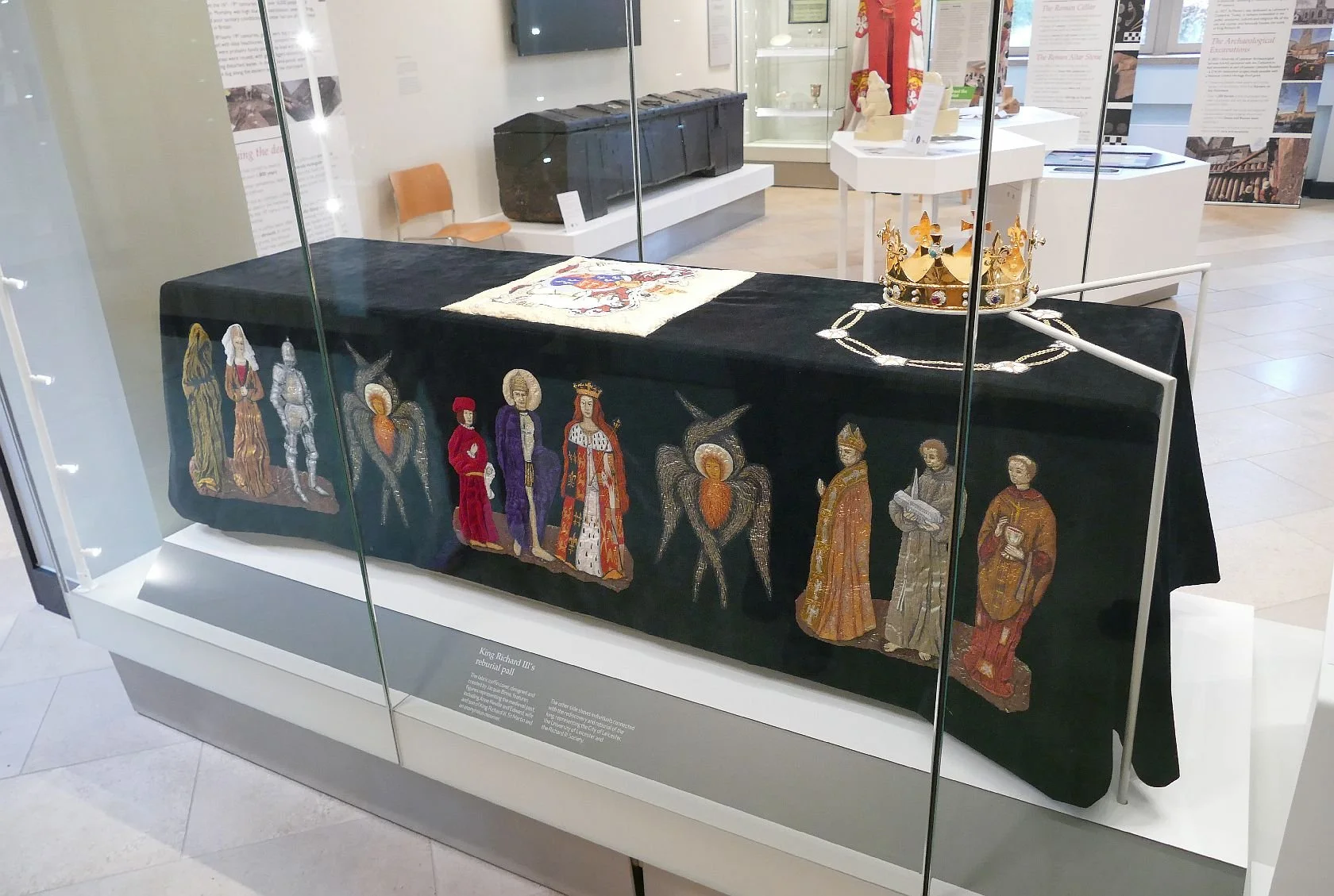
Of course the cathedral is immensely proud of its part in the final laying to rest of Richard III. Cathedral visitor numbers have risen dramatically since the interment of the new-found monarch and the cathedral authorities have developed some excellent information videos located within the body of the cathedral, as well as within its own mini museum. The guides are well briefed and, when Terroir visited, more than happy to answer a strange diversity of questions or share anecdotes relating to a joint love of English gardens! The tomb marker is an immaculately carved 6 tonne cuboid of Swaledale limestone, sculpted by James Elliott, and displaying its innate identity as a piece of sednimentary rock, full of fossils.
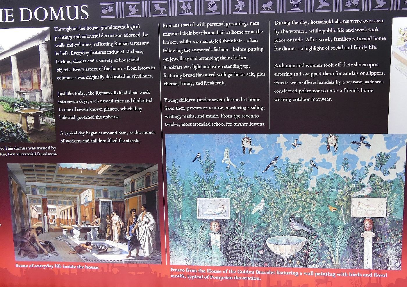
utside the Cathedral lies a strong contrast between old and new and the cathedral/church/cathedral was always an important feature of Leicester town. In the middle ages Greyfriars snuggled up to its walls and it was there that King Richard was taken in 1485, to be buried. The models below show the relationship between the Greyfriars monastery and St Martin’s church.
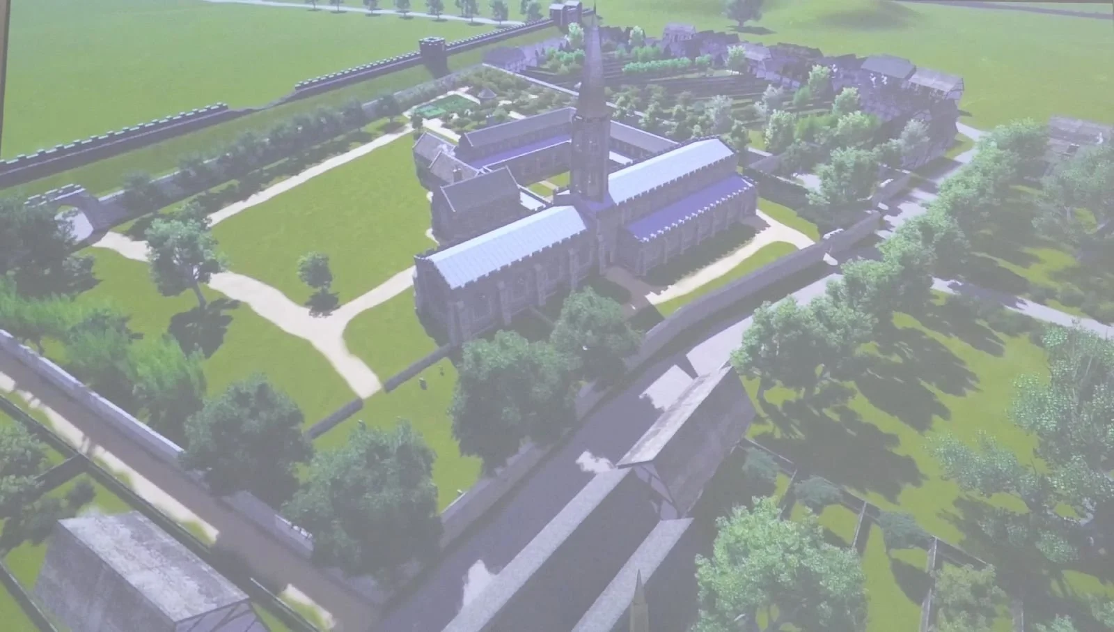


Models of Greyfriars in its prime (above left and centre) and its relationship to the Cathedral (above right)
Of course Henry VIII saw to it that the monastery was destroyed, an action which must have released a prime piece of real estate as well as other forms of Franciscan wealth. No one knew that the Parish Church might one day need another Cathedral Close, and it seems that no-one either knew nor cared where King Richard’s body lay. This part of the City needs some parking spaces? That’ll do nicely.
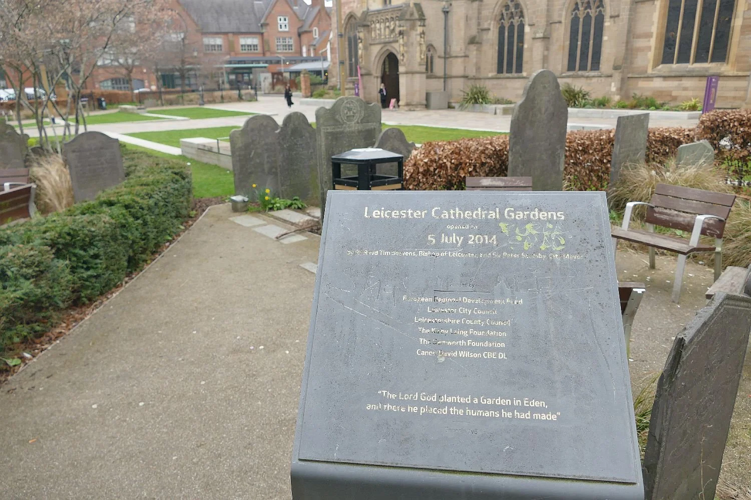
But of course parameters changed drastically once the will, finance, skills and partners were assembled to search for and, finally, to exhume the body of Richard III. Leicester Cathedral was intimately involved in making the exhumation posible, and now has a new garden worthy of the number of visitors who pass through this space.
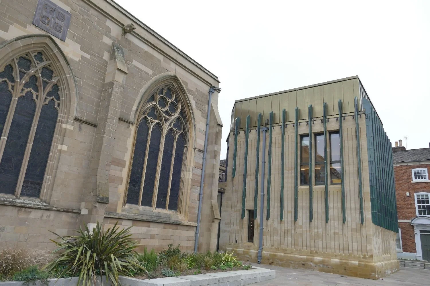
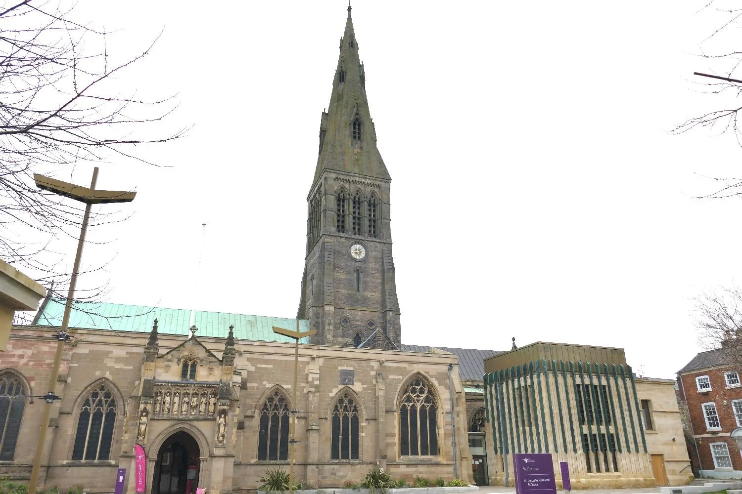
The Cathedral’s new Visitor Centre has avoided a pastiche extension and blends well in terms of materials. We can’t make up our minds whether it reminds us of an upturned medieval bucket or an oversized square pie, but it’s fine. Let it do what is has to do.
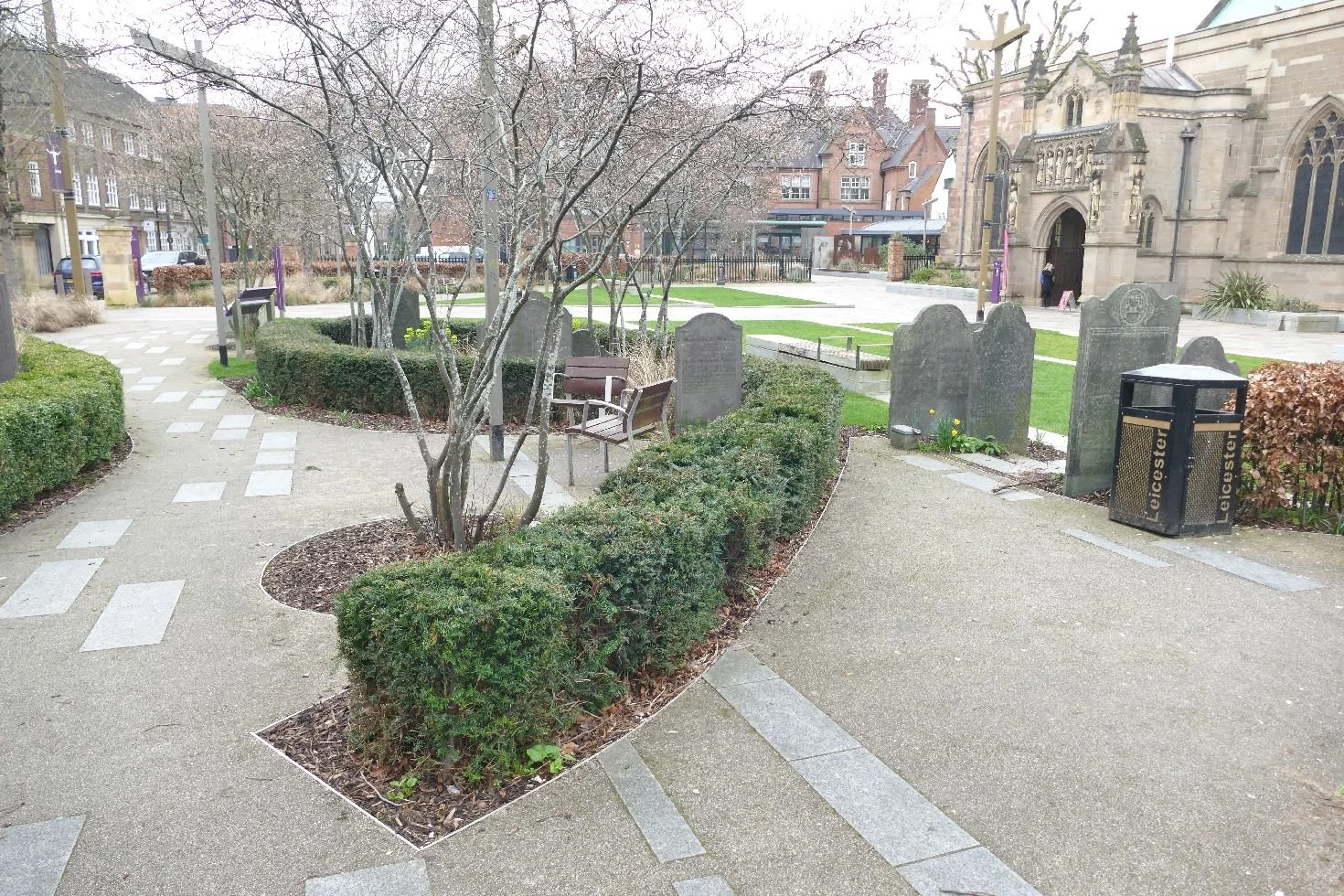
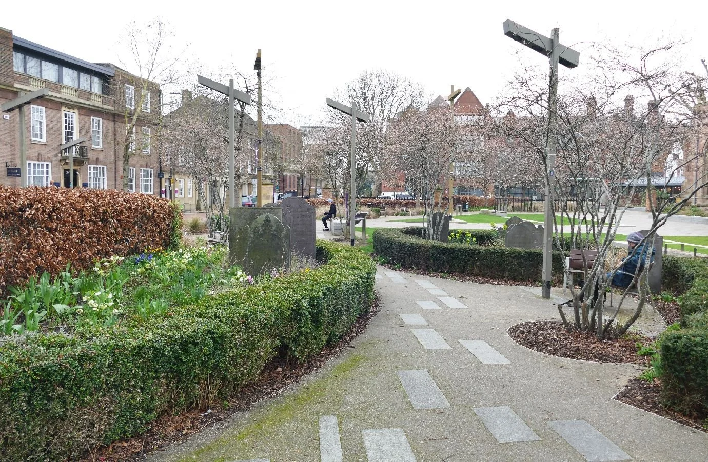
The garden seems to just keep its balance between an uncluttered welcome to the Cathedral and provision of interest and space to rest. Remember - this was early March and a chilly, rain-bearing wind was blowing over Leicestershire. Despite the conditions, people are passing through, taking a rest and appreciating the spring bulbs and the tracery of bare trunks and branches. But it did take one of us a few minutes to work out that the asymetrical ‘signposts’ were not modern scultures, representing medieval archers, but light standards!
We’ll be back in warmer weather. The Richard III Visitor Centre requires a longer visit and there is always Bosworth Field to visit - even if it is now the Bosworth Field Heritage Centre. Do we mind? We’ll let you know.
It’s Behind You!
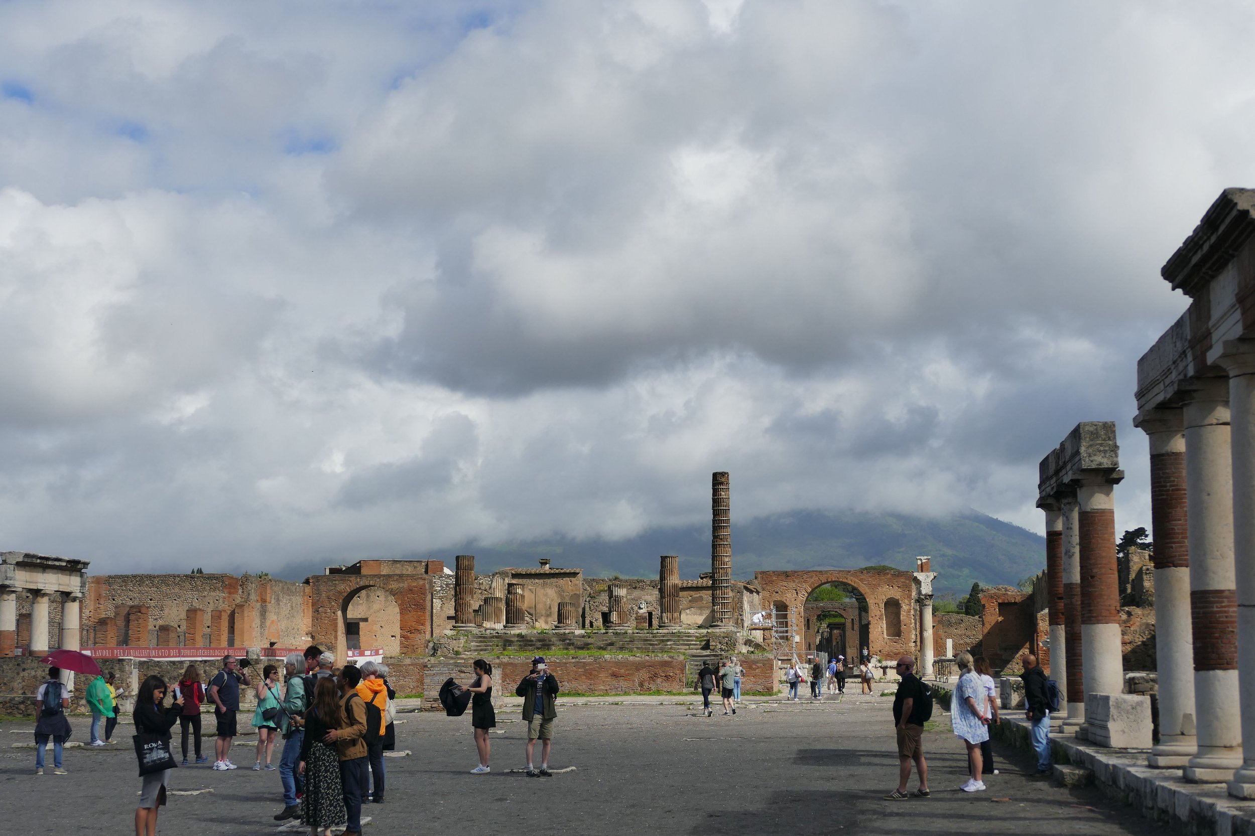
It was a damp and rainy day. Just as it was when we first went to Pompeii.
In May 2023 we wrote:
‘Impossible to sum up Pompeii in a few words, but brick loving Terroir revelled in some of the construction and design details, and the wall art was unbelievably impressive. And the gardens, and the amphitheatre, and the town planning and the occasional glimpse of Vesuvius’ foothills, once the early morning rain had stopped.’

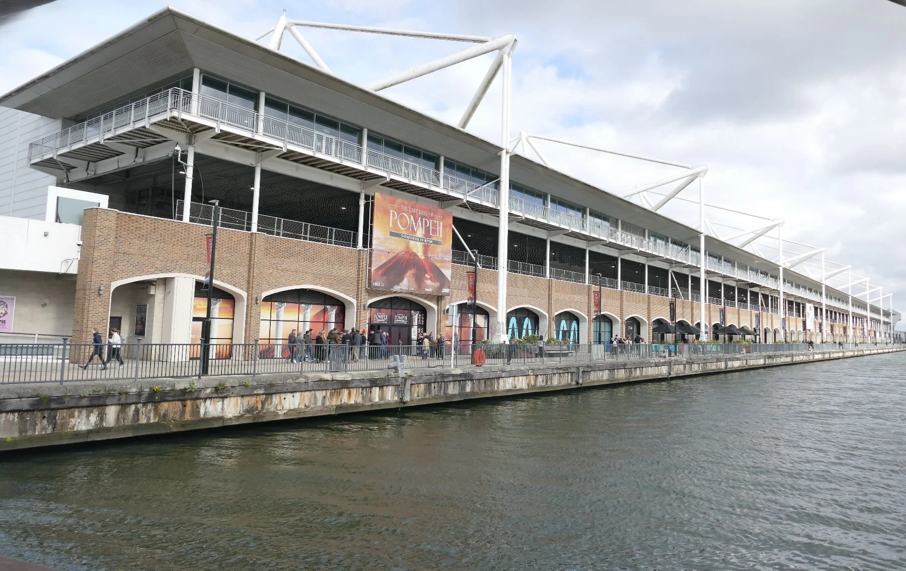
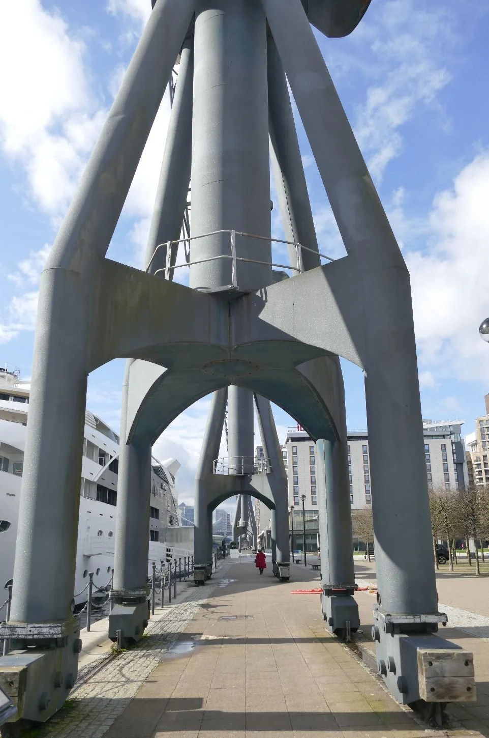
In February 2026, we sampled ‘Pompeii - The Immersive Experience’ located at the London Excel Waterfront. As we left, the early morning rain had stopped and we had a stunning view of the conical peaks of Victoria Dock’s sculptural but redundant derricks, tethered to their dockside rails, and attempting to rise above (figuratively at any rate) the faux warehouse architecture behind them.
So at first glance, there seemed little more than the weather to provide a common link between the warmth, colour and antiquities of southern Italy and a digital re-enactment inside a modern shed in London’s re-purposed docklands. Roman ruins versus accessible interpretation? Classic drama versus digital pantomime? Let’s see.
Two things became clear very early on: you will get more out of the ‘The Immersive Experience’ if you are a) a child and b) never been to Pompeii. So top marks for bringing Pompeii to the huge audience which is in easy reach of East London. Sadly Terroir didn’t qualify on either count.
In addition, if you like a carefully choreographed tour rather than the serendipity of wandering at will then, again, Immersive Pompeii is for you. And, if virtual reality is your thing, then this will give you a real buzz and entertain kids big and small between the more static displays.
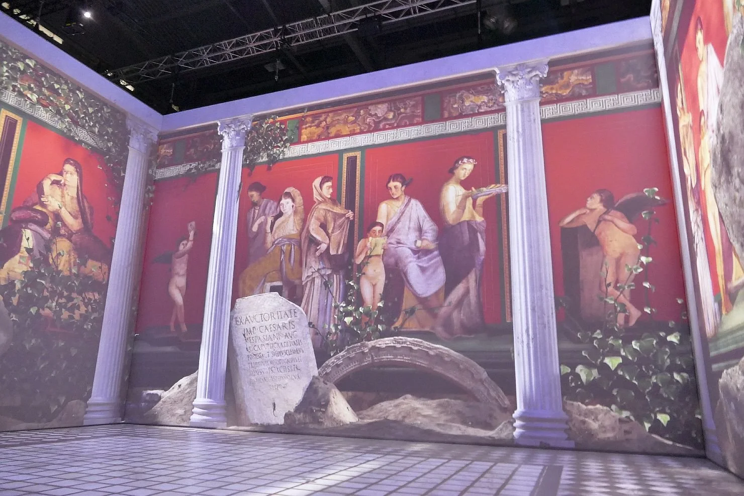
The huge poster-cum-interpretation boards are bright, informative and relate easily to visitors’ experience of modern life. Well maybe not: starting the day at 8am and taking your shoes off as you enter the house is not yet universal, just as not all of us are strangers to eating breakfast standing up.
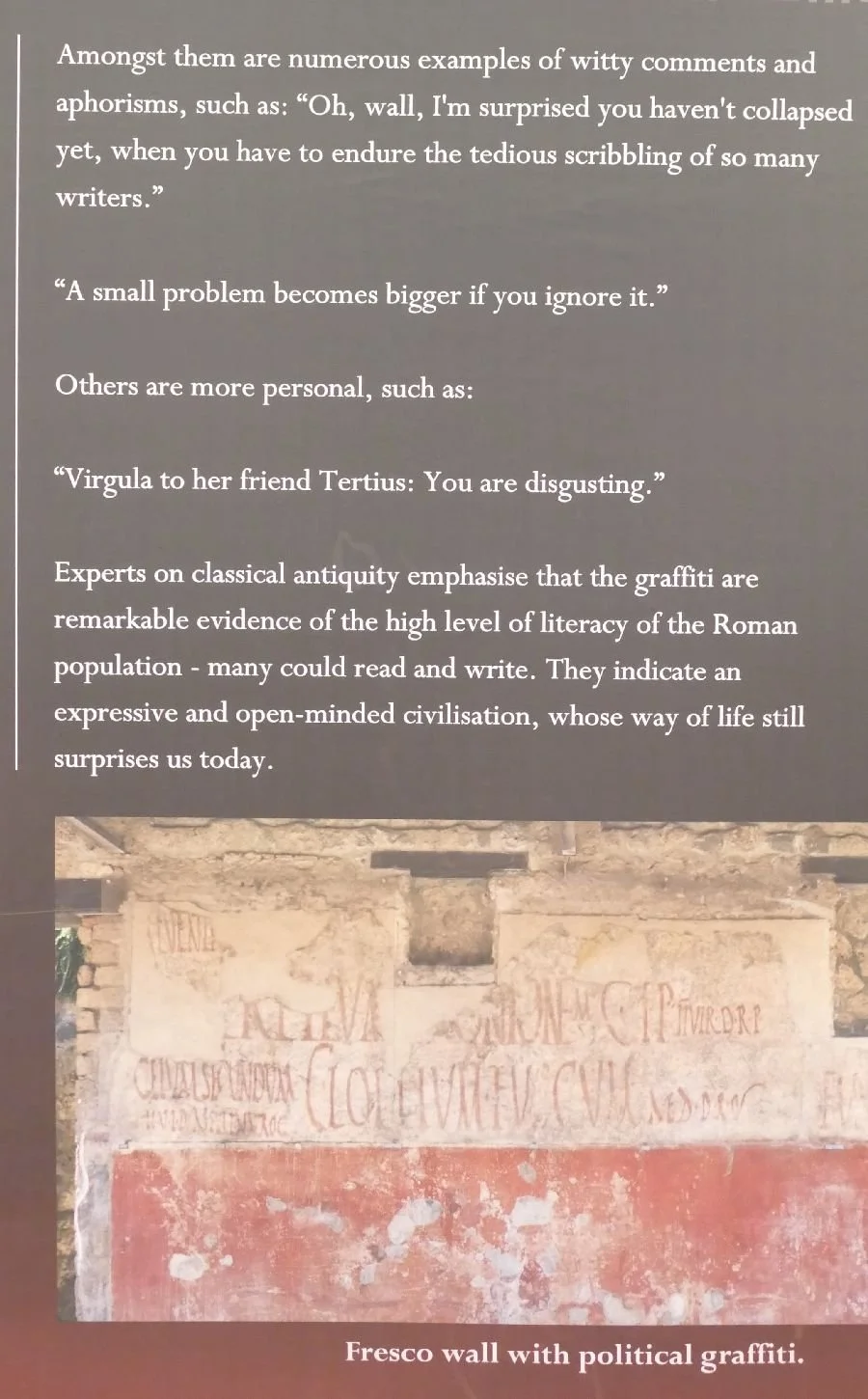
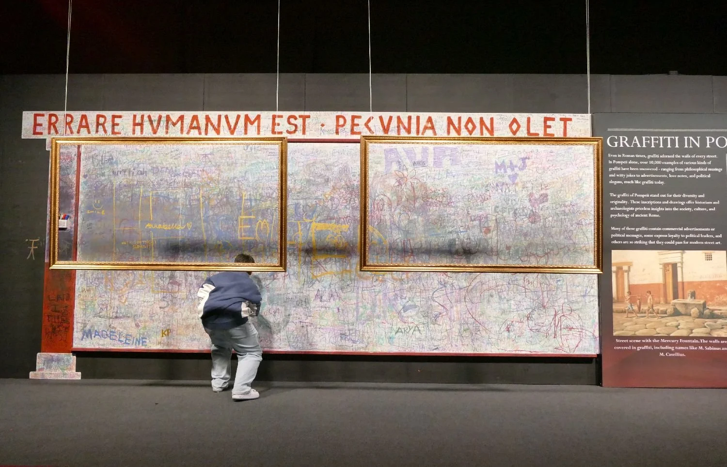
The Romans may not have invented scribbling on walls (see below), but they do seem to have provided the linguistic base which inspired Italian speakers to invent the word graffiti (though the singular ‘graffito’ seems to have long since fallen into disuse). The immersive experience embraces both the old and new versions of illicit wall messages.

And there are more comparisons between posters and recent-ish observations:


But the unique selling point for the London immersive experience of Pompeii is, of course, the re-anactment of Pompeii life through the medium of virtual reality. Taking photographs while actually experiencing a bout of VR is, of course, tricky as this image to the right demonstrates, so we will do our best to describe our experiences in words.
Our first Virtual Reality session consisted of a journey through a countryside dotted with over-fluffy stone pines, vineyards, clear views of the mighty Vesuvius and meadows of such a bright and verdant green that they look as though they have been well doused in chemical fertiliser.
Above: the fluff-free pines that we actually saw and the realistic view of Vesuvius, buried somewhere in that cloudscape.

Back in VR land we pass though a mighty wall and enter the amphitheatre to watch chariot racing and gladiators beating each other up, only for the victor to be devoured by a sabre toothed tiger. It all feels like a Hollywood animation, particularly when the tiger walks through you and vanishes from view.
We move on to what appears to be a huge hall draped in variegated ivy (really?) with the face of perhaps Domenico Fontana, the 16th Century architect who is credited with re-discovering the remains of Pompeii. This four ‘walls’ are used as a screen on which to articulate Pompeii life and art before it was destroyed by the cataclysmic eruption. One of us is particularly taken by the animated mosaic family (below left) which wanders out onto the terrace before the eruption occurs.
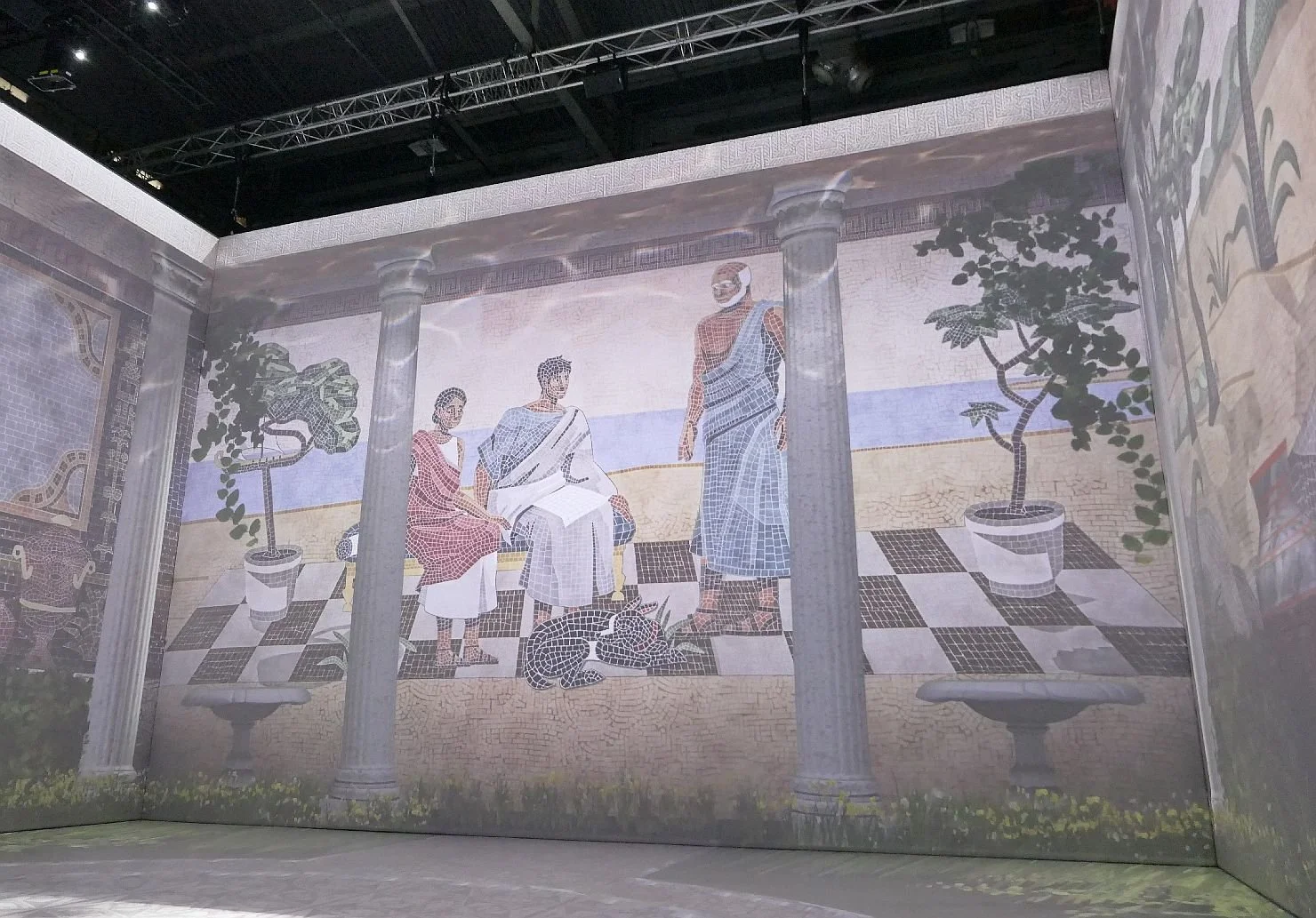

It was here that the continuous background music really started to get to us. Scenes from classical Italy accompanied by Hollywood adventure music just doesn’t work for us. Something a little more close to home would have been welcome.
Once more we don VR goggles. This time I appear to have no identity or spatial form at all. It is seriously unnerving and totally disorienting. Everyone else in the room is represented by a floating classical roman head with a large white number pasted on it. Where am I? I eventually learn that my companion is number 23 and that it is unwise to clutch at any other number for comfort or support. We are looking at the ‘domestic offices’ of a Roman house, but I have scant visual memory of what we experience; at least I feel that I am lost in a Roman villa not a huge shed in London Docklands.

By now we are experiencing our third? (to be honest I’ve lost count) eruption of the mighty Vesuvius and each one feels less realistic than the last. We can understand why it has been dumbed down to accommodate a young audience but it is so unfrightening as to be funny. We keep wanting to shout ‘it’s behind you’ whenever the whole process starts.
Yes, there is certainly an air of pantomime in ‘Pompeii - the Immersive Experience’. But don’t let that put you off. Just make sure you see the VR before you visit the real thing.
‘January, February’
‘January, February, I don’t understand’
The lyrics of Barbara Dickson’s song, ‘January, February’, pretty much sum up Terroir’s attitude to January.
This year we’ve had a pepper pot shaking of snow and now, as the rain falls in showers, sheets, stair rods, storms, drizzle, cats and dogs, buckets, torrents and deluges, the mud deepens and Seasonal Effective Disorder (SAD) is rampant.
Dickson’s song begins
‘You just say the things you want to hear
And like a fool I believed everything was clear
But now I feel so distant, I don't know what to say
The things I thought important are just another day’
These lyrics are, obviously, about a relationship with a person but today they remind Terroir of our reaction to Climate Change. In 1980 we, ‘like a fool … believed that everything was clear’. These days we recognise the threat of climate change but still ‘don’t understand’ or take enough action: ‘the things I thought are just another day’. No wonder a rainy, climate changed, January in 2026 is tough.
We’ve taken a look at what other pre-climate change poets thought of this first month of the year. Apparently Dante Gabriel Rossetti thought of ‘mighty fires in hall, and torches lit; / Chambers and happy beds with all things fit‘. https://interestingliterature.com calls this ‘shamelessly idealistic’ and Terroir is absolutely in agreement. Obviously Christina and Gabriel Rossetti did not suffer from SAD.
In the same website, we find that others were, like Terroir, less enthusiastic about January. Hilaire Belloc refers to the ‘undefeated enemy’, William Carlos Williams to the wind ‘running chromatic fifths of derision outside my window’, and I will spare you most of R S Thomas’ uber distressing poem on a wounded fox, save this passage: ‘…the snow that feels no pity, Whose white hands can give no healing’. Well, with climate change, maybe that horror may actually diminish.
It’s time to cheer up. Terroir has been travelling despite the weather, the gloom and the short days.
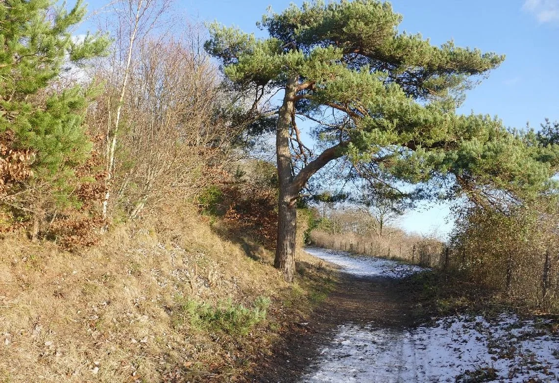
To start with, we’re on a SAD reducing walk along the North Downs, with snow, sun and a lone pine. Lone pines seem to inspire American poets more than British writers so here is Emily Dickinson on ‘The Pine Tree-:
‘It is alive, strong, and free,
Yet it never weeps nor sighs.
No matter how fierce the storm,
It stands tall against the skies.’
You can tell that Ms Dickinson was a stranger to the stunted growth of a southern English pine, grimly routed into the scarp slope of the North Downs.
The low, wintry sun casting low, wintry shadows brings on a melancholy piece of Shakespeare’s Macbeth, perhaps a premonition of the seemingly endless days of rain to come.
‘Life’s but a walking shadow, a poor player,
That struts and frets his hour upon the stage’
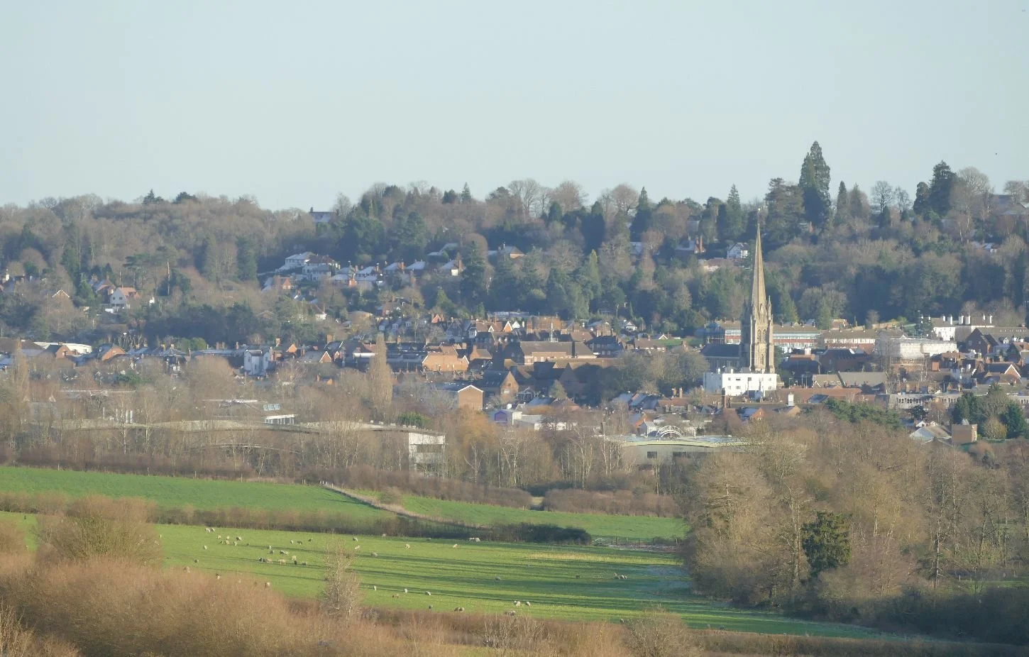
Below us is the market town of Dorking with the decorated gothic spire of St Martin’s providing a landmark for miles around. Jane Austn’s heroine, Emma, would not have seen this spire from the picnic grounds of Box Hill, but might have spied a much older medieval church which is said to have been demolished around 1830.
We discovered this, somewhat quaint, ode to Dorking, written by the Victorian poet William Cox Bennett and entitled ‘An Emigrant Song’:
O, Dorking is pleasant, and Dorking is green,
And sweet are the woods and the walks of Deepdene,
But for Dorking’s sweet meadows in vain I must sigh,
And Deepdene’s green woods will no more meet my eye;
But the green woods of Surrey, the sweet woods of Surrey,
The dear woods of Surrey, I’ll love till I die.
A trip to London: the snow has gone and the rain has arrived but we dress for the occasion and sign in for an open day at the pumping station which controlled the early 19th century equivalent of the M6 toll motorway.
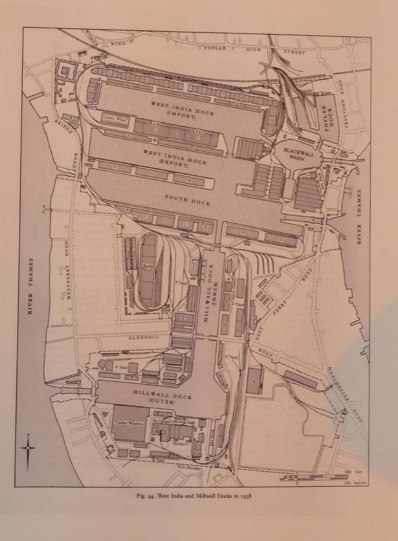
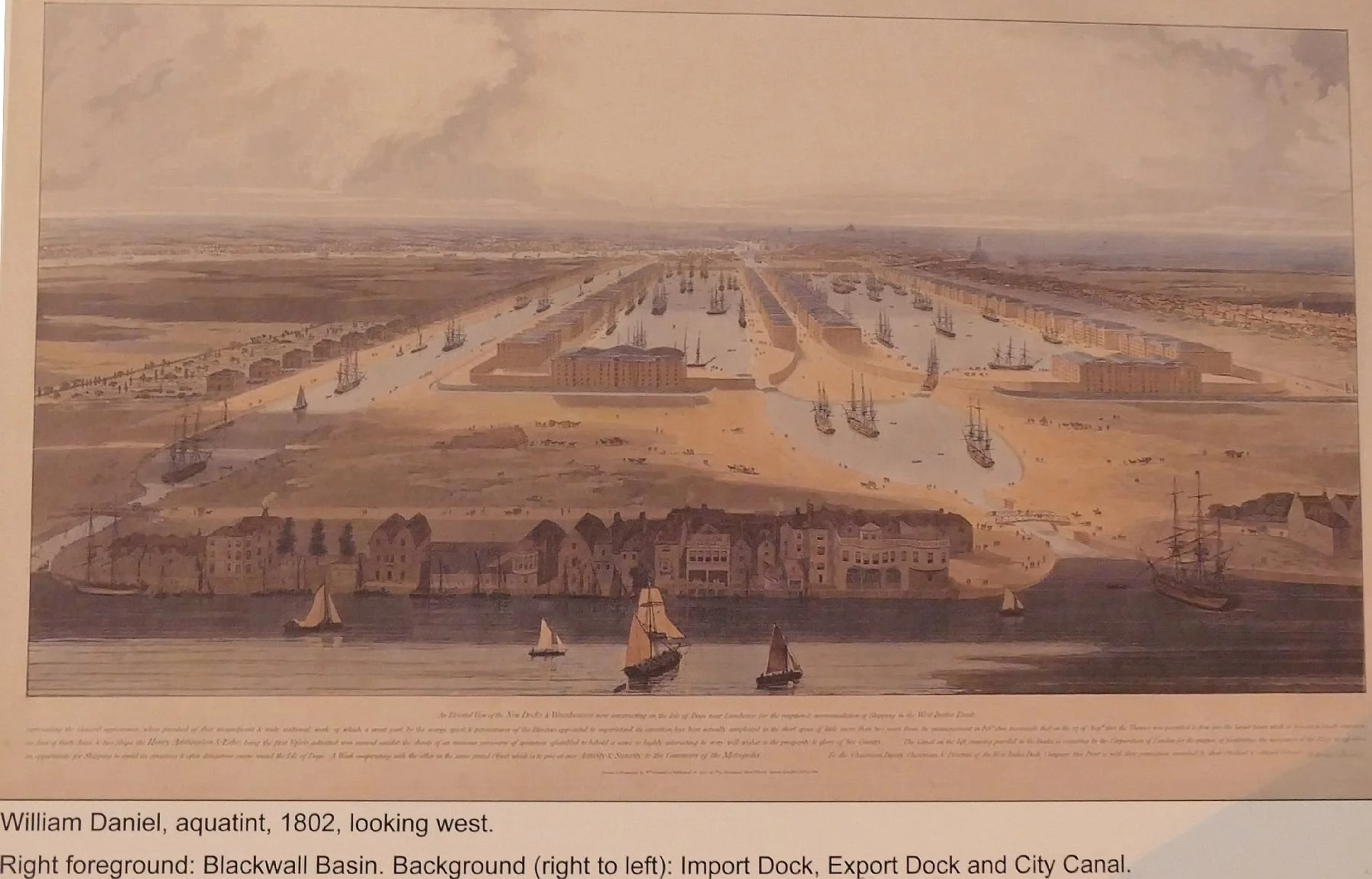
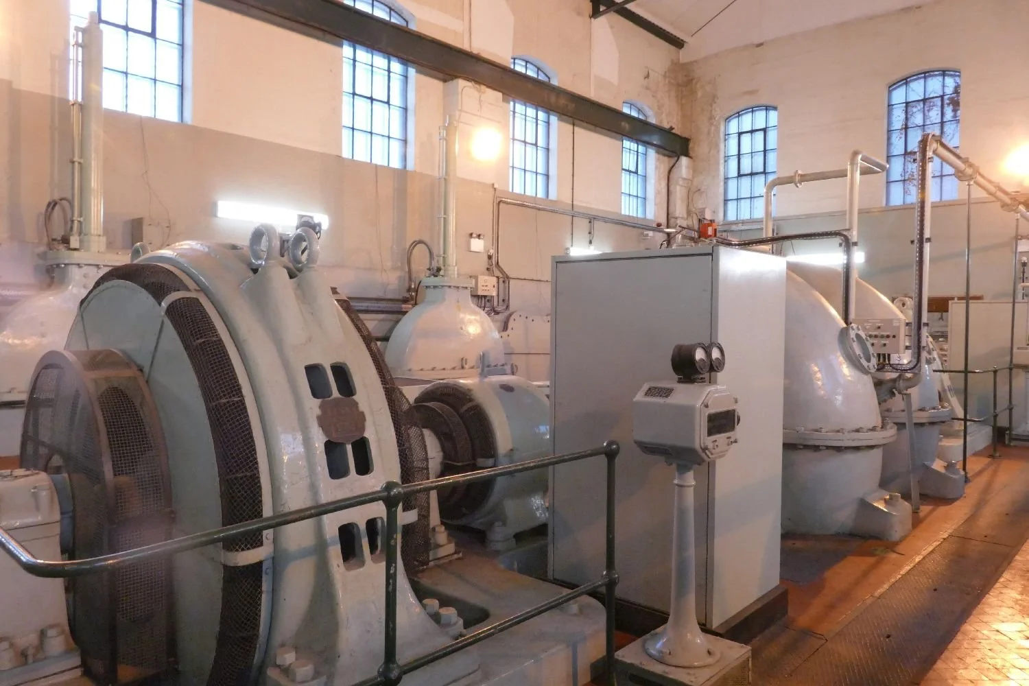
What is now called ‘South Dock’ was originally constructed as a speculative canal to save shipping from the long haul around the Isle of Dogs on its way to and from the Pool of London and the increasing acreage of new docks to the east. Sadly the canal was an economic failure. Shipping chose the longer route rather than pay the canal toll and have the hassle of passing through the locks at either end.
Locks were required to allow passage through the canal at all times as, of course, the Thames is tidal. As well as the huge lock gates a phalanx of pumping engines was also required to control City Canal’s water level. The machinery is stunning and still runs as required (its managed by the Canals and River Trust), although the engine hall did remind us of something created by and for cinematic yellow ‘Minions’.
Most poets sing the praises of the Thames (although Henley and Westminster Bridge seem to feature more often than Docklands). We feel that the following excerpt from William Blake’s poem entitled ‘London’ is more suited to our January theme: .
I wander thro' each charter'd street,
Near where the charter'd Thames does flow.
And mark in every face I meet
Marks of weakness, marks of woe.
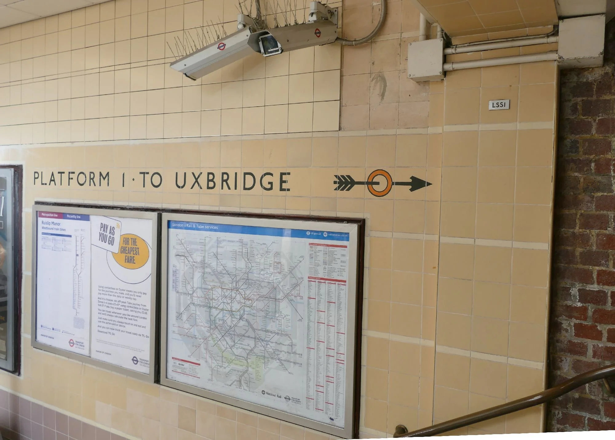
Of coure no trip to London is complete without a visit to Uxbridge.
We couldn’t resist a photograph of this elegant and now historic signage, or the inclusion of the following ditty. Thanks to http://www.eddiethecomputer.co.uk/history/uxpoem.htm putting this together.
“In 1976 Uxbridge was undergoing great changes. The town centre relief road had come into use. The stark concrete mass of the Pavilions shopping centre was ready, but lacked the later refinement of an over-all roof. A Labour Council, led by the left-wing John Bartlett, was in power, and had greatly increased the domestic rate. The Civic Centre was under construction, but costs were continually rising; and it became known that expensive roof tiles were being used which would add even more to the final bill. The local firm of Carsons, Brooke-Partridge & Co., planning consultants, sent a Christmas card to all the Socialist Councillors containing this poem. ("Pete" was used simply because it rhymed with "street".)”
"Come friendly bombs and fall on Slough
It isn't fit for humans now."
So wrote John Betjeman, our mate,
Who's now the poet Laureate.
I know not why the fates should frown
Upon that poor benighted town.
If it appalls the Bard, I bet
He surely ain't seen Uxbridge yet.
Now there's a place where all can view
The worst that architects can do.
Its concrete canyons where, they say,
The shop rent would turn Croesus grey.
Its car parks and its traffic schemes -
Bewildered spider's tangled dreams.
A town that had a certain pride
Now needs the service of a guide
To show the locals how to view
Familiar landmarks once they knew.”
There’s a lot more, if you care to look!
And so a trip to Scotland to celebrate Burns night on the 25th of January. As we’re sure you all know, Robert Burns was born in Alloway on the Ayrshire coast of south west Scotland, and boasts many Burns related landmarks. On a wet January weekend, Alloway’s outdoor attractions had little appeal, however, so we made our way to Rozelle Park and the Maclaurin Art gallery.
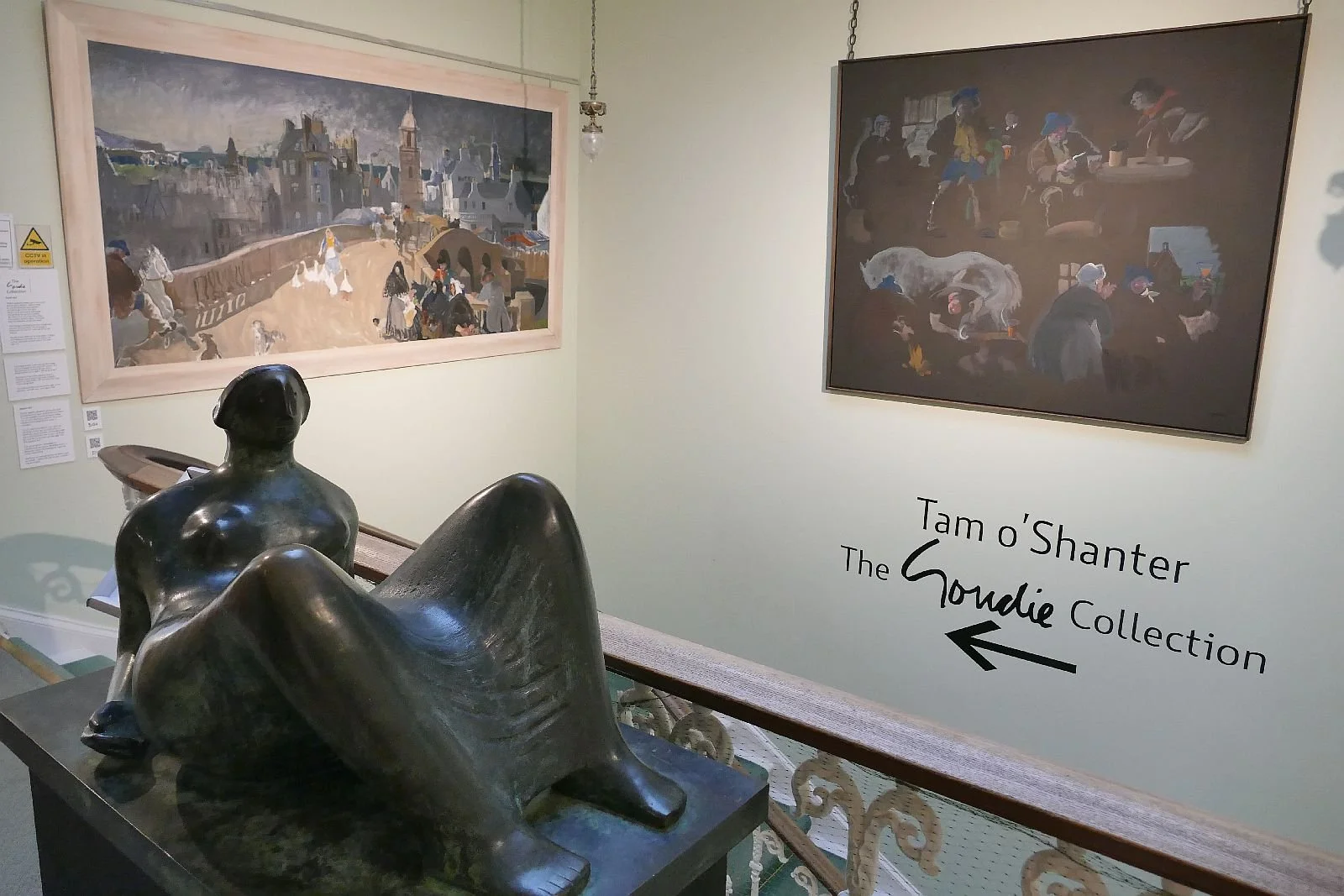
What a magnificent treat was in store for us: the complete Tam o’Shanter, fabulously illustrated by the paintings of Alexander Goudie
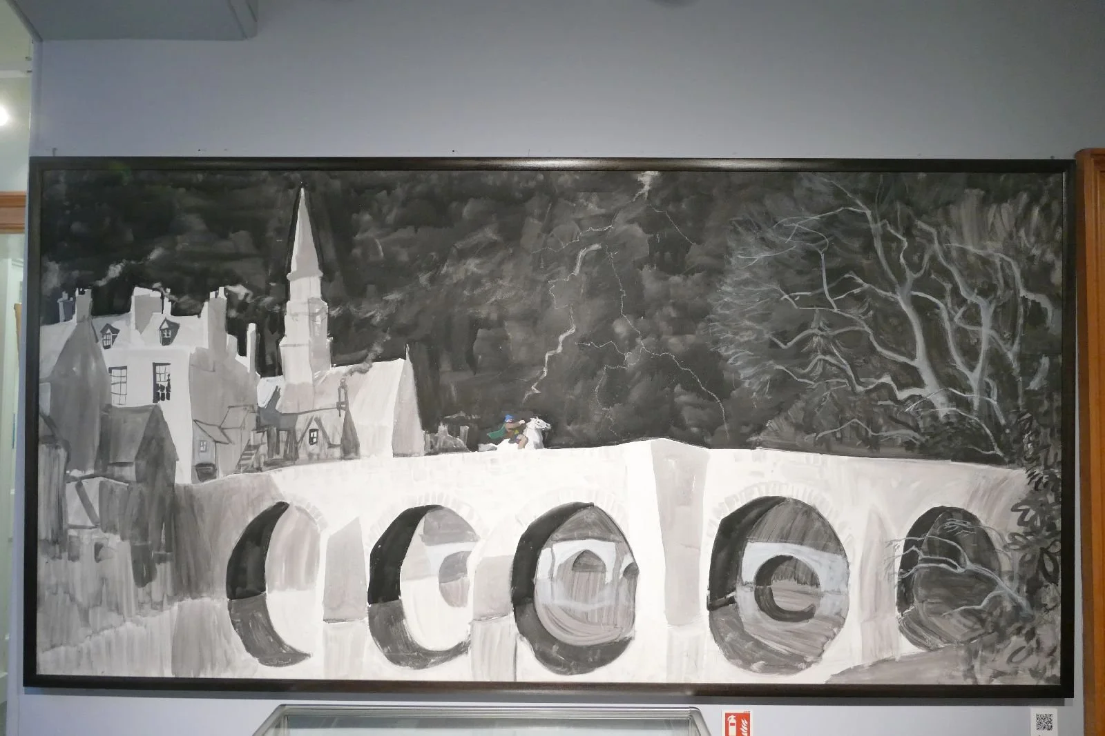
“Before him Doon pours all his floods;
The doubling storm roars thro' the woods;
The lightnings flash from pole to pole,
Near and more near the thunders roll;
When, glimmering thro' the groaning trees,
Kirk-Alloway seem'd in a bleeze”
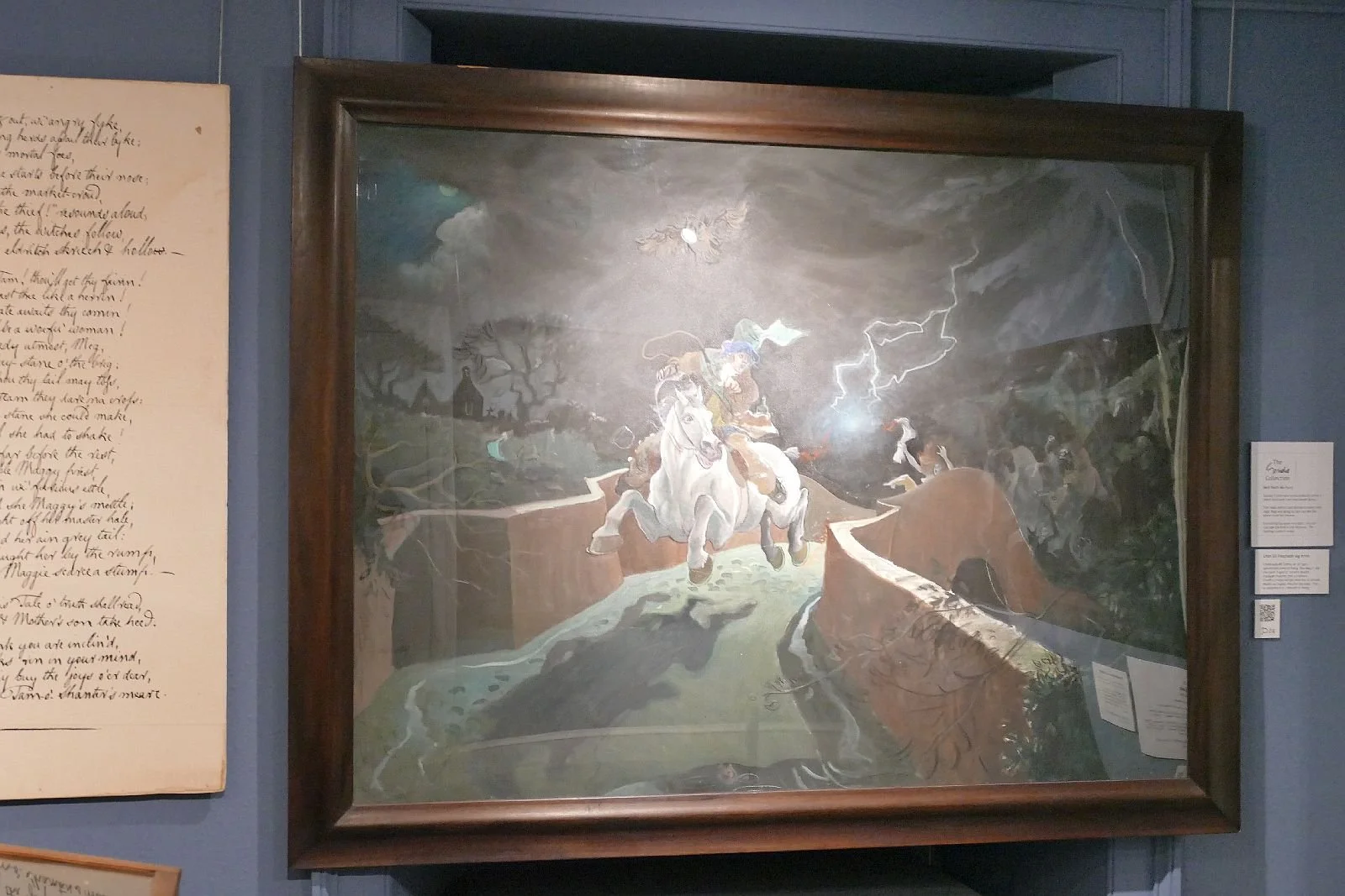
“Now, do thy speedy utmost, Meg,
And win the key-stane of the brig:
There at them thou thy tail may toss,
A running stream they dare na cross.
But ere the key-stane she could make,
The fient a tail she had to shake!
For Nannie far before the rest,
Hard upon noble Maggie prest,
And flew at Tam wi' furious ettle;
But little wist she Maggie's mettle—
Ae spring brought aff her master hale
But left behind her ain grey tail:
The carlin claught her by the rump,
And left poor Maggie scarce a stump.”
Tam’s faithful grey mare saves the day yet again.
Elswhere in the gallery, another, less enegetic, peice of art caught our landscape eye. Ian Hamilton Finlay seems to have been a complex indivdual, a writer, poet, artist and gardener. One of us was struck by the artwork below, which we do not pretend to understand but which spoke to us both visually and horticulturally.
“[Finlay’s] work encapsulates a multitude of complex references born from an interest in the history of the European Revolution, occidental culture and relationship to the natural world.” Poetry in sculptural form.
As Alloway lies to the south west of Glasgow, so Helensburgh lies to the north east, on that tangle of coast and river bank created by Gare Loch, Loch Long and the Clyde Estuary. On this occasion only the ‘other one’ got to visit Helensburgh but the one left in Glasgow is grateful as it has introduced us to StAnza, Scotland’s International Poetry Festival held in St Andrews, and to the StAnza’s Poetry Map https://stanzapoetry.org/projects/poetry-map/. What an invention! The project aims ‘to cover the entire map [of Scotland] with [poem] pins, from coast to coast, highlands to borders, and covering a wide range of landscapes including cities and villages, mountains and lochs, rocks and reservoirs.’ That’s Terroir’s kind of map.
Here is Helensburgh’s Poem No. 216, ‘Waterside’ by Thomas Clark:
“The swans in twos would sail along,
Along the grimy pier;
The winds were wet; the seas were strong;
The captain smelt like beer;
The harbour-master hummed a song
And hauled a salty rope among
The passengers and gear.
“The waters where the colours float
Did not seem very deep;
Upon the stones a fishing boat,
Its ribs were pale and steep;
A hobo crumpled in a heap,
His crinkled eyes were shut with sleep,
His head lay on his coat.
I understand it now; the way
That life has slipped aside,
While I was watching by the bay
For something great, and wide;
And waters wash up every day
We things that have been thrown away,
We articles of tide.”
It’s time to go home. We must say goodby to our eagles’ erie on the 14th floor with its of fabulous view of Glasgow Central Station, its metallic parallel lines and twinkling array of red lights. This view has led one of us to perhaps the favourite of all poems we have discovered or re-experienced on this trip. Here is an extract from ‘Letters to Glasgow’ by Imtiaz Dharker, first published by Bloodaxe Books in 2018.
“…over the Clyde where the great ships were born,
over the water, a ghostly foghorn,
over the bridge to the city they come,
some of them visiting, some returning.
They take up their baggage and their belongings,
they take up their longings
and the train brings them in to Glasgow Central…”
The ABC of Coal
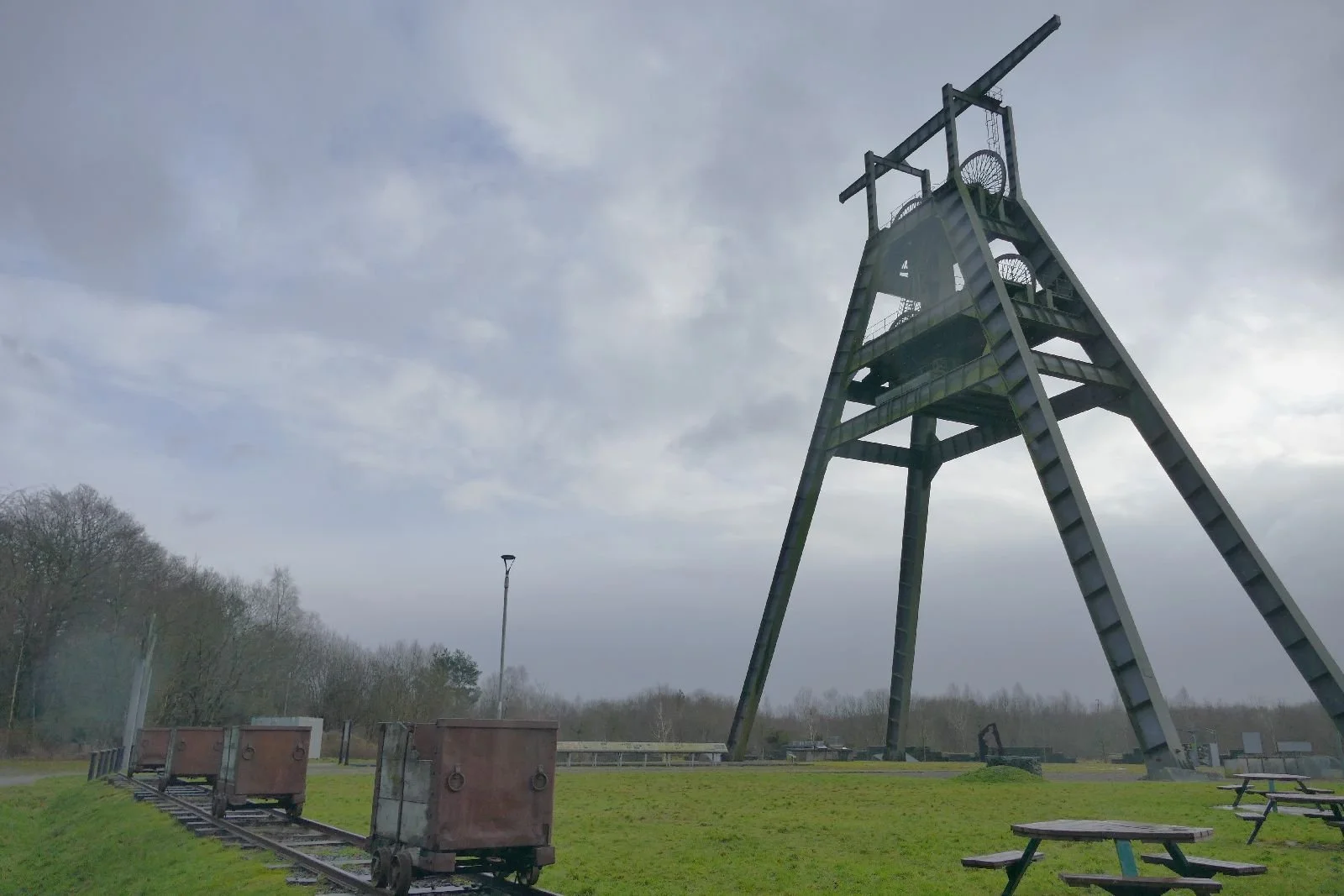
A is for Ayrshire and A frame
B is for Barony, Burr and Baird
C is for coal, colliery, community, crisis and conundrum
Let’s start with C for coal. Ironically coal is the product of prehistoric climate change. Layers of vegetation deposited in warm, damp conditions, were covered and compressed by later mineral strata to create first peat and then, given time, coal. The cycle was often repeated to give further layers of coal within a kind of geological club sandwich.
Coal has probably been used as a fuel source for thousands of years (although this time frame must be unnoticeable on the Geological time clock). “The earliest recorded use of coal as a fuel source can be traced to ancient China, around 3,000 BC”, (https://coalhut.com/the-history-of-coal-as-a-fuel-source/). In forested, medieval Europe, ‘coalhut’ website continues, wood was easy to come by but as population and demand increased so deforestation became a significant problem. “By the 13th century, records show that coal was mined in Scotland and Northern England.”(ibid) But it was the industrial revolution which produced the significant gear change and started us on the path to another, quicker, universal and manmade climate change.
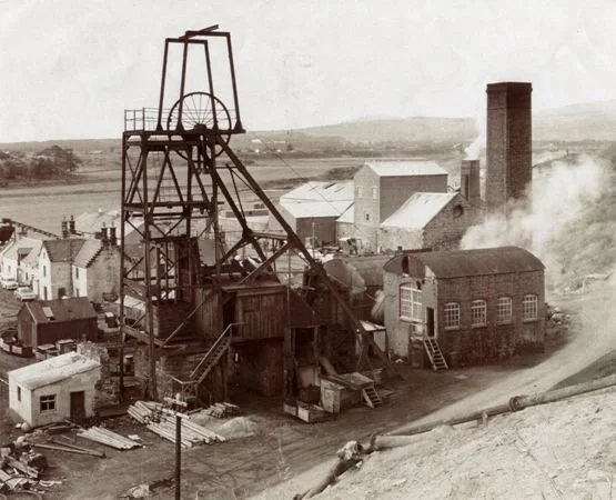
Coal layers have proved to be accessible in many parts of the world and Britain is well endowed. The internet tells us that our northernmost coalmine is the Brora coalfield on the east coast of Sutherland, in production from the early 19th century until the 1970s. (https://nmrs.org.uk/mines-map/coal-mining-in-the-british-isles/brora/)
Image right: Brora Mine © Brora Heritage Centre
Britain’s southernmost field is in eastern Kent (yes really) and was discovered when an early channel tunnel project failed in 1882. Some additional geological exploration (while we’re here we might as well) proved that what had been formally guessed at really did exist. A speculator called Arthur Burr formed the first Kent coal company in 1896, but the geology was complicated and it was 1912 before any of his collieries produced commercial coal (https://www.dovermuseum.co.uk/Exhibitions/Coal-Mining-in-Kent/History/Arthur-Burr-and-the-Development-of-the-Kent-Coalfield.aspx). Eventually four collieries became viable.
Chislet colliery finally closed in 1969, Tilmanstone in 1986, Snowdown in 1987 and Betteshanger in 1989. They left behind bleak, often chalky, moonscapes located in a deeply agricultural setting. They also left deprivation and unemployment in the nearby mining communities. Tilmanstone, Chislet and Snowdown colliery sites now support industrial estates, while Betteshanger has become Fowlmead Country Park. Nearby villages, such as Elvington near Tilmanstone, are eerie, architectural survivors of miners’ housing, more often associated with the north of England or southern Scotland.
So, let’s go north of the border to investigate another scarred ex-colliery landscape. We have arrived at the site of the former Barony Colliery in east Ayrshire, a mine which operated over a very similar time span to those of the Kent Coalfield. This time the entrepreneur was one William Baird whose company established the mine around 1910 (sources vary on the exact date) to feed the local iron industry.
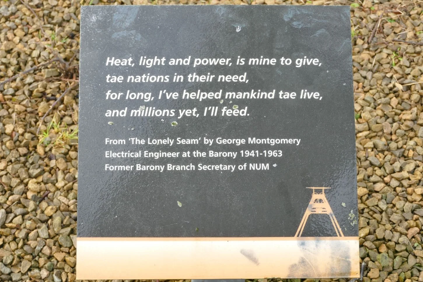
Coal became more lucrative than iron and a 3rd shaft was commenced in the late 1930’s but had to be postponed until after WWII, with completion in 1950. “The finished shaft was 2,052 feet deep (635.4m), making it the deepest in Scotland.” (https://www.britainexpress.com/scotland/Strathclyde/museums/Barony-A-Frame.htm)
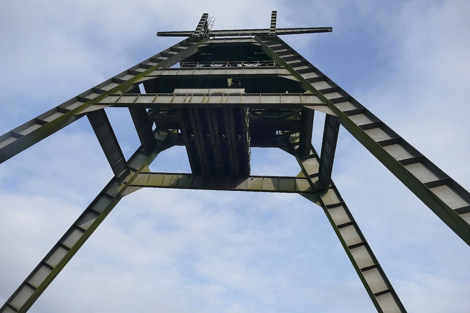
With this expansion some new engineering was required and a massive ‘A frame’ was erected over No.3 shaft. With two sets of winding gear to lower miners and raise coal, it must have made a significant impact on production levels. “… at its height, the colliery employed some 1200 people. Most of the local boys left school at the age of 14 and started work in the pits alongside their fathers.” (Ibid)
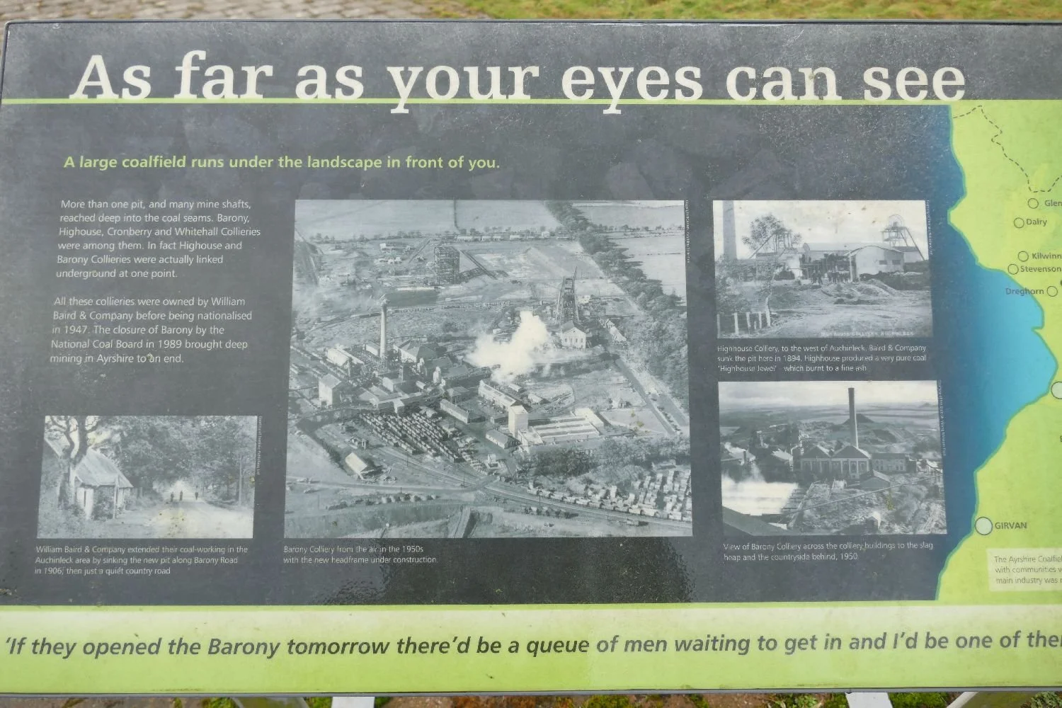
The coal field itself was extensive, but so was the colliery above it - a thriving but probably noisy, dirty, industrial complex.
By the 1950s, the major client was now coal burning power stations and, indeed, one such station was built adjacent to the mine in 1957.
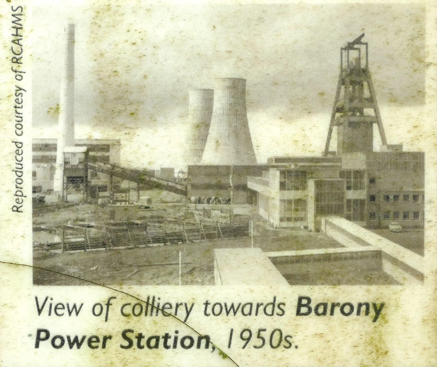
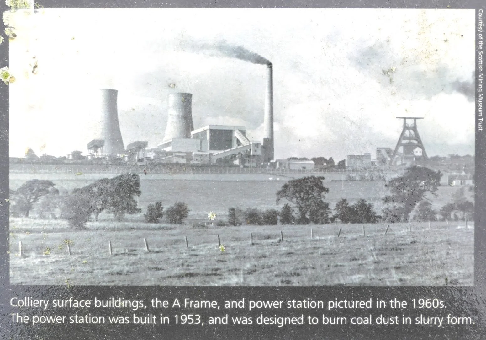
The 1960’s saw life at Barony begin to change. In 1962, the No 2 shaft collapsed, four miners were killed and the decision was taken to fill in both 1 and 2 shafts. No 3 shaft could not operate without an additional escape shaft and so the pit was shut with 1,100 men laid off. Salvation came in the form of a new coal fired power station within the region and a No 4 shaft was sunk, enabling the colliery to re-open in 1966. But the writing was creeping along the wall and technology and political attitudes were changing. The adjacent power station closed in 1983, to be quickly followed by the Miners’ strike and, for Barony, geological difficulties in the form of a fault in the coal seam. The pit was declared no longer viable and was closed in 1989.
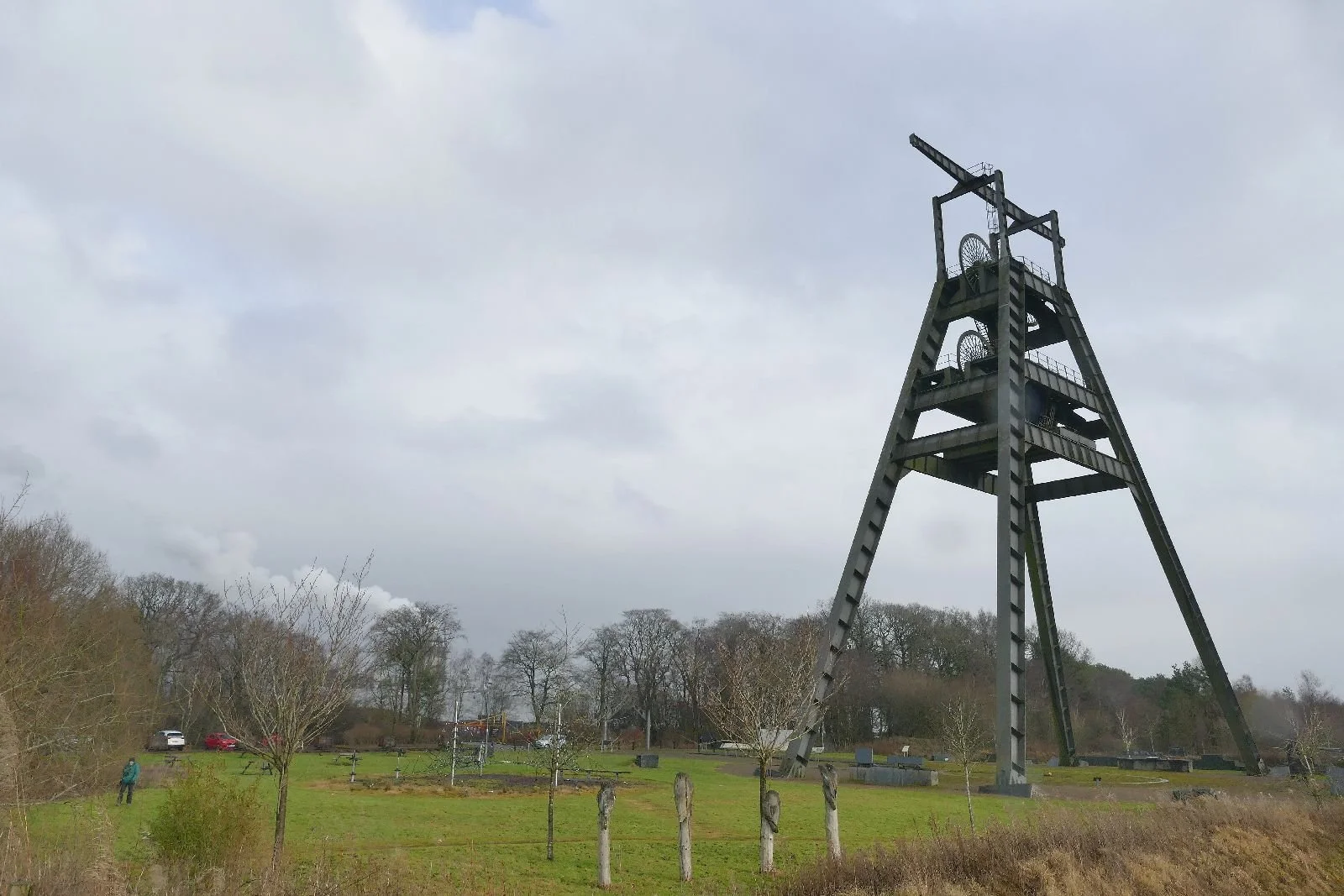
But for the A frame, Barony’s fate could have been very similar to Tilmanstone or Betteshanger. Of course, local communities were devastated and the site seems to have been cleared immediately after closure. But the mighty A frame was left in position and indeed restored in 2007 - no industrial estate in this part of Aryshire. Today the Barony A frame stands as a lone memorial to the people and the industry which once flourished here.
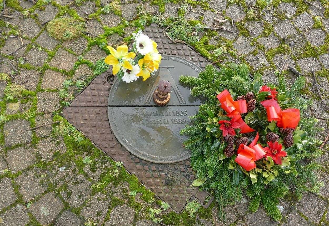
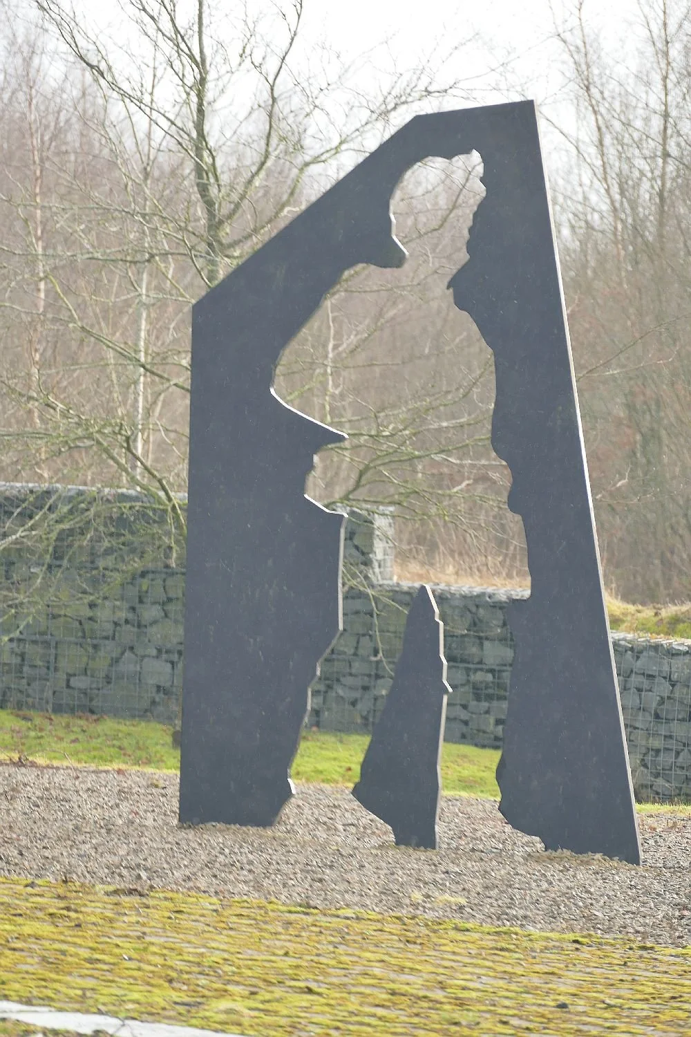
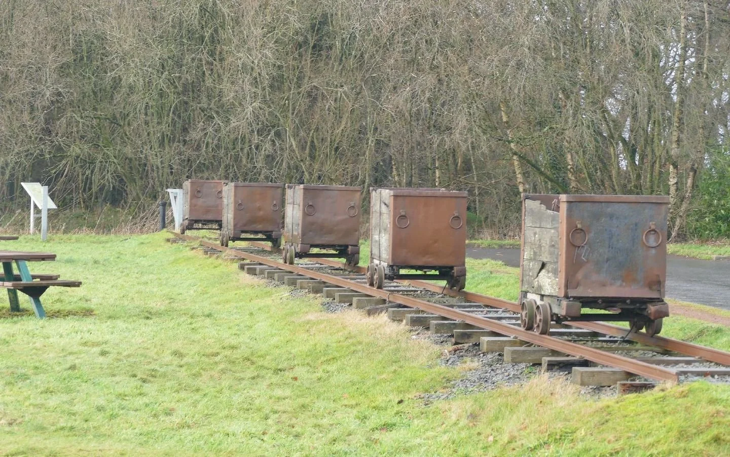
But Barony has other functions as well: it operates as an open air museum (the interpretation is weather-worn but fascinating), as a children’s playground, and as a recreational and dog walking area. It could be regarded as bleak and windswept but it is hardly fair to judge it on a damp January morning!
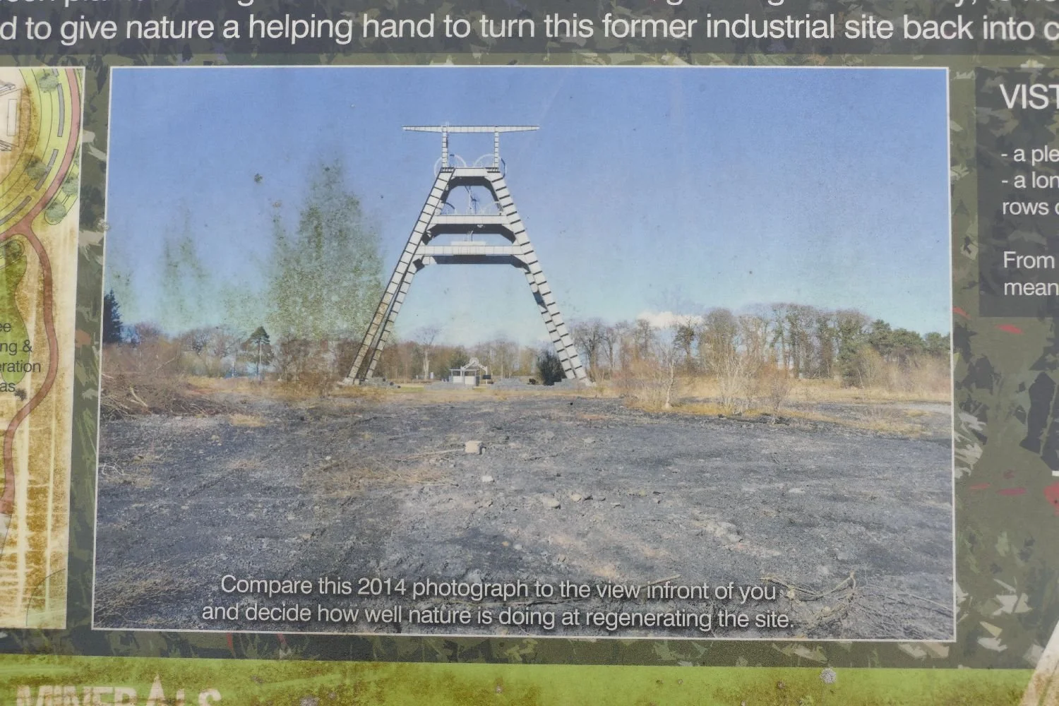
It is also on its way to becoming a nature reserve and an area of biodiversity. Again, it is unfair to judge it in January!!
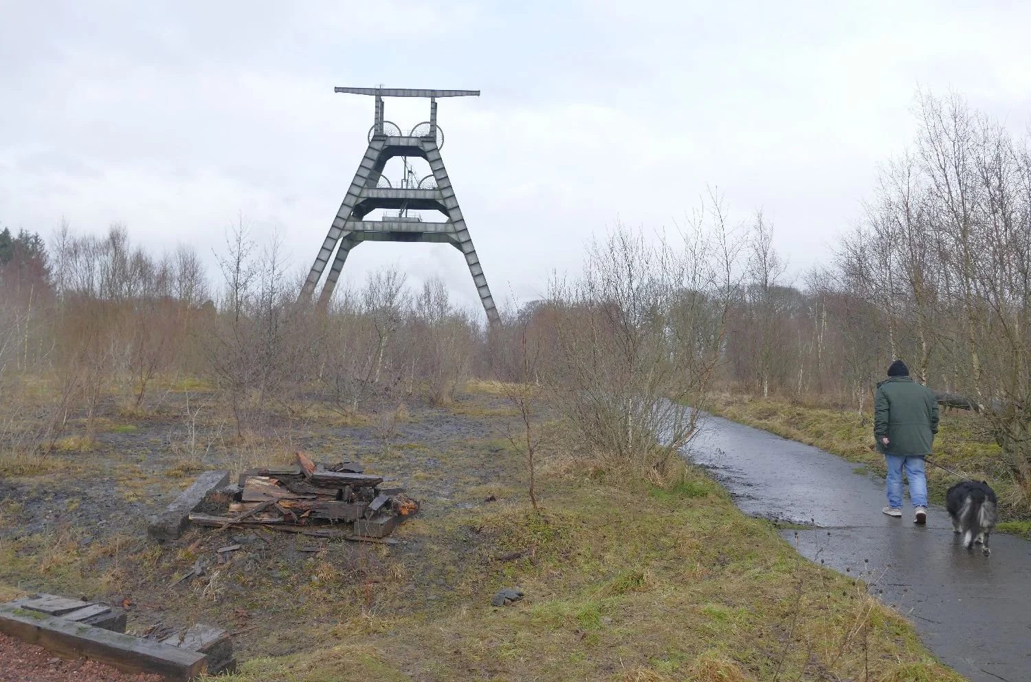
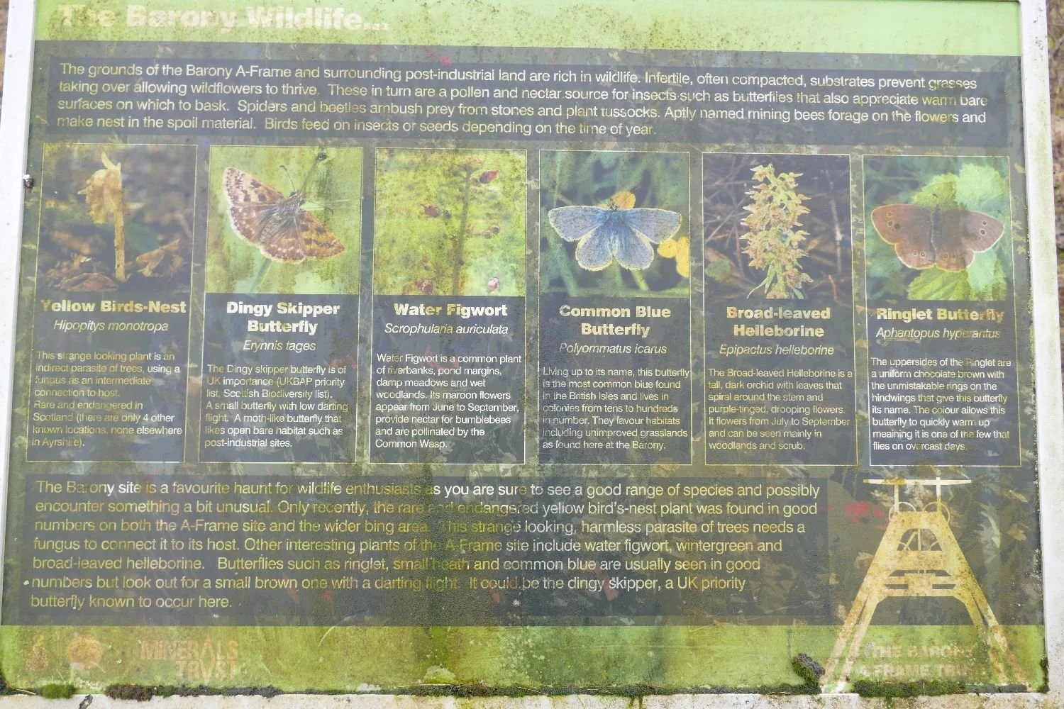
This is a different and perhaps better memorial to our industrial history, but something is missing: neither Barony’s mighty A frame, nor the Kent Coalfield’s commercial face lifts, are really representing, expressing, exploring, facing up to, apologising for or feeling creative about the ‘c’ words of crisis and conundrum created by climate change.
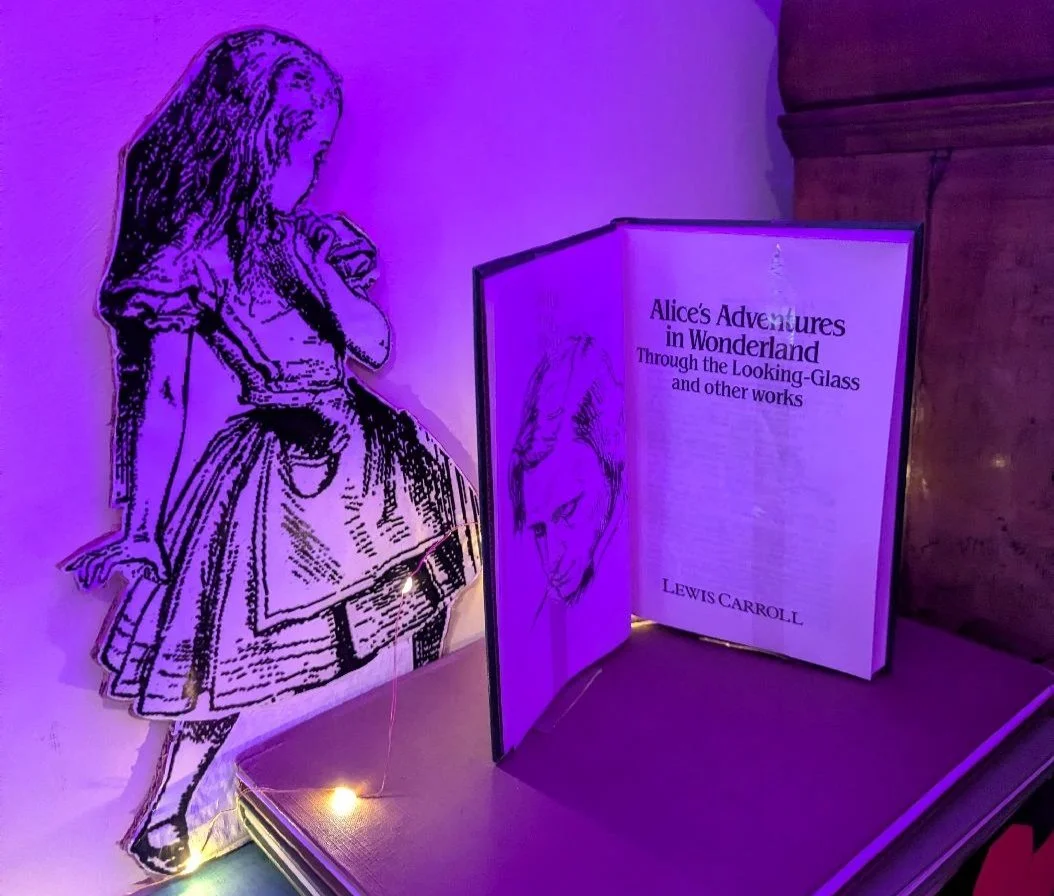
Wonderlandscape
One of us has been re-reading Alice in Wonderland by Lewis Carroll (aka Charles Dodgson) and we have discovered how relevant this 19th century children’s book is to anyone interested in 21st century landscapes.
We’ll tell you why we’ve been rediscovering Alice and the White Rabbit in a minute, but re-reading as an adult revealed many caricatures of modern situations. Take the Caucus-race: the Dodo (thought to be based on Charles Dodgson himself) marks out a race course, and places the participants here and there along it. Chaos ensues when runners set off or stop whenever they feel like it. How many business meetings or family discussions have you encountered, which feel just like that? The Dodo declares all to be winners and insists that Alice supply the prizes. She complies and finally presents herself with her own thimble. A classic representation of having a brilliant idea, only to have it adopted by someone else and presented back to you as their own wonderful work.
The trial of the Knave of Hearts reminds us of the Planning Inquiry which we recently endured (regular readers will be aware of this, see Qimby - Blog 167, and ‘How do I love thee’ - Blog 173). We have just had great news: the Queen of Hearts – no, no, the planning Inspector - has dismissed the developer’s appeal, to the delight of the local community group and, we hope, the local planning authority.
And of course we’ve all been caught ‘painting the roses’. Poor gardeners: ‘Two’ (of Clubs) explains that they have planted a white rose tree instead of a red one. Rather than be beheaded by the Queen of Hearts (no, definitely not the planning inspector) the gardeners are busily applying red paint to the offending flowers. It’s also very reminiscent of The Traitors. In this case, banishment plays out in Ardross Castle, located in a glorious Scottish highland valley, north west of Invergordon (below right).
By Anne Burgess, CC BY-SA 2.0, https://commons.wikimedia.org/w/index.php?curid=177648807
Our obsession with Alice’s visit to Wonderland-scape was actually sparked off by the National Trust. Our first introduction to visiting Trust properties at Christmas was PC (Pre Covid), when we enlivened a long drive with coffee, cake and Christmas at Greys Court (below) and, on the way back, at Prime Minister Disraeli’s home at Hughenden Manor. Both houses were pretty much decorated for a Christmas season appropriate to their history and inhabitants, and Hughenden had an excellent display of good old fashioned paper chains.
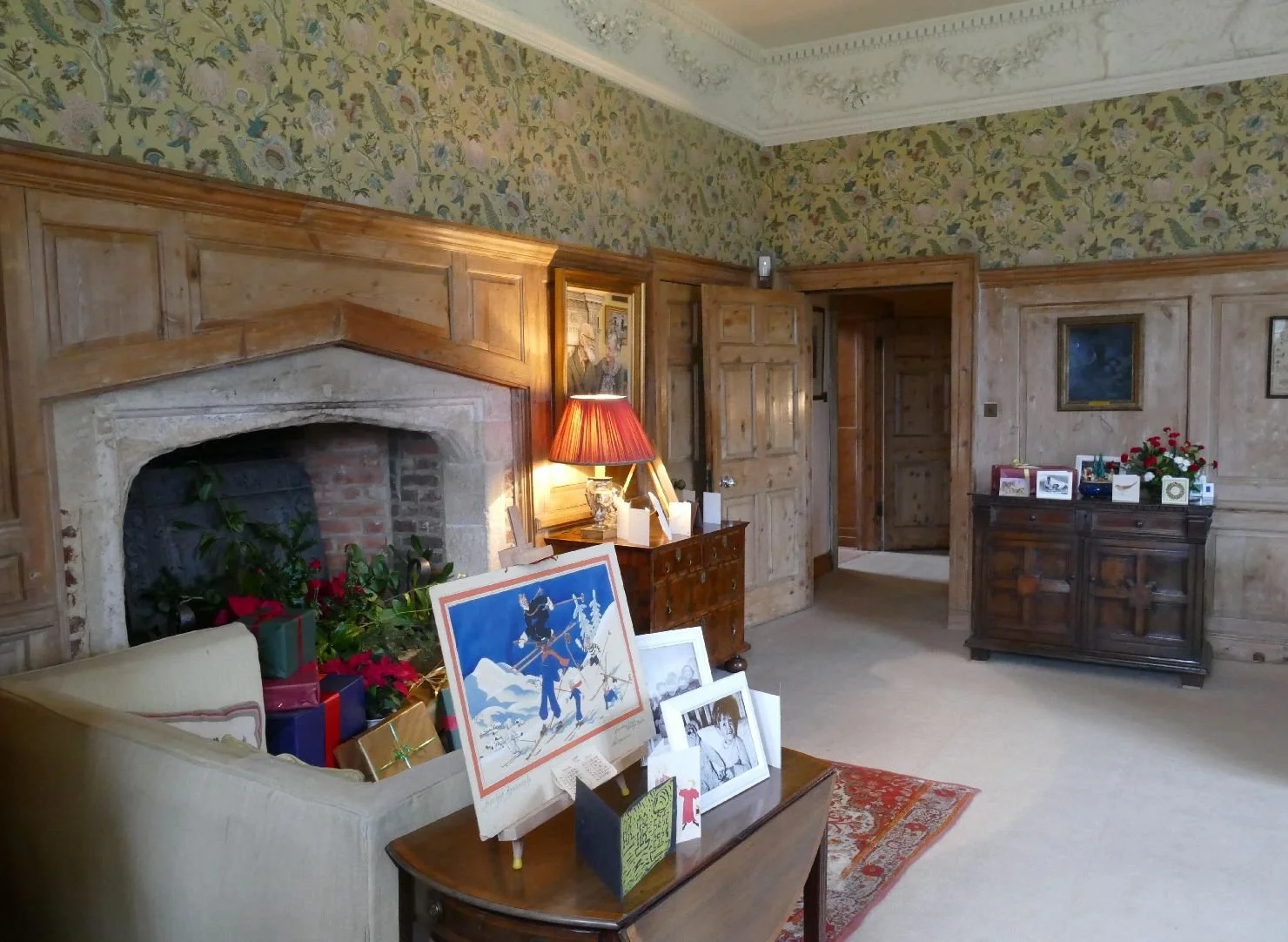
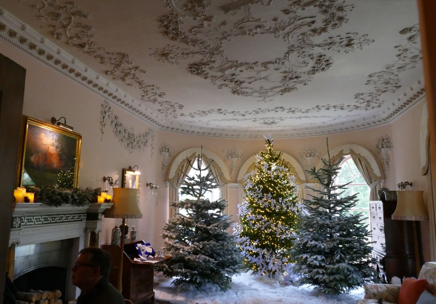
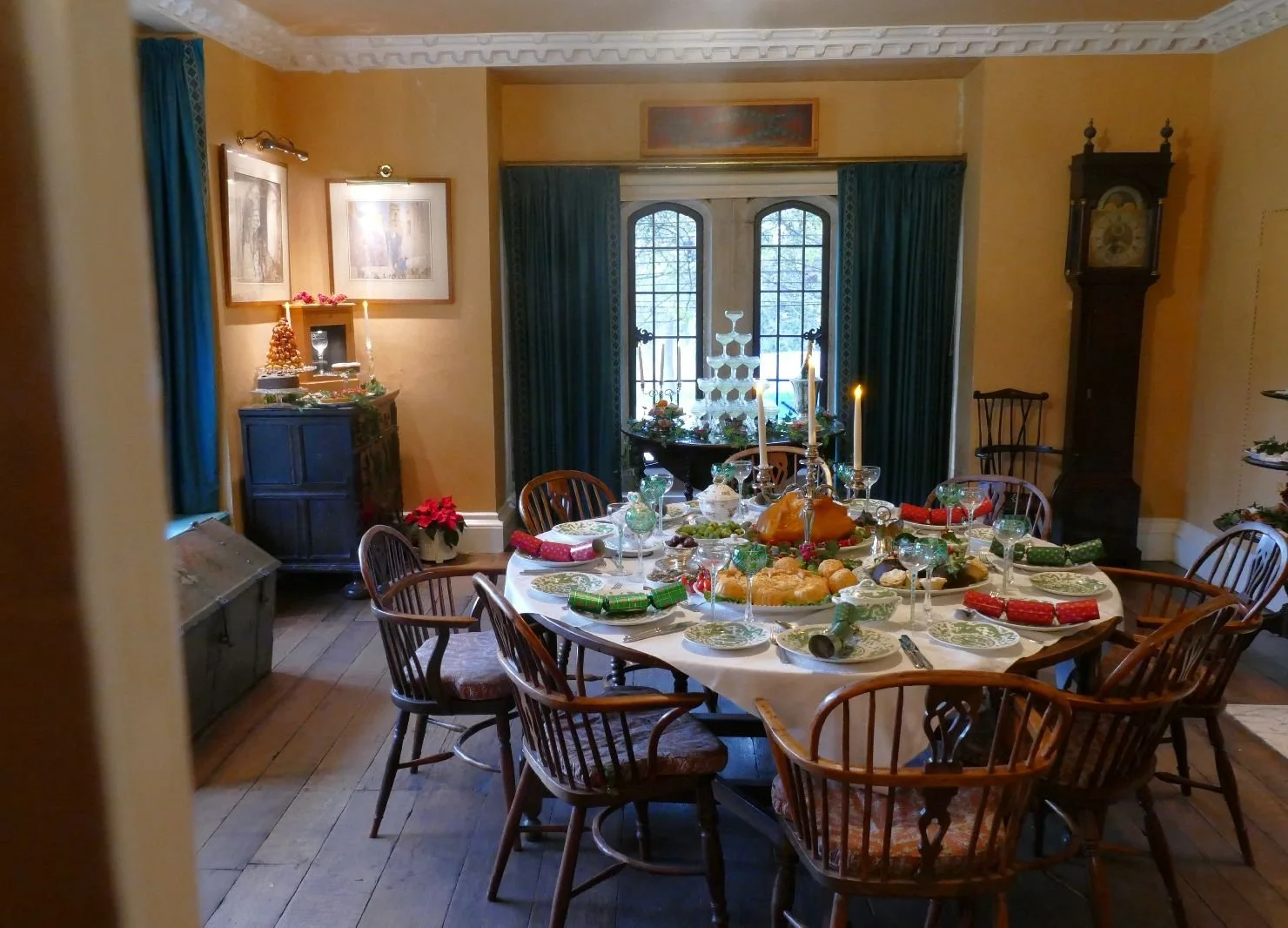
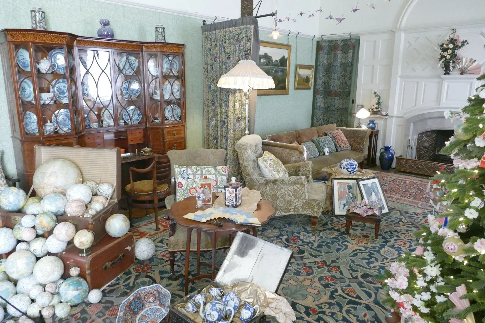
Things have moved on considerably since then. It’s Christmas 2025, and Standen – an Arts and Crafts property in West Sussex - was bristling with Christmas trees and messages to Father Christmas representing the family and staff who might have been in residence over the festive season. The decorations took their theme from the wish lists and expanded on them significantly!
Above: a map lover’s Christmas

Our only problem with Standen was those Christmas trees. Not because they are plastic (unfortunate of course but we can understand the convenience and re-use factors) but because they are obviously Nordmann firs (see image right, and our Christmas Day blog entitled ‘ Christmas Trees’). Even our plant identification app thought they were Abies Nordmanniana!
Surely the historically appropriate Christmas tree for a house of Standen’s vintage would have been a Norway Spruce? But I suspect we should blame the artificial tree manufacturers rather than the National Trust.
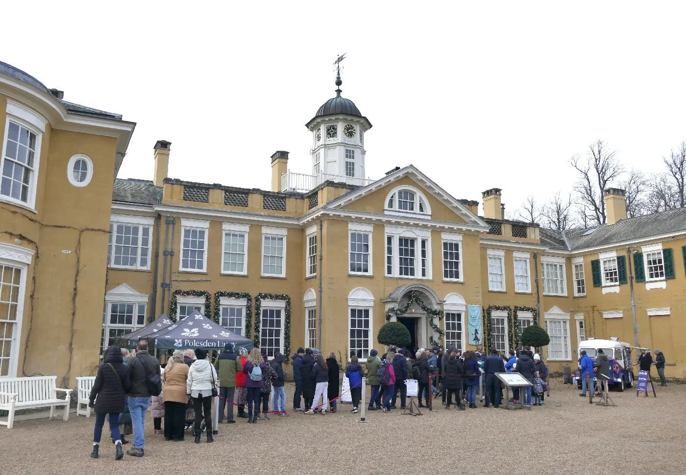
Going back to adventurous Alice in Wonderland, however, we discovered she had taken up residence in Polesden Lacey (right), the Edwardian makeover of a much older building, which became the Surrey home of society hostess Dame Margaret Greville.
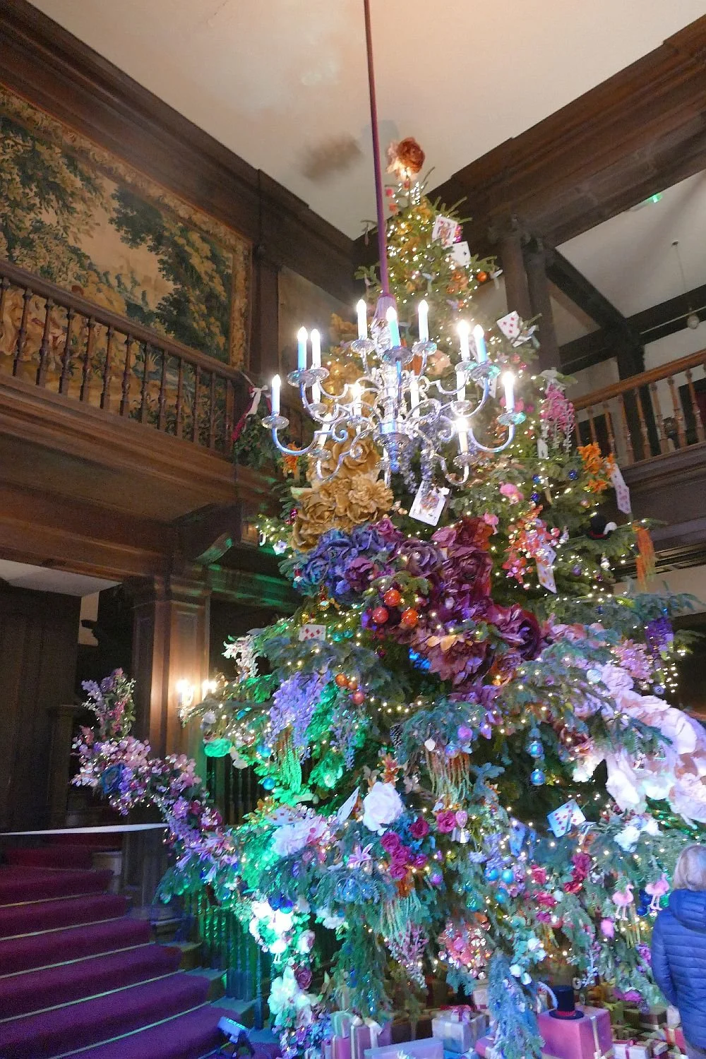
We have visited Polesden Lacey many times so it was something of a shock to walk into an entrance hall stuffed, festooned and swagged (is that a word?) with a riot of artificial flowers which smacked of the tropics rather than the Home Counties. The Christmas tree (left) was a actually a pale example of the oversized and over colourful blooms which filled the space.
Of course we hadn’t done our homework but it didn’t take long to realise that Polesden Lacey’s interior had gone down a rabbit hole and had emerged in the garden of Lewis Carroll’s imagination. In our ‘eNotated’ version of ‘Alice in Wonderland’ the introduction reads: “Perhaps without truly intending to, Lewis Carroll peppered this children’s classic with death, mutilation, racism, politics and savagery while also dealing with anger, confusion, memory, logic, reason, women’s role, and insanity.” (eNotated by PamSowers – 2012). To be honest, I didn’t quite get all that when I read it as a child, but I did register fear, confusion, and a smattering of incredulity!
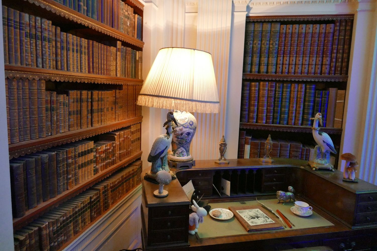
Once we had adjusted our mind set, we pressed on through the Wonderlandscape. We had to queue to get into the library but at least we weren’t forced to drink strange potions or nibble on dodgy biscuits. Entering the room at our normal height we looked around at the comfortable array of leather bound books and a writing desk of apparently unimpeachable character.
But look more closely dear reader: what Edwardian furniture would sport such strange objects as ceramic fungi and a small white rabbit? Suddenly a Cheshire cat appears and, yes, it’s ‘Behind You’, a worryingly psychedelic array of toadstools. The children seemed to love it. Although we suspected that the hookah smoking caterpillar was perched a little above their eyeline.

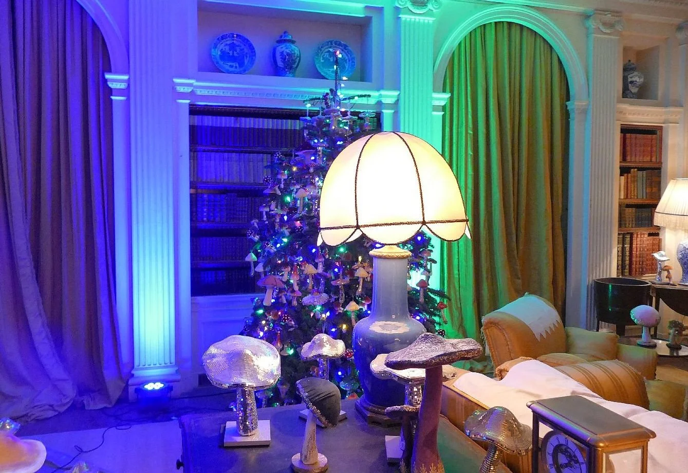
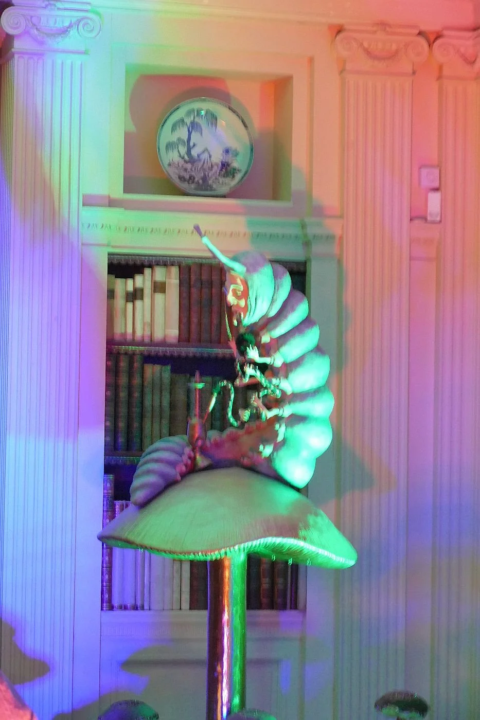
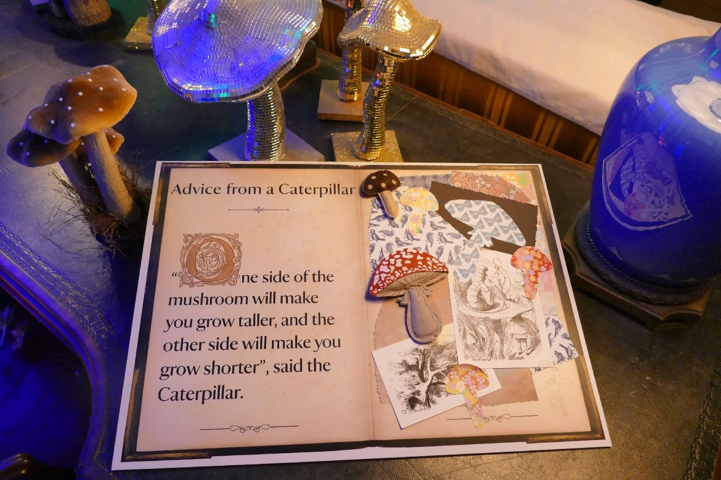
A flexible smoking insect was nothing compared with the Mad Hatter’s tea party and I don’t think either Lewis Carroll or his illustrator Sir John Tenniel had imagined such a colourful riot. We certainly didn’t when we read the book. To be honest, I think One of Us was more terrified by Tenniel’s grey, Victorian illustrations than by any aspect of the text.
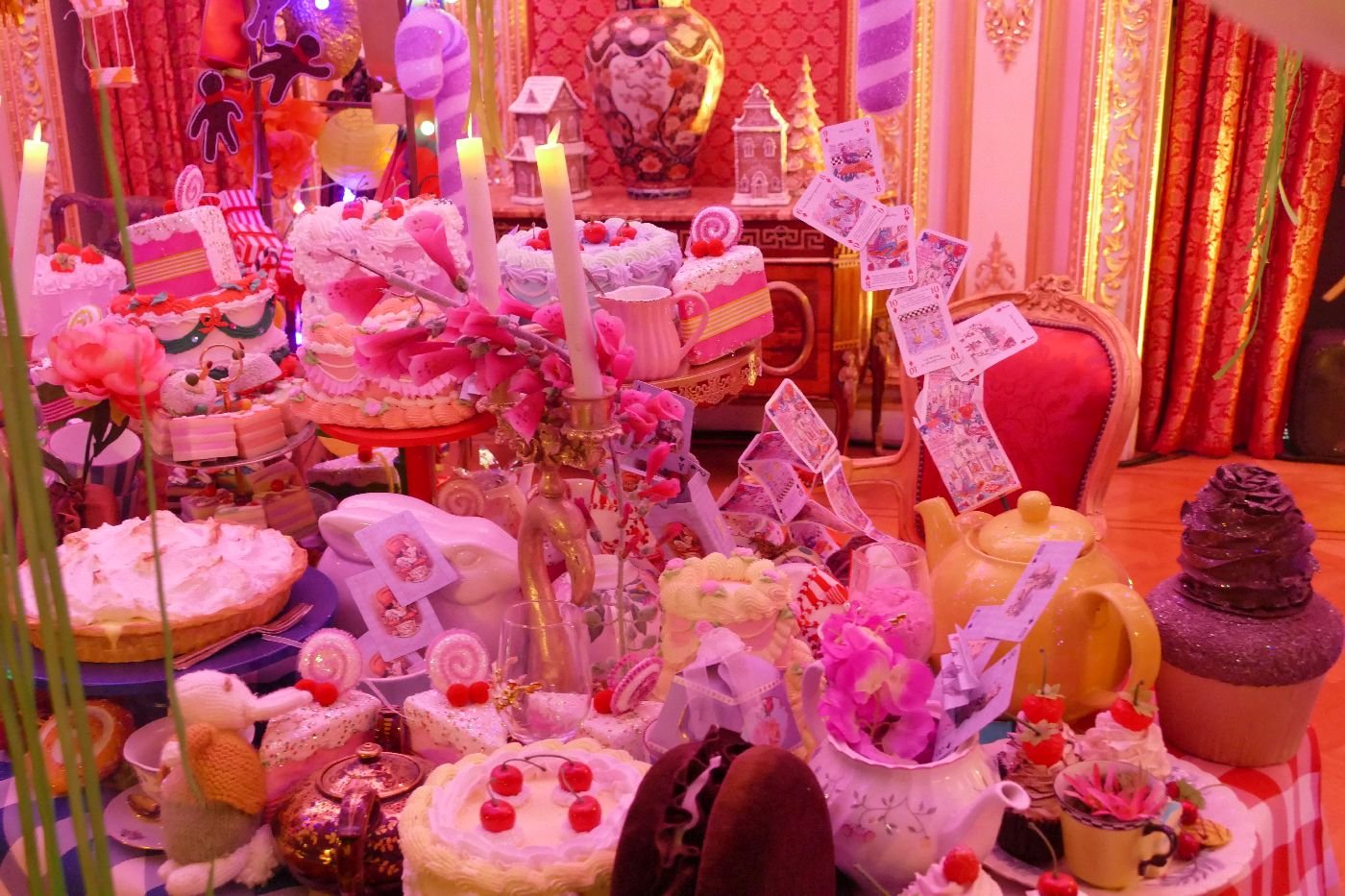
It’s all there – croquet, chess, criminality (who stole the tarts?) but if the trial of the Knave of Hearts was reconstructed, I’m glad we missed it.
As we stumbled into another dimly-lit, potenial cave of horror, One of Us cried out, in joyous relief, ‘You’re Nothing but a pack of cards!’. We could so imagine Alice’s relief at finally taking control and waking up.

But we, the visitors, hadn’t woken quite yet. There was one last room where the designer had added a little bit of their own magic. There, tucked away in narrow corridor, was a ‘dry book wall’ looking like nothing so much as Welsh slate steps, leading Alice out of the rabbit hole and back to her sister on a Surrey river bank. Pure ‘wonderlandscaping’ wizardry.
Farewell to 2025
January 2025: the perfect post-Christmas colour schemes
February: ‘tenacious of purpose’
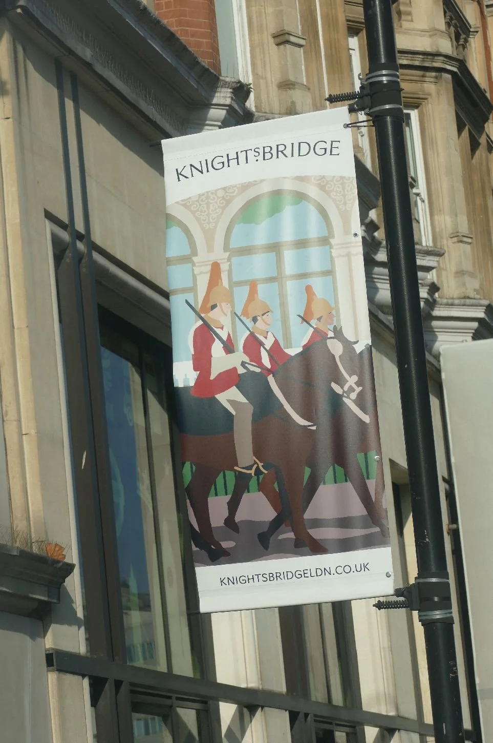
March: London
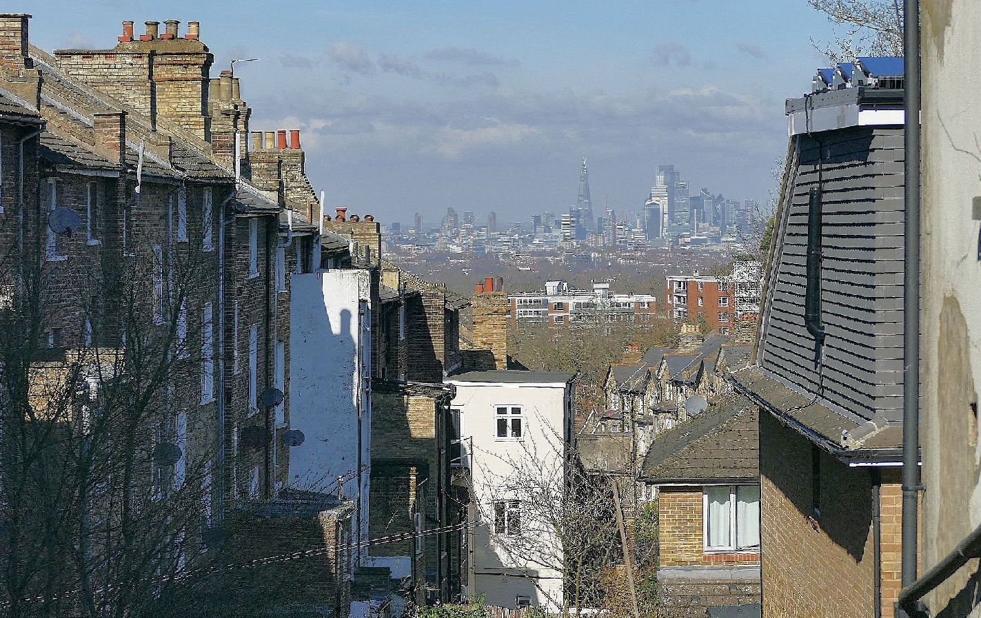
April: Hard won celebrations
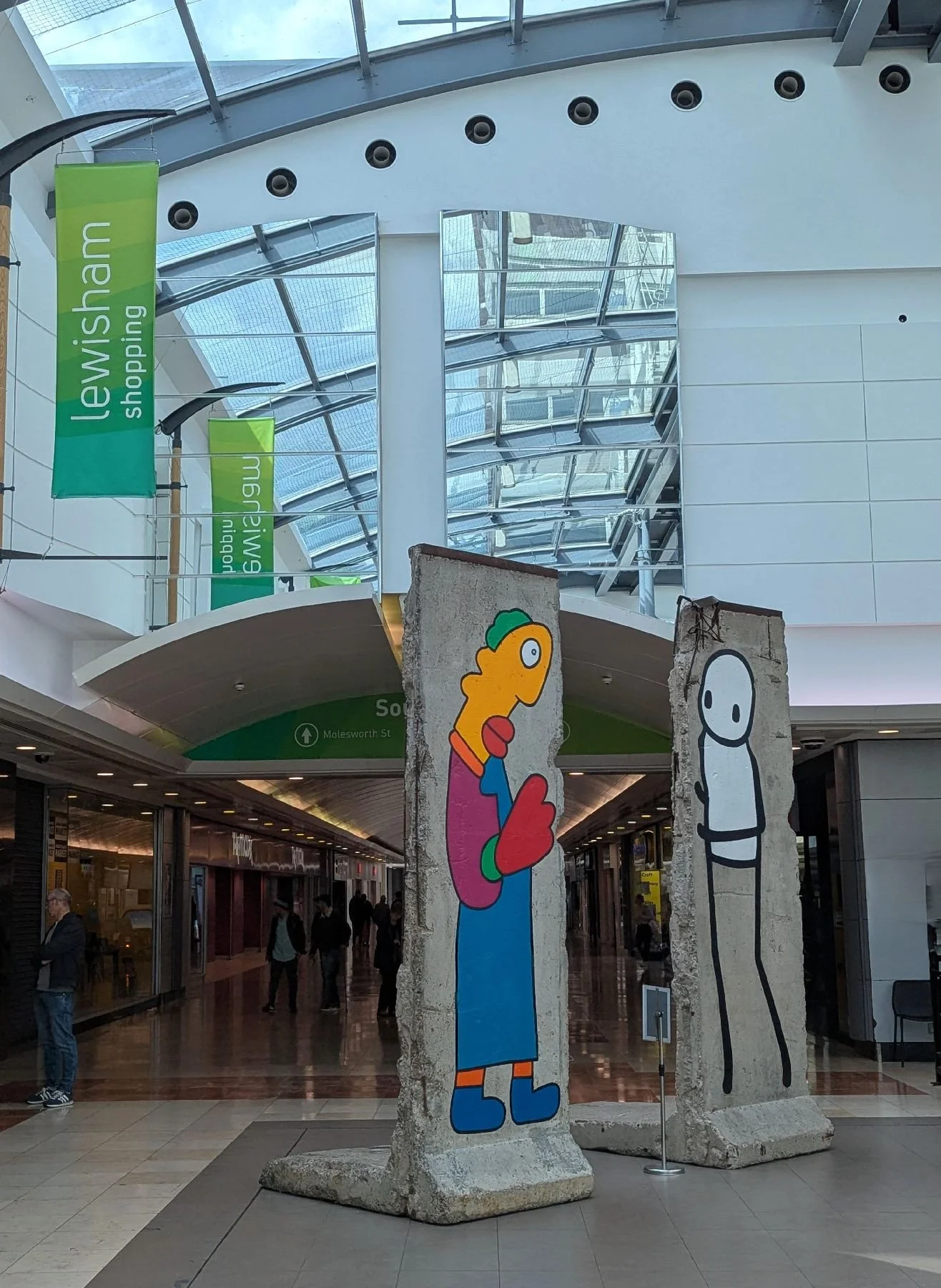
May: Wild Life


June: Colours
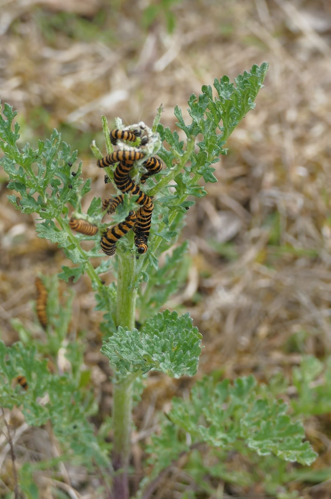
July: remnants of an undemocratic but very stylish Rotten Borough (Gatton Park in Surrey)
August: Women in Beverley, East Riding of Yorkshire
September: Stonehenge
October: County Durham
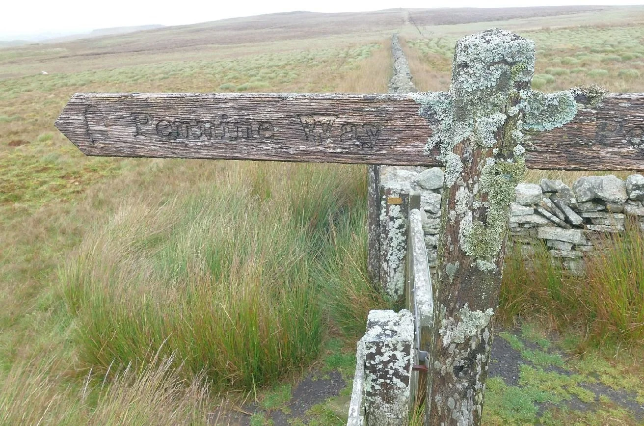
November: Quirky
December: Christmas celebrations

Best wishes to all for a very happy and healthy 2026.
Christmas Trees
How do you like your trees at Christmas?
When Terroir was little the tree which arrived in our living room every December was a Norway spruce (Picea abies). This is the same species of tree which the city of Oslo donates to London every year as a memorial to the welcome and support offered to the exiled King of Norway and his government, during the Second World War. Newcastle receives a Norway spruce from its twin city of Bergen, also to commemorate support and friendship provided during the war years.

So perhaps it is unsurprising that, for decades, the Norway spruce was the Christmas tree of choice in most British households. Actually, from memory, it was the only tree available and one of us can remember being shocked when other species began to be introduced. What? Break tradition with the Norwegian Spruce?
Above: a somewhat undernourished Norway Spruce, decorated to look like a maiden aunt and relegated to the Christmas garden
But we did and it’s now a Nordmann or Caucasian Fir (Abies Nordmanniana) (left) which provides the centre piece of our Christmas decorations. Glossy green and better suited to modern centrally heated homes, this native of eastern Turkey, Georgia and the Russian Caucasus holds its needles, tinsel and baubles with panache.
Are we being unfaithful to our British roots (pun intended)? How did non-native conifers become the symbol of a British Christmas? We can blame Prince Albert and Queen Victoria for starting that tradition, of course, although most of us have drawn the line at adopting the custom of opening our presents on Christmas Eve!
Our national tree is, of course, the mighty Oak and one can understand why this didn’t really catch on as the arboreal decoration of choice for a winter celebration, particularly for those of us who don’t live in baronial halls and palaces.
In out pre-Christmas travels, however, we did see many natives which would have made splendid outdoor Christmas trees. Let us celebrate these while we cover our non-native conifers in angels and stars. Here is a small collection of outdoor Christmas trees:
Above: our mighty English Oaks - determined to show their versatility by presenting themselves as pre decorated for Christmas but just missing that trad green and red theme!
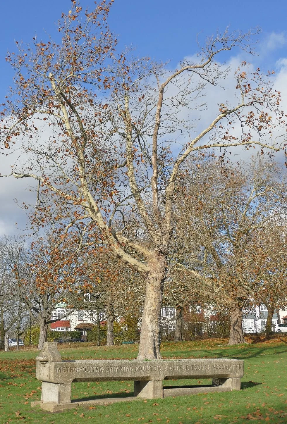
These Christmas trees also come pre-decorated: with mistletoe (above left) and baubles (on a rather plain plane, above right)
Trees also come complete with back- or fore-grounds. These theatrical compositions are the perfect addition to your festive landscape. Above left: a valley landscape with train and, right, the monumental look, perfect for your Christmas lunch.
Alas (right) not all hair styles truly reflect the 21st century Christmas tradition but somebody always wants to stand out. Welcome everybody to your table!
We wish all our readers a very happy Christmas and all best wishes for the New Year.
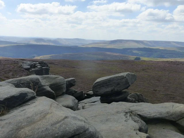
‘How do I love Thee?’
‘Let me count the ways’
Terroir has been counting the ways to love and honour a landscape.

In September of this year we wrote about the process of influencing the quality of development proposed for one’s own ‘back yard’ (‘Qimby’ Blog 167). We had been participating in a local planning inquiry over a development proposal which many individuals and local organisations considered to be at best inappropriate and at worst disastrous.
Image right and below © Jan Sharman
The original planning application had been refused by the local planning authority (largely on heritage grounds) and the developer had appealed the decision. Regular readers will know that the original 4 days allocated to the resulting planning inquiry were woefully inadequate and a further five days were timetabled for the end of November.
We’ve now come though the ordeal. It was hard work and time consuming – and that was just for those of us watching from the side lines! Our barrister, town planner and ever faithful local councillors were in the thick of it. One thing was clear, however: it is extraordinary how many ways there are to represent the social and cultural value of a chunk of real estate, but it is extrordinarily difficult to assess the comparative value of all these perceived merits in terms of financial gain and loss.
Our title quote is, of course, from Elizabeth Barrett Browning, one of the ‘Romantic Poets’ of the later 18th/early 19th centuries, whose numbers included Wordsworth, Shelley, Keats and Coleridge. According to Wikipedia (https://en.wikipedia.org/wiki/Romantic_poetry whose author can probably sum up the key ingredients of romantic poetry better than Terroir), the movement was “a strong reaction and protest against the bondage of rule and custom…”. Although obviously of its time, we can sympathise with this statement; it seems the difficulty of evaluating an ‘intangible asset’ is nothing new!
Image right: Public Domain, https://commons.wikimedia.org/w/index.php?curid=230346
Before you shout that Barrett Browning’s sonnet No. 43 was a love poem to a human being not a landscape, let me remind you how Wordsworth turned the Lake District from wilderness to a romantic and desirable destination. We suggest (only slightly tongue in cheek) that there is a direct link between the 1804 poem, ‘I wandered lonely as a cloud’ (based on an earlier encounter with wild daffodils on the shores of Ullswater), and the designation of the Lake District as one of England’s first two National Parks (1951) and its later upgrading to a UNESCO World Heritage Site (2017).
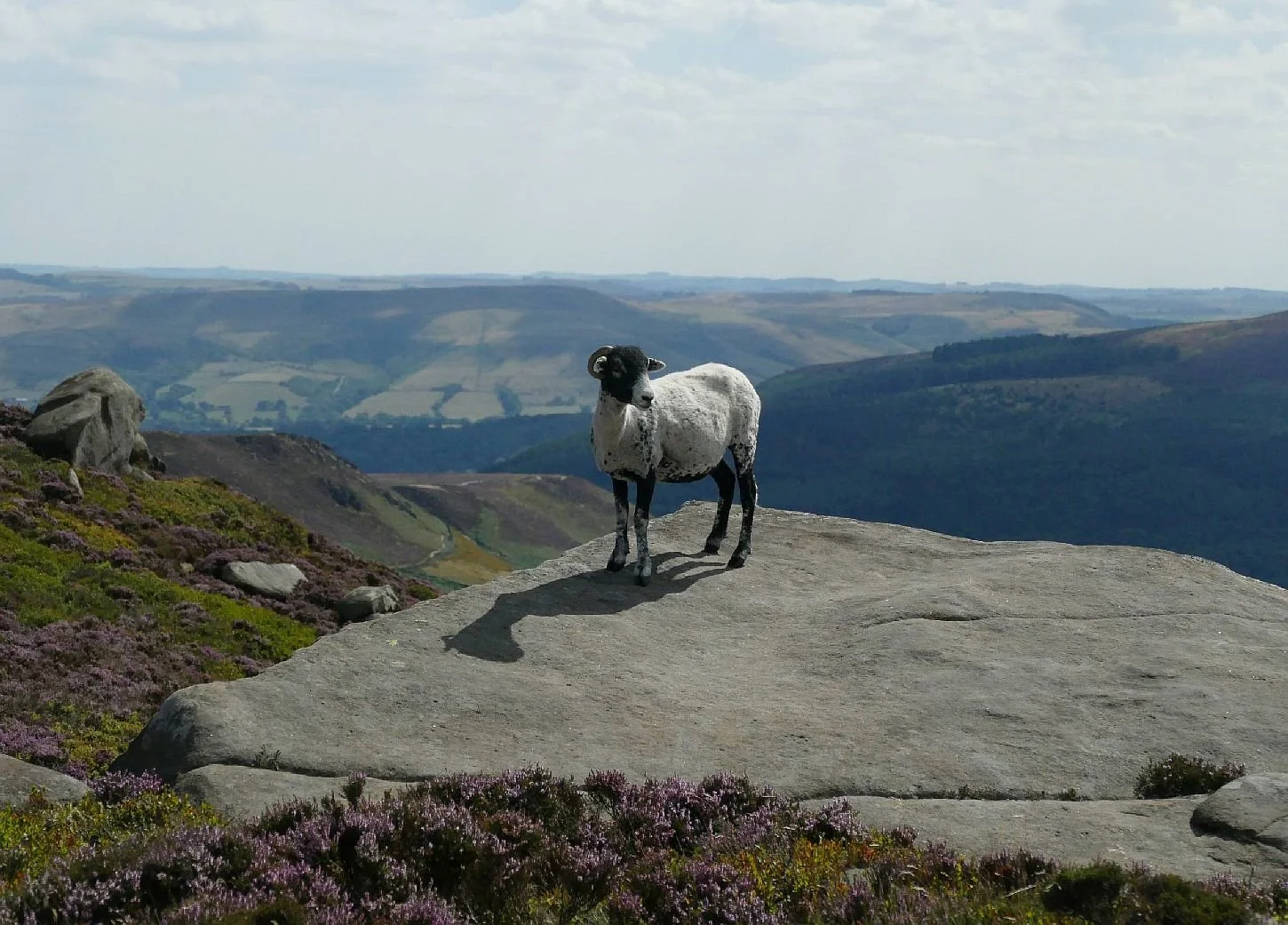
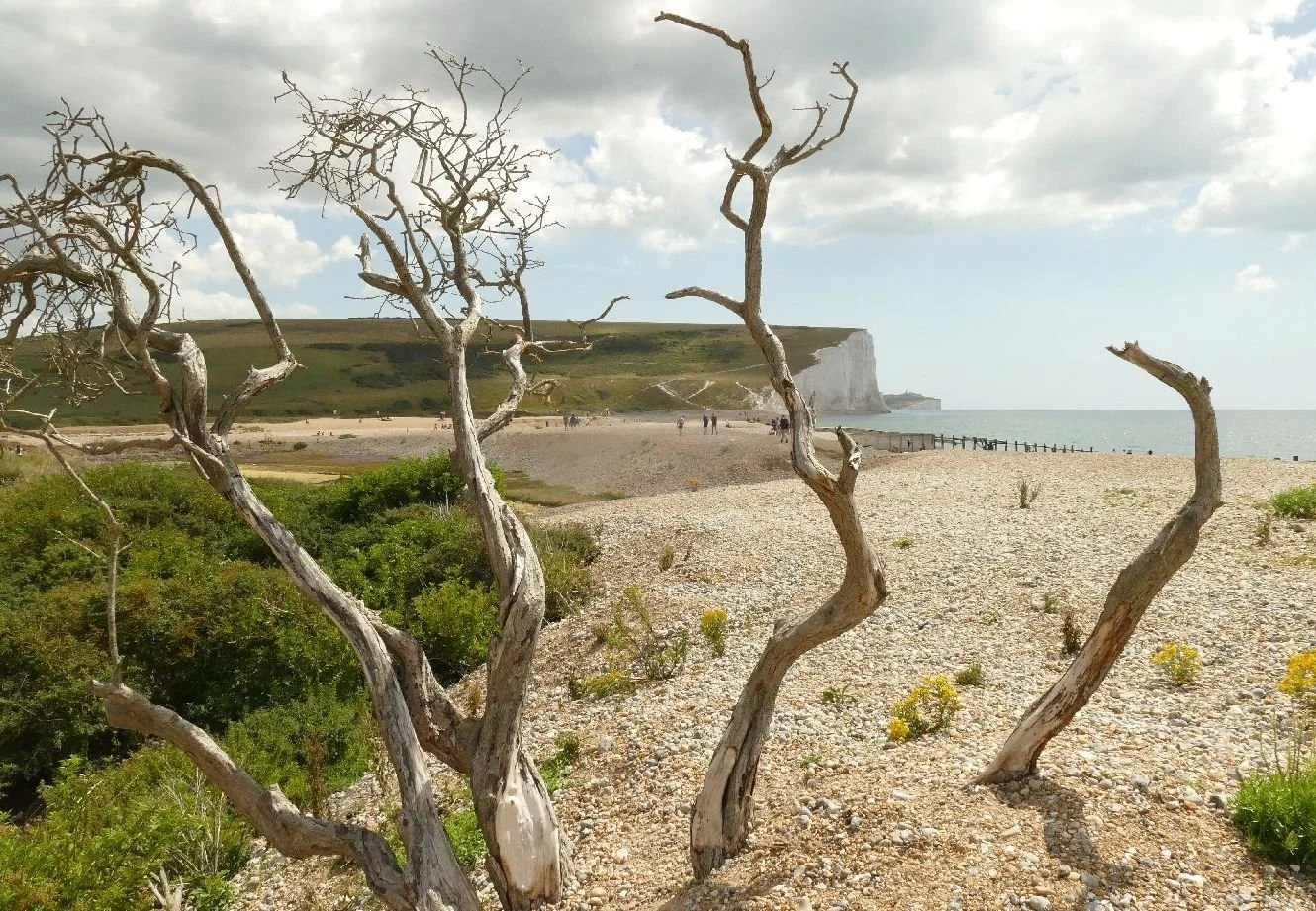
Above: a selection of National Parks, from left to right, Peak District, South Downs, Lake District and Snowdonia
Today, the selection, protection and honouring of our special landscapes, buildings and other forms of cultural heritage is a complicated, complex and bureaucratic process. It ranges from international to very local levels. Each heritage ‘type’ has its own criteria for designation and its own specifics for assessing its significance in a planning appeal, such as the one we experienced.
Tell a barrister, appearing for the appellant, that a proposed development is inappropriate because of a few mountains, a lake and a bunch of daffodils (or whatever applies to your own particular back yard) and they will laugh in your face. Tell them that it lies in or near a landscape or cultural feature that is ‘designated’, and they will have to take some sort of notice.
But, without a campaigner of the calibre of Wordsworth, nor the timescale it took to turn the Lake District into a National Park, modern planning inquiries involve many legal wrangles about the niceties of planning policies and/or the significance attributed to a view from say a specific Conservation Area. Romance just doesn’t come into it, but hard graft does.
As an illustration of the complexity of the answer to ‘How do I love thee?’, we have listed below a very few of the policies, designations and guidance which were relevant to the assessment of, in our case, the development of tall buildings on a piece of local townscape. This list is by no means exhaustive.
National Planning Policy Framework
County Council Highways policies
Borough Council policies and plans including topic and site specific strategies such as planning, housing, heritage, flooding, biodiversity and a great deal more
Designations relevant to this particular site: a National Landscape, Historic England Listed Buildings, a Registered Park & Garden, locally Listed Buildings and Conservation Areas (5 relevant CAs in our case).
Of the illustrations below, only one applies to our case (Gatton Park, far right) but all are examples specific designations.
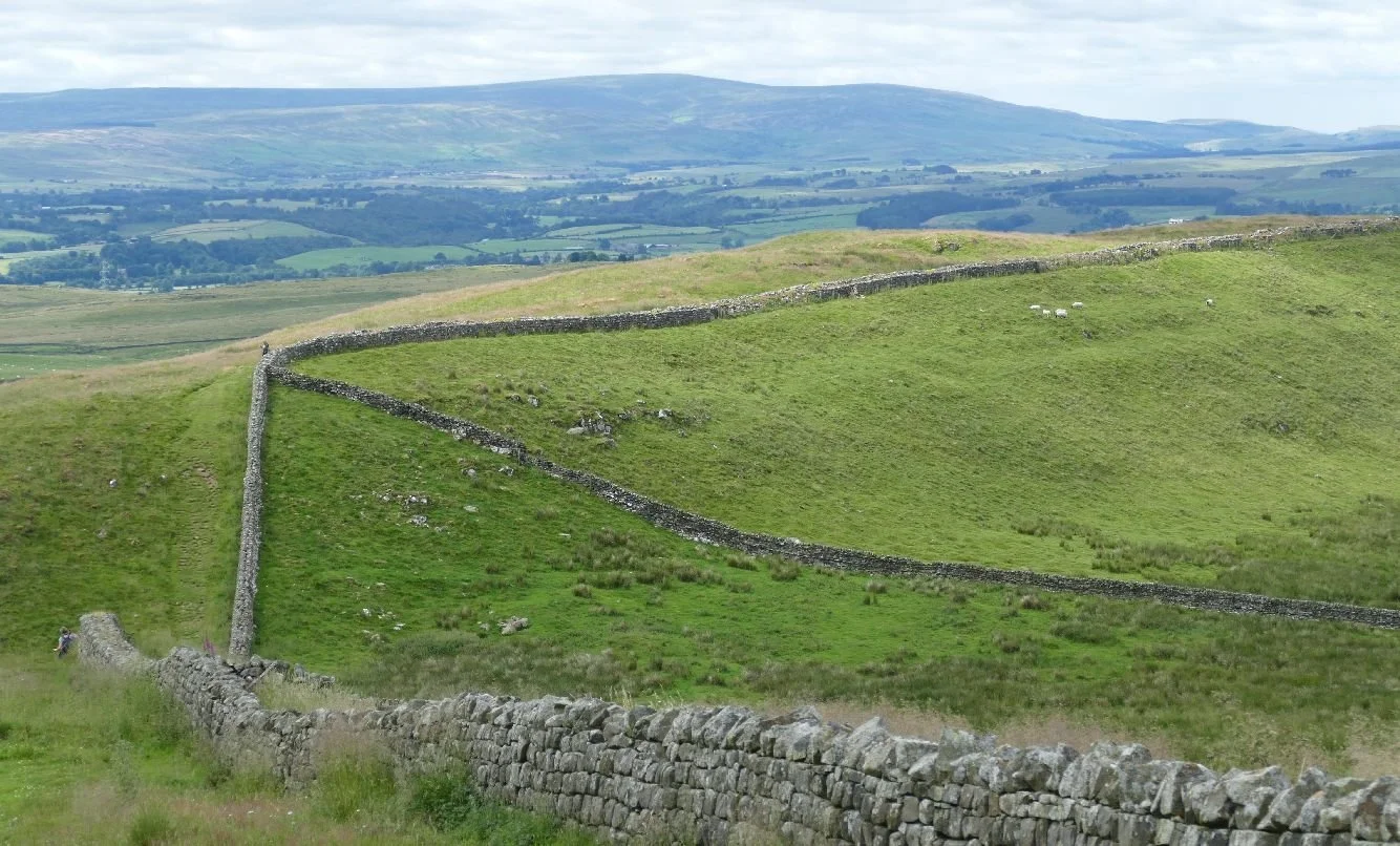

A basketful of other requirements and guidance were also relevant to our specific inquiry. Here is just a small selection to ilustrate the diversity:
Public Sector Equality Duty
Active Travel England Guidance
BRE Guidance - Daylight Sunlight & Overshadowing Assessment
Guidelines for Landscape and Visual Impact Assessment
Daffodils - sadly no, although Gatton Park is locally famous for its snowdrops
Elizabeth Barrett Browning’s list is much less prescriptive and much more romantic. It’s just a pity she didn’t dedicate the poem to brown field site adjacent to our local railway station.
I love thee to the depth and breadth and height
My soul can reach, when feeling out of sight
For the ends of being and ideal grace.
I love thee to the level of every day's
Most quiet need, by sun and candle-light.
I love thee freely, as men strive for right.
I love thee purely, as they turn from praise.
I love thee with the passion put to use
In my old griefs, and with my childhood's faith.
I love thee with a love I seemed to lose
With my lost saints. I love thee with the breath,
Smiles, tears, of all my life; and, if God choose,
I shall but love thee better after death.

Confused of Kingston
How many towns in the world are called Kingston? Wikipedia (https://en.wikipedia.org/wiki/List_of_places_called_Kingston) suggests that there are quite a lot, even if you ignore the settlements which are defined as hamlets, villages or suburbs. The impact of a largely male British monarchy and the enormity of the British Empire ensure that Kingston is a fairly common name throughout the English speaking world. ‘English’ in the geographical or political sense may also be significant: Wiki’s list for Scotland only records the name against a hamlet, a village and a district of Glasgow and the website has no listing at all for Wales. The fact that the letter ‘K’ does not exist in the Welsh alphabet may also be a factor.
This year, Terroir visited both Kingston upon Hull (for a Coldplay gig - yes, really) and Kingston-upon-Thames; or maybe it was Kingston upon Thames or Kingston-on-Thames. All these monikers have been assigned to this confusing town and we believe it is currently using the name Kingston upon Thames, a compromise between grandeur and hyphenation.
The reason for the trip to Kingston-up-river-from-London was to complete a further section of the London Loop which was obviously invented in Kingston, as its full name is the London Outer Orbital Path (no hyphenation). “The London Outer Orbital Path, or LOOP, almost completely encircles Greater London. Nearly 150 miles are split into 24 sections between Erith station [east London, south of the Thames} and Purfleet [east London, north of the river].’ (https://tfl.gov.uk/modes/walking/loop-walk). Of course the Loop (Sorry LOOP) crosses the Thames to the west of London at, wait for it, Kingston upon Thames.


King Egbert: By Unknown author - http://www.bl.uk/manuscripts/FullDisplay.aspx?ref=Royal_MS_14_B_V, Public Domain, https://commons.wikimedia.org/w/index.php?curid=28008709
Bob Marley: By Avda - Own work, CC BY-SA 3.0, https://commons.wikimedia.org/w/index.php?curid=24942405
Kingston upon Thames means different things to different people. To part of the Terroir South team it means standing on Kingston Bridge waiting for Bradley Wiggins to race past (literally) during the 2012 Olympics. To many of our friends, ‘going to Kingston’ means failure in local shopping venues so heading to the Kingston shops (including a famous department store) to find that perfect outfit. Meanwhile, thousands of students sign up at Kingston University while John Everett Millais based his picture of Ophelia on (or rather in) Kingston’s other water way, the Hogsmill.


This all seems pretty clear cut, but controversy and confusion have a long history in the town. In 838, King Egbert (pictured above) was in charge of what was then a border town between Wessex (who knew that Wessex spread so far east?) and the mighty, midland territory of Mercia.
By the tenth century Mercia’s King Athelstan had combined the two and had, apparently, created England (https://en.wikipedia.org/wiki/Kingston_upon_Thames). As a result, “According to the Anglo-Saxon Chronicle, two tenth-century kings were consecrated in Kingston: Æthelstan (925), and Æthelred the Unready (978).” Clear enough, but further coronation evidence is “less substantial”. Perhaps things would have been easier if there has been more diversity in royal initials (no wonder explanatory suffixes were so necessary). Apparently the uncertainty relates to Edward the Elder (902), Edmund I (939), Eadred (946), Eadwig (956), Edgar the Peaceful (c. 960) and Edward the Martyr (975).”
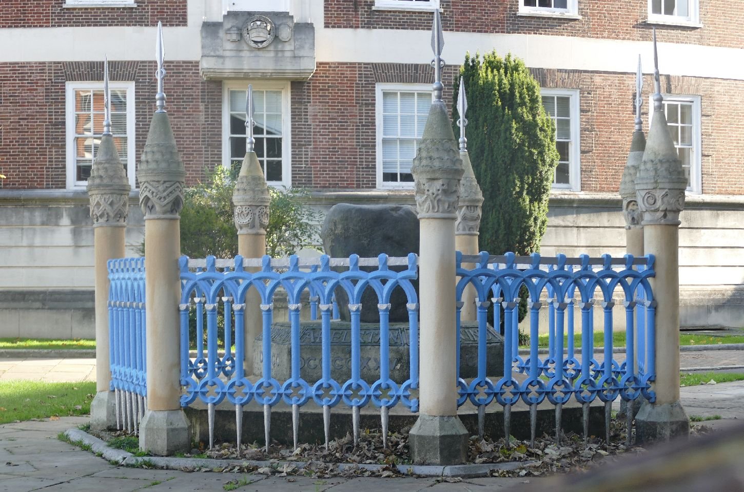


Today, Kingston’s ‘Coronation stone’ provides an impressive (if somewhat surprisingly brightly coloured) focal point between the town’s Guildhall and the Hogsmill River. It may not be an actual coronation stone and may not be as old as the Saxon kings, but it does what Kingston has been doing for centuries – combining old and new in a constant evolution of form and function.

Bringing confusion right up to date means that Kingston’s best known bureaucratic oddity has finally been obliterated. For years, Kingston upon Thames was famous for being the County Town located outside it’s county boundaries. According to Wkipedia, Kingston has been a royal manor, a parish, a borough (since 1441) and became a formal Municipal Borough in 1836. Known for many years as a Royal Borough, King George finally formalised even that title in 1927.
Kingston’s role as a County Town started in 1893 when Surrey County Council moved HQ from Newington to a new and very grand County Hall in Penrhyn Road, Kingston. In 1965, the town became part of the London Borough of Kingston upon Thames (no hyphens) but, despite being located in London, the Penrhyn Road premises remained the focus of all things Surrey. Not surprising then that, for the next 35 years, Surrey’s County Hall’s location became a quiz question until the Council finally decided to vacate the imposing, Victorian, Grade II listed building for slightly less grandiose premises in Reigate - yes, in Surrey- but almost as far as you can get from Kingston, without being, once again, out of County. Welcome to the Far East.
As a post script, Surrey County Council itself will become history in April 2027, with the creation of two unitary Councils called, imaginatively, East Surrey and West Surrey.
Currently, the Kingston County Hall is under scaffolding for convertion into “high quality, residential led, mixed used[sic] development”. If you want to live in the land of the Saxon Kings, which your friends will mistake for Yorkshire or Jamaica, then you can register your interest in advance. Confusion is included at no extra cost.
Hopetown or Hadestown?
They sound diametrically opposed but in so many ways they are scarily similar. Could you lead your lover out of Hopetown without looking back? I don’t think so.
But let’s be clear: Hopetown is the optimistically named railway-works-now-museum in Darlington, County Durham, while Hadestown is the name of a Broadway musical with lyrics like
“On the road to hell there was a railroad track”
Or
“Lover you were gone so long
Lover, I was lonesome
So I built a foundry
In the ground beneath your feet
Here, I fashioned things of steel
Oil drums and automobiles
Then I kept that furnace fed
With the fossils of the dead”
I suppose we always suspected that Hades was both King of the underworld and patron saint of all things powered by coal aka “the fossils of the dead” (although I think coal is strictly vegetarian so the analogy may well be flawed!).
As part of our homage to Rail200 (Part 1 is in the previous blog) we visited the Hopetown Railway Museum in Darlington. Somewhere we had read that ‘Hopetown’ was so called because a carriage works, which the Stockton and Darlington Railway propsed to build in this area, gave some hope for a better or perhaps more secure future for the local workforce. A brief Internet research makes no mention of this theory but it seems entirely credible and an obvious candidate for another musical.
The carriage works opened in 1853, its brief to build and maintain ‘two axle railway carriages’ for passemgers on the Stockton and Darlington Railway (SDR).
The site, a little under a mile to the north of the centre of Darlington, was already the location of the town’s first railway station (right). If you wonder why it was so far away from the town centre we must remind you that the primary function of the SDR at that time was the delivery of coal from local collieries to the river ports of Stockton on Tees!
With the subsequent construction of other railways on other routes, a more central town station was constructed in 1841 (others would follow) and the original SDR station renamed North Road. As its later name suggests, this location was also handy for the Great North Road heading to Newcastle.
Maps published around the time of the carriage works’ construction indicate that the Hopetown area was still largely rural but the impact of ‘King Coal’ is already very evident. Apart from the railway infrastructure (the Hopetown foundry, goods’ sidings and railway workers cottages) there is already a gas works and the South Durham Iron Works.
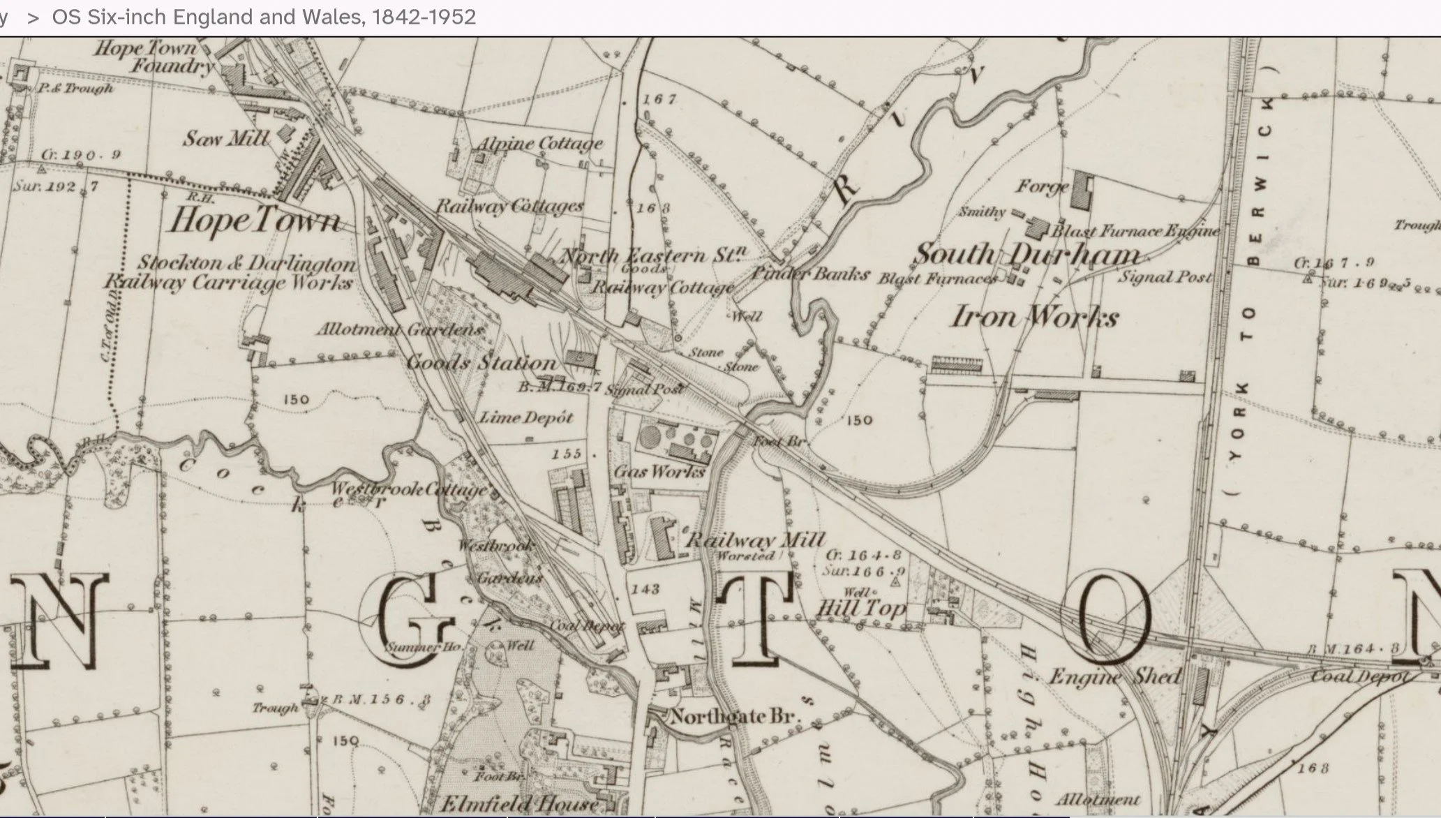
Reproduced with the permission of the National Library of Scotland' https://maps.nls.uk/index.html
Ironically, the carriage works closed in the 1880’s but the Hopetown name stuck. Perhaps some of the original ‘Hopefuls’ moved to the ‘Darlington Works’ (more concerned with locomotives than rolling stock) which were established in 1863 or to the ‘North Road Shops’ on the opposite side of the railroad tracks at the Hopetown site.
Although threatened with closure many times, North Road (Darlington) Station still survives (Bishop Auckland to Darlington in around 26 minutes) but the original station building and the Hopetown Carriage Works area were acquired by Darlington Borough Council in the 1980s and became part of the Darlington Railway Centre and Museum. When Terroir visited in September Hopetown was heaving, with a very varied selection of activities and displays.

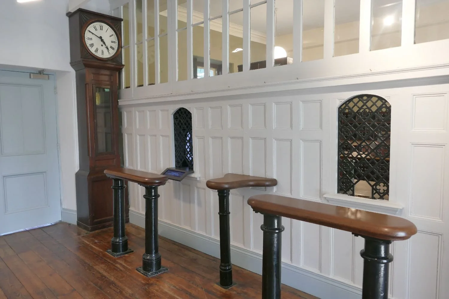


We were particularly delighted with a statue – not of Hades - but of Prudentia who, according to the Northern Echo (https://www.thenorthernecho.co.uk/news/25185272.prudentia-back-darlington/)
once adorned the offices of the Prudential Insurance Company in Darlington. After an eventful career, including many years in a packing case, she has finally been released to adorn a garden adjacent to the preserved North Road Station building. She is obviously recommending the use of a mirror (cunningly disguised as a table tennis bat) to escape from Hades and the Greek underworld.
But the reference to Hadestown in this blog was not just a jokey play on words conjured up by the discovery of a place called Hopetown (although that was, indeed, the start of it). We knew of course, that County Durham was a colliery county. We knew that the Stockton and Darlington Railway was founded on coal and fuelled by the same stuff. We know that mining was not a career path which we would have wished to follow, out of economic necessity or for any other reason. Paintings at the Miners’ Gallery in Bishop Auckland, really drove home the reality of Hades’ underworld for a huge section of the local population.


Above: Images from the Bishop Auckland Mining Art Gallery Guide Book
Our last story from the land of Hope and Hades is, therefore, about the intimate link between geology, technology and design. This interaction was beautifully illustrated by the historic wagon displays inside the mighty exhibition shed at Shildon. The Hopetown carriage works had been relatively short lived; transporting people didn’t go out of fashion but the technology changed and production moved to York. The Shildon works fared better. By converting from locomotive construction and repair to the production of wagons, Shildon continued in production for over 150 years, creating wagons adapted to transport various raw materials, manufactured goods and a variety of other types of freight. Here follows a selection of our favourite design adaptations to accomodate changing cargoes, new materials and methods of loading and unloading.


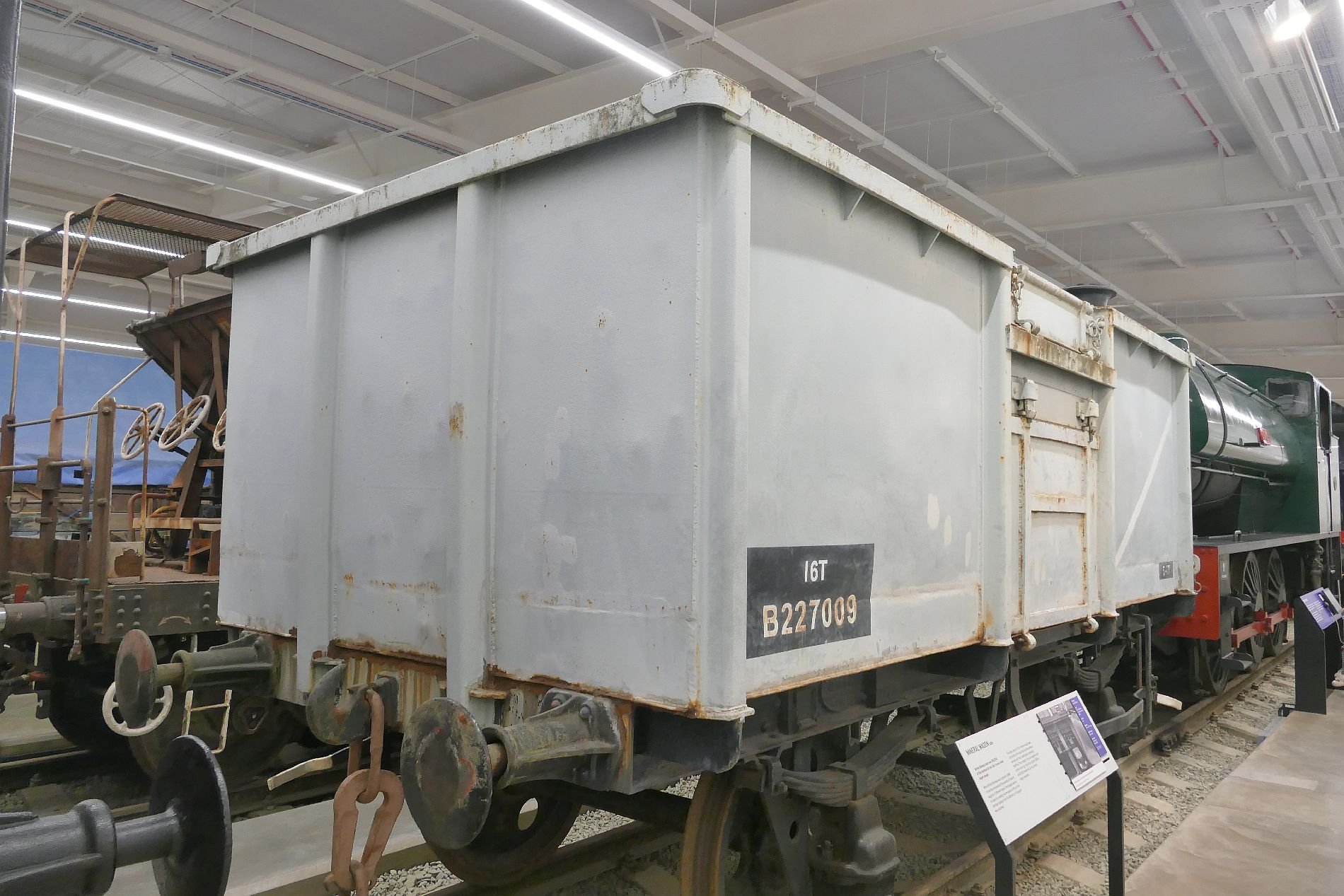
The basic coal wagon or chaldron wagon (above left) was the staple on horse drawn railways but as demand for coal expanded, so did the design of the wagons to allow easy bulk delivery. No doors became side doors or doors in the base of the wagon. Construction changed to keep up with modern materials which were longer lasting or could be easily maintained.
Horses hauled wagons for centuries but ended up being transported by them instead (below).
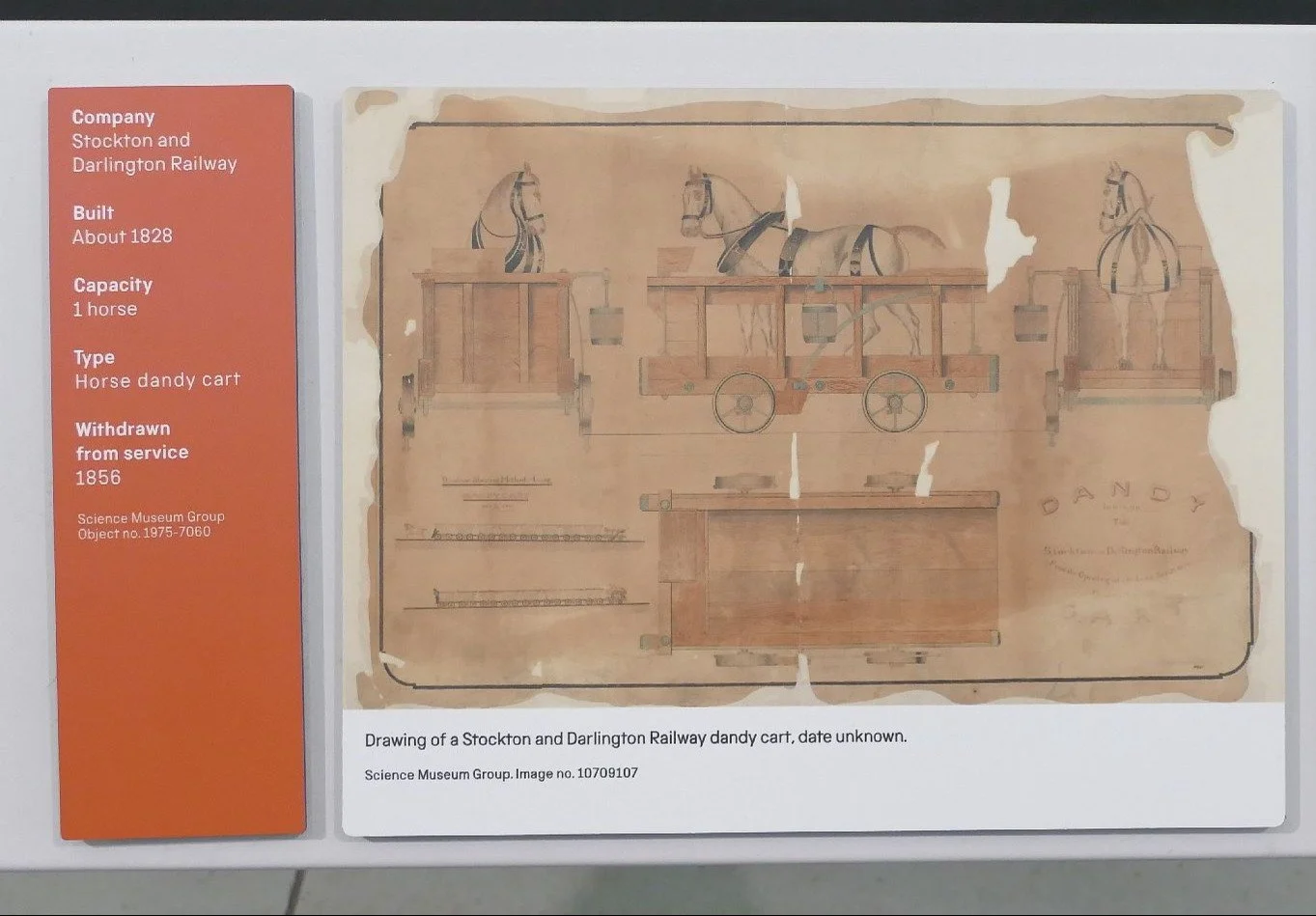

Carrying liquids was a new challenge and required a complete rethink of materials and shape (below).


Well wagons were designed to carry heavy vehicles or large loads by creating additional depth between the wagon wheels (below).


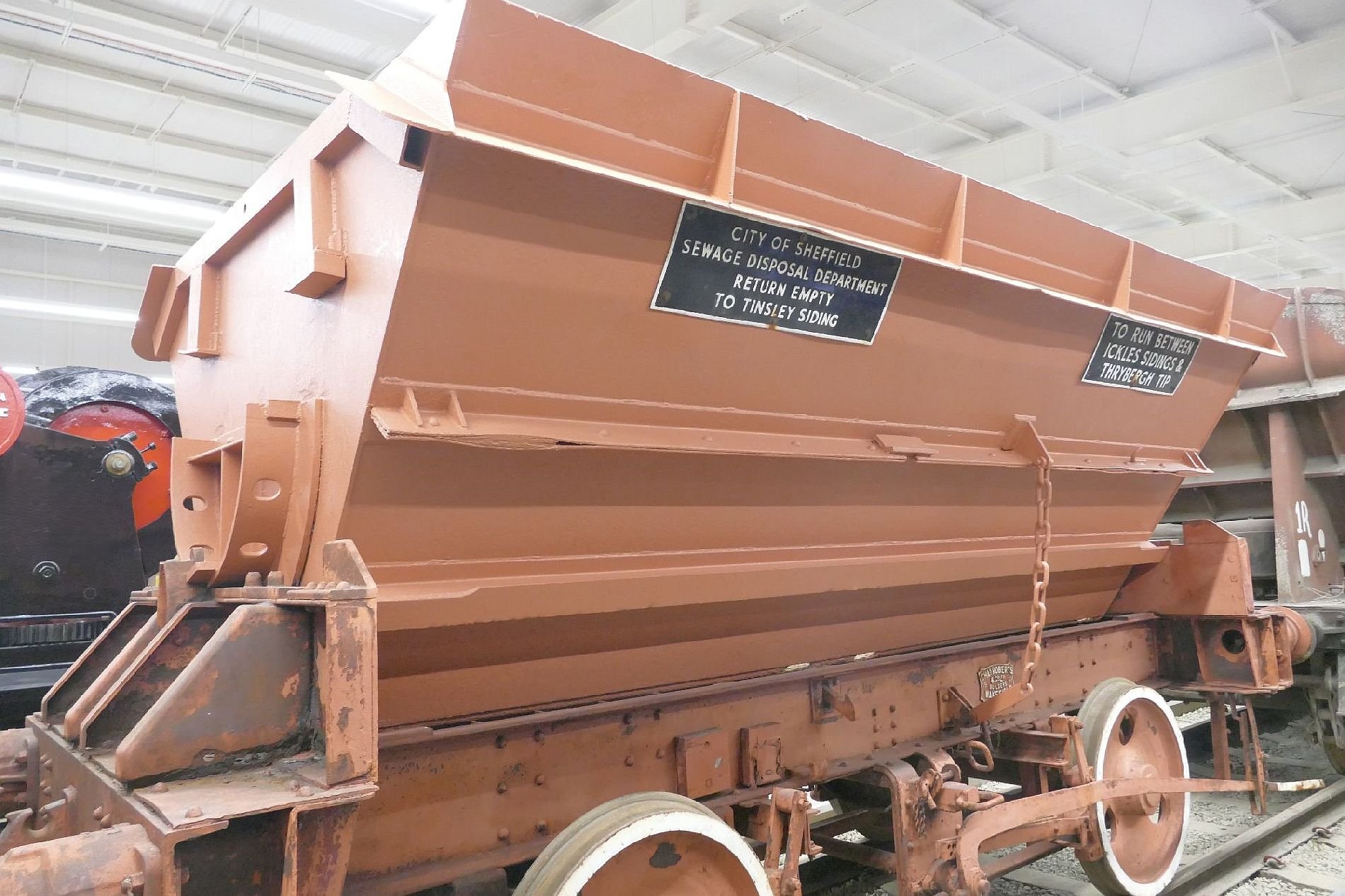
And here is our all time favourite for going just that extra mile - the sewage disosal wagon.
We suggest that neither the mythical Hadestown nor the actual Hopetown developed the ingenuity or adaptabilty to cope with changing circumstances. Condemned to be myth or museum respectively, they could be a salutary comment on the future of rail transport. So much of railway engineering is already classed as heritage. Is sufficient realistically being developed to meet the challenges of climate change and competition from other transport modes? Well, at least we have the Musical to look forward to.
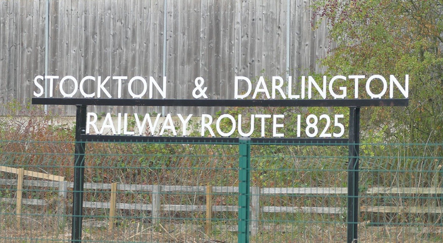
Grumpy Gricer

Glenfinnan Railway Viaduct © Ken Morris
Many of Britain’s classic landscapes are influenced – in a good way - by what we now call ‘transport infrastructure’. The Glenfinnan Railway Viaduct, striding across its Highland glen with breathtaking, late Victorian assurance, was admired and photographed long before J K Rowling and film industry location scouts made it world famous.
But we can also say that much of British transportation is enhanced by beautiful landscapes. The M6 south of Tebay passes though Cumbria via the magnificent Lune Gorge. For the passenger at least, the view of fells, plumped up like enormous green velvet cushions threaded by tumbling gills, is magnificent. But for the walker, or driver on the A685, the valley will never look or sound the same again.

By Don Burgess, CC BY-SA 2.0, https://commons.wikimedia.org/w/index.php?curid=13145536
What has brought on this stumbling discourse on the relationship between transport and landscape?

The answer is ‘Railway 200’, described as “… the 200th anniversary of the birth of the modern railway. Britain and the world changed forever. Railway 200 celebrates the past, present and future of rail.” (https://railway200.co.uk/about-railway-200/).
The website continues with a lot of public relations style prose stressing how wonderful the railways were and are and will be.

Terroir spent a few days in County Durham, visiting the land of the Stockton and Darlington Railway. It was fascinating, fun, nostalgic, frustrating, informative, misleading, advertorial and well worth the visit. There was even a rail replacement stage coach (image right - can you spot it?). But the experience also raised a lot of questions and unexpected answers, if you were willing to look beneath the hype.
For Terroir, the core message was ‘Myth and Money’.
The Big Myth – the Stockton and Darlington Railway was the first railway.
The Railway 200 website says: “The Stockton & Darlington Railway opened on September 27, 1825, connecting places, people, communities and ideas and ultimately transforming the world.”
But surely, there have been transport routes which employed wheeled vehicles guided by two parallel rails (ie a ‘railway’) in use in many countries long before the September 1825? The Greeks were certainly onto something when they used ‘rutways’ to guide flatbed trucks to carry ships and cargo across the Corinth Isthmus around 600 BCE. The wheel was guided in a rut, instead of on a rail, but the basic principle is enough for some to call it the first railway.


Fast forward a few thousand years to find that ‘inclined railways’ (with rails not ruts) existed in mines from the early 17th century, using horses and/or gravity to provide the motive power. Above ground horse drawn ‘tramways’ were used in England frm the early 18th century, usually to shift materials from source (eg quarries) to boats.

‘The Railway 200’ people are careful to note that 27th September is the birthday of the ‘modern railway’. If ‘modern’ means the first use of steam engines, then we find that steam locomotives were hauling trains before 1825.
According to (https://en.wikipedia.org/wiki/Steam_locomotive) it was Richard Trevithick who should be credited with creating the earliest steam locomotive. This summer’s celebrations did make a passing reference to Trevithick but it was George Stephenson (right) who took all the engineering honours.
Image right: Bronze statue of Robert Stephenson by Carlo Marochetti, originally erected at Euston station in 1871
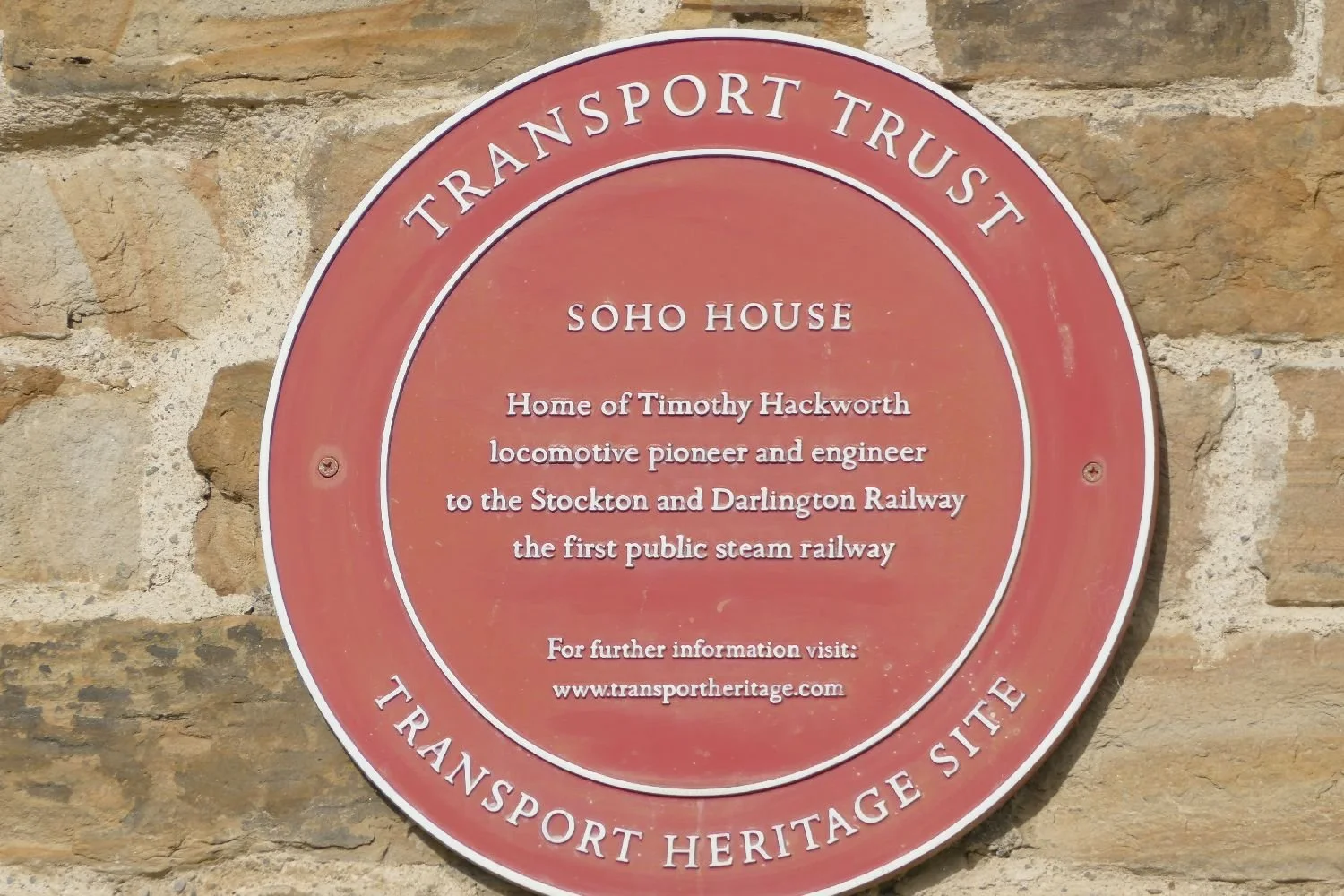
Another side-lined engineer was Timothy Hackworth, five years younger than Stephenson but born in the same Northumbrian colliery village. TH built a number of steam locomotives, his earliest being the Sans Pareil. Granted it blew up at one point but then so did Stephenson’s Locomotion No 1.
Hands up all those Terroir readers who have actually heard of the adventures of Master Hackworth (1786 – 1850)? Be quiet Terroir North. We know that you know!
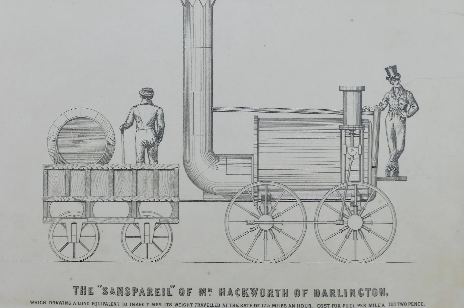


So forget first steam engines as defining a modern railway. Is the modern railway about hauling coal trucks from collieries or carrying paying passengers? Nope - Trevithick also managed both those before 1825.
So what was so special about September 27th 1825? It was actually the birthday of the Stockton and Darlington Railway company, not of steam hauled trains, not of passenger on trains, but the day the first railway company went into commercial operation. That day was celebrated in style with crowds of onlookers. The SDR put on a special train with wagons carrying coal and wagons carrying people and a wagon carrying a brass band. It was hauled by ‘Locomotion’ and travelled 18 miles from Shildon to Stockton. It seems to have been a splendid and exciting pageant; possibly the first modern use of a good promotional team, as well?

Locomotion hauling coal, passengers and a brass band across the Skerne Bridge


So, Terroir wonders, was the 27th September 1825 celebrating railways as such, or just a new transport business model? Was the engineering prowess, the industrial revolution’s hunger for coal, the need for an Act of Parliament andextensive use of Compulsory Purchase Orders just part of the back story? We are sure the answer is no. That epic journey must have been a celebration of engineering prowess, as well as a recognition of the business opportunities offered by coal, the industrial revolution and the empire. Who can blame the shareholders for making it into a ‘right good do’.
A one hundreth anniversary celebration of railways was also held in England in 1925. Perhaps we shouldn’t blame the big four railway companies for using the Stockton and Darlington as an excuse for a celebration. The London and North Eastern Railway must have been particularly keen on the location although a date in July was deemed more appropriate than September. It must have seemed the perfect opportunity for a post war knees up, and celebration for the whole of Britain and its Empire.
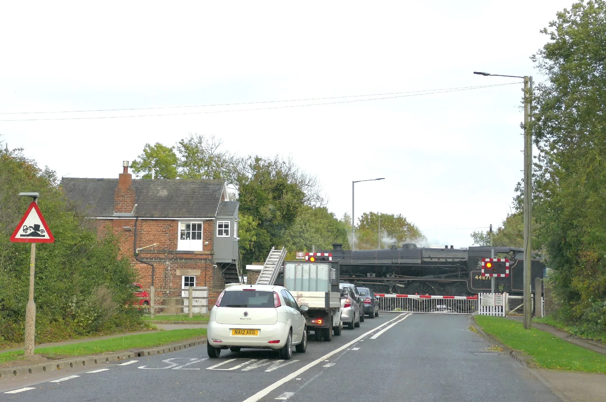
It all happened again in August 1975, although ironically, this event was more of a celebratory farewell to steam than the welcome shindig of 150 years ago.
So it’s no surprise that August and September 2025 was in the diary for another railway extravaganza. The Rail 200 website again: “During 2025 Network Rail, alongside many other rail industry partners, will be celebrating rail’s remarkable past, recognise its importance today, and look forward to its future.” (https://www.networkrail.co.uk/who-we-are/our-history/railway-200/).
So why did Terroir return home with a few grumpy nit-picks lurking in the back of the mind? Your honour, I submit the following evidence. The first observation is ridiculously simple: the number of those who were asking ‘why this date’ or saying ‘it’s the wrong date’. How come so many people thought of it as a 200th anniversary of railways in general? We got the message that “Railway 200 will showcase how the railway shaped and continues to shape national life” but not that it was the third in a series of railway celebrations based on the opening of the Stockton and Darlington Railway. Where was any information which illustrated the 1925 and ’75 celebrations? But does it really matter? Yes, to some people it did.
The second nit-pick is much more serious. Where was the replica engine of Locomotion No.1? It was billed to appear on the day we were visiting. No sign of it, not even an announcement that the scheduled service had been cancelled.
The third nit-pick was distinctly worrying. The razzamatazz and display of shiny locomotives prepared us for exhibits which would talk up the UK railway industry, something which the majority of visitors probably ignored.
On wandering into a display on the future of railways, however (apparently presented by the Rail 200 partners), my propaganda klaxon started bleating. Now no-one in Terroir has a PhD in mechanical engineering or computer science but we are interested in sustainability, climate change and new technology. We can also read and, occasionally, we are quite good at reading between the lines or spotting very selective use of information and data. The display was very selective indeed.


Appalled, I expressed my indignation out loud. A young engineer standing nearby looked over and substantiated my views. As we left, the trio on duty at the entrance to the display were – politely - informed of my/our opinions! They took it well but I doubt the feedback went much further.
Next time we will be looking at the fun stuff – yes really - and how important geology is in the design of wagons.
And if you are out there, Mr Young Engineer, it was great to meet you and I do hope you raised those dodgy information boards with your colleagues.