
Derbyshire Postponed!
For the first time in the history of Terroir’s 162 blogs, we are not posting on our normal schedule. Yes we know - you will all be bereft! Reasons are many but we will return to our normal service in one week’s time on Thursday 24th

The First Brexit
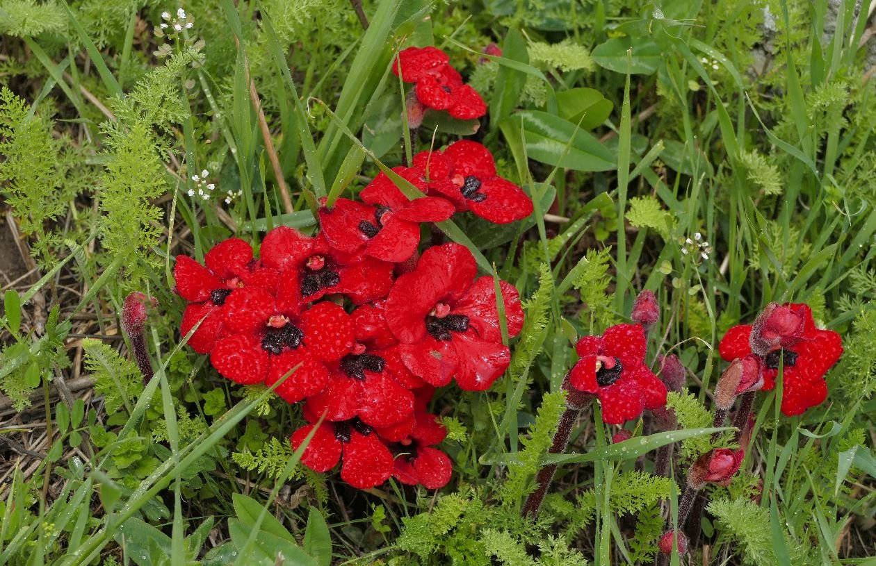
We found them at the Tsakhats Kar monastery site.

Have you ever stooped to admire, and perhaps try to identify, a wildflower on mainland Europe? Have you ever wondered why so many such plants look familiar but aren’t quite ‘right’ - perhaps a niggling difference in flower or leaf, or in an unexpected location? As a young wildflower spotter, one of us can well remember standing in a French coastal ecosystem (aka at the seaside) and puzzling over what was growing at my feet.
Image above right: surely this is a meadow full of cowslips (Primula veris)? Well, actually these are probably the mainland European subspecies …
To get a handle on this, we need to look at the vexed subject of climate change. As many climate change deniers [Is that a word - it sounds more like the description of a pair of stockings?] keep informing us, ice ages have come and gone for millions of years, and what we are seeing now is just the end of the latest (and currently thought to be the planet’s fifth) global cooling/warming event. What deniers don’t mention is that the speed of retreat of our current ice age, and the simultaneous and extraordinary hike in temperatures across the globe, has been madly exacerbated by human activity.
But this blog is not about climate change as such but about one of the impacts of climate change: the rise in sea level. What we now think of as the British Isles were once firmly part of the Eurasian land mass. Around 450,000 years ago PB (Pre Brexit), however, melting ice and changing sea levels caused the separation of Britain from Europe by washing away the land bridge which connected our peninsula to the mainland.
From then on, so the perceived wisdom goes, our ecological development could no longer be strongly influenced by plant and animal species spreading by land from the east, but by internal, maritime and airbourne influences associated with being an island. As a result, many European plant species never made it back to Britain in time to be considered ‘native’. To drive the point home, Britain and Ireland have less than a quarter of the ‘higher’ plant species found in France. Although France has a much wider range of habitats, the difference in numbers of species is still staggering. Belgium has around the same number of higher plant species as the UK, but contained within far fewer different habitats. So, although Darwin and his origin of species theories made the Galapagos Islands famous, he might have spared himself, Fitzroy and the crew of the Beagle a lot of discomfort by just crossing the channel. Although Fitzroy’s work on weather forecasting might have been significantly delayed.
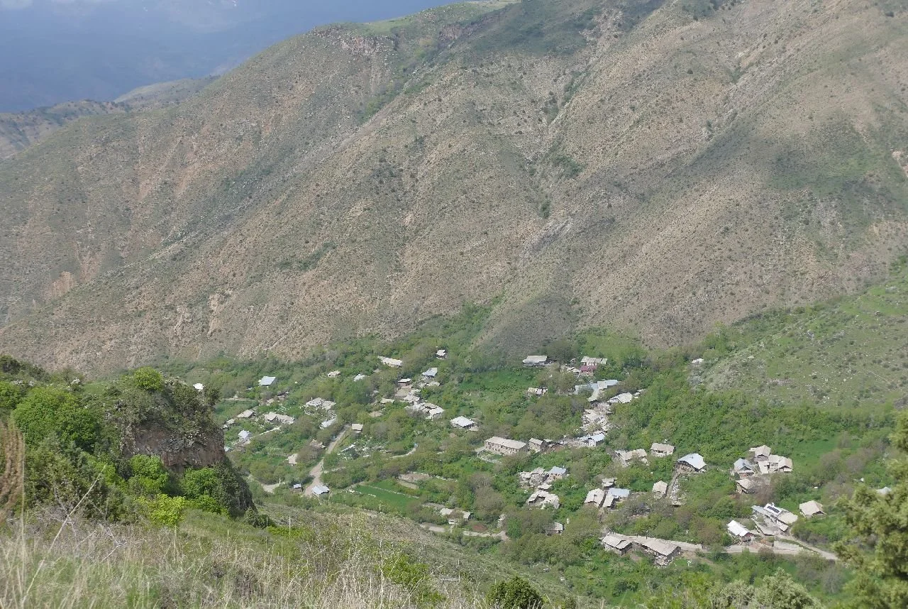
One of our reasons for going to Armenia (apologies, yes, Armenia again), was to look at the wild flowers and the trip was a classic illustration of this (I hope not xenophobic) view that European wild flower species are just not the same as British! Someone would shout ‘oh look Bugle’ but the suspicion that it was not going to be our familar British Ajuga reptans was always hovering in the air.

We think this is Ajuga orientalis (how romantic) but it could be A genevensis. Can you help us?
How did we work out the identity of the plants we saw? Let us first state very clearly that we are not expert botanists, that we would never claim to be anything close to 100% accurate and, if you can correct our dodgy identifications, then we would be delighted to hear from you.

Of course the wonderful ‘A Field Guide to the Plants of Armenia’ by Tamar Galstyan (published in 2021), and purchased on line, finally arrived at home after we ourselves had arrived in Armenia, so most of our identification work was carried out back at base, using our own photographs, plant identification aps, Tamar Galystan’s book and internet research. And no, we didn’t see these amazing Iris iberica subspecies elegantissima which are illustrated on the book’s cover.

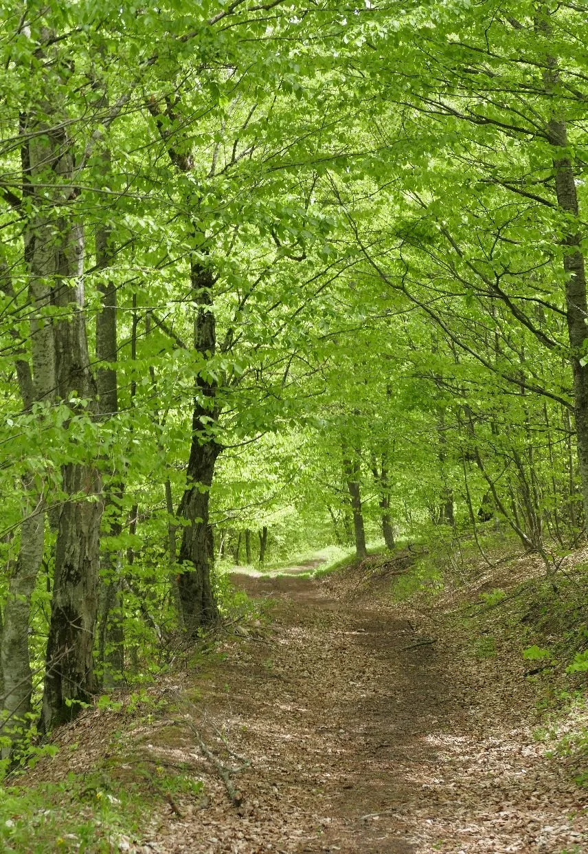
Our first walk was though a rain dampened woodland of hornbeam and field maple, both we think, the same species with which we are familiar in the UK. But it was very exciting to know we were walking the Transcaucasian Trail, not the South Downs Way.


Now we can start enjoying the floral Brexit experience.


Left: Anemone caucasia - far bluer than our own wood anemone (Anemone nemorosa)
Centre: a small yellow Star of Bethlehem (Gagea bulbifera?). There are 7 Gagea species illustrated in the Armenian flora but Britain has just one (Gagea lutea).
Right: probably Caltha polypetala - Britain’s Marsh Marigold is Caltha palustris
The next day we progressed to an equally wet beech woodland with equally exciting signs - and plants.


Left: our path was lined by a mass of beech seedlings - evidence of what must have been a good mast year followed by equally favourable spring weather for germination. Which one of these will finally achieve dominance and a statuesque new beech tree? Probably none of these, located as they are so close to the path!
Centre left: a yellow anemone (Anemone ranunculoides), found in Britian, but probably as an escapee from doing ornamental duties in nearby gardens. Seen here co-habiting with, perhaps, a scarlet elf fungus?
Right: we think this is a Whorled Coralroot, Cardamine quinquiefolia, a native of this part of Europe/Asia but a stranger to the British Isles.
Emerging from the woodland we enter the land of the Cowslip. as mentioned above, Britain is home to Primula veris but Amenia hosts P veris subspecies macrocalyx. This description must surely refer to the Victorian style bloomers which encase the yellow petals.


By day 3, we were aspiring to higher things: a climb to the top of Mount Artanish, a fairly innocent looking hill but which tops out at 2,460m (over 8,000’). Although we didn’t start at anything like sea level, it was still quite a hike for those of us whose lungs had not really adjusted to the change in oxygen availability.
Thank goodness for an excuse to stop on this grassy, rocky hillside to take photographs of wild flowers.


The yellows:
Left: Potentilla crantzii (we think) snuggling up to what looks a bit like our own Germander speedwell (Veronica chamaedrys) but is probably Veronica multifida.
Centre: Adonis volgenis? This one is not in the Armenian flora and an internet search suggests that it is a Russian species which wandered westward.
Right: Pedicularis armenia or Crested Lousewort - from the name alone it is clearly not an English Lousewort.


And the blues:
Left: the amazing Pasque flower; not our own Pulsatilla vulgaris, but Armenia’s very own, droopy headed, Pulsatilla armena
Centre left: Onobrychis cornuta, a prickly purple version compared with our own rosy pink Onobrychis viciifolia aka Sainfoin.
Centre right: how amazing to see Grape Hyacinths in the wild. We saw Muscari armeniarcum (shown here) and the wonderfully named Muscari neglectum with flowers tipped in a paler blue, like a little pompom.
Far right: and finally a clump of purple Iris pumila, keeping snug to the ground.
We walked further and saw more but we will leave you now with one of the most extraordinary plants which we have ever seen: Diphelypaea tournefortii. It is included in the ‘Plants of Armenia’ but it took us a while to identify even its name. Further research was also hampered by a scarcity of information on the internet - we often couldn’t make head or tail of the short but very technical English websites, and many sites were written in Russian or Armenian and, assuming an equally technical approach, we lost the will to get it translated. So we leave you with a short item taken from Wikipedia, and with our photographs.
‘Phelypaea is a genus of flowering plants in the broomrape family Orobanchaceae, native to the Balkans, Greece, Crimea, the Caucasus region, Anatolia, the Levant, Iraq and Iran. They are root parasites which cannot conduct photosynthesis and are only seen above ground when flowering.
Currently accepted species include: [three cited, followed by a fourth:] Phelypaea tournefortii Desf. Transcaucasus, Turkey’. (en.wikipedia.org › wiki › PhelypaeaPhelypaea).
Tamar Galystan adds ‘Perennial … Hosts Tanacetum [Tansy], Achillea [Yarrow], Gorges, forest edge, meadows’.
I think we were very lucky to see it.


Geometry
Religion plays a remarkable, and somewhat unusual, part in Armenia’s history. It also played a part in the choice of many of the key words which we listed in our previous Blog. Architecture, funerary monuments and monasteries are a rather obvious selection but history, identity, ironwork, stones and walking trails are also relevant.
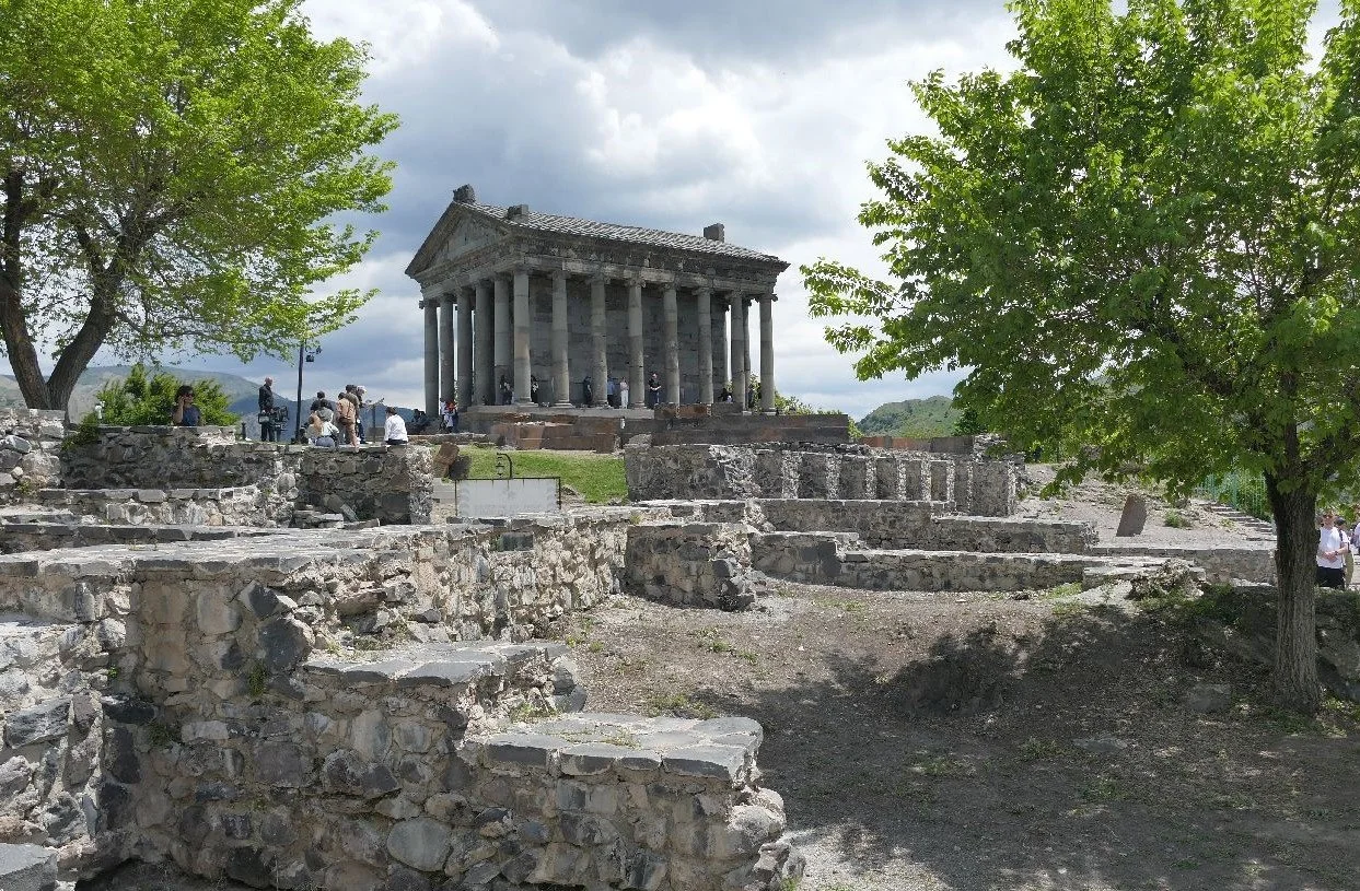
For those of us thinking of Armenian Orthodox architecture, this little number (right) was rather a surprise. Garni Temple is at the heart of a UNESCO World Heritage site and is thought to be the only Greco-Roman building surviving in the former Soviet Union. For the sake of balance, however, it seems probably that Christianity converted or destroyed many temples long before the USSR disapproval of religion nearly completed the process.
To say that Garni Temple ‘survived’ is also a little generous, as this 1st (or possibly 2nd?) century temple (dedicated to Mithras or possibly a ruler’s tomb?), was destroyed by an earthquake in 1679 and was heavily restored in the latter part of the 20th century. The guide book says that this is one of the few historical monuments in Armenia which charges an admission fee which may well reflect on the somewhat two-edged sword of UNESCO protection – standards can be demanding and expensive.
But getting back to Armenian Orthodox, it is suggested that Syrian apostles began the work of converting Armenians from Zoroastrianism (probably a Persian import) to Christianity in the first century of the current era, thus laying the foundation for 4th century St Gregory the Illuminator to formally establish the Church of Armenia, become its first bishop, and be credited with converting Armenia’s King Tiridates the Great (aka Trdat III), thus making Armenia (probably!) the first nation to adopt Christianity as its state religion. And this is just one version of what happened. (https://en.wikipedia.org/wiki/Christianization_of_Armenia https://www.worldhistory.org/Saint_Gregory_the_Illuminator/)
Monasteries are good for tourism and so are walking holidays. You can combine the two – as we did in Armenia. We’ll take a look at some of the monastic structures here, and revel in the walks and wild flowers next time.

Armenian ecclesiastical buildings are usually built of stone. The local volcanic rock provided plentiful and colourful tuff, plus black basalt and grey/green andesite.
Image right: built from its local geology - a classic Armenian monastery building constructed from the local tuff
The guide book suggests that timber suitable for building purposes was unavailable (hence thick walls to support heavy stone roofs), a statement which Terroir finds somewhat puzzling. An, albeit rapid, internet search hasn’t clarified the situation, so comments from anyone with further information on this statement would be welcomed.

Earth quakes were also a factor in design and an early form of concrete was used to form a core within the tuff walls, to provide the necessary stability. Later, niches (left) were also incorporated to increase flexibility during quakes.
The monastery and church buildings that we saw reminded us of a combination of a geometry lesson and a box of children’s building bricks. Don’t get us wrong, they are a delight to visit but the photographs below will probably illustrate why we give this apparently uncomplimentary description.
The basic construction was based on a box either square or rectangular in plan with a pitched roof and often two extra gables on either side. On top of this was erected a cylinder (a tambour) which in turn supported a cone (the cupula).


External detailing is varied, fascinating and often intricate:


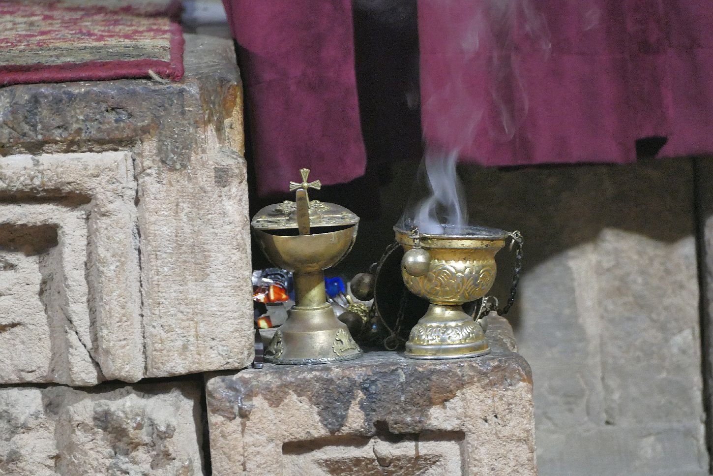
Inside the churches there is no iconostasis to separate the nave from the sanctuary, as used in other orthodox traditions, but a curtain which the clergy draw when preparing for various parts of the service.


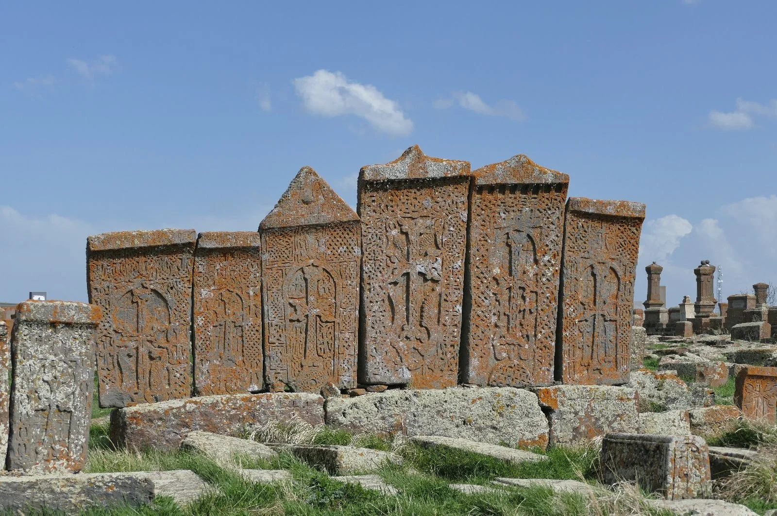
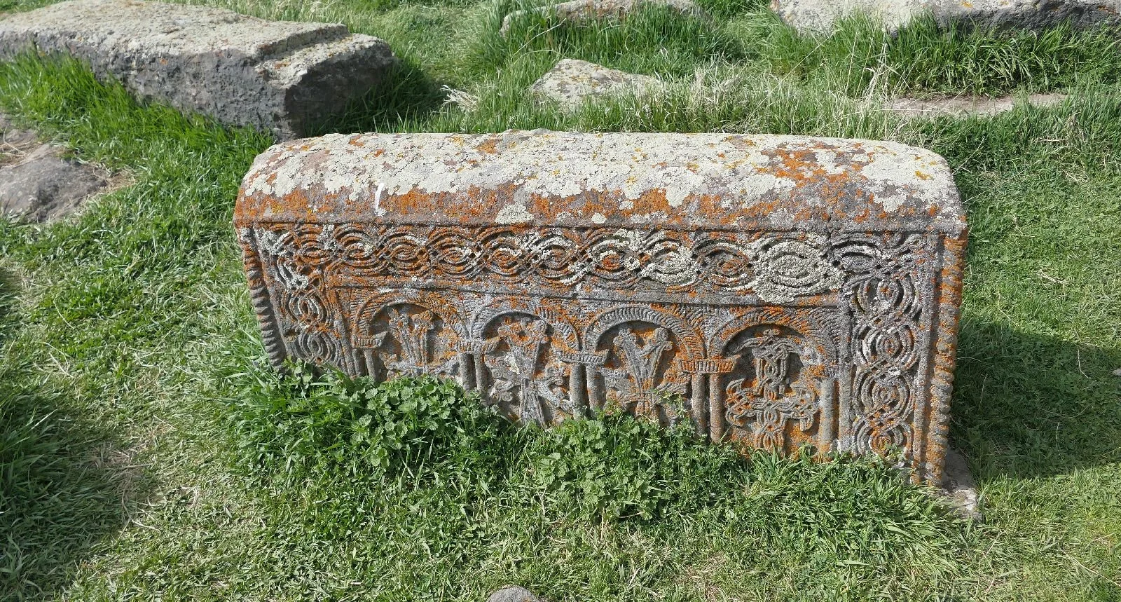
A key part of all these sites are Khachkars or memorial stones, beautifully decorated, and erected outside churches and in many other places as well. The earliest known khachkars are said to be 9th century and were created to commemorate many different events. Understandably, salvation for the soul seems a common purpose but we were told they may also commemorate victory in battle, or the completion of churches and other buildings. Each tells its own story in symbols and pictorams. At Noratus in central Armenia (near Lake Sevan) is an entire cemetery of densely packed Khachkars. Our photographs can only hint at the spectacular nature of this piece of religious heritage, the largest such site still remaining within Armenia.


By our standards, this is a brief blog and we were also going to tell you about two other iconic pieces of Armenian architecture which had references to key words such a ‘ironwork’ and ‘obsidian’. This blog has run out of time, however, due to one of us being technically on convalescence after some creative hospital interventions. You may well be relieved to be released but we leave you with our favourite ‘ironwork’ pictures.


Complex
How many readers correctly guessed the location of our last blog? The answer is:
Armenia
In early May, a very un-secret group of seven companions (including Terroir) spent some ‘super’ time travelling in Armenia. While walking up mountains and through flowery meadows, one of us is also embarrassed to report that a working title for an Armenian blog might be ‘How do you solve a problem like Armenia?’! (This E Blyton/Julie Andrews thing can be very infectious.) On return to the UK, however, we started collecting words which summed up our Armenian experiences and, thankfully, the word ‘problem’ never appeared in our list or in Terroir’s mind set. The only such word which one of us felt was an honest reflection of our visit was ‘complex’.
Here are those key words:
architecture, borders, diaspora, emigration, flowers, food, forests, funerary monuments, gas pipes, genocide, history, identity, ironwork, lakes, lavash, monasteries, mountains, Mount Ararat, neighbours, obsidian, pomegranates, stones (grey, pink, black, volcanic), sunlight through trees, walking trails, welcoming.
Apologies for the unfortunate but unintended collision of words beginning with ‘G’ in the strictly alphabetical listing above.
We will be exploring some of the stories behind these words in this and the following blog.
Let’s start with that travellers’ companion, the guide book. Perhaps unsurprisingly, guide books to Armenia are not as numerous as guides to, say, neighbouring Turkey. There is also a tendency to combine guides to Armenia with Georgia, to the north, and Azerbaijan to the east. There is a logic here: Armenia’s borders with Turkey and with Azerbaijan are closed, but you can travel to both countries via Georgia. We suspect, however, that a joint guide which includes Armenia’s fourth neighbour, Iran, doesn’t currently have much financial appeal to travel book publishers.


Our guide book of choice is the Bradt Guide to ‘Armenia & Nagorno Karabagh’. Where you may ask, is Norgorno-Karabagh? It was an ethnically Armenian enclave situated within south east Azerbaijan but, following the most recent Azerbaijan military offensive, almost the entire ethnically Armenian population has fled.
https://www.rome2rio.com/s/Nagorno-Karabakh/Armenia-Azerbaijan-border
Armenia’s relationship with Azerbaijan is, obviously, extremely complicated. The situation is fluid and it is impossible for guide books to provide accurate and up to date travel information. There is, technically, a road link between Nagorno-Karabagh and the Armenian border but, as we said, it’s complex.
Looking at the historical background to this whole region is not simple either. A staple of any guide book to anywhere, is a section on the history of the country in question. If you look at the combined Georgia/Armenia/Azerbaijan volumes, however, the history of Armenia is disappointingly short. Not so, in the more geograpically focussed Bradt Guide. There are twenty pages devoted to Armenian History (5% of the entire book) and it’s a tough read.
It goes something like this:
Armenians call their country Hayastan (the Land of Hayk). Legend has it that Hayk was one of Noah’s grandsons. So straight in with the huge significance of Mount Ararat.
Stone age: 600-800,000 years ago.
Agriculture: from about 6,000 BCE; carvings/petroglyphs, metal work.
The Urartu people arrived around 1,165 BCE, kicked off what was to become the Armenian language and founded an empire.
300 CE (approx): the first country to convert to Christianity ‘perhaps the single most important event in Armenian history’.
387 CE: Rome and Persia divi up the country between them, with restoration of Armenia monarchy in 884 CE
11th century: enter the Byzantine Empire.


Above: Exhibits from the Mashtots Matenadaran Collection of Ancient Manuscripts housed in a purpose built archive in Yerevan
1453: enter the Ottoman empire in the west, and Persians in the east.
1722: the Russians replace Persians, except in Nagorno Karabagh. There is a dispersal of population but eventually an Armenian dominated state is created in the Khanate of Yerevan.
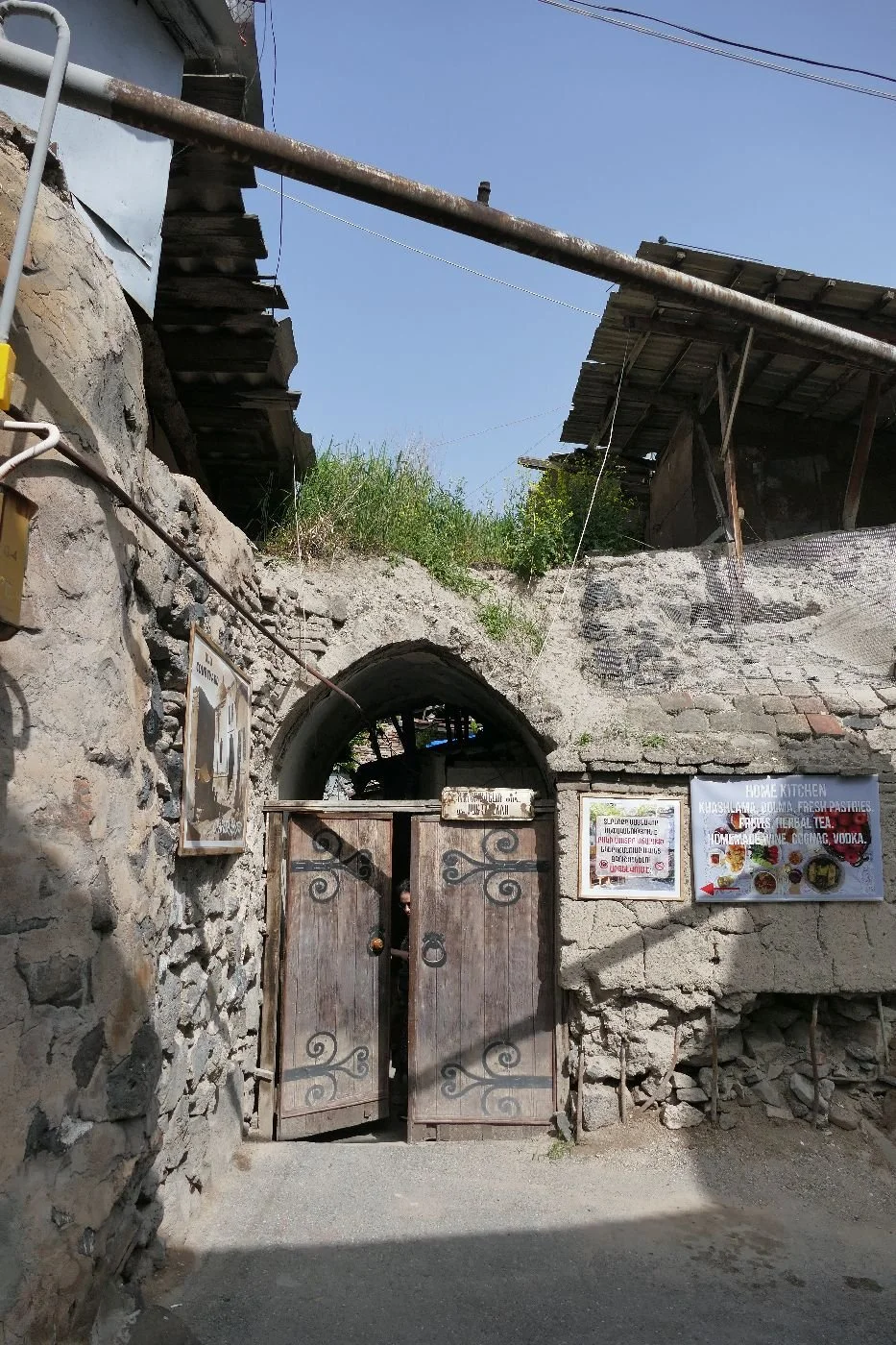
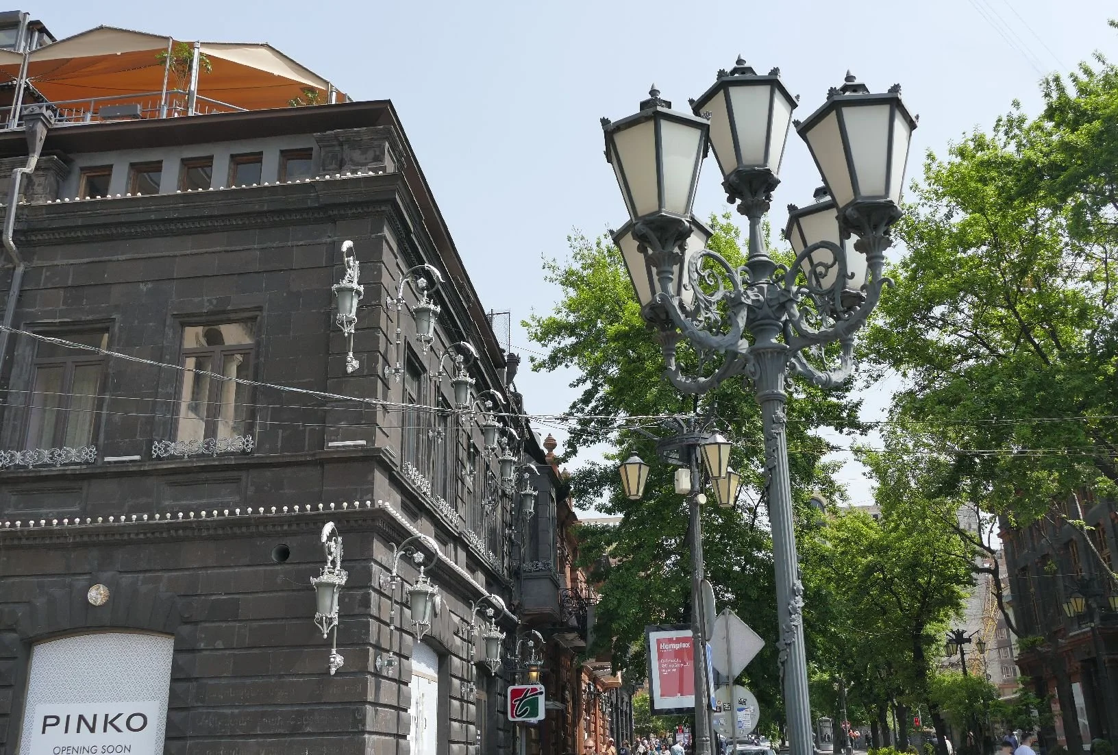
Below: glimpses of Yerevan’s old town, based on its 17th C layout but with adaptions to accept modern amenities such as electricity and gas.


19th century and enter the British: Britain, France and the Ottoman Turks fight Russia in Crimea. Post war, Britain worries about Russian disruption of trade routes; control of Armenia is key.
Turkish and Russian dominance shuttles back and forth. Britain agrees to support Turkey in exchange for Cyprus and improved conditions for Armenian Christians. Britain gets Cyprus but drops Armenia like a hot brick. Thousands of Armenians emigrate.
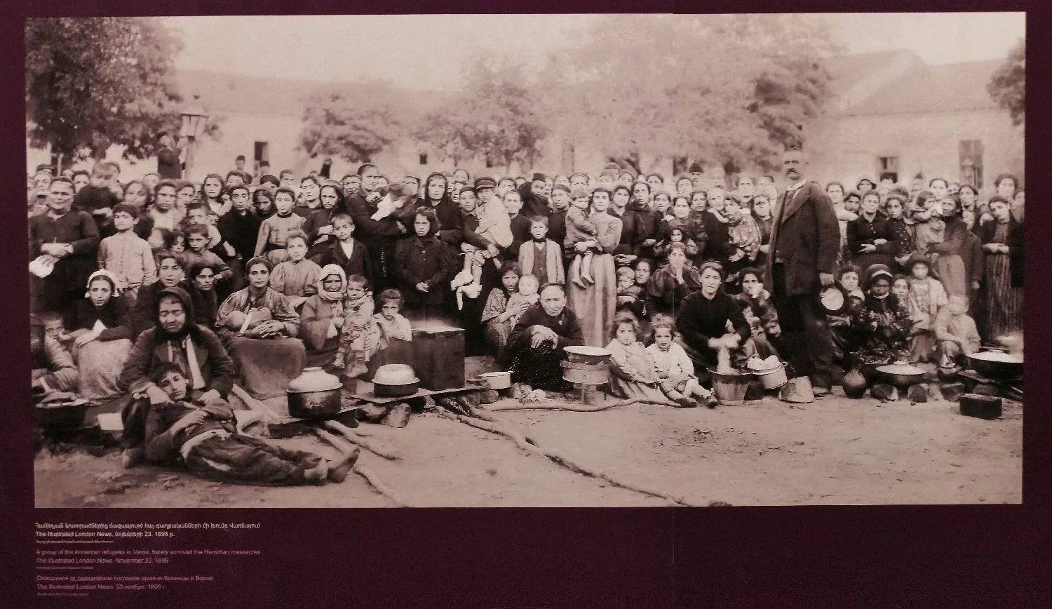
Armenian Refugees 1896 Genocide Museum
WWI and Genocide: a weakened Ottoman Empire enters WWI on the side of the Germans. Russia and diaspora Armenians defeat the Ottomans who retaliate by demobilising the local Armenian troops and massacring them.
There follows an organised mass extermination of around 1.5 million local Armenians in what became the first genocide of the 20th century. It was recognised as such by the European Parliament in 1987 but, post Brexit, Britain has yet to recognise these 1915/16 atrocities as genocide.
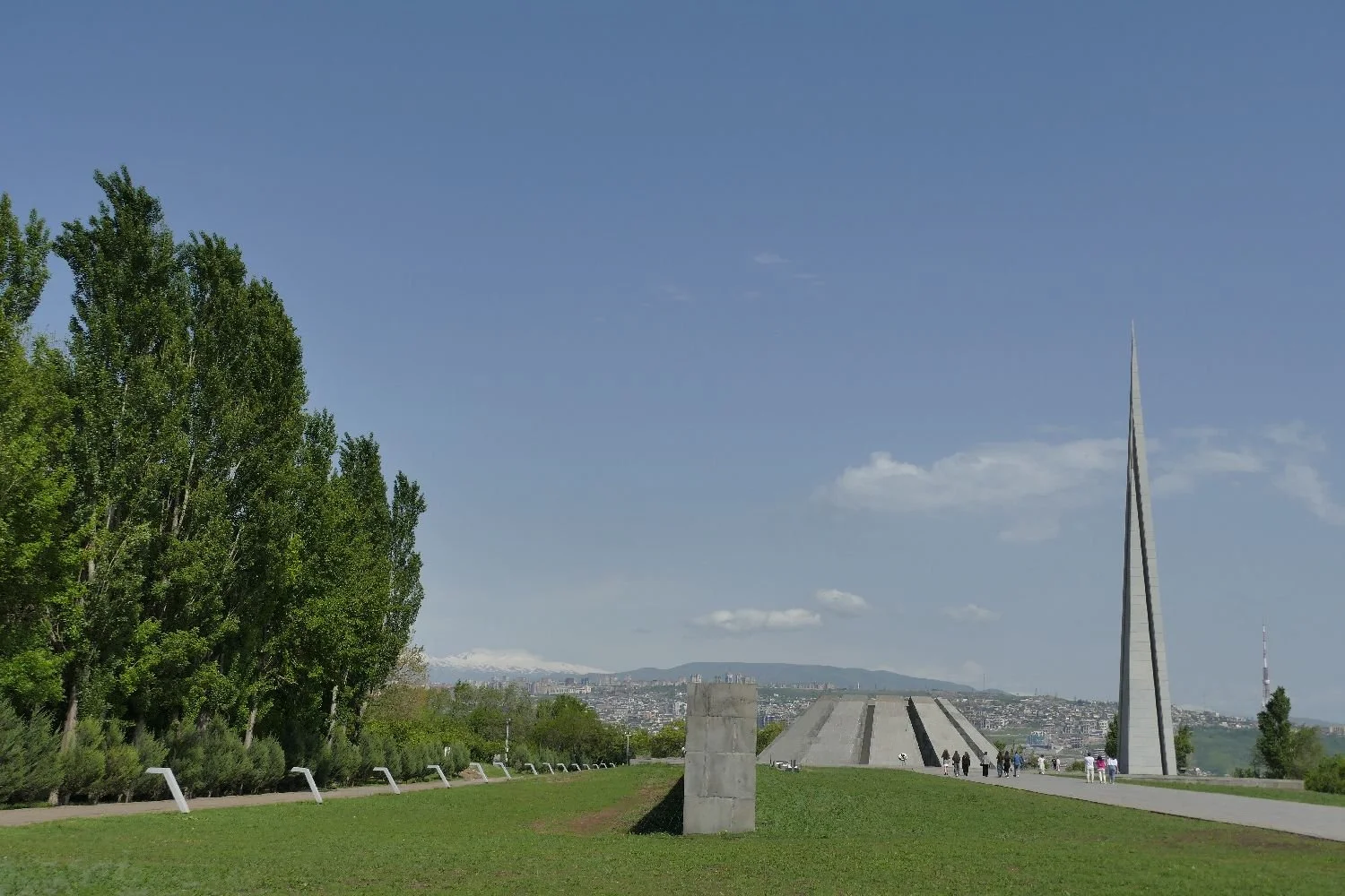
Right: The Genocide Memorial In Yerevan
Below: images from the Genocide Museum


1917/1918: Russia tries, unsuccessfully, to unite Armenia, Georgia and Azerbaijan. After many Turkish and Russian attacks, the first Republic of Armenia is established in May 1918. The territories of Nagorno Karabagh and Nakhichevan (an exclave of Azerbaijan) are included for about a week.
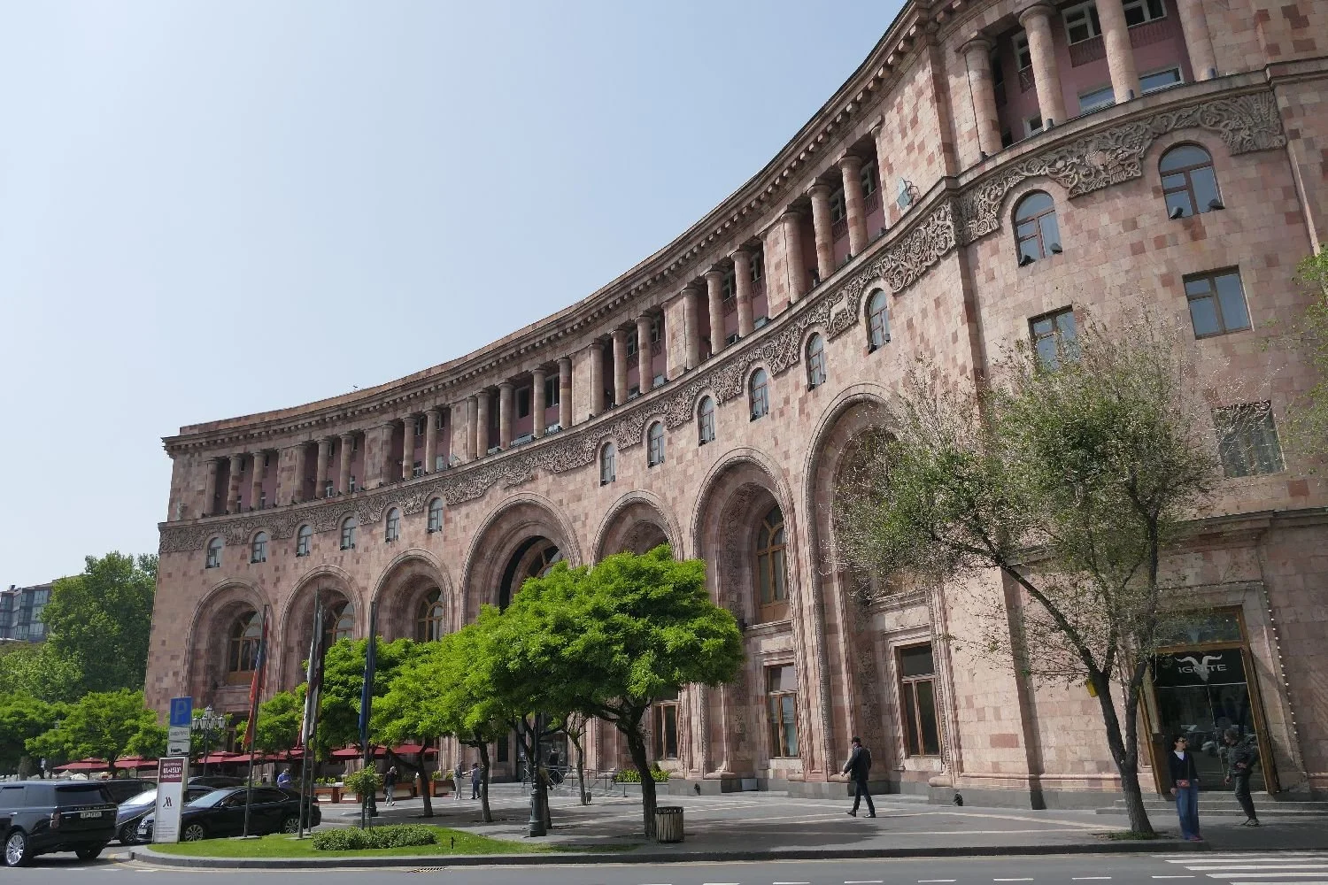
Early 1920s: resurgence of intellectual and cultural life. Soviet architecture and town planning is established including the construction of Yerevan’s Republic Square (images below) and the State University. Private enterprise, churches and ordinary people were not so lucky.
1920: there is much scrapping over borders and political control, but Armenia is finally incorporated into the Transcaucasian Soviet Federated Socialist Republic in the November.


Above: Yerevan’s Republic Square. Architect Alexander Tamanyan - ‘among the finest of all Soviet ensembles’ (Bradt Guide)


Above: the green side of Soviet town planning
Below: the pink, the tuff and the ugly. Yerevan building stone is volcanic tuff and the city is famous for its pink and pinky-orange buildings. A few black basalt (also volcanic) buildings also creep in but for the everyday block of Soviet flats? Concrete of course.


WWII: Germany is distracted by the oilfields of Azerbaijan but around 630,000 Armenian soldiers fight for the Soviet Union with only half returning.


Above: Victory Park in Yerevan. Joeseph Stalin was the subject of the original statue but he was replaced in 1962 by this powerful rendering of Mother Armenia. Despite Stalin’s exit it was not thought appropriate to display an orthodox cross with his replacement; the position of Mother Armenia’s sword is, therefore, doubly symbolic for the people of Armenia.
Post war: Armenian nationalism is discouraged by the usual Soviet responses (secret police, Siberia etc). Relationships between Armenia and Azerbaijan become deeply inflamed over Nagorno Karabagh. Moscow imposes direct rule in 1989 and Azerbaijan closes its borders with Armenia.
1990 brings the third Republic: elections are won by the Armenian National Movement, Levon Ter-Petrosyan becomes president, Armenia secedes from the Soviet Union and in 1991, votes for independence - but also signs a mutual assistance treaty with Russia and others. Internal and external struggles continue with violence, corruption, political shenanigans and unfeasibly high turnouts at polling booths.
2018 and the Velvet Revolution: although 2009 negotiations with Turkey fail to reopen the border, internal desires for a better, fairer, less violent and more honest political system begin to grow, culminating in the elections of May 2018, later described as the bloodless or Velvet Revolution.
So there you have it: an illustrated history of Armenia in around 600 words compared with the Bradt Guidebook’s encyclopedic offering of around 3,700 words. Whichever you read, it still sounds complex.
Armenia today - in numbers:
Corruption Perception Index (https://www.transparency.org)
(O=terrible, 100=’clean’)
In 2018, Armenia scored 35. Just six years later, in 2024, Armenia scored 47 (the score peaked in 1920/21 at 49). Armenia ranks 58 out of 180 countries on the index. In comparison:
Denmark scores 90 and is top of the leader board
UK scores 71 (down from 82 in 2017) and ranks 11th
South Sudan ranks 180 out of 180 and has recently slipped 5 points to a score of 8 in 2024.
Gross Domestic Product (https://www.worldometers.info/)
Country Ranking Total GDP Per capita GDP
Armenia 112th $24.086 billion $8,183
Azerbaijan 82nd $72.356 billion $7,012
Turkey 18th $1.118 trillion $12,814
UK 6th $3.381 trillion $49,224
Armenia today - in pictures:
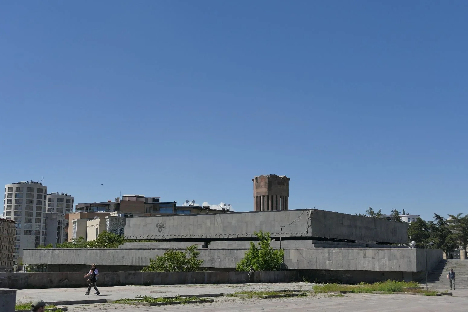
In many ways, modern Armenia suffers the same ills as much of the globe. Yeravan’s Cascade is a classic example of the problems of building a future out of the past.
The cascade was commenced during the soviet era as a limestone stairway/waterfall linking the hilltop monument (constructed to celebrate 50 years of Soviet rule) to downtown Yerevan at the bottom. Building was started in the 1980s but has been very stop/go ever since.

A post-Soviet injection of diaspora money (from the Cafesjian Family Foundation) has moved things on significantly and the Cafesjian Centre for the Arts opened in 2009. It’s a glorious spot, with the Tamyanman sculpture Park at the bottom (right and below). And escalators to help you up (except on Bank Holidays!).
Below: the sculpture Park at the bottom of the cascade


On the way up:


And at the top - just a tad more required to finish it off!


We’ll be back soon to explore more key words, but after that climb (yes, we went up on a bank holiday) its definitely time for an Armenian coffee and one of cosmopolitan Yerevan’s little treats.

Where Do You Think We Are?
This is a great season for travelling, partiularly if you are not tied to school or uni holidays. Terroir is making the most of this spring adventure period, and so we are setting you a puzzle - to identify which country we have recently visited and which may feature in a future blog. Answers by email (see contacts) or in the comments box below. Will there be a prize? Who knows…


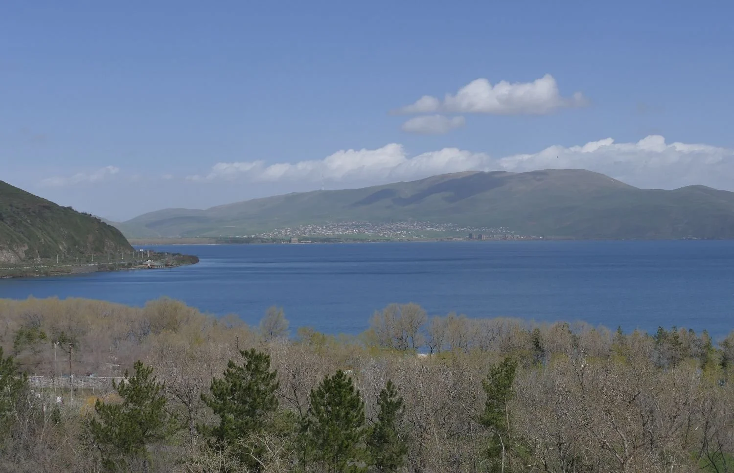


One final clue: no seaside holidays here.

Sunshine and Shadows
Eileen Lucy Garwood was born in 1908, the third of five child born to Ella and Frederick Garwood. Like many women, she had a variety of names and there are many reasons why you may not immediately recognise her. Her nickname was Tirzah, possibly a reference to Tirzah in the Book of Numbers in the Bible, and/or from her grandmother’s reference to "Little Tertia" ie the third child (https://en.wikipedia.org/wiki/Tirzah_Garwood). Later in life she became Mrs Swanzy, but before that she married the artist Eric Ravilious. You may well have heard of him.
This first marriage seems to have been a period full of sunshine and shadows. Tirzah was an artist in her own right but, as with many female artists, Garwood’s career was overshadowed by that of her husband’s. The Dulwich Picture Gallery is currently showing what is billed as ‘the first major exhibition of her work’, an event which, we feel, is long overdue. ‘Tirzah Garwood: Beyond Ravilious’ is open until 26th May and, in Terroir’s opinion, is definitely worth a visit - despite the number of Ravilious’ pictures also on show.

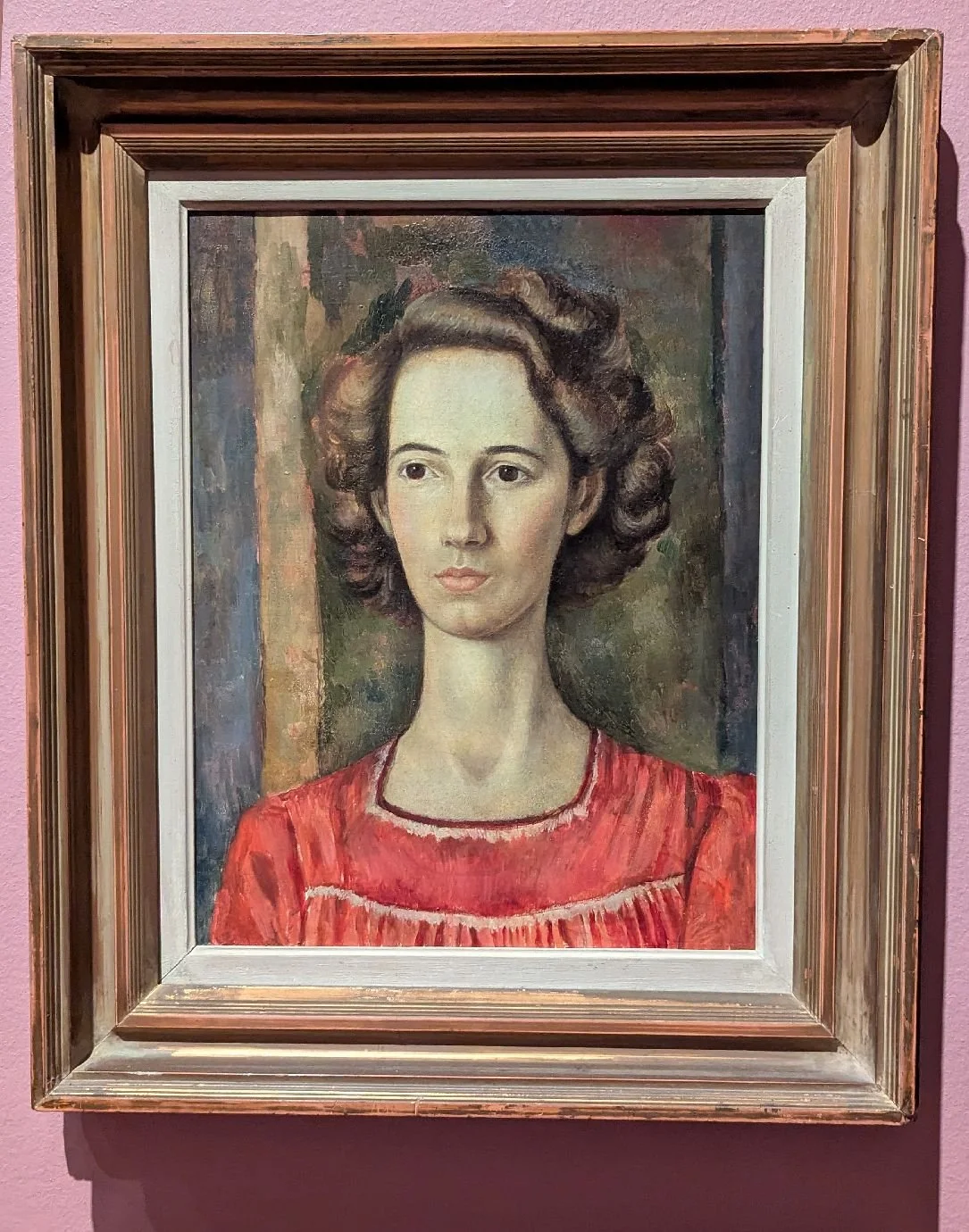
Tirzah Garwood (above left) and Eric Ravilious (above right): Phyllis Dodd
Tirzah was born in Kent. Her father, was Lieutenant Colonel S F Garwood (Royal Engineers), and to some extent her childhood was a military classic, moving on from one posting to another. There doesn’t seem to have been much glamour in this however: “[Tirzah] and her family accompanied her father on army postings to [wait for it] Croydon, Littlehampton and then Eastbourne” or “Glasgow, Lyndhurst, Croydon and Littlehampton”, depending which website you read. All the effort, one suspects, but none of the romance. https://en.wikipedia.org/wiki/Tirzah_Garwood / https://flashbak.com/tirzah-garwood-a-very-british-vision-of-marriage-lovers-and-work-464951/

Settled in Eastbourne, Tirzah attended secondary school (Wiki suggests West Hill School but the link takes you to a boys school in Stalybridge, Manchester!) and then, in 1925 (Wiki), or 1920 (flashbak website – surely a misprint) to Eastbourne School of Art.
Enter Ravilious who taught her wood engraving – with great success it must be said. Unfortunately, “Tirzah’s parents thought her subject matter hideous. She stated in her autobiography: ‘They thought Mr Ravilious was perverting a nice girl who used to draw fairies and flowers into a stranger who rounded on them and did drawings that were only too clearly caricatures of themselves’”. (flashbak website, quoting Grawood). Certainly, Ravilious’s background was considered to be of a lower social status than that of the Garwoods. If these ‘scurilous’ engravings or drawings still exist, there is no evidence for them in the exhibition.


Tirzah married Ravilious in 1930. They lived in London (Hammersmith) for a couple of years, then moved to Great Bardfield, in Essex, and became part of the Great Bardfield Artists community. It appears that Tirzah’s main role at this time was helping to run an enormous house – cooking, cleaning, entertaining and so on - although it was this period which, with the support of Charlotte Bawdon, saw her develop beautiful marbled papers (often to be made into lampshades!), technically brilliant and inspired by many organic and plant forms.


Later, in a search for a house of their own, Tirzah and Eric moved to nearby Castle Hedingham where their three children were born and raised and where they also played a full - and time consuming - part in village life.
As a woman, art had to take a back seat at this time, something she said she always regretted. The Wiki entry for the Great Bardon Artists is a classic reflection of the period: “The principal artists who lived there between 1930 and 1970 were … Eric Ravilious … [+ 10 other names]. Other artists associated with the group include … Tirzah Garwood [+ 6 other names]”.
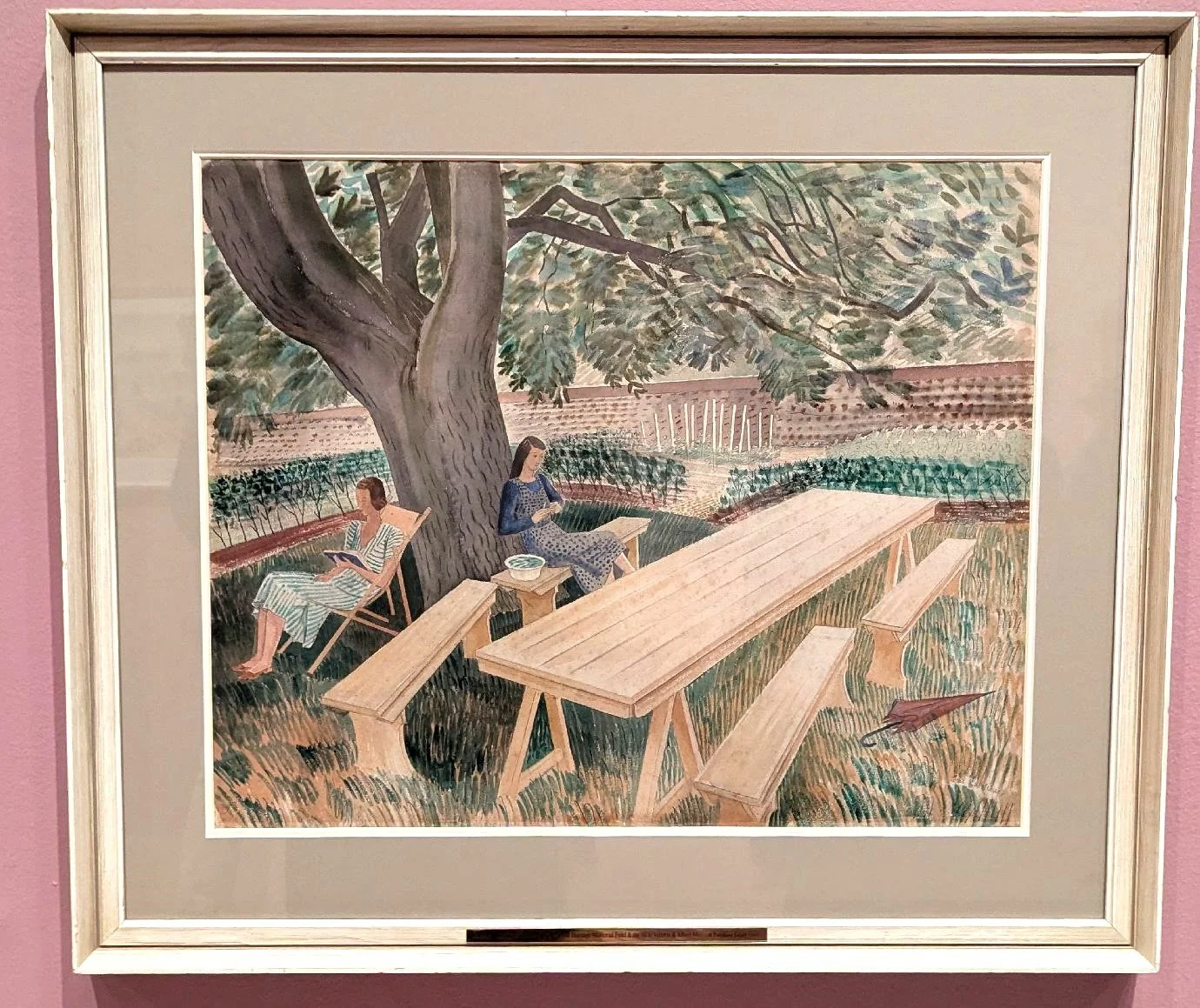

Above: two contrasting interpretations of life in Great Bardfield - left is Ravilious’s view of Tirzah and Charlotte Bawden relaxing in the garden; right is Tirzah’s much more vigourous and hard working portrayal, a beautifully designed and stitched representation of a wonderful, but time consuming, productive garden. Every vegetable is clearly identifiable and instantly capable of producing a bad attack of kitchen garden envy.
It seems that these pre-war years became increasingly complicated with another house move and various affairs on both sides. But WWII saw many changes: in 1941 Tirzah began her battle with cancer and, in 1942, Eric (now an official war artist) was posted ‘missing – presumed dead’, while involved in a flying mission off Iceland. By 1944, Tirzah had a written her biography, moved the family home again – and started painting.

Garwood seems to have been inspired by her environment, her personal landscape, her terroir. Her subject matter comes from gardens, agricultural landscapes, stately homes, village scenes, wild and cultivated flowers and her children and their toys. Even the view point and scale of her painting seems to be influenced by a child’s view of the world.
Her palette included wood cuts, oil painting, collages and models. Many of her works reflect an eerie, unsettling atmosphere, which make her legacy the more memorable – and disturbing.
Below: the images of Essex countryside and farming are fascinating and, we suggest, the changes in scale and dominance of certain items are troubling, yet also evocative of childhood simplicity and optimism. Do feel free to disagree!


The exhibition curator uses the word ‘surreal’ for some of Garwood’s children related work; we don’t disagree!


In her gentler moments, Garwood used oils and collage to represent more homely and domenstic village street-scapes:


The works illustrated above represent just a tiny selection from this excellent exhibition which is also a celebration of a female artist stepping out of the shadows.
In 1946, Tirzah Garwood married Henry Swanzy, a BBC General Overseas Service radio producer and moved to London. The cancer returned but she continued to paint, moving to a nursing home in Colchester where she died in 1951.
So, we leave you with one final but unfinished work: a vision of Mrs Noah and the steam locomotive ‘Nero’. This is a Tirzah Garwood classic, and one which she was working on just a few days before she died. The words of Henry Swanzy and the exhibition curator make a very fitting epitaph:


The Box Hill Work Out
When a friend was planning a hiking trip in Nepal, his fitness training involved trekking up and down Box Hill, in Surrey. With a somewhat lower altitude and less onerous trip in prospect, one of us decided to try the same technique.
A training walk up Box Hill on a sunny day in the Easter school holidays is not as straightforward as you might think. For starters, although one of us was walking alone (the other one was elsewhere on the Hill, with the decent camera, recording butterflies) and with only a camera phone, the temptation to stop and take photographs was still irresistible. And just because you don’t have to inspect every inch of the terrain for butterflies, there are plenty of other distractions to look at, such as plants, birds, views and all of landscape’s little idiosyncrasies. Nothing ruins an attempt at a Strava record more than an interest in one’s environment.
My other worry was overcrowding. How many others would also be ambling/walking/climbing/ running up or down the Hill? The answer was not as many as I feared, but plenty enough for some very enjoyable sociable chit-chat: greetings to be exchanged, different route options to be discussed, offers or requests to take photographs and commiserations when children were too slow or too fast. It was holiday time and no-one wanted to be grumpy.
So here is my diary of a sunny day out in one of Surrey’s MAJOR beauty spots. We start at the bottom of the hill.

If you studied geography at school, you may well have heard of, or even taken a field trip to, the Mole Gap. Not a dental problem but a picturesque cutting through the chalk of the North Downs, the Gap was created by the river Mole as it flows from its source (now unromantically described as ‘near Gatwick Airport’) to its confluence with the Thames close to Hampton Court (a much classier location).
Image above right: the arrow shows the approximate position of the Mole Gap within the folds of the North Downs
Box Hill forms the eastern side of the gap and, if you want to climb the shortest but steepest route to the top, you must also effect a crossing of the River Mole where it flows sandwiched between the A24 and the chalk flank of the Hill.
Want to get the kids involved? Tell them about the stepping stones, first recorded in 1841 and still an extremely popular way to cross. Want to get the less adventurous involved? Tell them about the much more recent bridge built nearby. The bridge becomes extremely popular when the river rises and the stones disappear under water.


On Maundy Thursday, the stones were high and mostly dry, but seemed to have got further apart since the days when one of us could cross with a hop, skip and a jump. Galling to be outclassed by a 7 year old with much shorter legs.
In this dry spring, the area close to the stepping stones and the path to the bridge is bare earth, beaten hard by the passage of feet, but vegetation closes in as the path begins to rise slowly but surely away from the river bank. A strong, almost tangible fragrance hits the nose a fraction before the eyes identify the dense ground cover of wild garlic.


- The path begins to tackle the incline, curving and climbing to reveal – oh no - steps!! For one of us, this is the hardest form of scaling a hillside. These steps are robust and unforgiving, essential if they are to survive the footfall and changing weather conditions, but a relentless challenge for the climber! Delighted to report that not a single step was bypassed in the making of this blog.


Thankfully management of the scrub and young woodland which is colonising this west facing chalk slope provides sufficient excuses to stop and admire.


But also gives us an ecology lesson in both colonisation – bramble (below left) and blackthorn (centre) - and the much, much older specimens of the classic yew groves of the chalk downlands (below right).


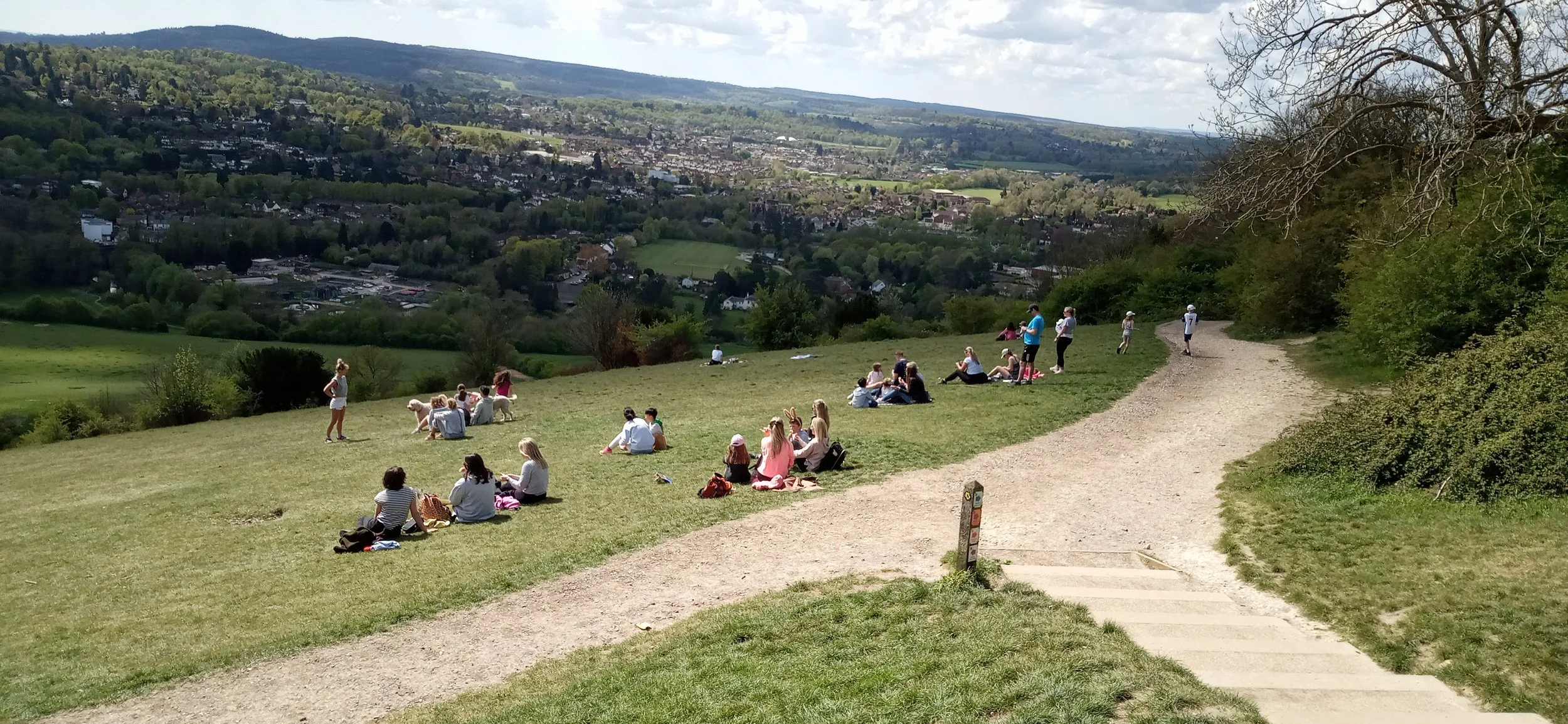
Suddenly, as one of us rounds a corner, the world opens up into an expanse of chalk grassland. How did that happen so quickly? This is nearly the top of the climb! Above lies the famous viewpoint with its panorama of the Weald, the South Downs and the town of Dorking (at the southern end of the Mole Gap). Strava records an elevation gain of a mere 204 m (c 670’). It’s time to saunter up that last slope and turn into tourist. I don’t think that climb has done much for my fitness training.


Where’s the cafe?

Science, Art or Crusade?
No, let’s step back a bit before we answer that question.
Terroir had heard good things about the exhibition entitled ‘Soil’ at London’s Somerset House. As much as anything, we were intrigued to know how such a display would be mounted and what story it would tell. Everyone else we mentioned it to seemed more surprised by the topic, than intrigued, and few seemed enthusiastic to attend. https://www.somersethouse.org.uk/whats-on/soil
Perhaps they were right, because both finding the ticket desk and navigating the exhibition was a bit of a challenge. By the time this blog is posted, the exhibition will be open for only three more days so here are some time-saving tips for a last minute visit. First of all, read the website (we didn’t) and enter Somerset House by the Embankment entrance, not from the Strand. This will save you having to traipse across the internal courtyard, although that also means you will miss the lines of intriguing fabrics, billowing in the quad’s breezy micro-climate (more of that in a future blog, we hope). Even if entering from Embankment you may still need to enquire as to the location of the ticket desk as it is in the basement (sorry, at lower ground floor level), presumably surrounded by subsoil.

So you have your tickets and are directed to the exhibition portal (‘door’ seemed too ordinary a description) to start your exploration of ‘Soil’. Again, if we had read the website, we would have known that “This exhibition has low level lighting”. We would not have known, however, that this exhibition can also be ‘Quite difficult to navigate’ in other ways as well!
For example, questions such as ‘am I allowed in there?’, ‘where do I go next?’ and ‘is that space private or part of the exhibition’ may also need to be answered. Perhaps all this is part of the mystery of ‘Soil’. Alternatively, it may be due to a lack of helpful signage or to mounting an exhibition in a very awkward space - you decide. You may also have better eyesight than us or just be generally more appreciative of, or sympathetic to, confusing layouts!
The first thing you see on entering the magic land of ‘Soil’ is a short definition of what ‘soil’ actually is, in a physical/chemical/biological sense. To one of us (who had studied soils twice during a total of four years in academe), it was very familiar and rather a let-down. One of us had come to the exhibition to be intrigued, enlightened and inspired, not read a first year undergraduate introduction to the definition of soil. And I don’t think one of us was being over-picky. The first thing you should see or read in any exhibition, book or article should be the ‘hook’ or the thing that will draw you in and excite you to delve further.

The second thing you see does not, in our view, do much better (right and below)! Sure, this ‘Look Down’ message is very important but does it sound a tad condescending to you? Again, it failed to hook one of us in. If you paid £18.50 for a ticket (£15.00 concessions/Child 6-11 £10.00) then I suggest that this ‘public-open-space-interpretation-board’ style of writing could be viewed as, hmm, slightly pedestrian (excuse the pun), considering what comes next. Is this blogger ever satisfied?


But what does come next? Science, art and, finally, the ‘hook’ is what comes next. Let the magic begin!
Diversity of Forms 2020 – Photographic Images of bacterial growth on agar plates Dr Tim Cockerill in collaboration with Dr Elze Hesse
“Bacteria taken from a combination of metal-contaminated soils in Cornwall and ordinary potting compost” Exhibition catalogue.
Of course, our inner scientist wanted to know what these bacteria might have looked like without the contamination. Yeah, yeah, some of us are never satisfied! And, ironically we had to ‘look’ up to get a better view of this particular exhibit. Crane your necks, kids!
The first big thrill for us was a couple of time lapse videos, one of activity within a soil and the other of a Fly Agaric toadstool dispersing spores. We have only reproduced still images here but, believe us, these were mesmerising.


Moving on (somewhat relucantly) we suspect that the images below will be especially attractive for children …


… although we will never again look at our favourite teddy bear (left) in quite the same light.
Frances Bourély - electron microscope images of soil flora
For art, beauty and interaction with soil and nature try these:


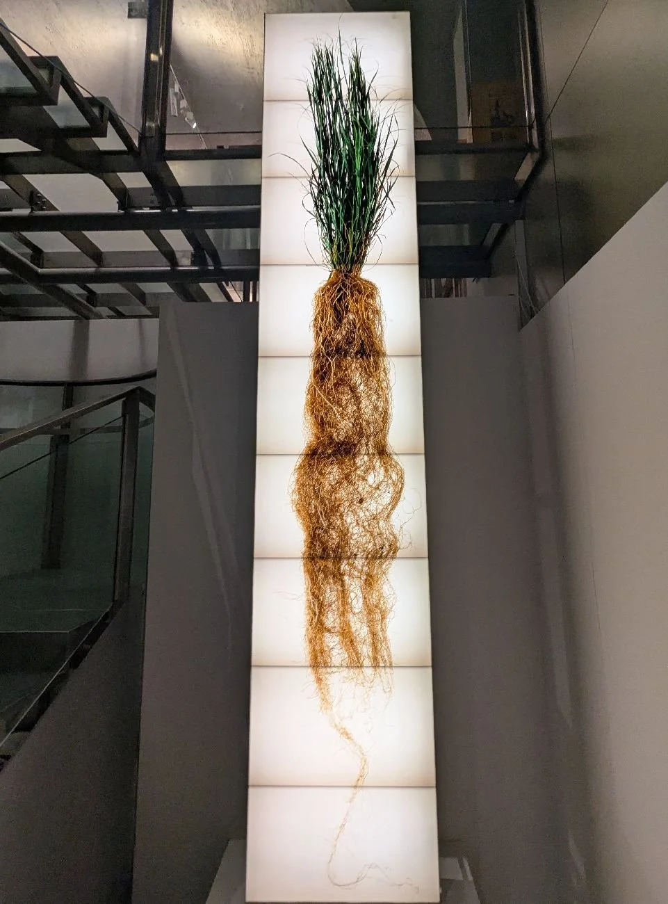
And now to roots music: Blue Stem - Jim Richardson
“The vast majority of prairie grass plants exist underground, out of our site. Growing downwards, up to four metres, they contribute to soil health and biodiversity, preventing erosion and storing carbon.” Exhibition catalogue
We forgot to include history and pre-history in our blog title. The role of soil in archaeology is, of course, crucial, but is something we tend to forget.


Above left: Joana Hadjithomas and Khalil Joreige - Trilogies: Monastiraki Athens, “the material imprint left by both human actions and natural events can produce varying historical narratives while acting as scientific markers of time” Exhibition catalogue.
Above centre and right: Cambridge Archeaological Unit - Iron Age Sword. Excavated from the fens, this armament was perfectly preserved in waterlogged silt. Yes, that wooden grip is original.
For an ecological ‘wilderness’ challenge we were intrigued by Mike Perry’s ‘Reverse Sod Swap’, pictured below.


In 1983, artist David Nash swapped a circle of pristine London lawn (containing just three species) for a circle of rough turf from North Wales with 27 species. In 2004, Mike Perry reversed the process (pictured above) using ‘wilded’ turf from Springfield Park in Hackney for a piece of sheep-grazed turf from West Wales. The species count was very revealing: 39 species in the urban turf and only four in the rural turf. Mike Perry: “I wanted to challenge the idea of ‘wildness’ as something only found in the countryside, when in fact our rural environments are fast becoming worn-out industrial landscapes”. Exhibition Catalogue.
Have you ever looked out of an aircraft window onto a semi arid landscape and noticed the circular patterns of the irrigation system below? That was a tough sentence to type, encapsulating as it does the need to be in an aircraft and the possible soil and water degradation which creates this 21st century ‘land art’ vision.
All this flashed through our minds as we caught site of Asunción Molinos Gordo’s work ‘Ghost Agriculture’ hanging on a far wall. “The geometry of the Nile valley discloses an encrypted dispute over natural, human and economic resources. … a crochet of thousands of small rectangular plots of land, none bigger than 100 square metres and each irrigated by renewable Nile water [producing] food to supply national demand. … Zooming out into the desert large circles appear … irrigated with non-renewable fossil water … [producing] commodities for export”. This dichotomy is superbly illustrated by the patchworks illustrated below. They are embroidered on Egyptian cotton: we hope this is a local, home grown fabric, not a product of the larger, private company/government combos on the desert plots.


Our final offering from this extraordinary exhibition is perhaps one of the most poignant. Annalee Davis’s ‘Saccharum officinarum and Queen Anne’s Lace’ portrays the plantation life of enslaved people in Barbados: the men tending the sugar cane and the women “rulers of the domestic space” creating embroidery and crockery for the home.
The art work is created on a plantation paylist document, symbolising the men’s role in the ‘capitalist machinery’ of the plantation and represented by the faceless rigid lines and columns. The role of the women is illustarted with ‘meandering crochet’ which interupts the document’s symetry and represents the ‘unpaid labour, knowledge and cultural inheritance’ of the women. Whichever way you read it, it is a a deeply moving comment on the impact of plantations and enslavement and the soils which supported this economy.


So, from grumpy ‘where is this exhibition’ to unexpected appreciation of a stimulating, varied and disturbing set of presentations. Science, Art or Crusade? Yes to all, if you are willing to look for it.
We hope you have already seen ‘Soil’ or can go before the show closes. Let us know what you think. We have had to miss out so many of the exhibits and we hope you disagree with us on many things. if nothing else, this exhibition should stimulate debate.

Grow Your Own
Some 30 odd years ago one of us had an argument with a lawyer on whether allotments were part of the urban or rural landscape. We agreed to differ (she said they were rural features, but then she would as she was on the opposing team to us at a public enquiry!). What’s your view? What is the visual impact of growing your own vegetables? Are they urban or rural? Are they a thing of beauty, a functional necessity, an eccentricity, or downright unattractive?

Let’s start by looking at the domestic garden. Whether urban or rural, people with gardens seldom grow vegetables in the space at the front of the house. For some reason we typically relegate the vegetable patch to the very end of the back garden. Are we ashamed of publicly exposing our meagre bean crop? Do we consider vegetables to be too ugly or too workaday to adorn the front of our houses?
Or perhaps more practically, are we concerned that our crops will be ‘scrumped’ by a passer-by or polluted by car fumes? A typical streetscape, whether in town or country, tends to be an entirely vegetable-free zone (image above).

Allotments, on the other hand, are quite a public way to grow your own vegetables and, in Terroir’s view, allotment sites are an integral part of the residential scene. Many of us want to be able to walk to our allotments, although car access is handy when there are builders’ bags of well-rotted horse manure or spent mushroom compost to be imported. So, yes, surely allotments are basically an urban or at least a residential phenomenon.
But what do allotments bring to the urban landscape? We suspect the concept of beauty in the eye of the beholder is relevant here. Take energy generation for example: many of us like the majestic size and graceful form of a wind turbine. For Terroir, this engineering-based design is further improved by the knowledge that it is helping to keep the lights on without using fossil fuel. But others regard these structures as the work of the devil, destroying our fabulous land and seascapes. [NB - remember that the appearance of our rural landscapes has been fashioned by centuries of growing food – meat, grain and, yes, vegetables]. There is, however, considerable opposition to wind farms, with considerable support, one suspects, from local Nimfy (Not In My Front Yard) groups.

Yet, the humble allotment - low key, higgledy-piggledy, messy, apparently disorganised, hippy and alternative - goes uncriticised in the tidiest of suburban loctions. Protests are more likely to be aimed at the length of the allotment waiting list, than what they look like. Scale (small) helps of course but let’s be honest, few would compliment allotment sites on their visual or architectural merit. What we love is what they represent - a low cost, local amenity which enables all (flat dweller and garden owner alike) to get outside and ‘grow their own’.
The benefits are wide ranging: healthy physical exercise, stress/anxiety busting activity, healthy food – spuds, raspberries, greens, whatever you like - straight from plot to pot or bowl; maybe a few chickens, maybe a few eggs, maybe a few chats with the neighbours, maybe a few swops – that gooseberry glut for a box of strawberries - or simply the delight of getting your hands in the soil and watching plants grow (or getting eaten by the wildlife).


Ay – there’s the rub. To achieve all of the above, we need to protect our crops from the competition - deer, slugs, caterpillars, pigeons. How to do this without wrecking the wildlife which we also enjoy (such as butterflies and wild flowers) but all of which, directly or indirectly, are also our competitors, just dressed in pretty clothing for at least part of the year?
Some allotment holders have dedicated wild flower areas but all have to indulge in physical crop protection. As this blog is about visual amenity, however, we won’t mention the few allotment holders who just might be using invisible chemical weapons.
No two allotments are alike. Some allotmenteers spend a lot of time, design and dosh on their plots. Raised beds, stout but attractive fencing, proper compost bins, substantial poly tunnels, enviable fruit cages and mown paths can all be seen somewhere on most allotment sites. Some holders, concerned with productivity, will use expanses of shiny black or blue sheet mulches. Many of us come at it from a somewhat hippie angle, using recycled material (some would say ‘junk’), making the plot look more like an adventure playground than a serious horticultural enterprise. It is this variety which is both the charm of the allotment site and it’s downfall in terms of visual appeal. But it’s small scale and if it’s not your thing, you don’t have to visit. It won’t wreck you local environment.


Here follows Terroir’s take on the visual amenity value of four allotment sites in two locations. Three are located in the same Surrey Victorian railway town and one is in Sheffield. All sites were still fields into the early part of the 20th century but had been becoming increasingly ‘urban fringe’ from the 1890s onwards. All were converted to allotments in the 1920s or very early 1930s.
Site 1 Quirky
There’s some productive growing happening here but also signs of a definite sense of humour.


Site 2 Serious
Some heavyweight gardening going on at this site - and its not all about growing veg.


Site 3 Old Playing Field
Who knew we were here?


4 The Cutler
The views are so much better in Yorkshire. Well, mostly.


We suggest that few would call these landsapes ‘sublime’ in the sense usually applied to gardens, or national and heritage landscapes. Their beauty and value lies in what they represent: a productive, social, inclusive, and health-giving community landscape.
Allotments are also significant due to their origins, and their fascinating, important, and political social history. You could write a book about them. Indeed some people already have. My current favourite (entitled simply ‘Allotments’ is a slim and well-illustrated volume by the aptly named Twigs Way, a garden historian, writer and lecturer. The allotment as social engineering? Yes, it’s a very chequered history indeed!

Camberwell Quilting
Our previous blog likened Burgess Park to an embroidered bed spread, covering the remains of a pre-war community with a new green quilt. Did we sound a little underwhelmed, perhaps a touch unexcited by what we saw on a chilly February day? Well, maybe we did.
So we are making a brief return visit to Camberwell, to explore three gems which decorate the edges of our quilt and which have been retained within the hemline of the Park. As with other historic items such as the Bridge to Nowhere and the lime kiln (briefly featured in the preceding blog), today’s jewels represent fascinating fragments of the former landscape: delightful, curious, but frustrating in their disconnection from both the park and the modern cityscape which surrounds it.
Addington Square
Addington Square lies at the western extremity of Burgess Park and is intimately linked with the construction of the Grand Surrey Canal (from ‘inland’ Surrey to the Surrey Docks and the Thames) in the first decade of the 19th century.
Wikipedia (https://en.wikipedia.org/wiki/Addington_Square) tells us that one Nathaniel Simmons “the engineer to the Grand Surrey Canal Company” owned the first house in the Square. Terroir has yet to find any other mention of Mr Simmons but a square of handsome Georgian houses was certainly built close to the canal at about this time.
Wikipedia again: “The 1851 census shows 32 houses with 179 residents and 33 servants, an occupancy rate of 6.2 persons per house.” And, we calculate, a ratio of 1 servant to 5.4 ‘residents’. We assume the servants were also resident, but not classified as such.
Some diversification followed, with smaller terraced houses and workshops (below) but the Georgian cohesion remained.


Today, the remnants of this classic Georgian square and its surrounding terraces seem rather surprised to be sitting between the park and a very assorted collection of later urban development, on and around the Camberwell Road.


The serenity of this handsome oasis is undeniable, however, despite the cars and the litter bins, and it is a popular stopping off place for rest, relaxation and a coffee from the nearby café.


Chumleigh Gardens
Chumleigh Gardens is equally elegant and unexpected. Contemporaneous with activity in Addington Square, the buildings associated with the Gardens were built in the first half of the 19th century but for the benefit of a very different section of society. In 1802 a Female Friendly Society had been founded ‘by and for women, operating “by love, kindness, and absence of humbug”. It gave small grants to “poor, aged women of good character”.’ (https://bridgetonowhere.friendsofburgesspark.org.uk/the-story-of-burgess-park-heritage-trail/heritage-trail-a-l/chumleigh-gardens/).

By 1821 the Society was building almshouses on the south side of Albany Road - an area which is now on the northern edge of Burgess Park. The operation expanded again in the 1840s, but the buildings were damaged during WWII bombing raids.

Thankfully, these structures were not demolished post-war but it took until the mid-1990s for this heritage to find a new purpose within the Park. The buildings have now been restored and the grounds re-created as a multi-cultural garden designed to celebrate Camberwell’s diversity. They include a memorial to local hero Keib Thomas (image left), a Welshman turned south Londoner, who campaigned for ethnic & inter-faith harmony, justice and equality.

A winter visit to Chumleigh Gardens is not a waste of time. The Gardens have been designed to represent diversity through spaces celebrating different local communities, using plants from around the world. Hope for a better future is epitomised, in February, by blossom and catkins …


... while the quirky café provides a haven for tired feet, succour for mind and body, and retail therapy.
Glengall Wharf Garden

This community garden just exudes fun, exhilaration and horticultural angst! Some might call it alternative mayhem, but for others, that is part of its attraction.
We’re back on the Surrey Canal. Glengall Wharf is technically in Peckham (London Borough of Lewisham), but from our perspective, it is at the very eastern end of the Burgess Park green space. The Wharf was built on the junction of the main Surrey Canal and the Peckham Branch which opened in 1826. The junction was wide enough for the timber barges to turn down the branch line to the many timber yards which lined the route (https://bridgetonowhere.friendsofburgesspark.org.uk/the-story-of-burgess-park-heritage-trail/heritage-trail-a-l/glengall-wharf/).
By the 1890s, the Edison Bell company opened a factory to the north of the junction but ‘Edisonia’ closed in 1933 and other commercial projects have obliterated all signs of the imposing building which one stood there. Lewisham opened a refuse depot in the south east angle of the junction, which was also unlikely to have improved the local streetscape. The canal was filled in, in about 1970, and the depot converted into the Glengall Wharf community garden. The time line seems a bit hazy and is further complicated by the Glengall family owning a large part of the Isle of Dogs. Many links take you to various fascinating, but unproductive, rabbit holes in Millwall!
The garden entrance can be mysteriously hard to find and, on finally entering the garden, one can be forgiven for thinking that yet another alternative rabbit hole has opened before you. Yes, there really are saunas here, housed in a wooden cabin and a converted horse box (or is it a shepherds hut?)!


Beyond that is the fascinating, organic, make-do-and-mend, mélange of a community garden devoted to growing food, increasing biodiversity and recycling, to reducing the speed of climate change and to changing community minds of what constitutes a garden.


So there you have it. Georgian terraces in the west, Georgian alms houses, with a modern diversity garden, in the north and a refuse depot recycled into a community garden in the east. That’s Burgess Park all over: a community’s geography buried below ground, with volcanic eruptions of history exploding through the green quilt in a most unregulated manner. We’ll be back.

Camberwell Beauty
Burgess Park in Camberwell (London SE5) rose slowly, like a self-assembly phoenix, from the ashes of the Blitz. It is a remarkable open space which touches on many facets of London’s history, but its story is as diverse, fragmented and as quirky as the Park itself. Let’s see if we can build a compelling narrative out of the Burgess box of bits.

Burgess Park - thanks to https://www.layersoflondon.org
Some visitors might think that Burgess Park in winter is somewhat unexciting, akin perhaps to a quilt of green in the early stages of embroidery, hemmed in by Albany Road, Old Kent Road, St Georges Way, and Camberwell Road. Key features such as the lime kiln, the Bridge to Nowhere and the Lake have been added to the bedspread but there are large areas of short green grass which seem to stretch in unbroken swathes to the urban-edged park horizon.


Above: OK, so these images aren’t of the exact spots mentioned above, but you get a rough idea of what we are talking about.

The Bridge to Nowhere (image right) was once an important crossing point over the now infilled Surrey Canal. This waterway once ran east/west right across what is now the park. The route is unmarked, save for an anonymous, grey/black tarmac path, looking like a stick of liquorice laid from one end of the park to the other.
Only in an underpass (where the canal would have passed under Wells Way) is a hint of the former canal culture.
Images below: underpass wall decorations hinting at the cargoes which the canal carried.


To be fair, there are some gems within the park, but they do seem strangely isolated in the expanses of the Burgess prairie lands. The more peripheral gardens - Glengall Wharf Community Garden, the Chumleigh Gardens and Addington Square are terrific and offer wonderful facilities including cafes and saunas!


Just because some of Burgess Park history is invisible, doesn’t make it unimportant or insignificant, however. Unlike many London Parks, Burgess does not have a continuous history of open space, although the Layers of London website mentions that the area was once part of Walworth Common, noted for footpads.

Roque’s mid 18th century map of London (left) shows an agricultural area, but hints of urban sprawl encroaching from the north and west, suggesting that already this area is urban fringe rather than rural idyll.
images left and below: the National Library of Scotland https://maps.nls.uk/

By the mid 19th century the area is clearly urban…
Image left: the National Library of Scotland https://maps.nls.uk/
… and by the latter part of the 19th century, Charles Booth’s poverty maps show that the area of what is now the park was largely the greys and reds which depicted the less well-off.
image right: https://booth.lse.ac.uk/map
The Second World War was to be a tipping point. By May/June 1940 Britain was evacuating troops from Dunkirk. On the 18th of June, Churchill announced that “the Battle of France is over. I expect that the Battle of Britain is about to begin…”. France signed an armistice with Germany on the 22nd June and, according to Britannica (https://www.britannica.com/event/Battle-of-Britain-European-history-1940) the German army pretty much went on holiday, while waiting for Churchill to capitulate. He didn’t of course, so Luftwaffe leave was cancelled, German bombing raids on the UK started and the RAF got stuck into Churchill’s Battle of Britain. By October 1940, Britain was felt to be victorious. But - enter the shock and awe tactics of the Blitzkrieg.
The blitz lasted from September 1940 to May 1941 and had a huge impact on the social and physical geography of the UK. The bomb count for the Burgess Park and sourrounding area is illustrated below.

Around 30,000 bombs dropped on London as a whole with enormous impact on many aspects of life. The centre of London suffered particularly badly. But the far-sighted realised that this offered potential as well destruction. “London was presented with an opportunity to amend the perceived failings of unplanned and haphazard development that had occurred as a result of rapid industrialisation in the nineteenth century.” (https://en.wikipedia.org/wiki/Greater_London_Plan#cite_note-2)

Consequently, Professor Patrick Abercrombie and London County Council architect John Forshaw were, in 1942, commissioned to write the County of London Plan which aimed to direct the reconstruction of inner London. This was presented to the London County Council in 1943 and subsequently Abercrombie with Forshaw developed the Greater London Plan, completed in 1944.
The Abercrombie Plan, as it is usually called (Forshaw seems to have been a rather shadowy figure, seldom in the limelight), is seen as a seminal document in post war planning. It covers, amongst other things, industry, communications, housing, land classification and agriculture, community planning and public services. There are 28 appendices and is worth browsing for its (now historic) photographs of London and the south east alone.
For our purposes, the key section relates to Chapter 7 - Outdoor Recreation: Open Spaces, for it is this section which gave rise to the development of Burgess Park. Abercrombie (and, I hope, Forshaw) realised the huge benefits of accessible open space in the crowded communities of places like Camberwell and recommended 4 acres of open space per 1,000 people. Rather than rebuild or attempt to repair the shattered housing, dying canal and battered industry, it was agreed to demolish the majority of the buildings (including perfectly serviceable dwellings, churches and community buildings), and translate the area into an open space, in line with Abercrombie’s (not forgetting Forshaw’s) recommendations. This was to become a green lung for the new developments round the area, many of which (ironically, with hindsight) were high rise accommodation.


The open space was called Burgess Park in honour of Jessie Burgess, labour councillor for Camberwell Metropolitan Borough from 1934 to 1951 and the Council’s first female mayor (1945 to 1947).
Obviously this is a rather simplistic account of a very large and very significant open space. We will return to the Park in the summer to see what difference that makes to our perhaps rather low key response on a chilly day in February. Locals will also note that we have said little of the Surrey Canal but we will also return to that piece of heritage on another occasion.

What we would compliment is the width and depth of digital history and interpretation available to the inquisitive. We would particularly reccommend the Friends of Burgess Park website (www.friendsofburgesspark.org.uk). If you prefer a more traditional format, then a trip to Dulwich Library to read “The Story of Burgess Park” (sadly out of print) is definitely for you.
At 56ha, Burgess Park is bigger that either St James Park or Green Park. But who needs bedding plants, rose gardens, fountains and pelicans, when you have the entire history of a south London community buried beneath your feet?

The Importance of Eggs
“… the immense, tender, terrible, heart-breaking, beauty and solemnity of Eggs.”
These words come from Frances Hodgson Burnett’s book, “The Secret Garden”. One of us had remembered the quote as “the importance of Eggs” (hence the title), but on re-reading a large chunk of the story to find the quote, discovered that memory plays tricks, or, possibly, that one of us unconsciously summarised the slightly overblown text.

The eggs in question are birds’ eggs. As you probably know, they belong to a pair of robins who inhabit the Secret Garden and play a significant and symbolic role in the tale of two children called Mary and Colin.
The book is very much of its time (first published by William Heinemann Ltd in 1911) and paints a picture of the life of rich and poor in India and England, of death from cholera and childbirth, of loved and unloved children, and of very clear distinctions in class and gender. Whether they be robins, landed gentry or moorland cottagers, the male is always in the lead!
But though we still love the lively tale of Mary and Colin, the obvious star of the book is the garden and the obvious hero, is, clearly, a robin. Both these characters could easily be in existence today. The secret garden of the Edwardian period could be re-cast as a neglected, 21st century open space, to be taken over by local community volunteers and made into a haven for all - human, plant and animal. The robin would still be the symbolic lead and, as it is hard to distinguish male and female robins, one would hope the symbolism could also be gender neutral!
But, we suggest, it is still impossible to apply such inclusiveness to eggs. What sort of eggs did you think of when you read the title of this blog? We bet you thought of birds’ eggs - probably hens’ eggs, but full marks if you imagined robins’ eggs. But of course many, many other types of animals lay eggs which hatch externally to the parent’s body. Reptiles, amphibians and fish are obvious examples. Even a few mammals – the duckbilled platypus and the echidna – are egg layers.
But we tend to ignore the insects. The vast majority of insect species lay eggs and the majority of animals on planet earth are insects. So yes, eggs are very important indeed. Insects, however, tend to be small creatures with exoskeletons (ie their skeletons are on the outside of their bodies) and no lungs. They rely on diffusion to transport oxygen and this, according to multiple websites, means that small is not only beautiful but essential for getting sufficient oxygen to where it needs to be. Please correct us if we are wrong but when one of us was of an age to be reading the “Secret Garden”, teachers were rather vague on the causes for the small size of modern insects.
As well as being small, insects are, by and large, considered to be, well, not particularly attractive. Butterflies and moths are, of course, an exception to this rule, if only for part of their convoluted life cycle. On the wing, we love them. We have a bit of a love/hate relationship with their caterpillar (larva) stage and probably don’t see or recognise their weird pupa packages, which do their best to stay immobile and hidden until the time is right for the imago – the adult butterfly – to emerge.


But eggs? When did you last see a butterfly egg?
From Terroir’s perspective, the answer to that one is ‘about ten days ago’. This is the time of year when groups of humans (usually, but not exclusively, male) can be seen standing in a row, staring fixedly at a hedge of blackthorn (Prunus spinosa). For most humans, the blackthorn has two periods of the year when it is of interest (spectacular white blossom in early spring and dark blue sloes in the autumn); January/February just doesn’t feature. But for the butterfly enthusiast, searching for the eggs of the Brown Hairstreak butterfly (Thecla betulae) is a post-Christmas rite of passage in areas (particularly in southern and south west England and south west Wales) where the blackthorn flourishes.

The female butterfly lays her tiny eggs at the end of summer/early autumn. She prefers sheltered, south or east facing bushes or hedgerows, and lays her white eggs (usually one, sometimes two, but rarely more) in the angle between blackthorn twigs.
Image right: female brown hairstreak, heavy with eggs © Richard Stephens
Madam Butterfly prefers a bush which has been fairly recently cut back, so that such axils are more easily accessible. One of the great threats to the brown hairstreak population, however, is landowners/managers who cut back all their hedges in the autumn or winter after the eggs are laid.
Our favourite egg hunting ground, Spynes Mere, is a small nature reserve in north east Surrey, based on a flooded former sand quarry and sandwiched between the M25, M23 and an active sand extraction site. It sounds less than attractive but, once you have zoned out of the hum of the motorways, it is a pleasing spot, popular with dog walkers and birders and, in season, blackberry pickers. We featured the Mere in August 2023 when the (by then mature) quarry reclamation hedgerows were offering a particularly bountiful and varied display of berries. At that time, the blackthorn is less obvious, clad in greenery which hides immature sloes and, one hopes, plenty of twigs in a suitable condition for brown hairstreak egg laying.


Spynes Mere: above left -in summer garb; berries attract the humans, and the unassuming leafy blackthorn is attracting egg laden female brown hairstreaks
centre - winter reveals the young blackthorn regrowth; this is when and where the egg hunting takes place
right - a sprig of blackthorn displaying the multiplicity of twiggy angles which are so well hidden to the human eye in summer
And here the eggs are (below) - revealed to the eager searching eye (and possibly hand lens) of a butterfly watcher in January, and hugely magnified by the camera lense to reveal their fascinating sculptural form.


The eggs hatch in the late spring, after blossom time is over and about 7 to 9 days after leaf-bud burst begins (Life cycles of British and Irish butterflies, Peter Eeles, 2017, Pisces Publications). Eeles refers to a study by H H de Vries et al which links egg hatching with blackthorn leafbud burst, rather than air temperature, a charactristic which may help to future proof them against climate change. The caterpillar, having somehow received a message about leaf emergence, eats a neat round hole in the top of the egg shell and crawls into the developing leaf bud to start its journey to the pupa stage, before the final emergence of the butterfly in summer.
As you can imagine, the caterpillars are hard to see within their bushy hideout. But did you know that some caterpillars are fluorescent?! Hunting brown hairstreak caterpillars with a UV light reveals the eerie, blue phantom, below left. Below right is what you see with a more tradional light source. It is obvious which is the easier way of spotting a brown hairstreak larva!


Around June or July, the leaf fattened caterpillar starts to turn a pinkie-purple colour and heads for the leaf litter at the foot of its blackthorn bush haven. Here the creature pupates into another well camouflaged form - a small brown chrysalis (https://www.ukbutterflies.co.uk/species.php?species=betulae is excellent, with superb illustrations of all life cycle stages).
After about four weeks, the adult butterfly will finally emerge and forsake the blackthorn for the haven of a well grown ash tree (known as the Master Tree), to feed on honey dew and search for a mate. It will also become very difficult to photograph but here are some of our better efforts, from when they do come within reach.


This dependance of the species on a single Ash presents two challenges to 21st century society. First of all, some of us might well prefer to re-name the chosen ash as the prime, lead, pivotal, premier or home tree! But whatever we call it, dependance on Ash presents, potentially, a real problem to the Brown Hairstreak. We mentioned, above, the climate change advantage of caterpillar emergence depending on bud break rather than temperature. In southern England, however, Ash populations are being decimated by the fungal disease known as Ash dieback, and in the short term, the impact is severe with enormous numbers of ash dead, dying or already felled.

So next time anybody asks what something has to do with the ‘price of eggs’, don’t think of hens, robins or echidnas. Spare a thought for all the insects who struggle through complicated lifecycles to ensure their eggs make it to adulthood.
Image right: © Richard Stephens

The Ladybird Guide to Derbyshire: Winter
As a schoolchild, one of us experienced mixed emotions on receiving good marks for a composition required to demonstrate clichés! On conceiving the idea for this blog, therefore, imagine the discomfort when the first title which floated into mind was, “A Derbyshire Christmas”! How many nostalgic, rose tinted essays have been written under such a title, probably aimed at magazines such as ‘This England’ (“a large readership among expatriates”) or ‘The Countryman’ (which, latterly “tended to favour the views of urban-dwellers” and is now defunct). Both were beloved of my urban grandmother. [Both quotes come from Wikipedia].

So why choose the ‘Ladybird’ book reference as a title for this blog? The Ladybird books are also, of course, very nostalgic, resonating strongly with the Baby Boomer generation, although the first books were actually published in 1914 to keep the presses in use during the First World War.
The format which most of us recognise today, however, (image above right) was first published during the Second World War. Paper rationing had become an issue, but a 56 page book of around 7” x 4 5/8” could be printed on a single sheet of paper measuring 40” x 30”. This poster sized sheet was called a Quad Crown.
Opposite every sheet of text is a full page illustration. Clear, colourful and very competent, each picture tells a story with clarity and simplicity and created artwork which is still enjoyed today.


Nostalgic? Of course, but with artists including C.F. Tunnicliffe, Rowland Hilder and Allen Seaby, we would suggest that interest is not purely driven by the Boomers who grew up with them. One Instagram account, devoted to the books and their artists, has 28,000 followers. This seems like a biggish number to Terroir.

So, I ask again, why the Ladybird book title for this blog?
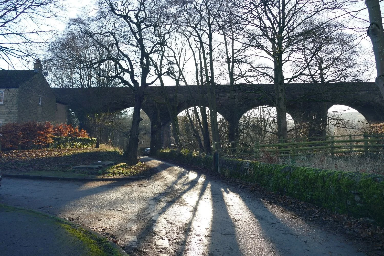
We spent Christmas in the Derbyshire village of Hathersage. The winter sunshine and shadows sharply defined key elements in the views, such as buildings and larger landforms, and resulted in panoramas which reminded us of nothing so much as a Ladybird Book illustration. Even the cement works in the background (image above) looked like a simplified, toy walkie-talkie.
We won’t attempt the writing style but we will try to keep what follows simple and very visual in the best tradition of a Ladybird guide to ‘A history of Hathersage’ and ‘Christmas in Derbyshire’.

As is so often the case, our first glimpse of Hathersage is via the Domesday Book of 1086, which describes an area or hamlet of just 2 smallholders and 8 villagers.
The Normans also seem to have built the mysterious Camp Green, a ‘Norman ring-motte’ with massive walls which now shelter a much more modern house. https://her.derbyshire.gov.uk/Monument/MDR4217
The first mention of a church dates to 1130, the list of parish priest starts at 1281 and 1381 saw the construction of a new church which, after much modification, grew to be the building we see today.
For many centuries, Hathersage remained an agricultural community, gathered around the church with a pub (the Bell Inn) and a small village green.


Image right: Reproduced with the permission of the National Library of Scotland
Inevitably, the industrial revolution reached Hathersage in the mid 18th century. Quarrying and the making of millstones was very much based on local resources but the proximity of the village to Sheffield and its steel works encouraged one William Cocker to set up a wire pulling business. ‘Wire pulling’ it seems is a metalworking process to reduce the thickness of a wire by pulling it through a die which forms the wire to the required cross-section. Things went well and Cocker built a new works at the bottom of the hill, below the village, close to the confluence of the Hood and Dale Brooks and a convenient public house, which had been built sometime around 1560. Slowly the village extended down the hill as other wire and needle making works joined in. The Hope Valley railway branch line arrived in 1894.


You could say that tourism in Hathersage started in 1845 when Charlotte Brontë visited the village to stay with a friend (sister to the then vicar). When Charlotte returned home she penned ‘Jane Eyre’, a novel full of Hathersage influences, ranging from names to buildings, landscapes, interiors and dramatic settings.

As just one example, in 1845, a widow called Mary Eyre was living in a substantial house, a little above above the main village. The house was called North Lees and is thought to be the model for fictional Mr Rochester’s residence of Thornfield.

Today, Hathersage still trades on all that inspired Charlotte Brontë. Tourism is now a major money earner, building on its dramatic location and spectacular scenery for walkers, climbers, cyclists (as well as less energetic visitors) and converting a host of traditional buildings into restaurants, cafés, outdoor equipment shops and accommodation.
But despite its new economic basis, its railway station, petrol station and two convenience stores, Hathersage appears to retain a strong Derbyshire community spirit.
So let’s get back to some real Ladybird Book style adventure stuff. We were told that Hathersage was a interesting place in which to spend Christmas. It is.

Top of the bill for one of us was an evening in the Millstone Inn listening to the splendid tradition of Derbyshire carols. Both Derbyshire and Sheffield have a long standing tradition of singing local carols - not in church but in pubs. We heard new words, new tunes and new combinations. How many of us outside the region have sung ‘While Shepherds Watched their Flocks by Night’ to the tune Cranbrook (otherwise known as ‘On Ilkley Moor’)! Thank you to the singers and to the Millstone Inn, Hathersage.
Hathersage is also good on crib scenes. Yes, there was one in the church, of course, but again Christmas in Hathersage is an outdoor thing with this full sized affair (below), opposite the George Hotel. Baby Jesus arrived a tiny bit early to coincide with a brass band and more carol singing.


Our final Christmas ‘Show and Tell’ (well more ‘show’ than ‘tell’ I’m afraid) was something we had never seen before: a village Advent Calendar. It makes an evening ramble around the village streets a real community light show. We just don’t know how you get to open the windows!


We are obliged to three organisations for helping us to tell this Ladybird story of Hathersage. In no particular order, these are:
The Museum of English Rural Life at Reading University who hold the Ladybird Book Archive
The Hathersage Parish Church of St Michael and All Angels for the book entitled ‘A Guide and Brief History’ (and yes we did pay for it!) and
The Millstone Country Inn for our first live introduction to the carols, hymns and songs sung in and around the village of Hathersage.
A happy New Year to you all.

New Year Resolutions
The change from the Julian to the Gregorian calendar seems to have been a messy operation, making Britain’s conversion to decimal currency and much of Europe’s change to Euros seem like child’s play.
Pope Gregory XIII eventually managed to introduce the Gregorian Calendar to Catholic states in 1582. Unsurprisingly this change did not impact on England and her colonies and, as far as Terroir can work out, New Year’s Day continued to be celebrated on 25th March (ie Lady Day or the Feast of the Annunciation), until 1752. As an aside, Scotland made the change in 1600!
Would our New Year’s resolutions have been different if made in spring rather than the middle of winter? Here is our commentary on typical NY resolutions as inspired by the December landscapes of Derbyshire. We hope to try the same exercise in late March to see if there is a seasonal impact.


Note: we think the image above left is a fox moth caterpillar, very active on a warm December day.


A happy and healthy New Year to all.

The Father Christmas Issue
If St Nick can’t get through, those are big boots (not to mention stockings) to fill.


What could possibly go wrong?
Happy Holidays!

Make Space for Children
The charity, ‘Make Space for Girls’ was founded in 2021 to campaign for better provision for teenage girls in parks and other public spaces. ‘We campaign for parks and public spaces to be designed for girls and young women, not just boys and young men.’ (www.makespaceforgirls.co.uk). One of us remembers one of the charity’s very telling illustrations of how boys and girls move around a school playground. The trace of the boys’ footsteps zigzagged madly all over the available space. In contrast the girls were, literally, marginalised, clinging to the edges of the space or moving around the circumference.

It’s not just that girls can feel excluded from spaces which suit boys well; girls seek different facilities and environments in which to hang out.
‘Overall, teenage girls do not feel that public spaces – whether parks, recreational grounds, urban areas or facilities – are intended for their use or are places where they are welcome’ (https://committees.parliament.uk/writtenevidence/127290/html/) , and that girls and young women tend to feel that their voices are not heard and their needs are not met.
I was strongly reminded of the work of Make Space for Children when Terroir recently visited an exhibition mounted in a small art gallery in Granada, Spain (Galeria Toro Brossard, Calle San Miguel Alta, 15). Exposición “Memoria de Una Infancia” is the work of Egyptian born artist (and now 20 years a Spanish resident), Husam Said, and is a celebration, a reflection and an extraordinary meditation on his childhood in a village near Tanta, about a 100 km north of Cairo. Several things struck us as we viewed and absorbed the images around us.

In Said’s paintings, children’s play does not seem to be segregated as it so often is in the UK. Obviously not being confined to a fenced ‘playground’ must allow significant fluidity in play and use of space. When your village is your playground, girls and boys, in active or quiet play, in huddles or adventuring can mingle or disperse as need arises.
Image above: girls and boys play hide and seek together in the play ground which is also their village

‘Huddles’ have obviously been an important part of this Egyptian childhood. The importance of ‘nests’, safe places, ‘secret’ places, contained places – call them what you will – seem to have been as important to Husam’s childhood, as they are today. Modern parents worry about children in ‘hidden’ places but the Husam’s nests seem to be contained but never invisible to others.


A village structure and community is also revealed by this celebration of childhood. What child could not be entranced by the dovecots (image left) – those weird cones in a village of rectangular buildings, where birds not humans provide constant movement - or, with adults, visiting the nativity by lantern light (below).


But the games, oh the games: a different continent, a different lifestyle, but so, so familiar. We would call them Hide and Seek, Blind Man’s Buff and Hopscotch. There are marbles (image right) and a circle game featuring stick and ball whose name Terroir can’t remember. Girls and boys play together; there is rhythm and movement, excitement and intensity. Even Husam appears – a key player but not the protagonist (can you spot him in the image on the right?)


Marbles are obviously an important part of Husam Said’s life - they appear in his sculptures as well as his paintings. This is probably not quite so true of British youngsters today but Husam’s exhibition illustrates so many truths about the importance of play and outdoor space in the lives of children and young people. A big thank you to Husam for illustrating both his childhood and what we in the UK need to provide to our youngsters.
Please contact Terroir if you would like more information on Husam Said’s work.

Mallorca/Majorca
Trains and Tourism
“…there’s a long-standing Spanish joke about a mythical fifth Balearic island called Majorca (the English spelling) inhabited by an estimated eight million tourists a year”. The Rough Guide to Spain, 2002.
Terroir’s first trip to the largest of the Balearic islands took place not long after that guide was published and we probably did go to Majorca rather than Mallorca. It was a pre-Easter visit, warm enough to swim (just) and fantastic hiking weather, but we have an enduring memory of a throng of AirBerlin planes waiting on the stands at Palma airport. Once established in our apartment at the western end of the island, we found that the early season meant a scarcity of open restaurants and, if Spanish/Mallorcan/Catalan was lacking, we needed basic German to order a meal.
We hoped our second visit – this September – would provide a little bit more of Mallorca. You may have gathered that Team Terroir does have a penchant for trains and thanks to the auspices of the fabulous Ffestiniog Travel company (‘Rail Holidays of the World’ https://www.ffestiniogtravel.com/) we were going to explore the north eastern end of the island, famed for its walking and, in certain quarters, for its railways.
Railway trip 1: Palma to Manacor
Manacor isn’t mentioned in the 2002 Rough Guide to Spain so we had hopes of the ‘real’ (what a cliché!) Mallorca.

These days, Palma’s main station is a rather brutal, subterranean confection, with smart 21st century trains, and unsmart old-fashioned departure platform chaos. Those of us with London commuting campaign medals just stood on the concourse and waited until both Manacor trains had sequential, rather than simultaneous, departure times.
Trip advisor’s web page on ‘Things to Do in Manacor’ (their capital initials, not Terroir’s) mainly advertises trips to somewhere else. But, the town is, of course, home to the Rafa Nadal Academy and Museum (and two of our group had a frabjous day there) …

… while the rest of us went off to experience the ‘authentic’ Mallorcan market’. And authentic it probably is, majoring as it does, like so many Spanish markets, on clothes, although we did find a few stalls with other specialities, including cheese (left) and plants and birds (below).


The town centre has some delightful nooks, crannies and restaurants, centred around the amazing convent church.


This little drama (above left) involved a policeman (legs just visible) and a ladder to rescue a small child who had inadvertently got locked in the convent garden (above right) when it closed for the long lunch/siesta break!
For people who enjoy towns over tennis academies, the other real joy of Manacor is wandering the back streets of Rafa Nadal’s home town. Arrow straight, grid pattern lanes are peppered with pot plants, easy-on-the-eye ironwork and jacarandas wherever there is a space. The repeated, squat, circuar towers had us fooled for a minute but Don Quixote quickly came to our rescue.


The train trip to Manacor was definitely worth it if you like tennis and towns. But the other great benefit of train travel is bagging a window seat and watching the landscape trundle past.
Railway trip 2: Palma to Inca and Sa Pobla
This one may be harder to justify as high quality train-tourism, but we will do our best. Again it’s a modern train running a modern service but the history of the line and the communities it served is much older. And the view is pretty good too.


Palma was once connected to much of the island of Mallorca by train, but by 1977 the line from Palma to Inca was all that was left, with the exception of the link to Soller which was in separate ownership, and which finally closed in 1994. In 2001 the link between Inca and Sa Pobla was re-opened and the whole system electrified. More was planned, but the future now appears uncertain. https://en.wikipedia.org/wiki/Serveis_Ferroviaris_de_Mallorca and https://fascinatingspain.com/place-to-visit/what-to-see-in-balearic/what-to-see-in-majorca/tren-de-soller-the-railway-in-mallorca/

The black lines represent the routes which are currently open and working.
By OpenStreetMap contributor - OpenStreetMap, ODbL, https://commons.wikimedia.org/w/index.php?curid=53809214
Our expedition on Railway Route 2 stopped at Inca in time for coffee. A sign outside the station indicated the way to a local museum with a pictogram of a boot. It took several other, rather more artistic, hints on our walk into town to realise that Inca was a place of leather workers and shoe makers. It does a decent cup of coffee too.


First impressions of Sa Pobla, at the end of the line, are a trifle bleak. A busy ring road now separates the train station from the town and it takes a while to walk along that flat, straight ‘boulevard’, past the industrial sheds, to something more inviting - unless of course you are a train enthusiast and recognise that pedestrian/bike path for what it is: a disused railway line, heading for the original town station.
By the time the railway link from Inca to Sa Pobla was reinstated, the new ring road had probably eliminated any practical possibility of rebuilding a rail/road crossing, and the lines were abruptly terminated on the wrong side of, in this case the road, rather than the railroad tracks.
Most of our group followed the beige-paved road ‘downtown’, took a quick look around and headed back for the next train to Palma. Not Terroir of course and here is what we found – a whole new take on a car free route into town. It is a bit alarming when we realised that the police station car park is built across the track, but in the interests of reaching the bitter end, we pushed on through.
Inevitably much of the old route is encased in high concrete walls but the town response to this is anything but boring. Where there is room, tree planting has been added and seems to be flourishing: jacaranda of course but also European hackberry and a buckthorn which we think is Chinese date/Common jujube.


And finally we emerge at the old station yard, now a community Police Station in the Plaꞔa des Tren, with its car park firmly up against the buffers.

What can cap that? Only lunch. The town centre was a gracious and spacious place providing not just food but a whole new transport experience. Who knew that Sa Pobla is now a centre for another form of tourism transport? Most people come here, not by train, but by bike.
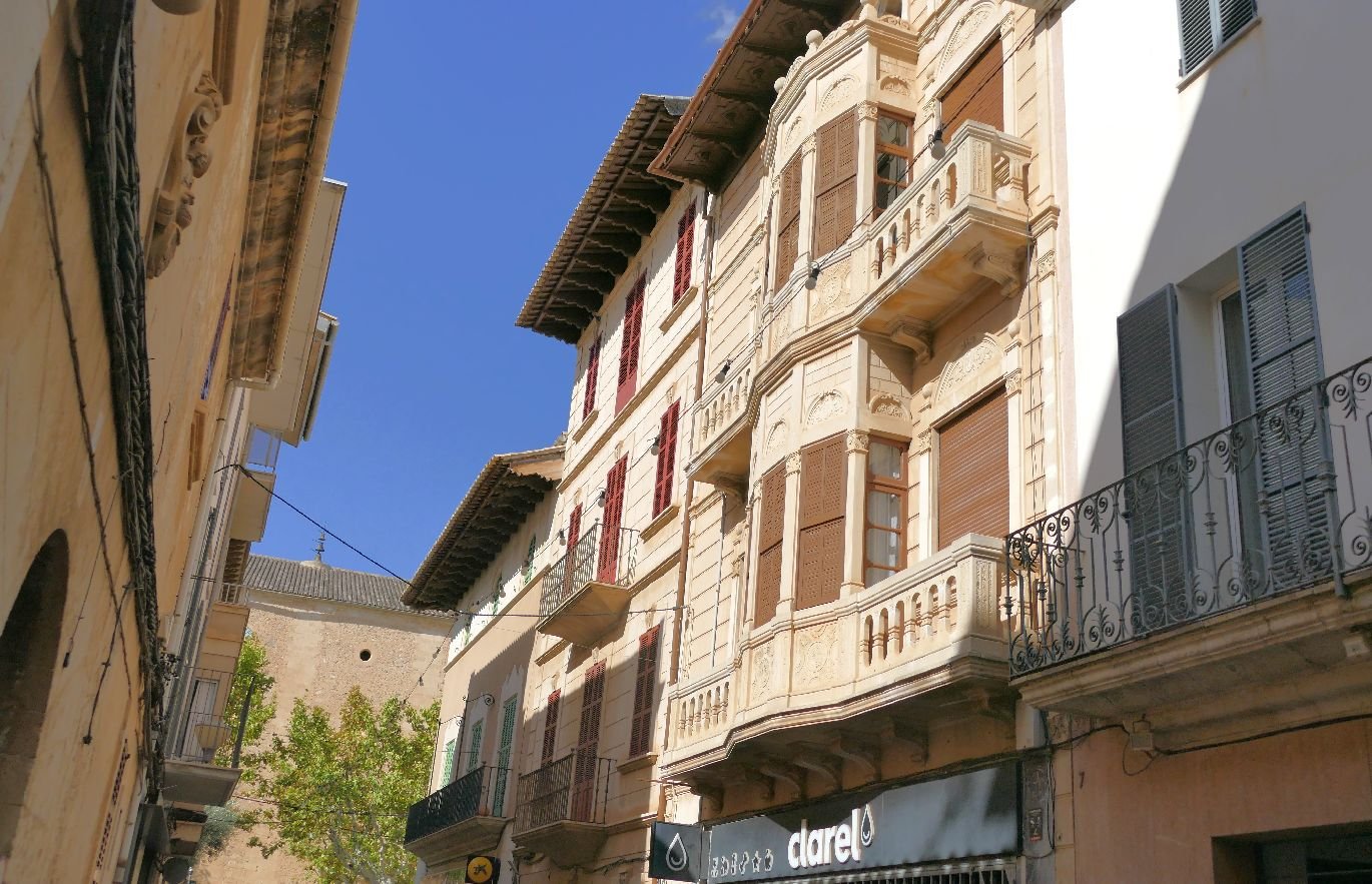


Railway trip 3: Palma to Soller and Port de Soller
I’m not quite sure why we are including this rail trip. It is definitely already on the tourist trail, and you don’t have to be interested in trains to enjoy it. I suspect it is firmly in Majorca not Mallorca.
Soller was once an isolated community in the Sierra de Tramuntana and separated from Palma by the Sierra de Alfabia. But in Terroir’s view, nothing excites railway engineers and their backers more than a project to punch a railway through or up a mountain. The line was eventually opened to Soller in 1912, with the tramway to Port de Soller following in 1913, and is said to have revolutionised the life of local inhabitants in terms of trade, travel and speed of postage. Inevitably, road engineers began to follow, however, and the line closed completely in 1997.
Of course nothing excites rail enthusiasts and their backers more than an abandoned ‘heritage railway’ , and a group of local business people bought the whole thing to create a tourist attraction. And of course nothing excites tourists more than a mountain railway and tramway with spectacular scenery and original engines and rolling stock. All while sitting down.
The Soller train and tramway is fun, spectacular and hugely popular. So welcome to the view and the crowds, the mountains and the seaside.
The Soller railway station in Palma is right next the main station but couldn’t be more different. It’s a wooden period piece with a little garden and tiny refreshment booth, run by a crew with a metaphorical rod of iron. There are two reasons for this: the first is to control the crowds of tickets holders all desperate to get what might be perceived as the ‘best seats’. The second is that, on leaving the platform, every train has to pass through a massive set of gates and set off down the middle of the public highway. Of course there are traffic lights but there are also pedestrians who might either have no idea what is about to come at them or are train photographers determined to get the best shot.


The train ride is amazingly scenic but you also spend a lot of time admiring the amazing dry Mallorcan stone walls which, in this environment, ensure the mountains do not slip onto the railway. Very difficult to photograph due to lack of light in the cuttings.


To be honest, weather matters, not just to see the view, but because the best fun is travelling on the passenger coaches’ ‘end platforms’. They are the sort of thing which feature in most Westerns and one of us kept expecting to see a sheriff chasing a pistol-toting villain leaping from carriage to carriage. Even when in the inevitable tunnel the end platforms deliver an interesting experience of the gradient, which is lacking from the comfort of your inside seat.


And finally – the tram from Soller town down to the port. This is pure tourism with all the struggle for seats, trying to work out the time table, wondering which harbour-side café will give you the best lunch and if there is time to walk to the lighthouse (believe me, there isn’t, just look at it at from a distance). It is spectcular though!


And then you have to go all the way back to Palma again!

Public Wealth or Public Health?
This very nearly turned into a blog about elitism in access to fine art.

Recently, one of us and a friend (in the UK for just a week), set out on a journey to see the Van Gogh exhibition at London’s National Gallery. Booked out for the rest of the run, one of us had signed up to become a member of the National Gallery to enable ticketless access for two.
Image (right) by Diego Delso, CC BY-SA 4.0, https://commons.wikimedia.org/w/index.php?curid=35481651
The NG had recently been heavily criticised for poor queue management so we approached the famous portico with some trepidation but, thankfully, the lines of people seemed benign and well regulated. Spotting a queue-free entry door on the right-hand side, we approached with caution, to be confronted by a grim-faced myrmidon. I cautiously raised my right hand in which was clutched my phone, displaying the QR code of my digital membership card. Mr Grim-Face melted instantly and ushered us into the bag search area like honoured guests, which, in a way, we were, thanks to spending twice the ticket price on membership.
And so the morning continued. Staff couldn’t have been more, well, ingratiating. Is that too damning a word? We were certainly made to feel special simply because we had paid more money to join a sort of London Club. But, as usual, we digress. The exhibition was splendid and ‘club’ membership does, of course, continue to offer benefits for the rest of the year.

There is so much for the landscape lover to enjoy in Van Gogh, and to see the terroir authentique of Provence through the eyes of an anxiety-ridden Dutchman is, yes, a glorious experience. Here is the embodiment of Provence - light and agriculture, fields and treescapes, skies and mountains. Here is the essence of the people who lived there, their architecture, their parks and their lives.


Ten days after our visit to the National Gallery one of us was to be involved in a symposium on the Landscapes of Public Health and was, therefore, particularly interested in the pictures created by Van Gogh during his time in the asylum in Saint-Rémy (some 15 miles to the east of his Provençal home in Arles). If Van Gogh could have been a symposium speaker, he would have been in excellent company.
Saint-Rémy Asylum Garden
What do we mean by public health? The UK’s Faculty of Public Health defines it as ‘the science and art of preventing disease, prolonging life, and promoting health through the organised efforts of society’ (https://www.fph.org.uk/what-is-public-health/). A quick bit of Terroir brainstorming came up with topics such as plague/Covid, drinking water and fluoride, sewage infrastructure and river pollution, open spaces and mountains.
The FOLAR symposium (The Friends of the Landscape Archive at Reading, (https://www.folar.uk/) presented a wonderfully eclectic and informative view of public health landscapes. The ‘Bermondsey Experiment’ undertaken in the early decades of the 20th century, took us, metaphorically, to a damp, unsanitary and unhealthy part of London’s south bank slums, where men sought work in the docks or on the railways, the single women worked in canning factories and the married women in jam factories. The mortality rate was sky high, the air filthy from coal smoke, income extremely insecure, and sanitation we leave to your imagination.
Ada and Alfred Salter (social reformer and medical doctor respectively) moved into this landscape to fight for, and instigate, much needed public health improvements. Their holistic approach included an open air school for tubercular children (these days we call them Forest Schools), improvements to the sewage system, extensive tree planting and other ‘beautification’ works, provision of parks and open spaces, community facilities and activities (sports, chess, music) and much more. Their dedication to improving immune systems and extending life expectancy in the Bermondsey community was extraordinary and effective, despite the ultimate tragedy of losing their own daughter to scarlet fever at the age of 8. Thank you to speaker Robert Holden.


Images above: Alfred and Ada Salter and the cat, with the view from modern Bermondsey, looking west
We are probably all aware to some extent of the role of parks and open spaces for mental and physical health thanks to the Covid Pandemic, but speaker Paul Rabbitts illustrated the low political profile which parks still hold in delivery of public health gains. The 1875 Public Health Act recognized the importance of public open space to the health of urban communities, and many supportive organisations followed (eg The National Playing Fields Association and the Public Gardens Association). But the role of parks in the delivery of Public Health is, in the opinion of Terroir, still woefully underplayed.

A talk on the landscapes associated with 19th century ‘lunatic asylums’ (including their gardens, parkland & farms) brings us nicely back to Van Gogh and the time he spent in the Asylum at Saint-Rémy. The exhibition at the National Gallery is subtitled ‘Poets and Lovers’ but to Terroir, the St Remy paintings speak more of survival, of making the best of things, of re-evaluating his environment and his ability to represent it in paint on canvas.


His life had a tragic ending – from mental health issues, rather than from the virulent strain of scarlet fever which carried off Joyce Salter - but his journey through life has bequeathed to us a vigorous bequest of uplifting, inspiring and bouyant landscapes.
Despite the cost of the therapy(!), we came away feeling uplifted, joyous and in excellent mental health.

The Big Deal

This blog, penned under the damp skies of late October, was meant to be a sunny – and probably rather inconsequential – tale about a recent trip to Mallorca and its quaint railways. You may still get this story later in the year, when skies are even gloomier and autumn colour has turned to a wintry tracery of bare twigs.
But for now Terroir has been diverted onto the more serious matter of Climate Change. So what happened? Two meetings (one planned, one serendipity) collided.
Concern Worldwide (https://www.concern.net/) had invited Terroir South to an event entitled ‘Ending extreme poverty – whatever it takes’. (As an aside, they didn’t actually know that they had invited Terroir blog, it’s just that the one of us who supports their work with a monthly contribution was on their mailing list.) As the event was also scheduled to take place in the House of Commons, it was hard to resist.
Concern Worldwide was founded in Ireland, in 1968, in response to famine and conflict in Biafra. Today, with offices in Dublin, Belfast and London, its reach is, as it says, worldwide. As we sipped wine and dropped canapé crumbs on the floor of the Churchill Room, we weren’t quite sure what to expect: maybe a disturbing film of poverty in action in East Africa, or perhaps a hard sell to raise funds for flooded Pakistan? Absolutely not, it was much more grown up and down to earth than that.
We were audience to a panel discussion on ‘the root causes of and key issues impacting extreme poverty’. On the panel were the director of the Somali NGO consortium, Concern’s Country Director in Kenya, and the Director of the Humanitarian Policy Group at the ODI (the London based Overseas Development Institute, and tactfully acknowledging any ‘white male’ comments – he was the only one who qualified).


The discussion (moderated by Martine Dennis, a broadcast journalist with credentials from Sky News, BBC and Al Jazeera), was a wide ranging view of the reality of translating cash into realistic aid to help communities help themselves in their struggle with extreme poverty. A big thank you to Concern World Wide for educating us in these realities. For one of us, three issues stood out: conflict, crisis and - climate change
As it happened, this was not the first reference to Climate Change which we encountered that evening. On the train to London, we were joined - totally unexpectedly - by a longstanding friend who heads up one of England’s ‘National Landscapes’ – perhaps more familiar to most as ‘Areas of Outstanding Natural Beauty’. Following the usual ‘how are you and how are the kids’ conversation, one of us was suddenly plunged into a questionnaire on climate change, as the train rattled through the London suburbs. It was turning out to be a bizarre evening.
What was the takeaway message from this evening? For one of us it was a rush of pure relief that climate change is really being taken very, very seriously by at least some of our planet’s community. That rush of relief came as a surprise and a shock. It made us realise just how inured we had become to the apparent lack of investment in viable actions to tackle climate change. So, please, support groups like Concern Worldwide and any other organisations which take these responsibilities seriously and creatively.
As a postscript, we arrived in Westminster early and spent 20 minutes in the Public Gallery of the House of Commons. It was fascinating of course. The wall mounted digital screens make it so easy to work out what’s going on and who is speaking. We watched part of the ping pong discussion on the second reading of the Employment Rights Bill, which was then interrupted by some deft choreography, to allow Katie Lam, MP for the new Weald of Kent constituency, to give her maiden speech. Part of her constituency lies within the High Weald National Landscape and although she made much of this Area of Outstanding Beauty (‘the weald of Kent boasts hundreds of square miles of the most gorgeous countryside’ (https://www.theyworkforyou.com/debates/?id=2024-10-21b.46.0#g79.2) there was no mention of climate change.
At least the walk through the Commons’ caverns and Westminster Hall wonderland (below) was splendid.


Community, Landscape and Art
What if we couldn’t speak out? Who would we get to speak for us? How could we communicate to others?
In the 21st century, we have many ways of expressing our opinions. We can vote in national and local elections. We can join local residents’ associations and community groups to express our views. We can write letters to our representatives in local government. We can write to our members of parliament (although one of us would point out that the devolved nations have two options here while England has only one parliamentary representative to whom they can grumble). We can join ‘focus groups’ or hope to meet one of those elusive pollsters who purport to record and publicise our opinions. We can (on the whole) join marches and demonstrations. Very occasionally some resort to rioting. Mostly we just moan to friends and neighbours.
Recently, Terroir South was travelling ‘up-country’ for a high level blogging summit with Terroir North. On the way, TS stopped over in Worcester, a city which has contributed much to English history and society. We learnt a little about a great variety things, including politics (Worcester and the King were roundly defeated by Cromwell), religion (Catholic monasteries, Judaism, Quakers, Anglicans, Non-Conformists), agriculture (tobacco – yes really – potatoes and hops), the importance of wool and the cloth trade, geology (all that coal, iron and limestone) and life on the geographical edge of the industrial revolution and the Black Country. It was a very entertaining day.


Our visit to the cathedral, which has watched over Worcester’s community since 680, even indulged us with a full-on organ rehearsal in preparation for a recital later that day.


But what really inspired one of us was an exhibition in the Worcester City Art Gallery and Museum entitled ‘Connections - In conversation with the community ’ (https://www.museumsworcestershire.org.uk/events/connections-the-worcester-city-collection-in-conversation-with-the-community/). Connections is a visionary expression (both literally and metaphorically) of how Worcester feels about itself and its City. So much more telling, revealing, and enjoyable than a focus group or community consultation.
Here’s the brief:

What a wonderfully communal and artistic way of expressing our feelings about our home town. The process must have been as exciting for the participating community groups as it is visually pleasing and stimulating for residents of (and visitors to) Worcester. Imagine the thrill of being ushered ‘behind the scenes at the museum’, of penetrating the unknown territory of stacks and stores, of viewing pictures not normally seen on the gallery’s walls. Imagine the thought processes – what do we value about our town, how do we like to see it represented, what if our favourite area has never been painted by an artist (is there a reason)? From the visitor’s perspective, we were constantly asking ourselves these questions about our own home communities.
Here is the Museum’s perspective:

The chosen pictures fell into two categories. ‘Snapshots of our city through time’ concentrated on recognisable locations at different periods thus emphasising the process of urban and industrial development in a familiar environment, and begging questions of ‘How did that happen?’ or ‘Why did that change?’.


The second part of the exhibition, entitled ‘Escaping the city’ was about the wonder of landscapes seen on holidays, on days out, or on walks or travels abroad. What do the people of Worcester find joyous and memorable? Perhaps unsurprisingly, for an island where most of us live inland, the answer seems to be the sea.


But we suppose the crucial and overriding question which visitors wish to ask of the people of Worcester is, ‘Who invented Worcestershire Sauce?’.

As with Coca-Cola, so with Worcester’s sauce: the inventors were pharmacists. According to Wikipedia and others, the pharmaceutical partnership of John Wheeley Lea and William Perrins of 63 Broad Street, Worcester is responsible for the invention, although its history and ingredients are as murky as the sauce itself.
Above: the reconstructed Victorian Pharmacy in the Worcester City Art Gallery and Museum
But, as one of us is the child of two generations of pharmaceutical chemists, we are proud, yes, but also unsurprised.